Your browser is out-of-date!
For a richer surfing experience on our website, please update your browser. Update my browser now!
For a richer surfing experience on our website, please update your browser. Update my browser now!
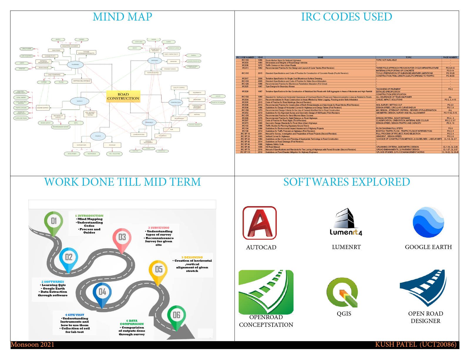
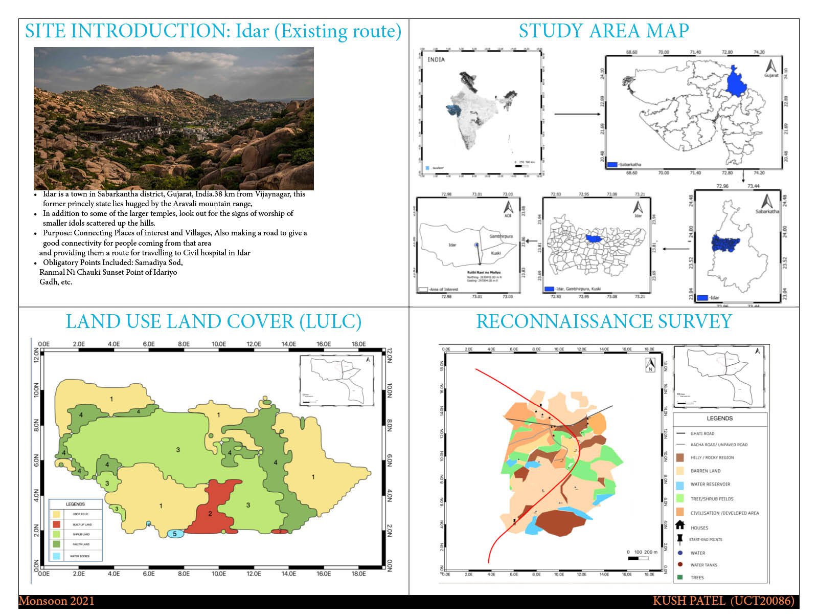
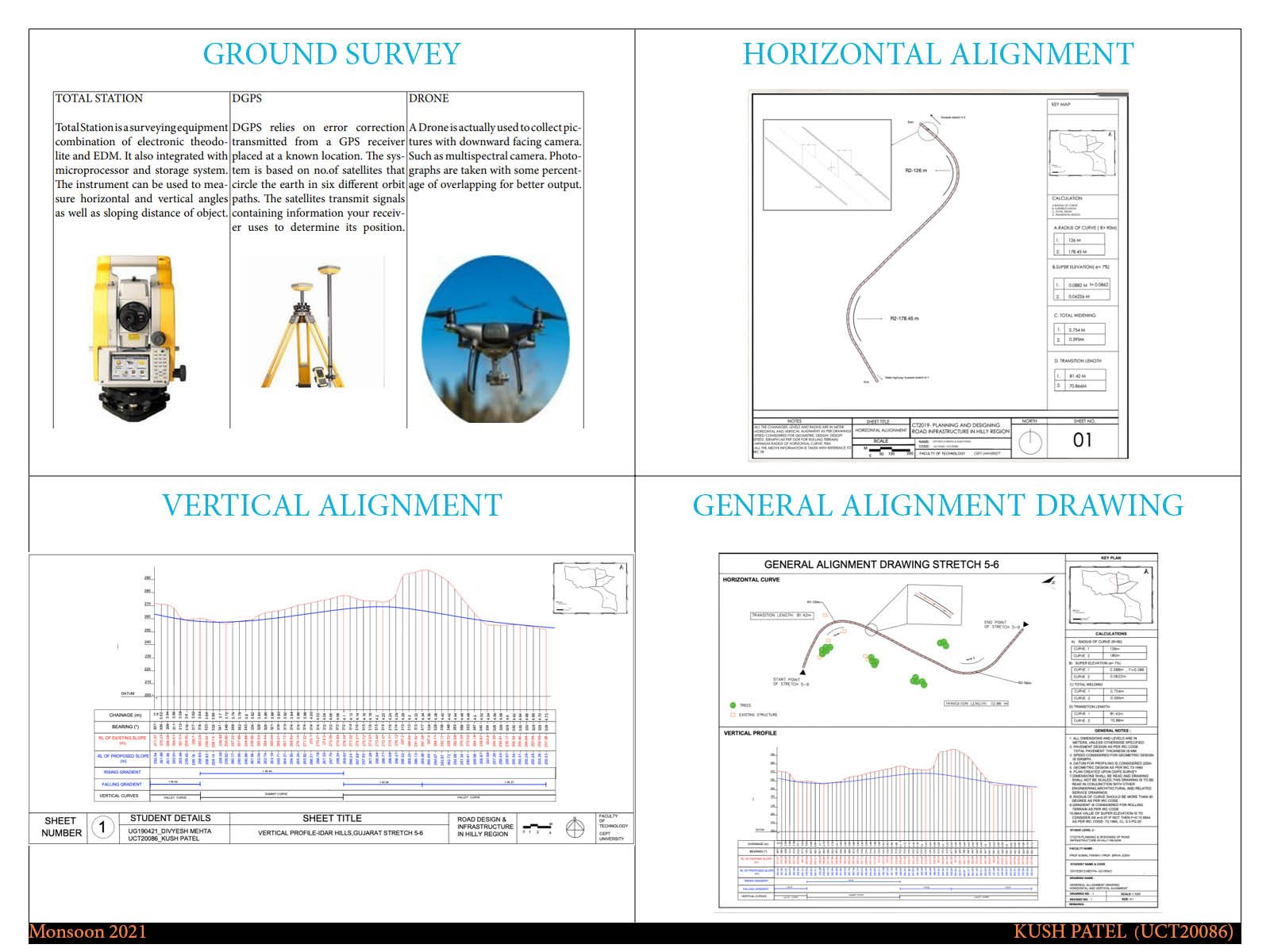
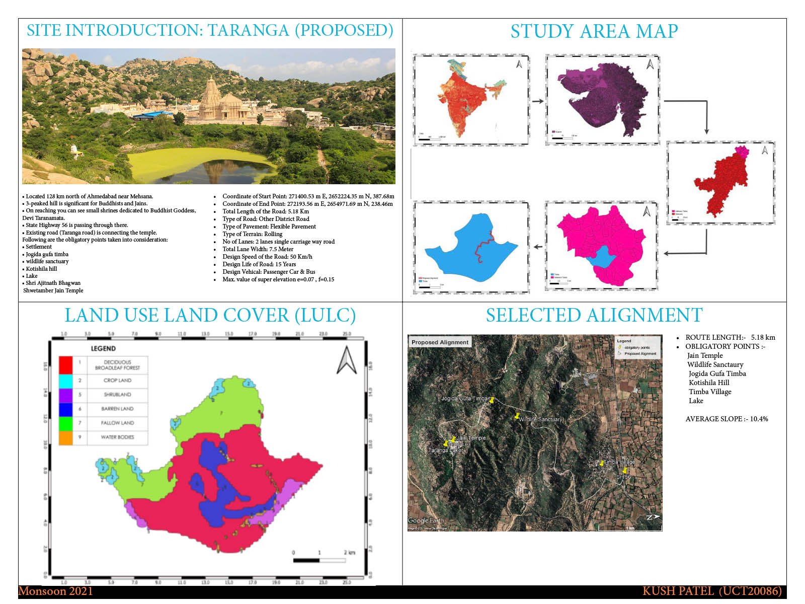
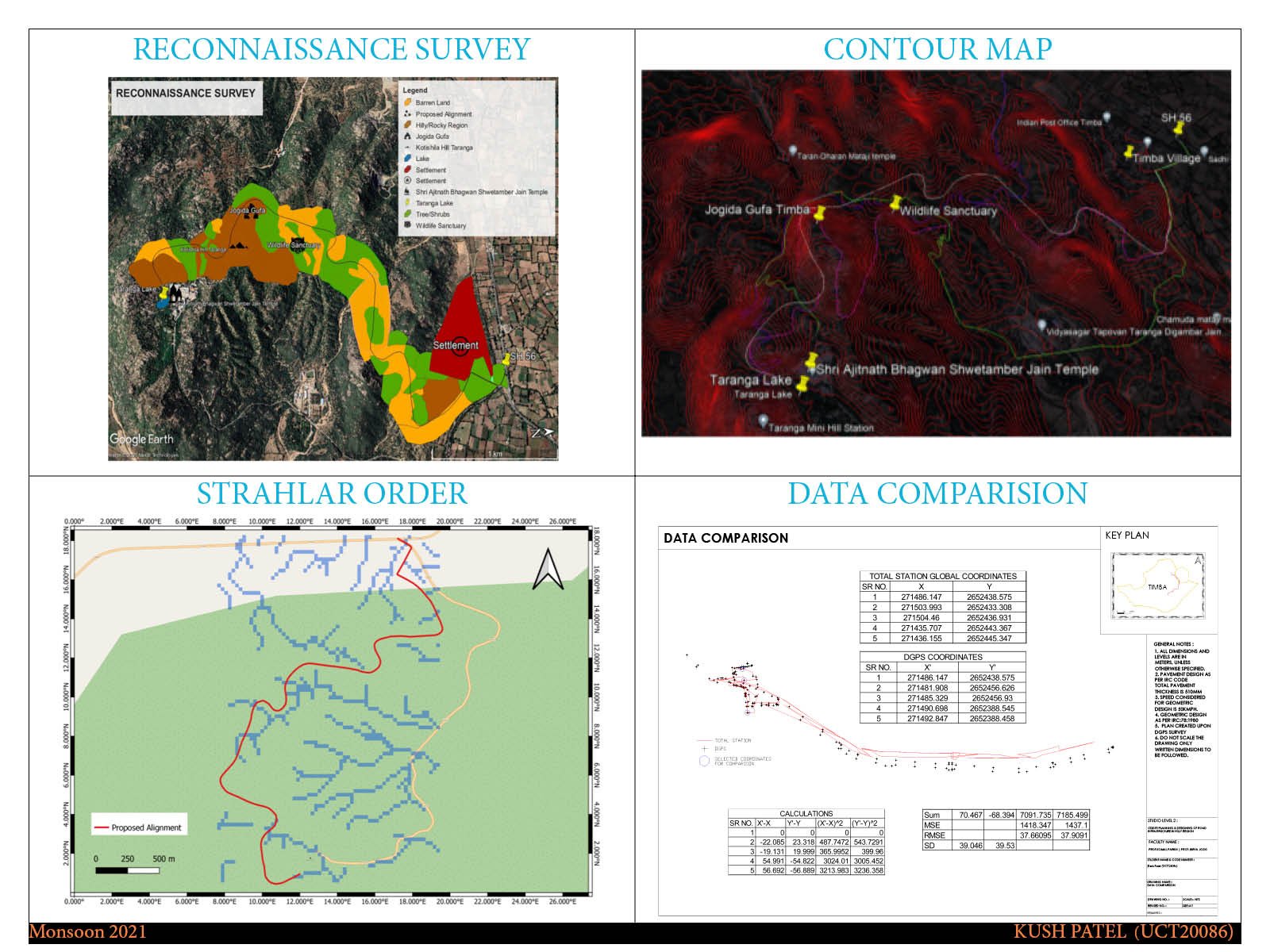
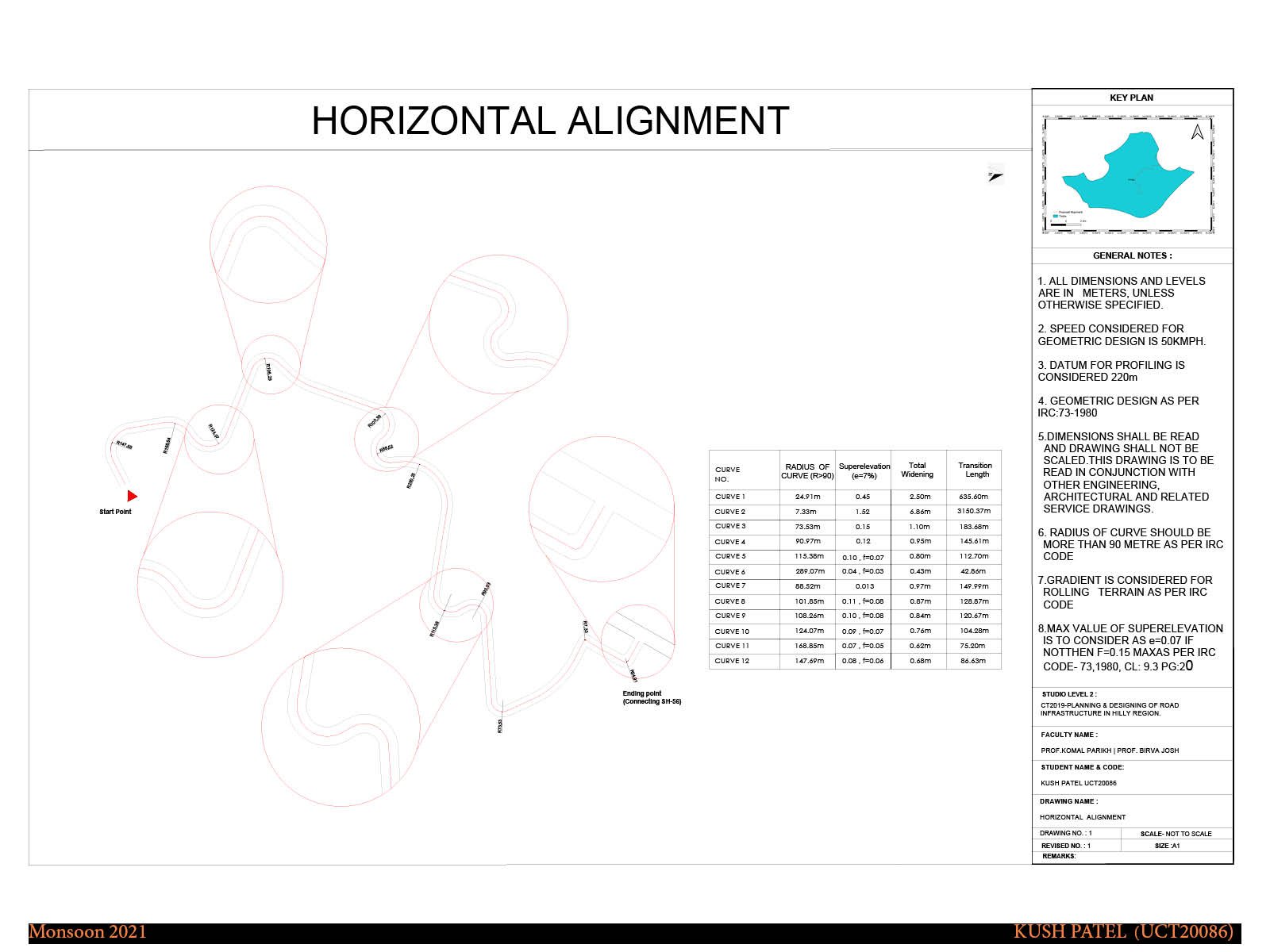
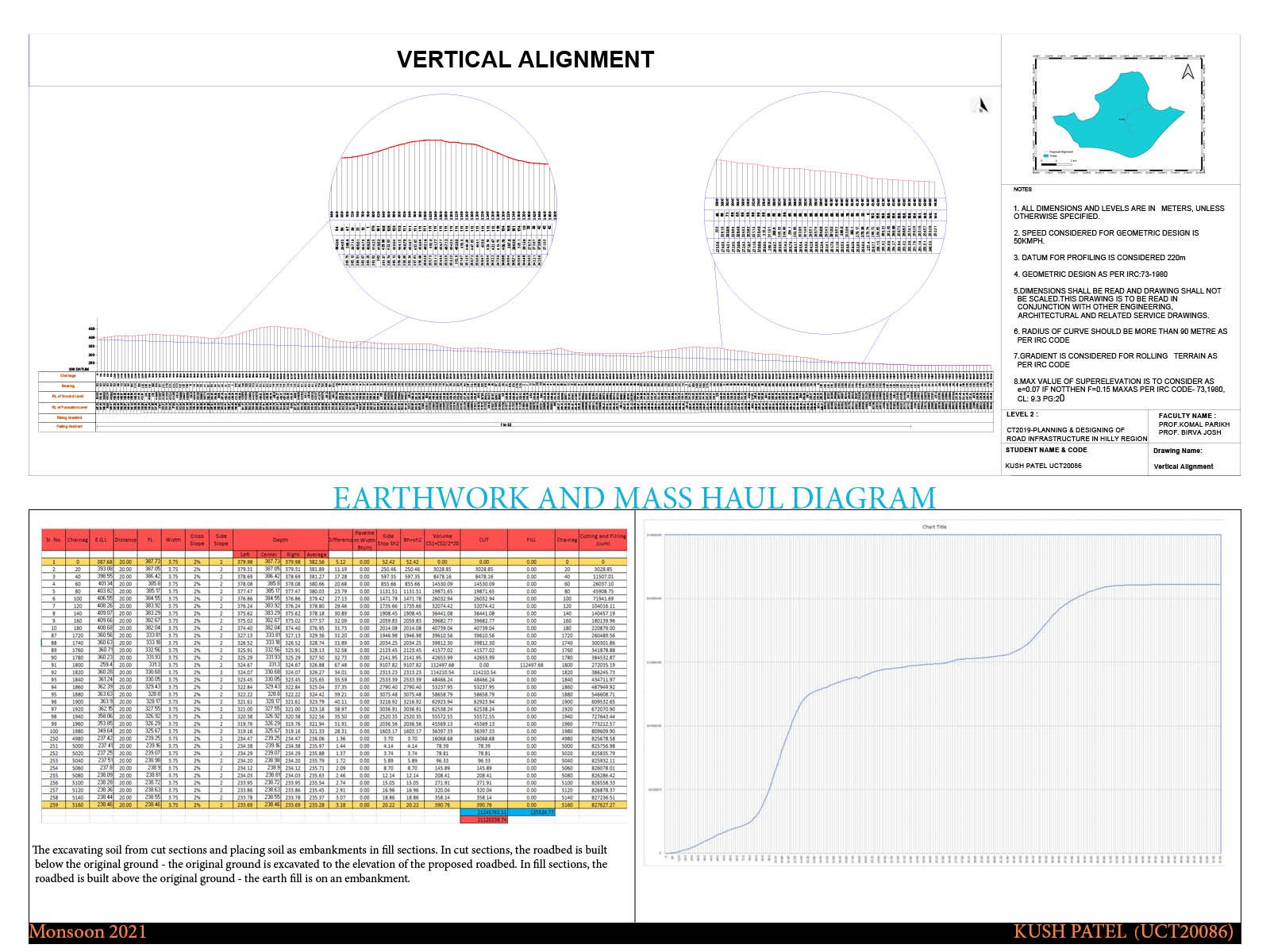
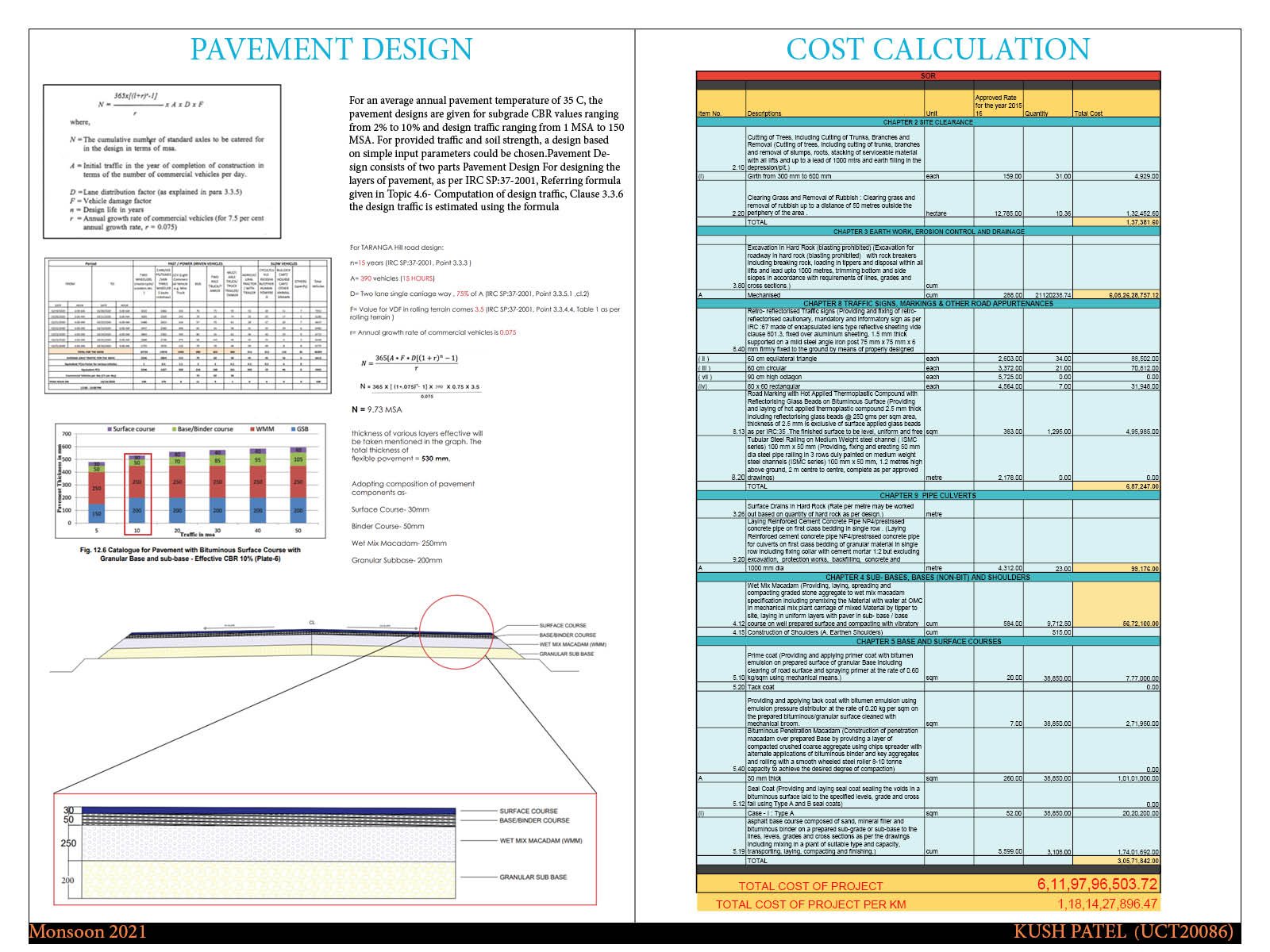
The difficulty of planning and developing an acceptable road alignment in a hilly terrain where natural and built environment effects can be significant is the focus of the studio. Civil and infrastructure engineering ideas and techniques that aid in the study and design of the road route and its pavements will be employed to develop a viable solution. The process and solution will be depicted using virtual and real representations. During the Monsoon 2021 semester, the studio looked into the subject of road alignment optimization in the Taranga district of Gujarat. Report