Your browser is out-of-date!
For a richer surfing experience on our website, please update your browser. Update my browser now!
For a richer surfing experience on our website, please update your browser. Update my browser now!
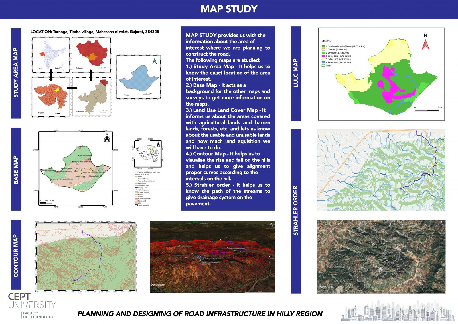
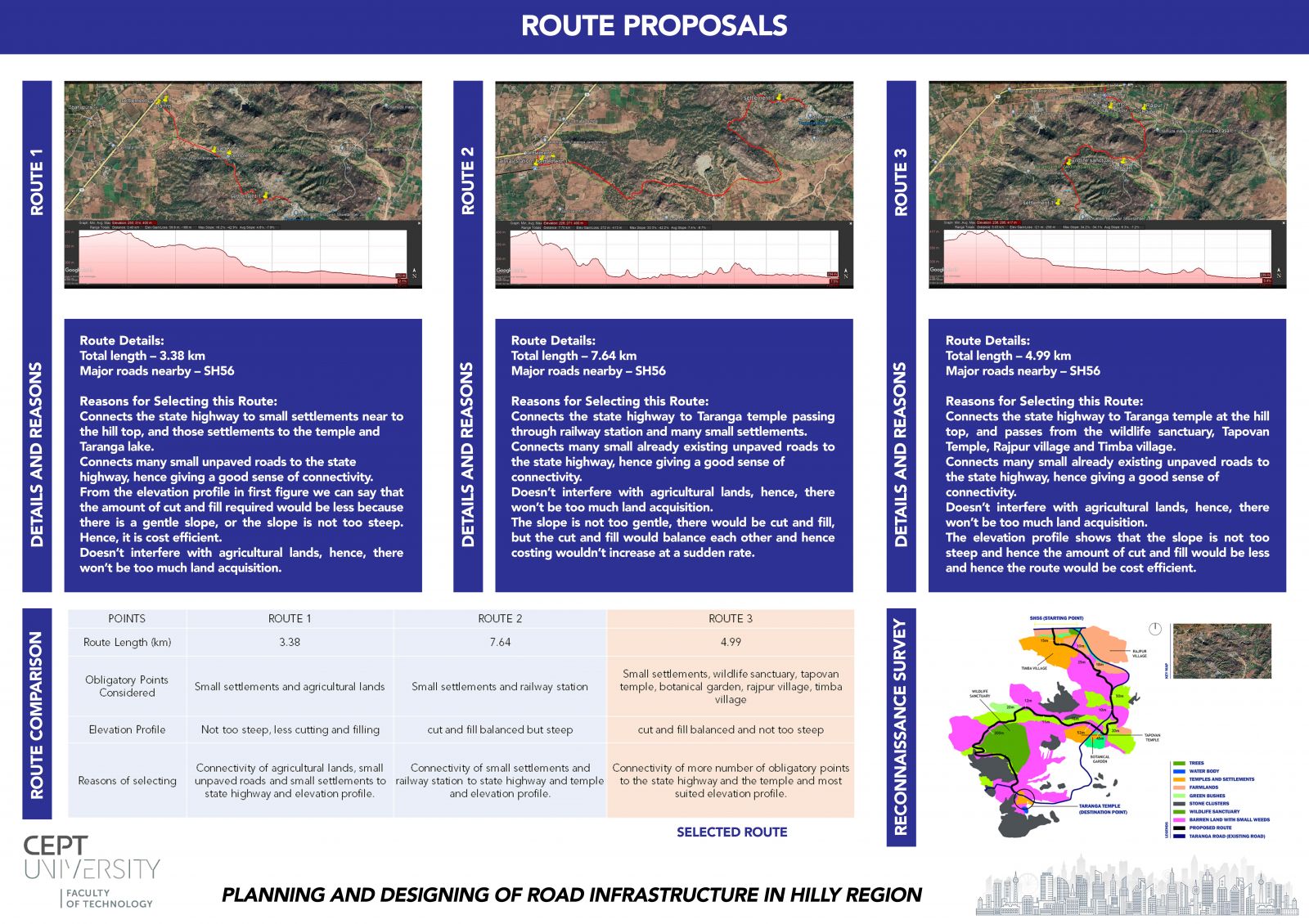
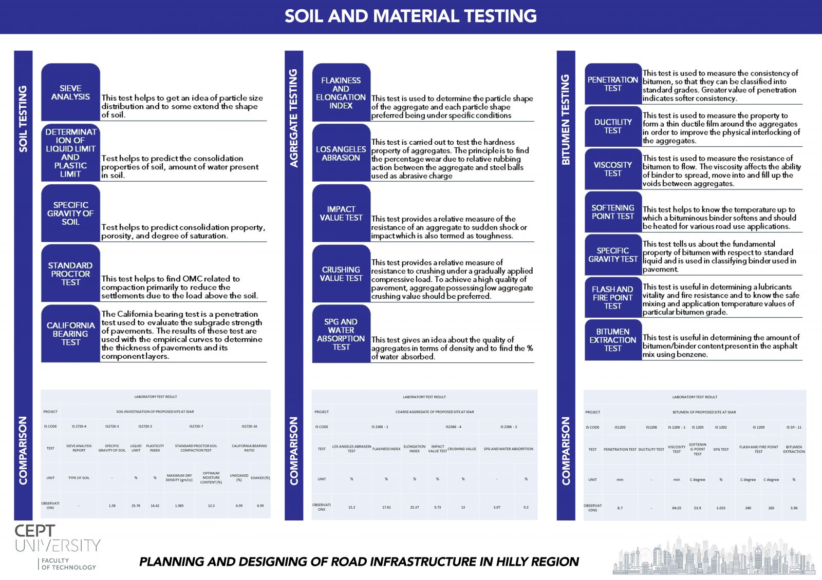
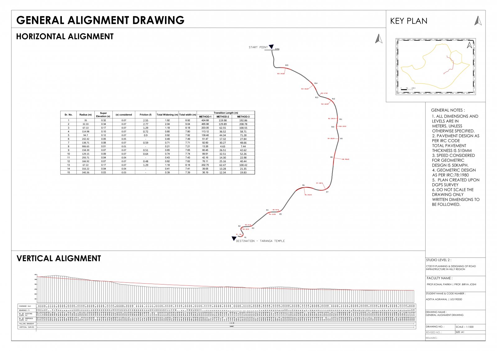
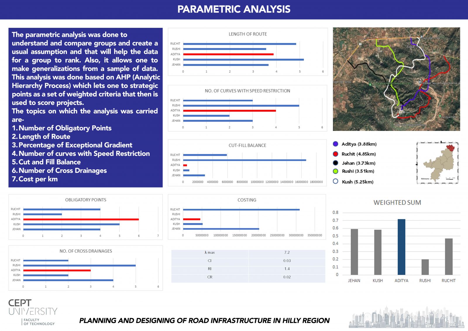
An alignment was to be designed on Taranga Hill connecting the Taranga temple (top of the hill) to the closest highway, SH56 (bottom of the hill). The alignment has to include the nearest obligatory points to give the road more connectivity to the surroundings, while keeping in mind about the length of the route, radius of the curves, land acquisition, slope of the gradients, etc. Including all these parameters the pavement has to be designed and then its cut-fill balance and costing is analyzed. At last all the pavements are compared with each other on the basis of these parameters.
View Additional Work