Your browser is out-of-date!
For a richer surfing experience on our website, please update your browser. Update my browser now!
For a richer surfing experience on our website, please update your browser. Update my browser now!
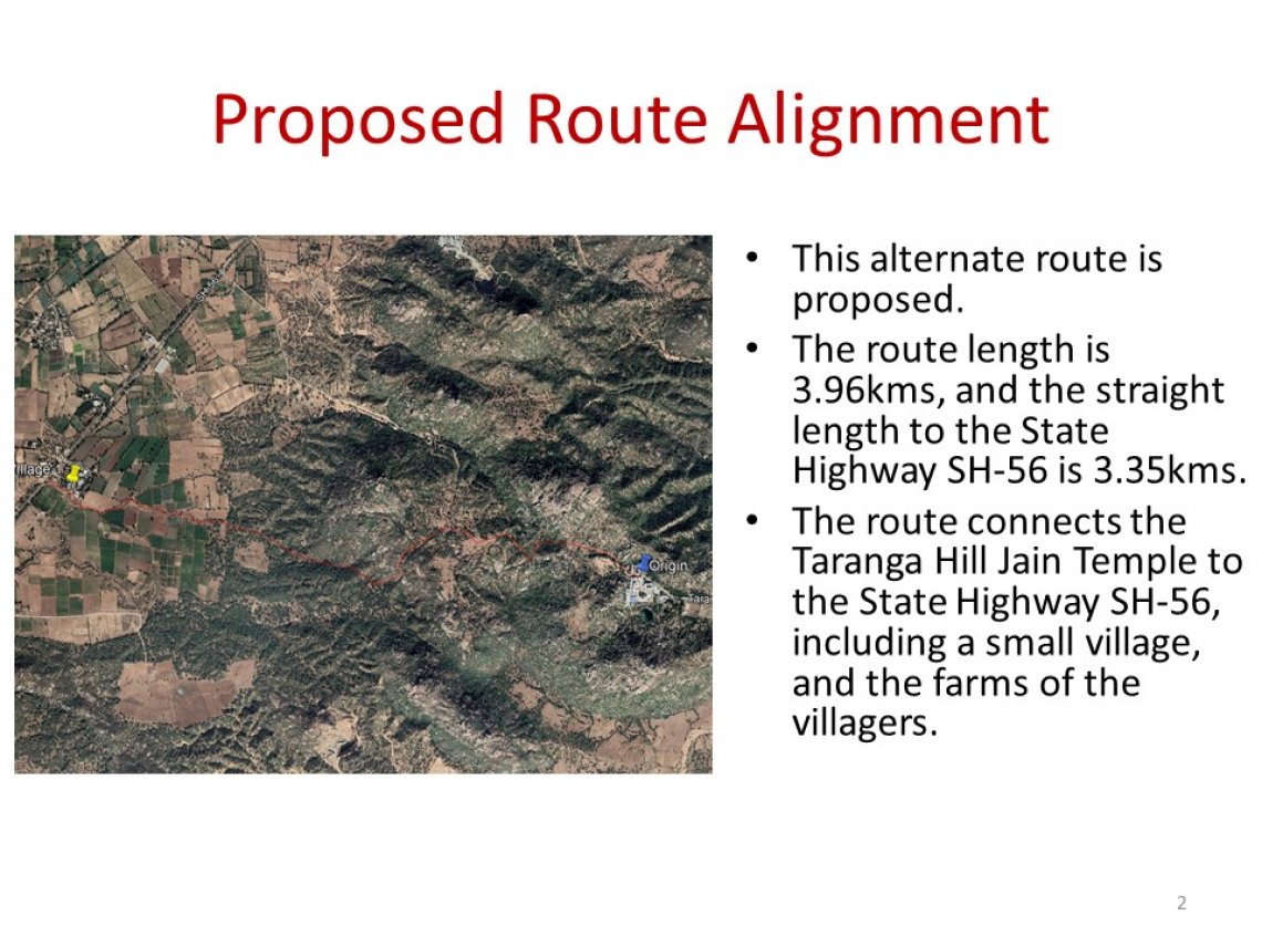
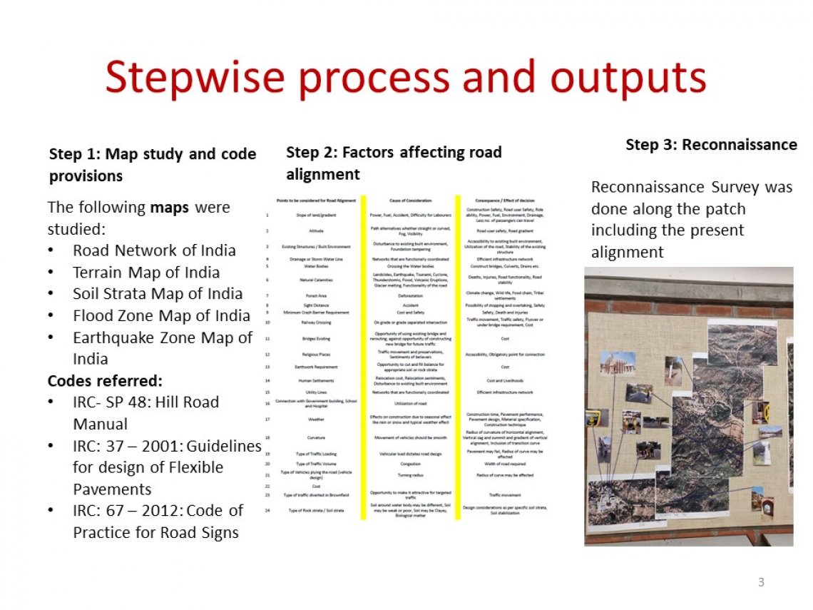
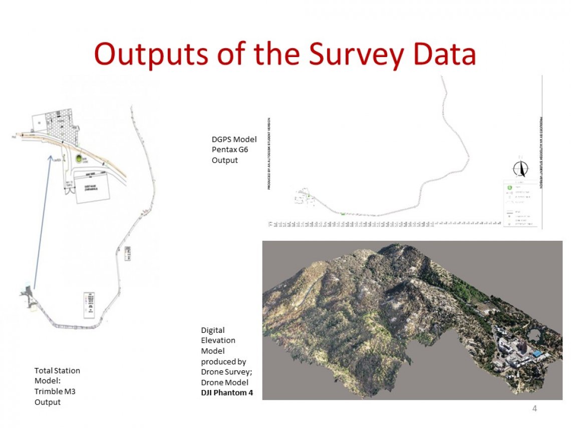
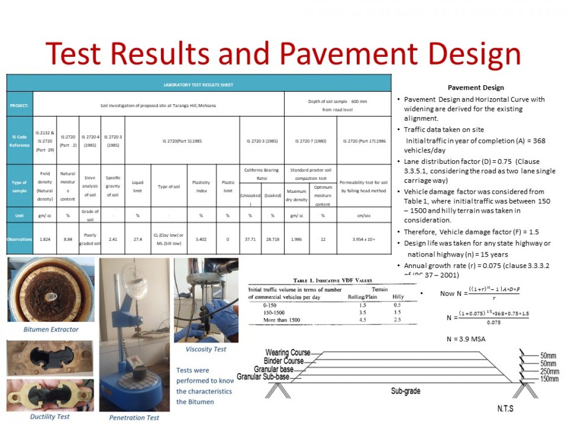
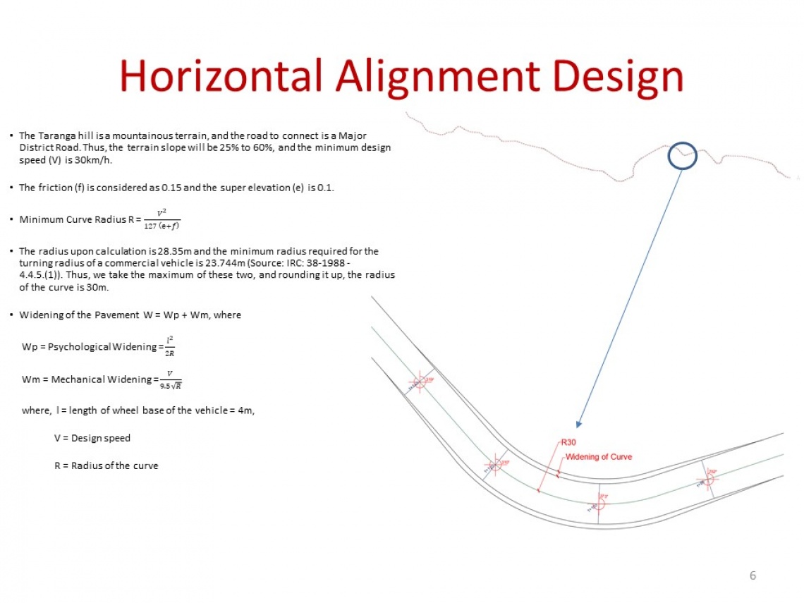
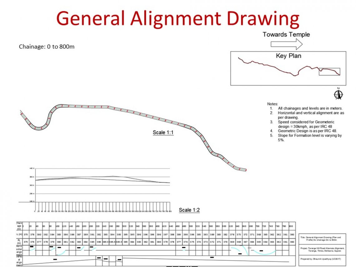
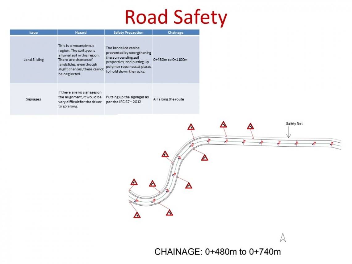
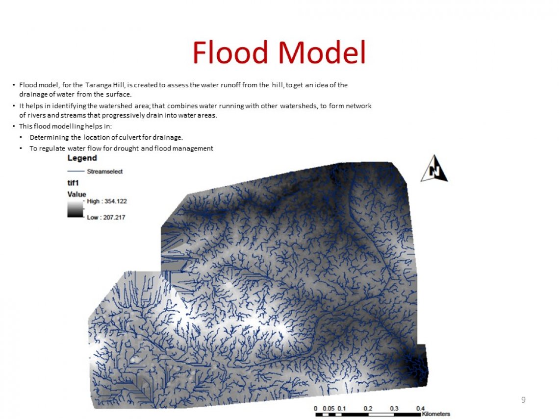
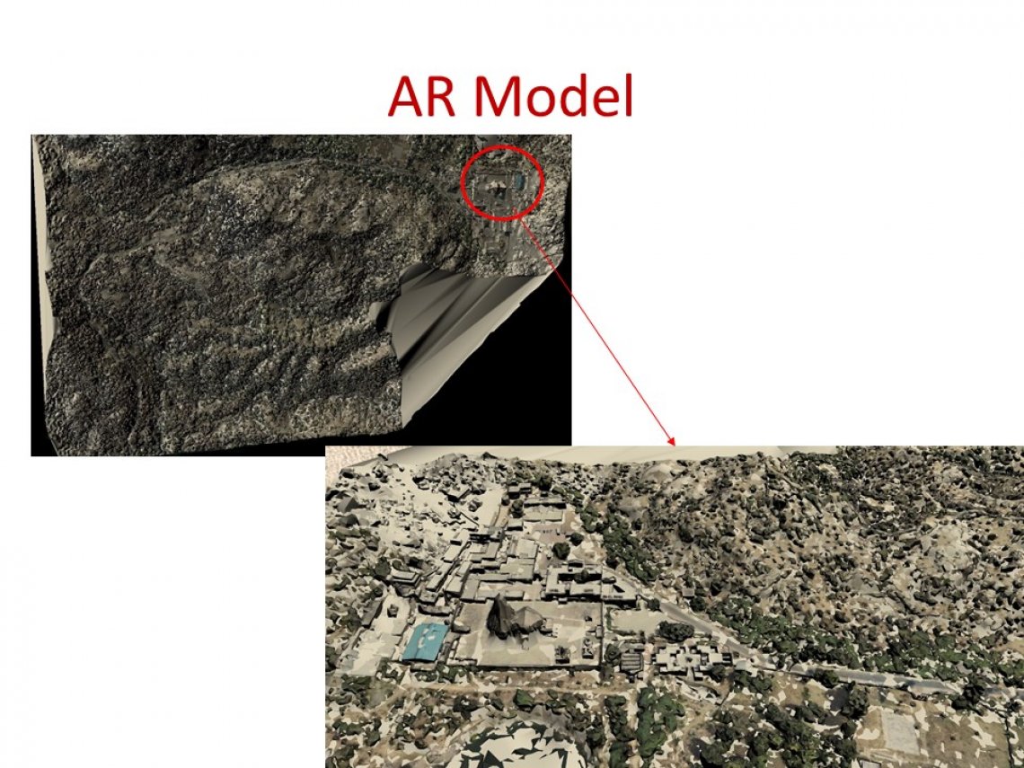
In this studio, the experience enabled us to use the different types of survey in the present alignment of the Taranga hill. We then implemented the cause, effect and parameters for Planning and designing of an alternate route alignment for the same. A flood model and an AR app was created to know the terrain at the convenience of ourselves. Here is the link to the application and that for the trigger image. Also, find the Portfolio here.
