Your browser is out-of-date!
For a richer surfing experience on our website, please update your browser. Update my browser now!
For a richer surfing experience on our website, please update your browser. Update my browser now!
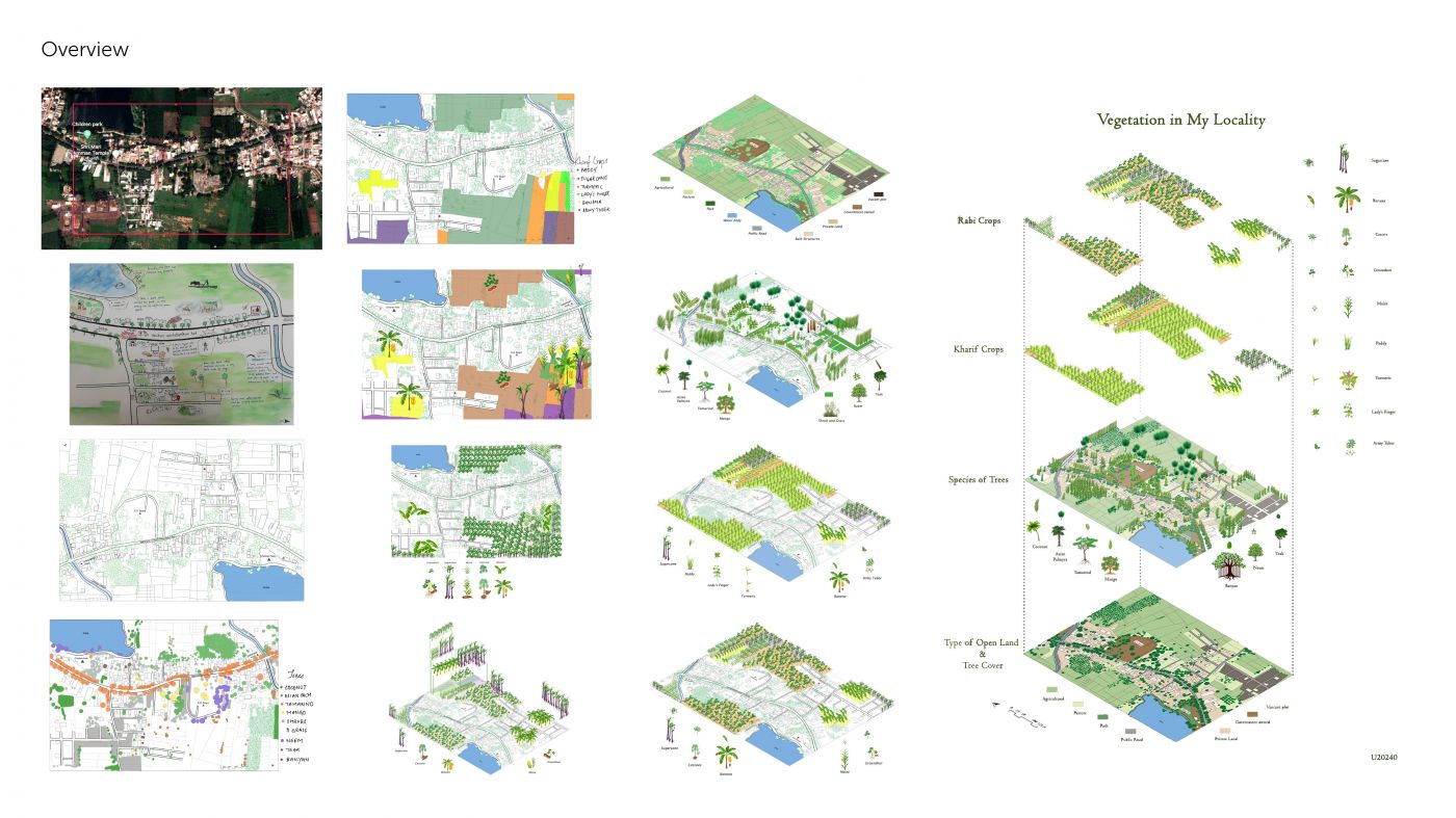
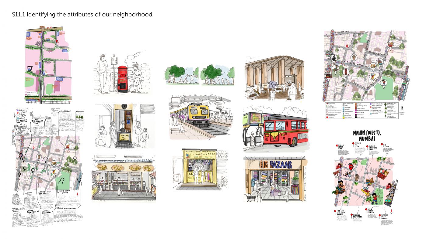
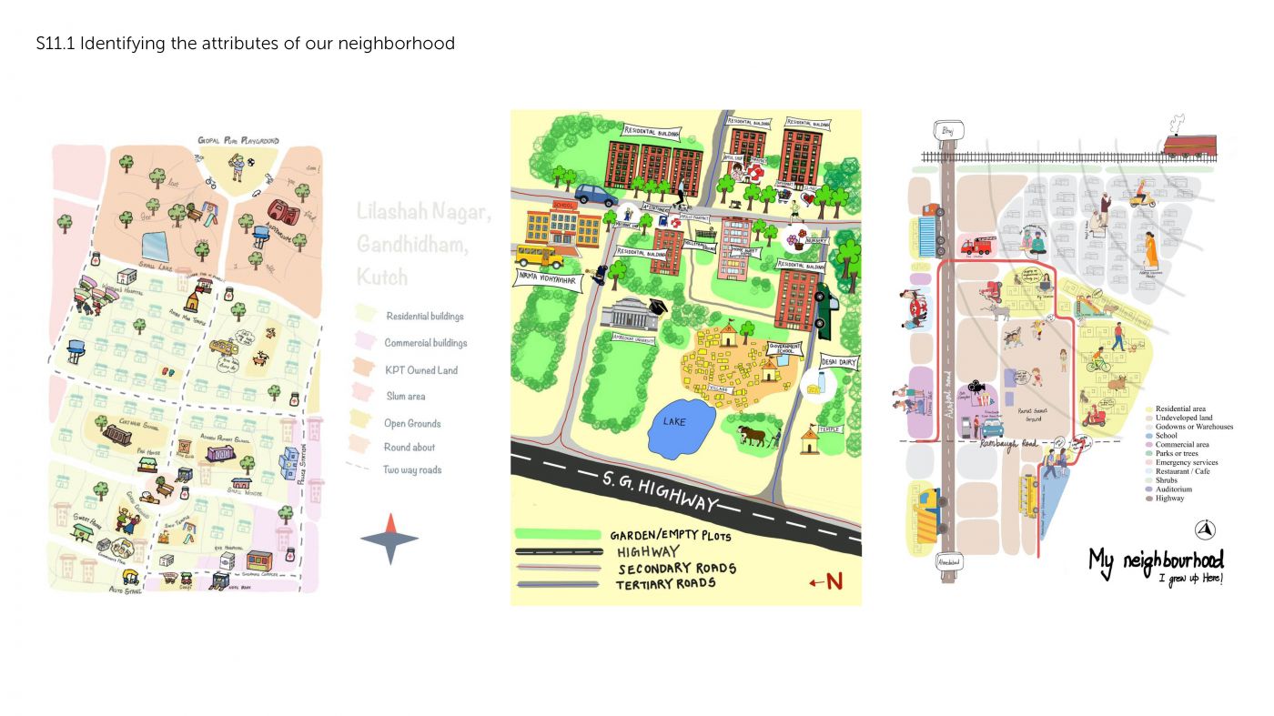
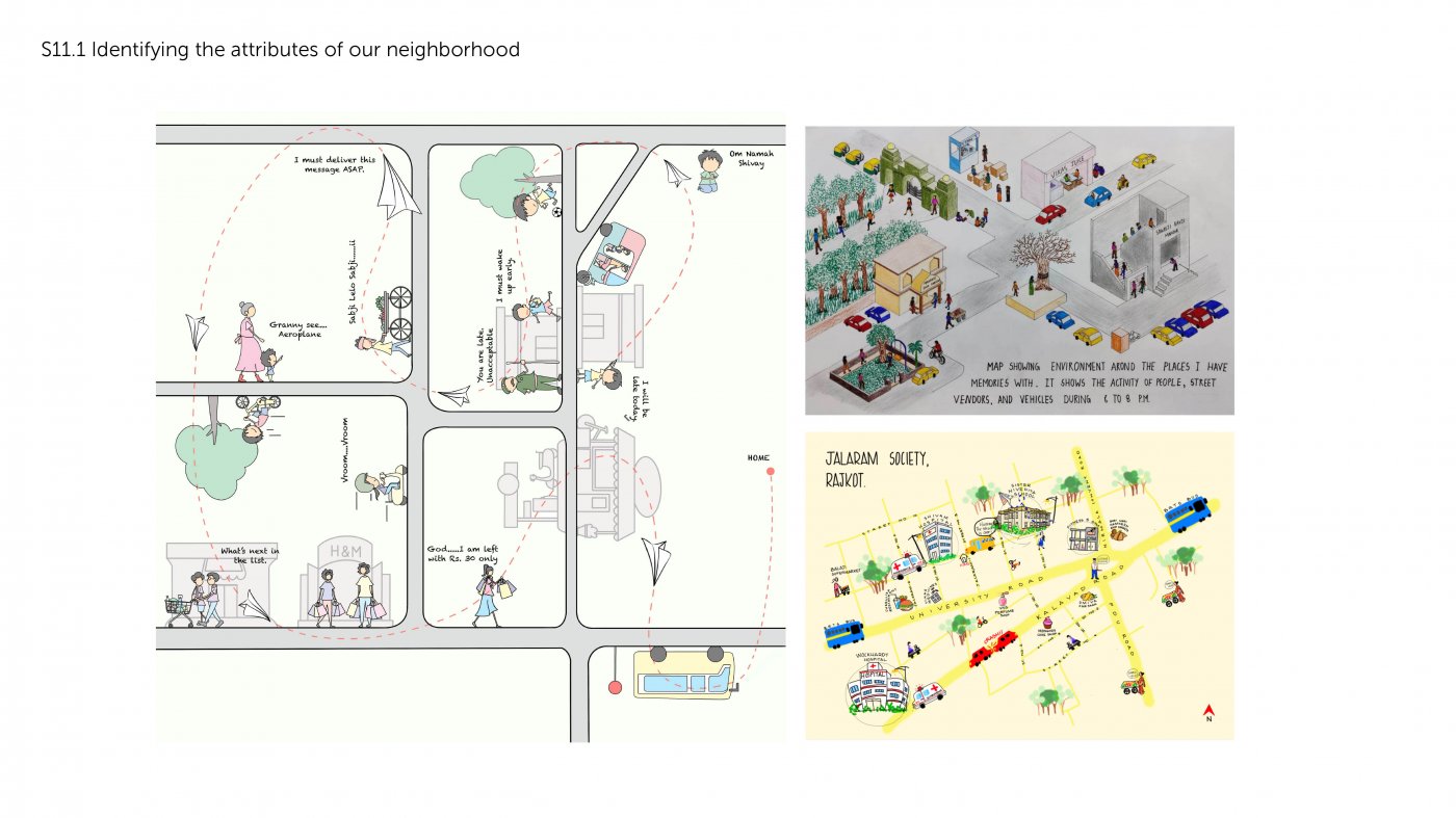
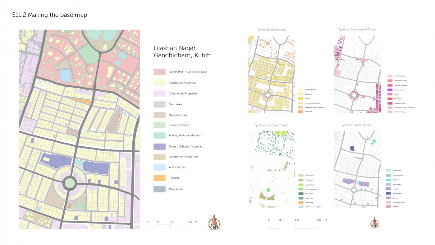
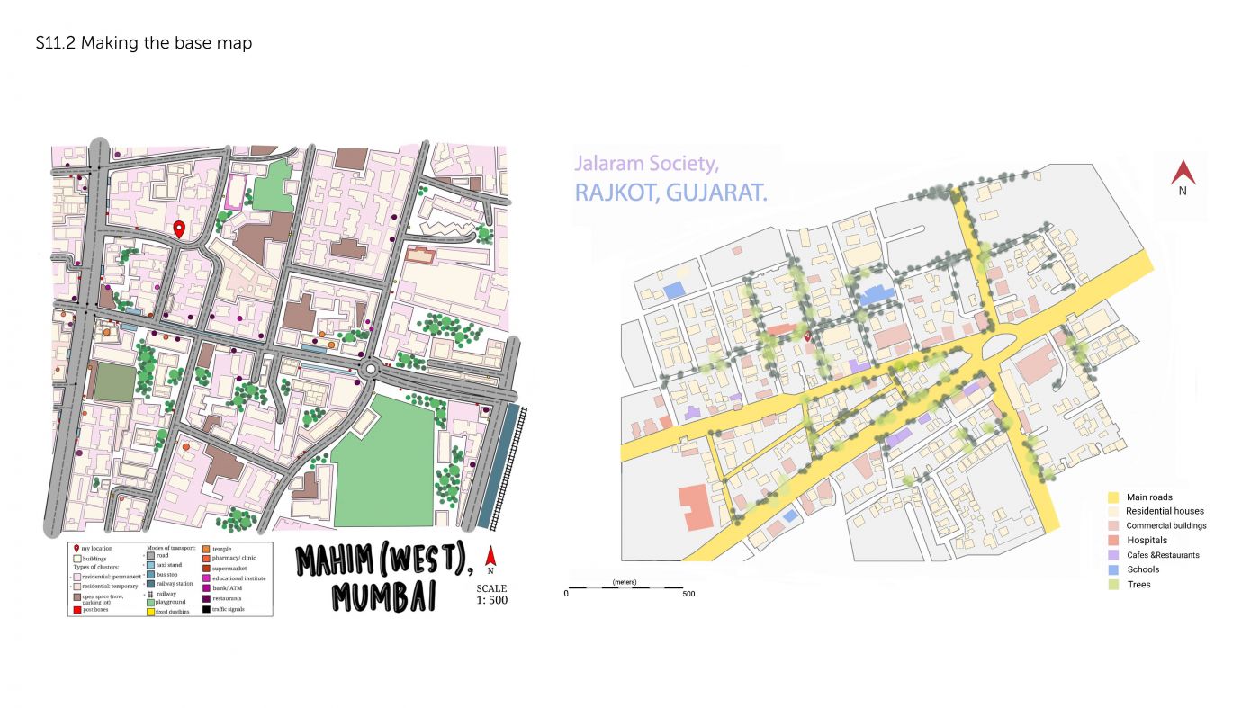
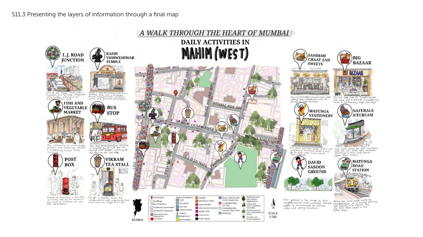
The exercise takes the students to an urban environment which they strive to understand and analyse through mapping. The initial stages involve the preparation of the base map of the selected urban environment, onto which specific data is later collected. Though brief, the exercise introduces the students to both static and dynamic mapping, and to software-based analysis of the data. It allows for variety in the nature of the data collected: from mapping of domestic and commercial activities, to mapping of biodiversity, signage and various movements.
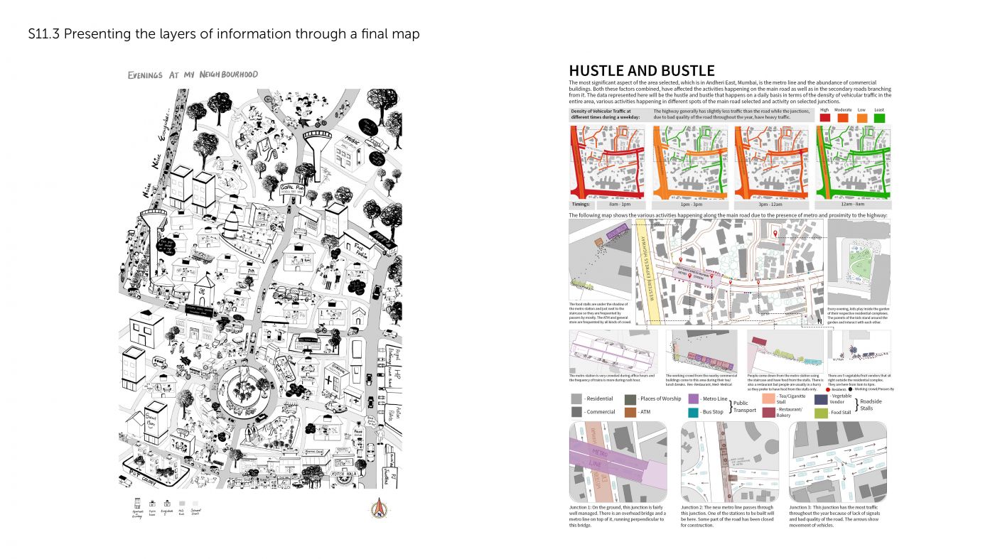
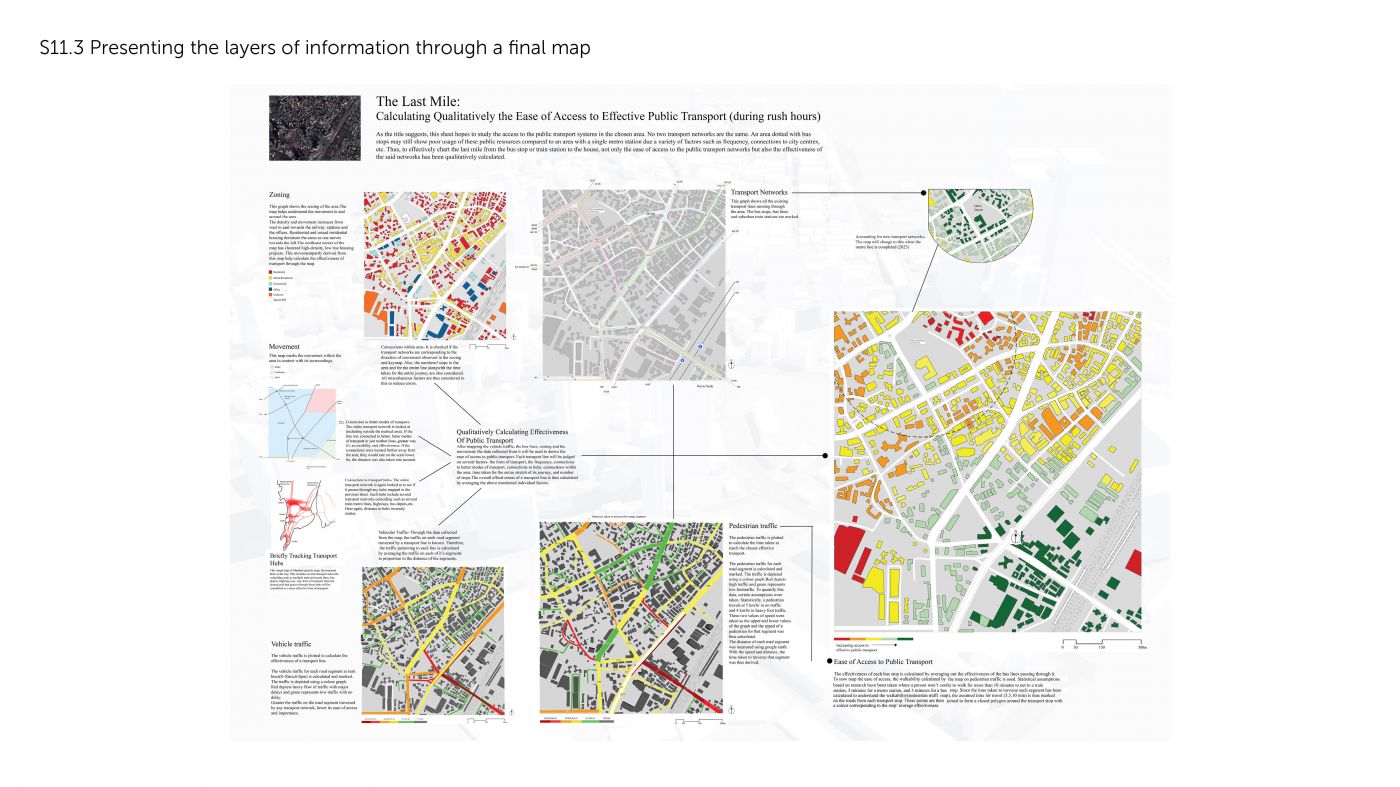
The observations and analysis guide the choice of representation in adding a layer of meaning to the map. The final representation, accompanied by a more detailed written analysis, constitutes an immediate way of communicating the variety of human interaction with various spaces. As multiple students’ work comes together, the layers added to the map permit preliminary observations of possible connections between the studies conducted in a particular area.