Riya Soni

LA4008

Synergizing Coexiting Entities

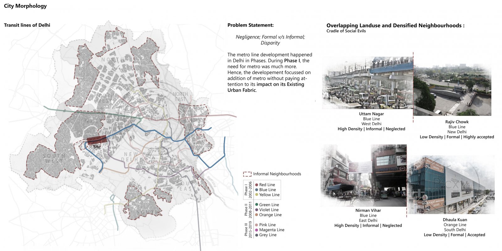
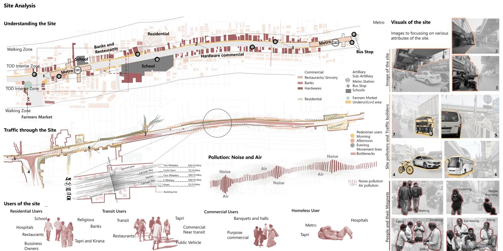
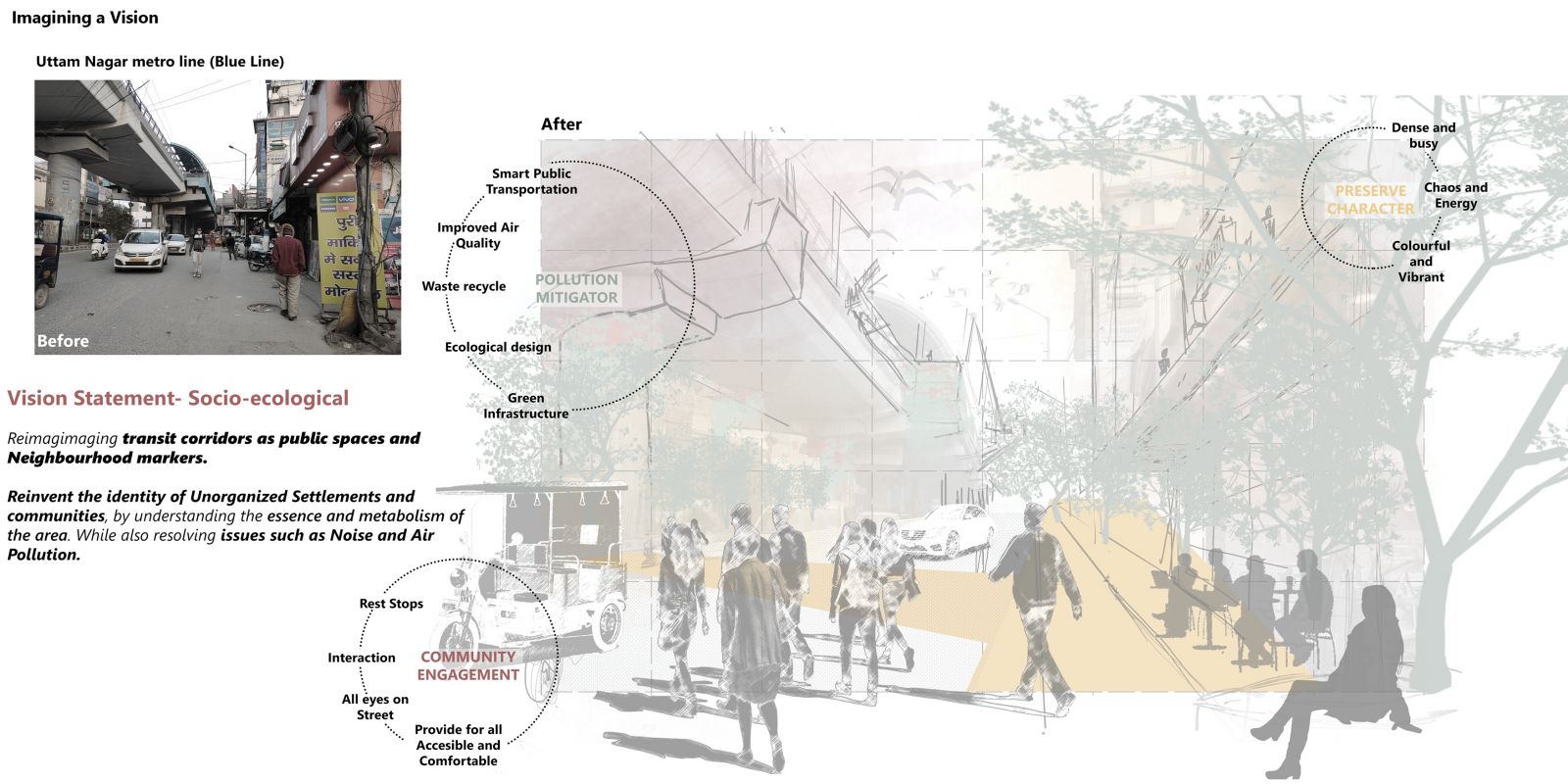
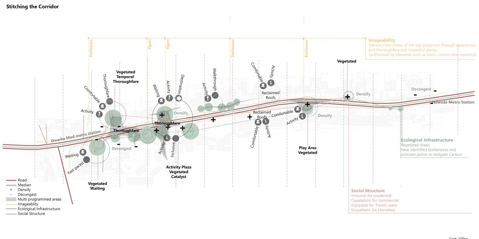
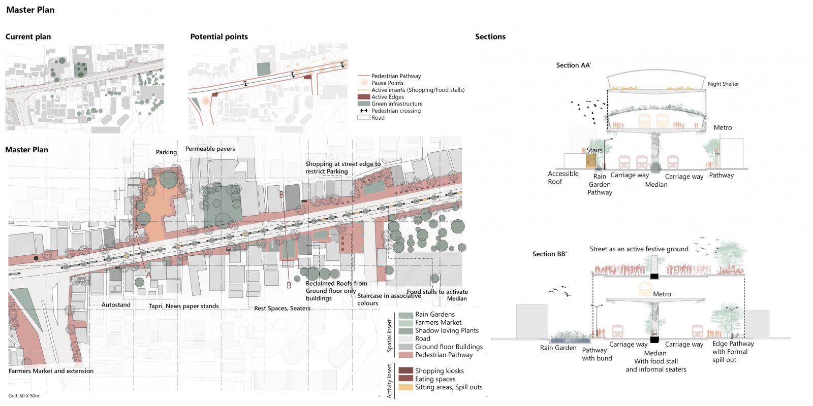
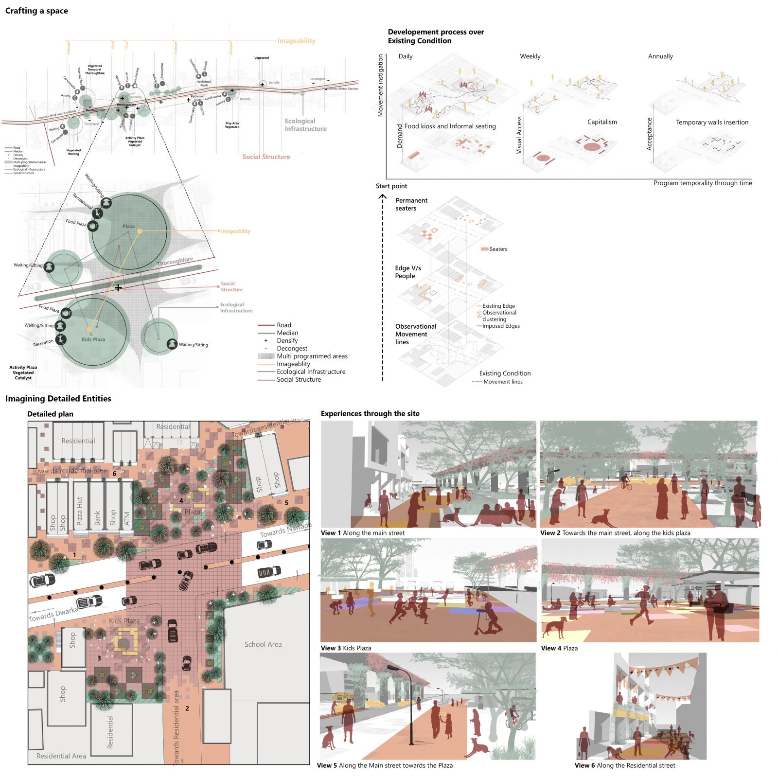
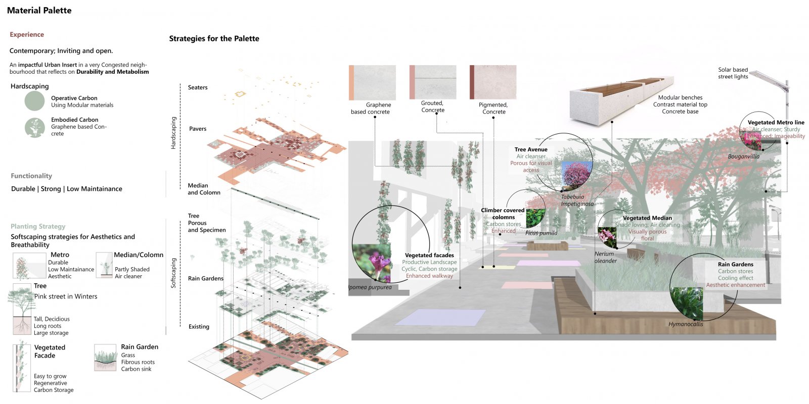
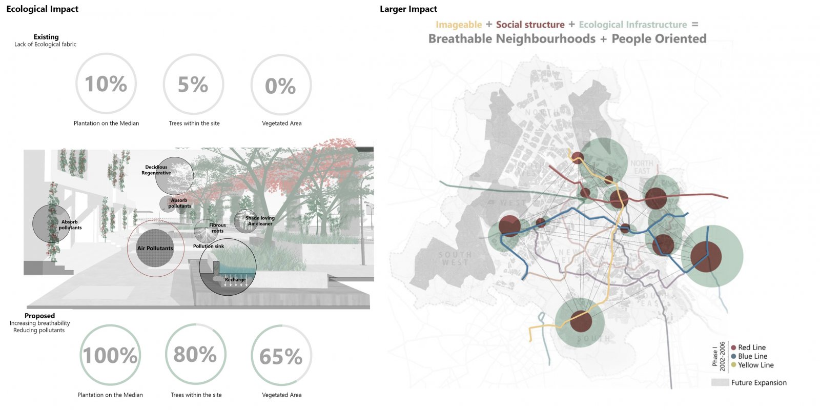
Transit lines in Delhi form an essential network creating Delhi's Identity. Over time, the identity has deteriorated as a hub of chaos, air pollution, congestion, and social evils. The project aims to re-imagine the transit line as a public space that reflects a Comprehensive culture in Uttam Nagar, Delhi. The process focuses on binding together multiple synergies, creating an equitable public space. The program aims to educate each user with an incentive, further instigating unobstructed management through time. This will make the urban inserts and all users an equal part of the system. Each system is supported by others to coexist. 

View Additional Work

Report Content

The city of Delhi is a result of its high immigration quotient leading to rapid unplanned growth and Urbanization. The timeline and morphology of Delhi majorly show that Delhi has two types of areas, Organized and Unorganized. Due to the initial placement near the centre, the immediate adjacency has a more organized city Image. Areas near central Delhi have an organized neighbourhood, whereas nearly 49% of Delhi are Unorganized neighbourhoods. The metro insertion happened to Delhi in phases. In the initial phase, the addition was focused on providing a metro while ignoring the neighbourhood’s urban fabric.

Uttam Nagar is a highly dense and populated area. It currently accommodates varied land uses. i.e., Transit, Commercial to Residential inserts like schools, etc., resulting in a large incoming traffic within the site. The above images show the land use, the existing usage of the site, its users and the consequences of the same.

The urban issues of the highly dense and unorganized neighbourhoods became worse with overlapping land-use, high density, and insertion of metro leading to more pedestrian density. To cater to such issues, it was imperative to create a user-oriented space that accommodates the chaos of the area, while making the area much more breathable. Hence, a vision statement was formulated.

Three parameters were looked into to achieve the vision, i.e., social structure, Ecological infrastructure and Imageability. The overarching ideology explored and aimed to align the existing users and their spatial magnets into a synergy. Forming a compact culture that benefits each other within a social structure and enhances Imageability while making it much more breathable. The three key strategies were curated to support each other to form a support system between each entity. This made all the four entities depend on each other, making the whole system synergized through time.

When applied on the street, the three main keys from the program gave a multitude of activities that needed to be integrated with the green infrastructure and Imageable spatial inserts. While collating all the three parameters, certain areas are decongested, and others are densified while instigating thoroughfare. This preserves the current movement on the site. This process was a layered approach where ecological infrastructure is added in pollution hotspots. Further, an activity layer was added within this ecological framework to render an interactive space for people as they engage with the urban inserts such as food kiosks and the vegetated spaces.

The existing condition is a very haphazard look on the site. Some underutilized pockets and niches give space for unauthorized parking, etc. This stretch has been reimagined by reiterating the overall program on a 500 m stretch within site. The placement of shopping kiosks, food stalls, seaters, etc., was done as per the user movement observed on site. The three strategies were overlapped with the existing fabric to achieve a better, imageable, community-oriented, and breathable area. Hence, green spaces along with activities have been put throughout the stretch.

A specific node was programmed in detail to understand temporality, major activities, movement, and densifying inserts. The temporality that the site aims to achieve will be formed by how people currently use the space. From the analysis of the movement lines and where people cluster, permanent seaters were added. These seaters will further develop into spaces on a daily, weekly and annual basis. The pocket has two functional spaces, a kids plaza and a plaza from the diagram shown above. These plazas aim to accommodate the temporal programs explained previously. The intent is to pedestrianize the street by discouraging vehicular traffic. The street has vegetated areas that aim to recharge the groundwater and mitigate the pollution.

The materials for this detailed plan were chosen with respect to the experience, functionality, and aesthetics. The hardscaping was done to curate an experience of a contemporary space. The planting palette chosen was to enhance the quality of the space, the experience along the road. This will also eventually reduce pollution and increase breathability substantially.

The temporality and seasonality will make space perform differently throughout to engage people within the site. Through this, the street will accommodate more users through seasons. The kinetics of the planting palette will bring more people to the site. This will activate the street through seasons while maintaining an engaging interface.

The issues that arise due to neglected neighbourhood fabric and Urban inserts often lead to unnecessary congestion and chaos. These issues often render the area avoidable or ignored. This will substantially enhance the image and experience of such areas. It will also increase the value of the area by reinstating the district as more than a transit line. This program and design will also help improve breathability, reduce pollution, and eventually start Re-imaging the Image of such areas.