Mehta Parth Pareshumar

4100

Foundation Studio

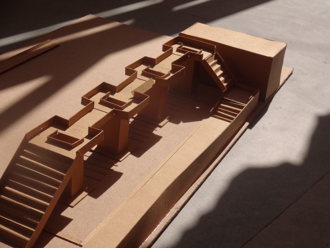
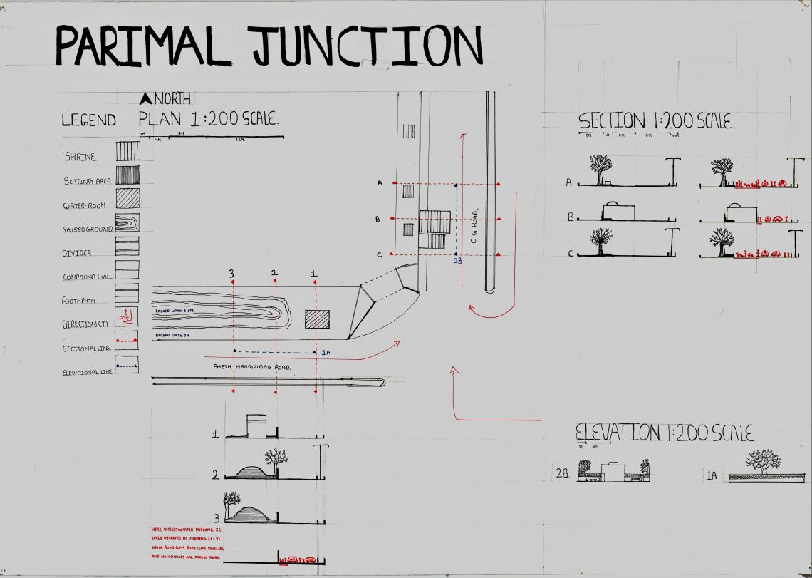
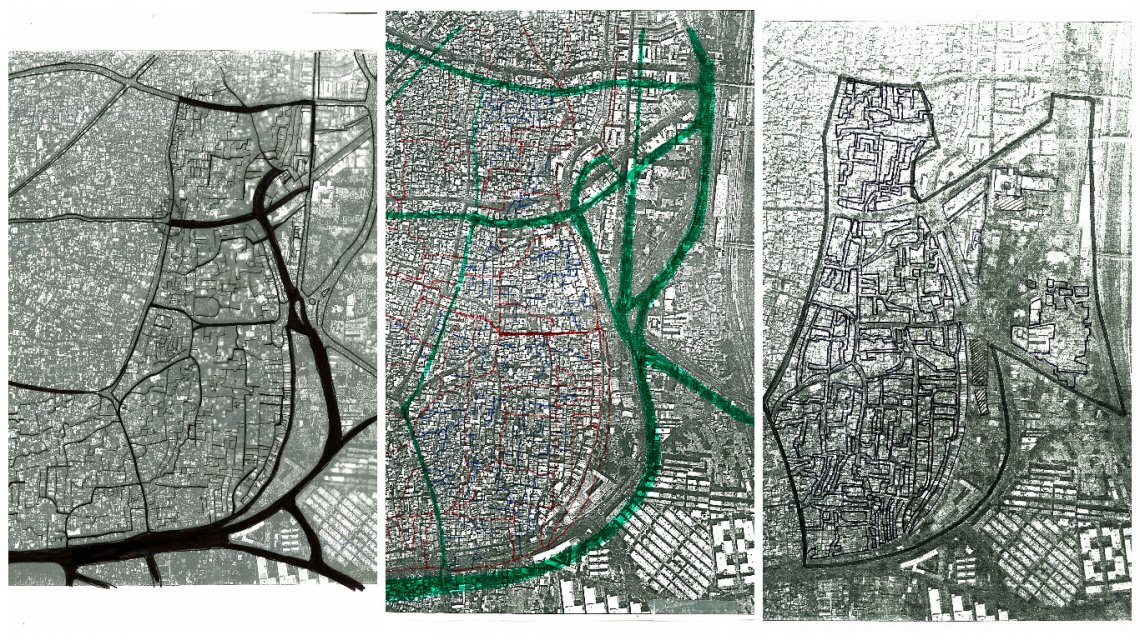
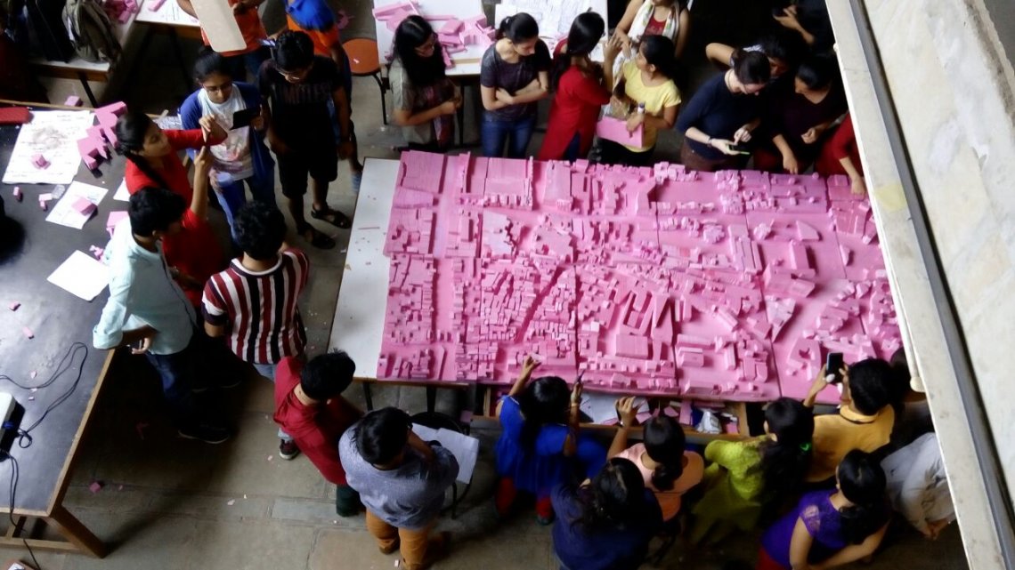
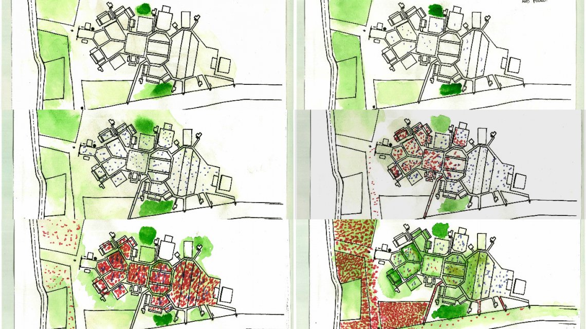
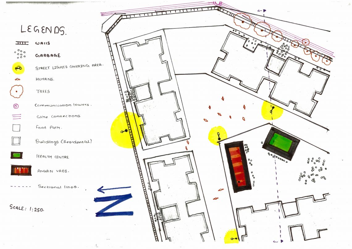
Here we developed the skills of visualization, and briefly understood the relationship between  buildings, roads, and public places with the urban environment. Here hand work was refined by sketching and model  making exercise. Along with this, spaces with different scales were studied. Coming to the final project, it was to design for the shared space,to discover prominent condition of the space and to design for an individual user group such that the design do not conflict for other user group and stays with the condition.


Report Content

Final Project-Page 2 Proposal for new designs and new installment in the plan, and sections show the expected changes to occur.

Final project-Model (Process) This is the model made during the process of final design. This was for the north edge of Parimal garden.

Final Project-Page 1 Present Conditions at the edge of Parimal garden are shown. Sections describes site with and without activities.

Final project-Page 3 Working of new installments and uses of them on the site.

Building Typology-Khadia(east.) Buildings were mapped according to the structure and usage of it.

Street Typology-Khadia(east.) Streets were classified on the basis of size, usage, accessibility and traffic accommodating at that street.

Model making-Old city Here there is the relationship between streets and building is discovered.

Navratri mapping-GMDC ground How the site is used by people (different types) in different interval during the festival Navratri.

BSUP Housing-Odhav This it the zoomed version of the site showing the activities as well as detailed.

BSUP Housing-Odhav The main aim was to look at the conditions of the site and implanting it on the plan rather only Mapping the things that are on the site.