Dibyashekhar Bhattamishra

UR3006

Creating a Home

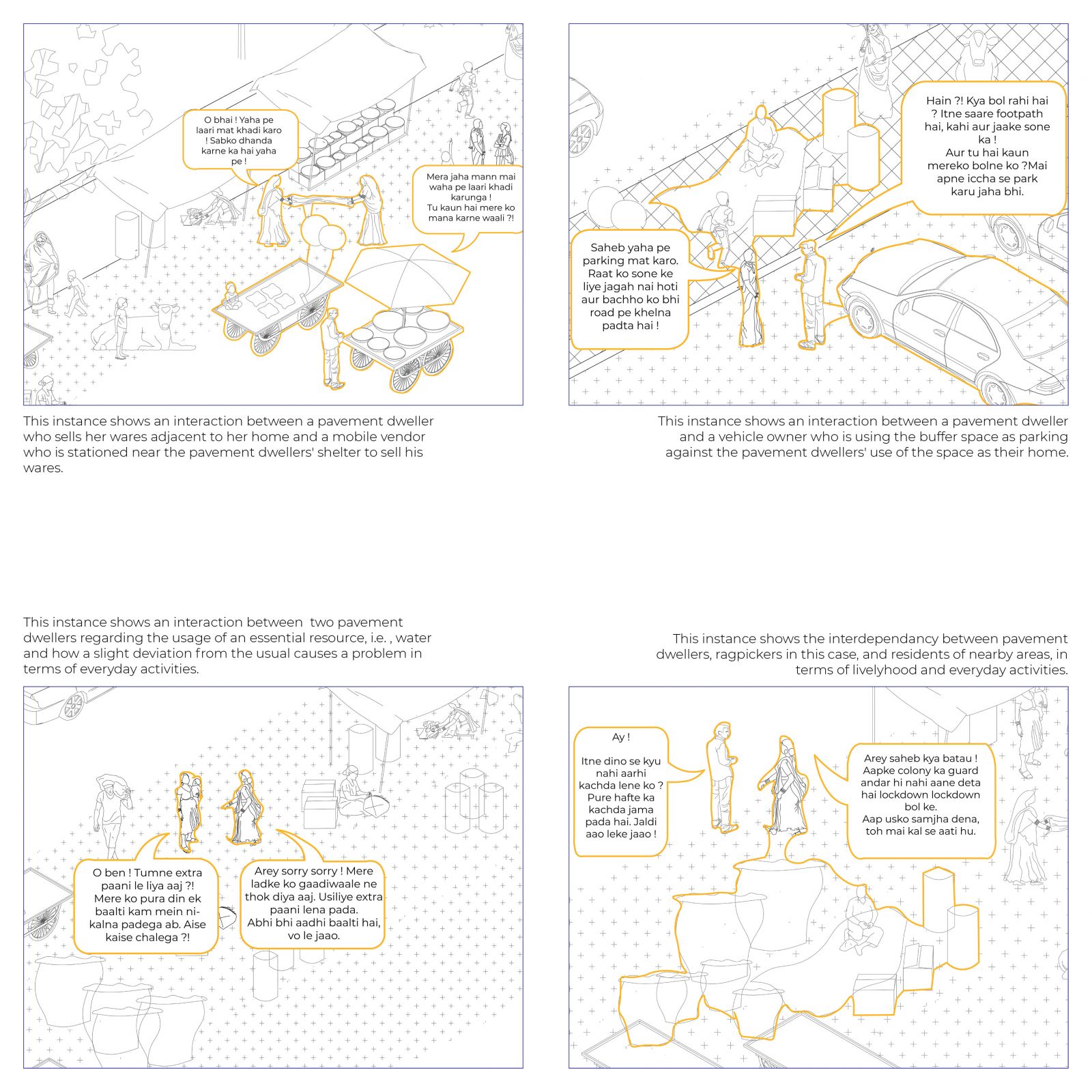
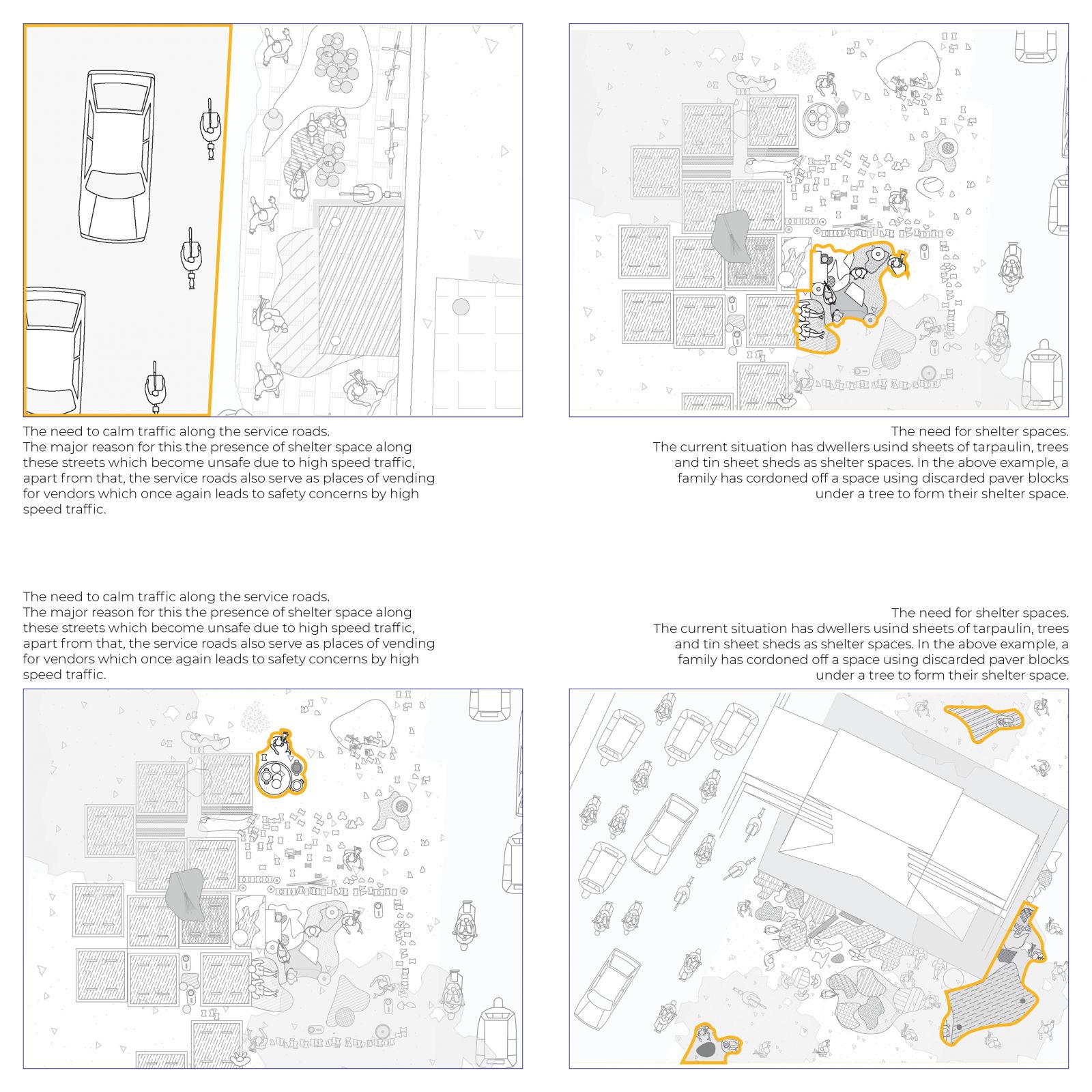
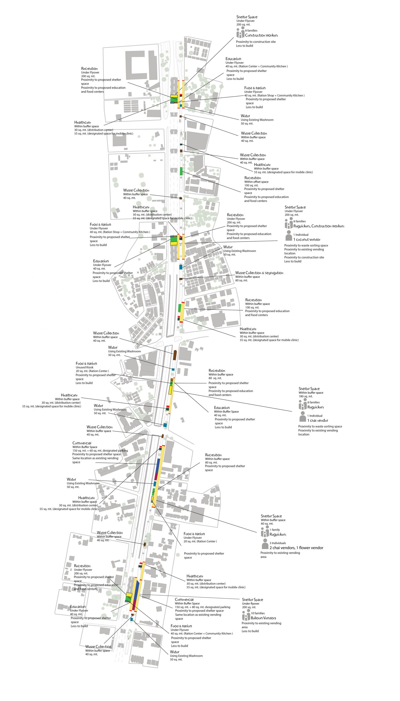
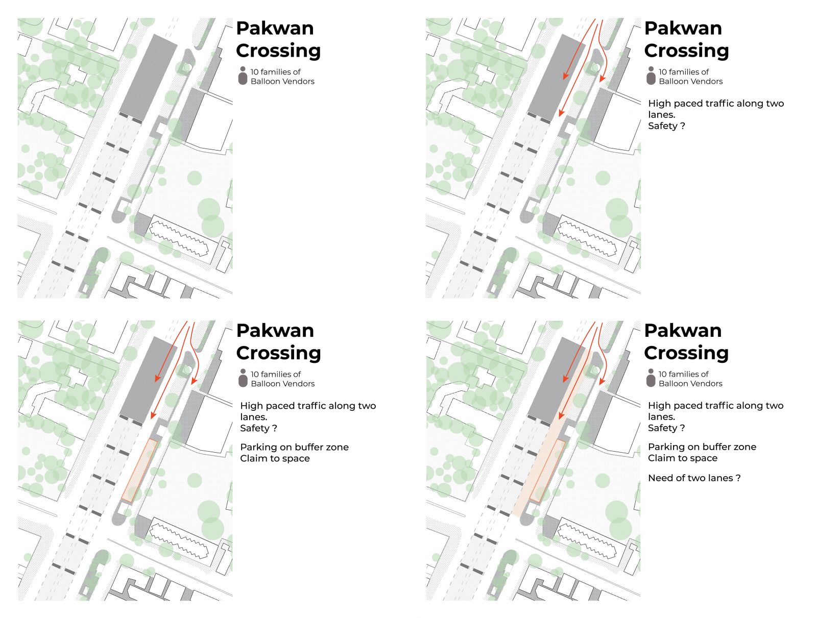
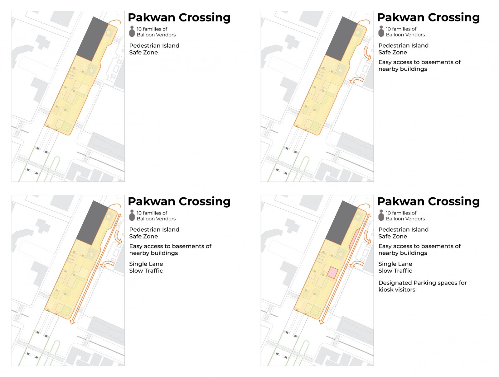
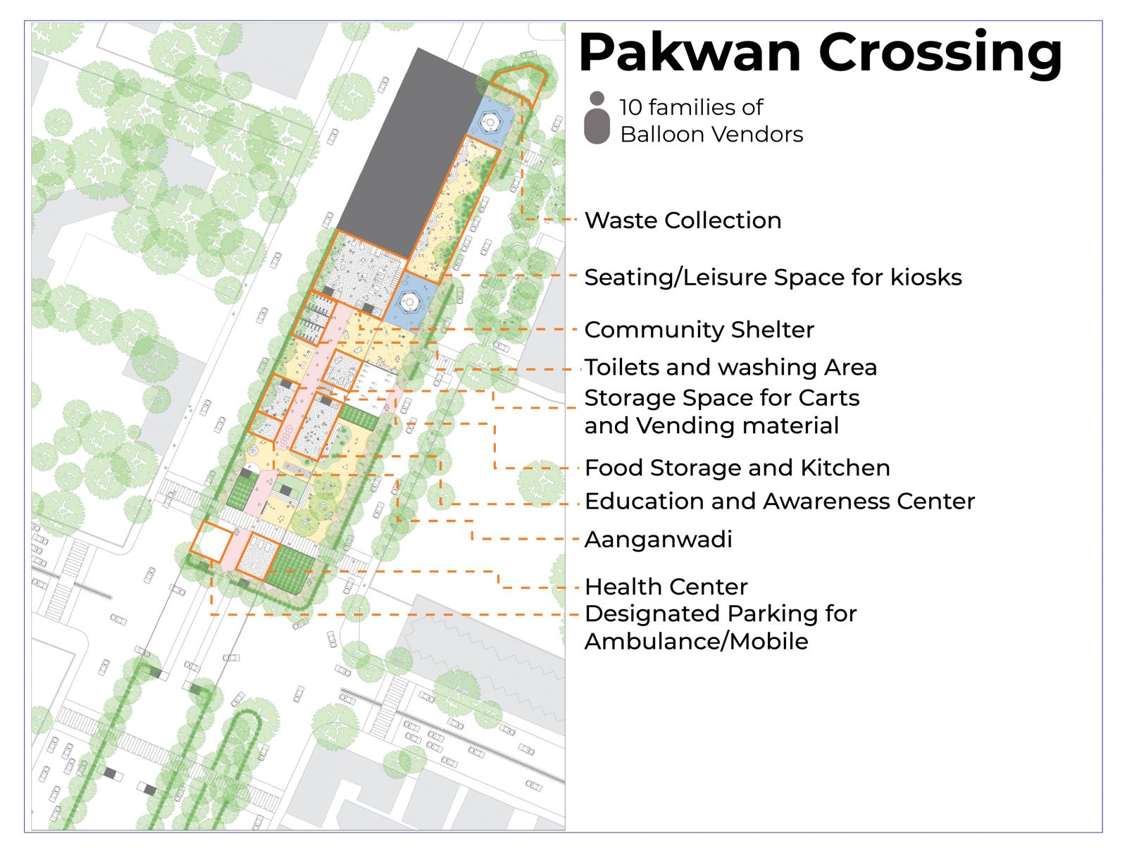
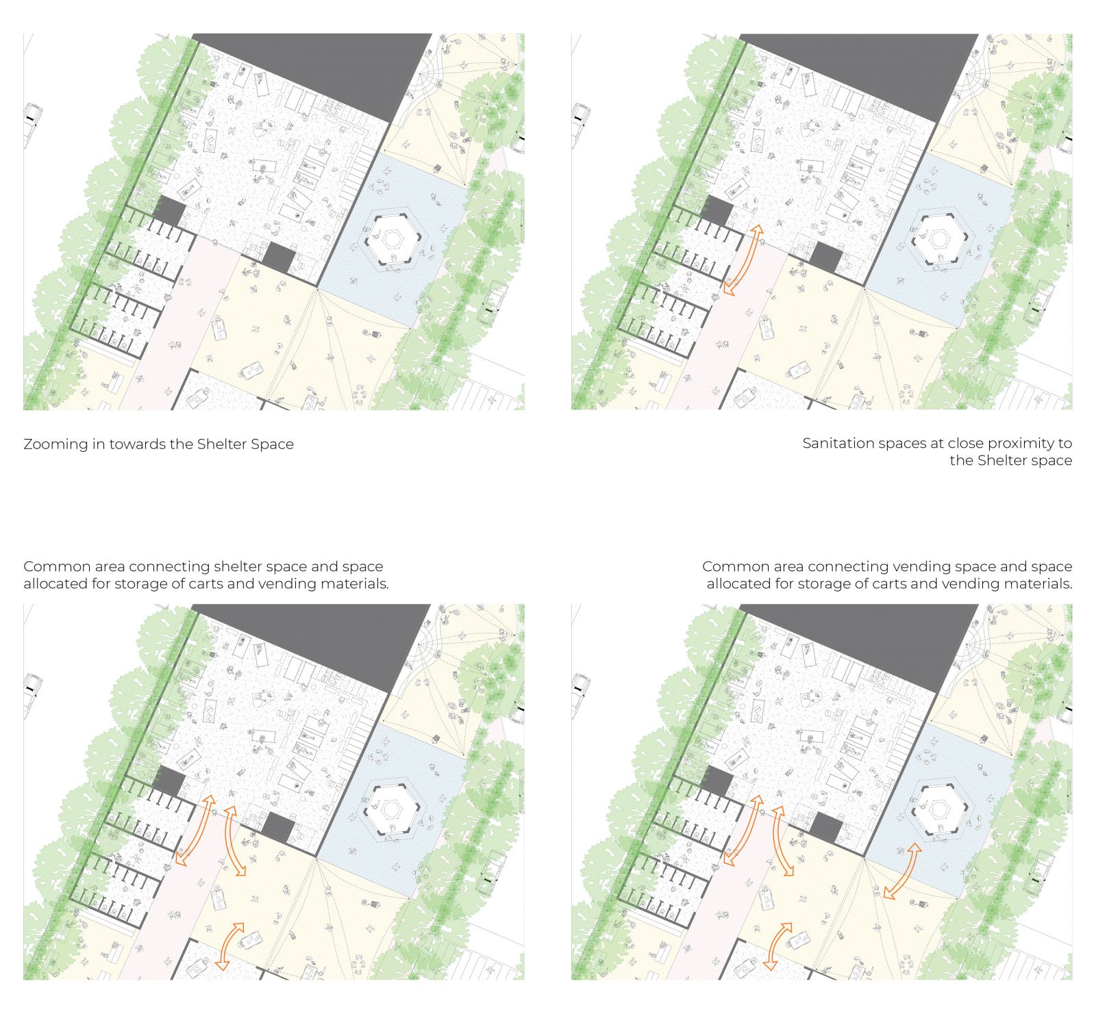
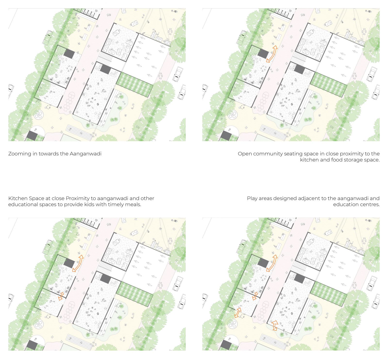
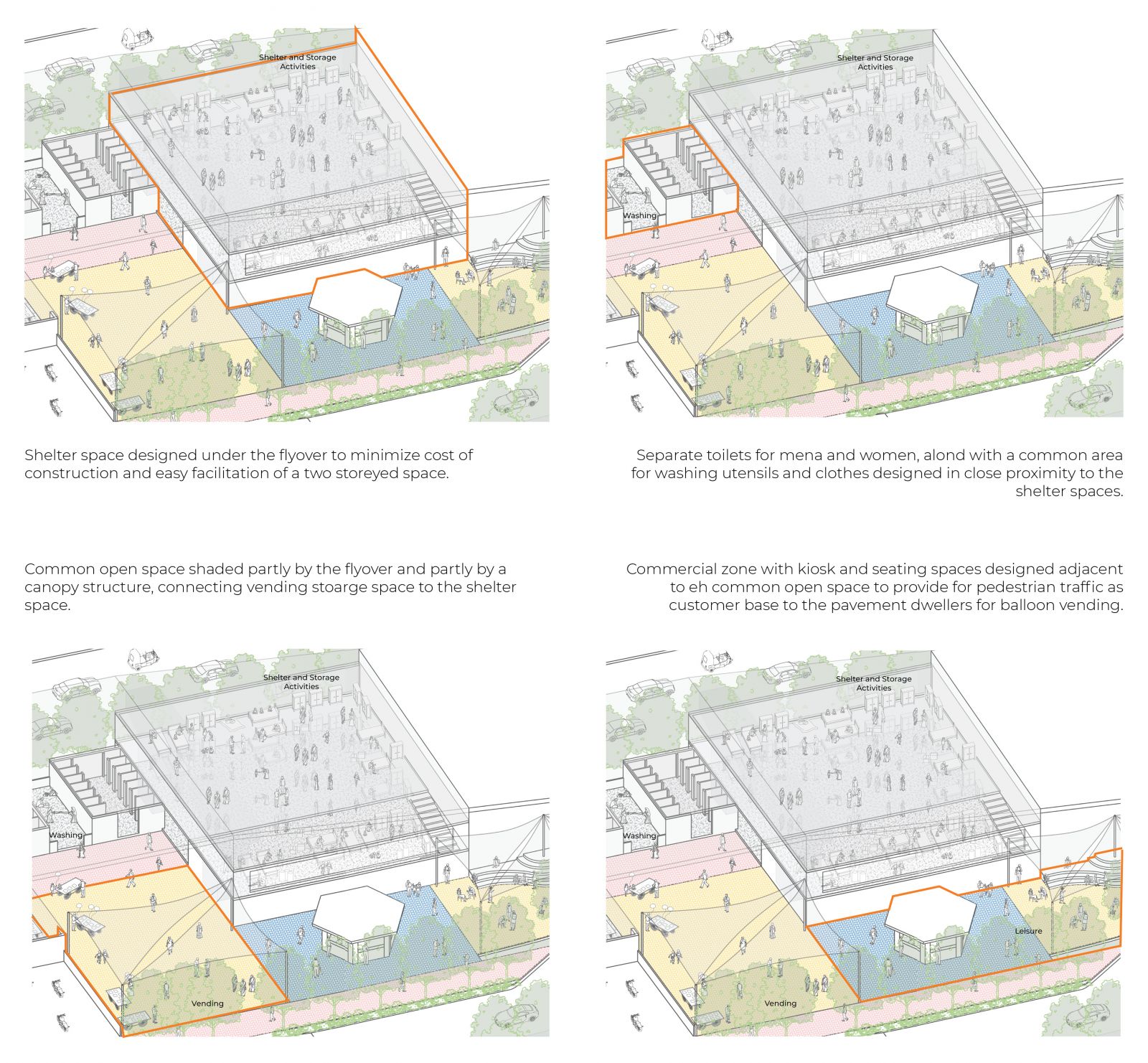
This project deals with creating a space for pavement dwellers on the SG Highway. In the current situtation, the people live on the pavements, earn their living on the street, drink water from public toilets and taps, get whatever they can to eat and their children play on the street with cars flying by at a high pace, yet they don't have any space they can call their own, any space where they fell safe and secure.CREATING A HOME puts forth a proposal to  provide shelter and other basic amenities to these pavement dwellers on the highway itself. 


Report Content

Initial obseervations made during visits to the site of SG Highway. These observations include conversations and activities amongst the various stakeholders on site such as pavement dwellers, mobile and stationary vendors, kiosk owners and employees. The study focuses on points of negotiation for space between these stakeholders, be it for the purpose of livelyhood, shelter, water or food.

The next step in the initial study was moving ahead from the initial observations and identifying the different needs that may arise as a result of these negatioations and interdependancies between different stakeholder groups. This includes a study of everyday activities in terms of resources, locations and other basic needs and what is needed in terms of these everyday activities along with other needs.

The intial study of observations from the site and the needs that may arise from those activities and negotiations led to three pertinent questions. Who in terms of the user group ? The user group that was chosen as a focus of the study was pavement dwellers. Where ? Which locations were occupied by the members of the user group. Why ? Why are the users there, one part of the answer to this question was because of livelyhood, leading to the narrowing of the user group to pavement dwellers who live and work on SG Highway.

Having answered the questions of Who? Where? & Why? The next step was to develop strategies to address the specific needs of the user group. Certain strategic systems were thought of and then locatd on site to create a strategic masterplan.

After creating a strategic masterplan, the next step was to zoom in and resolve one part of the whole site in greater detail. The site chosen for this leg of the process was the Pakwan Junction. The above image shows initial concerns and observations about the site.

This image shows the initial design ideas with regards to the traffic flow of the junction, creating a pedestrian zone and creating solutions for the issue of illegal parking.

The uses identied for the pedestrian zone.

Functiong of the diffrent Spaces.

Functiong of the diffrent Spaces.

Functiong of the diffrent Spaces.