Your browser is out-of-date!
For a richer surfing experience on our website, please update your browser. Update my browser now!
For a richer surfing experience on our website, please update your browser. Update my browser now!
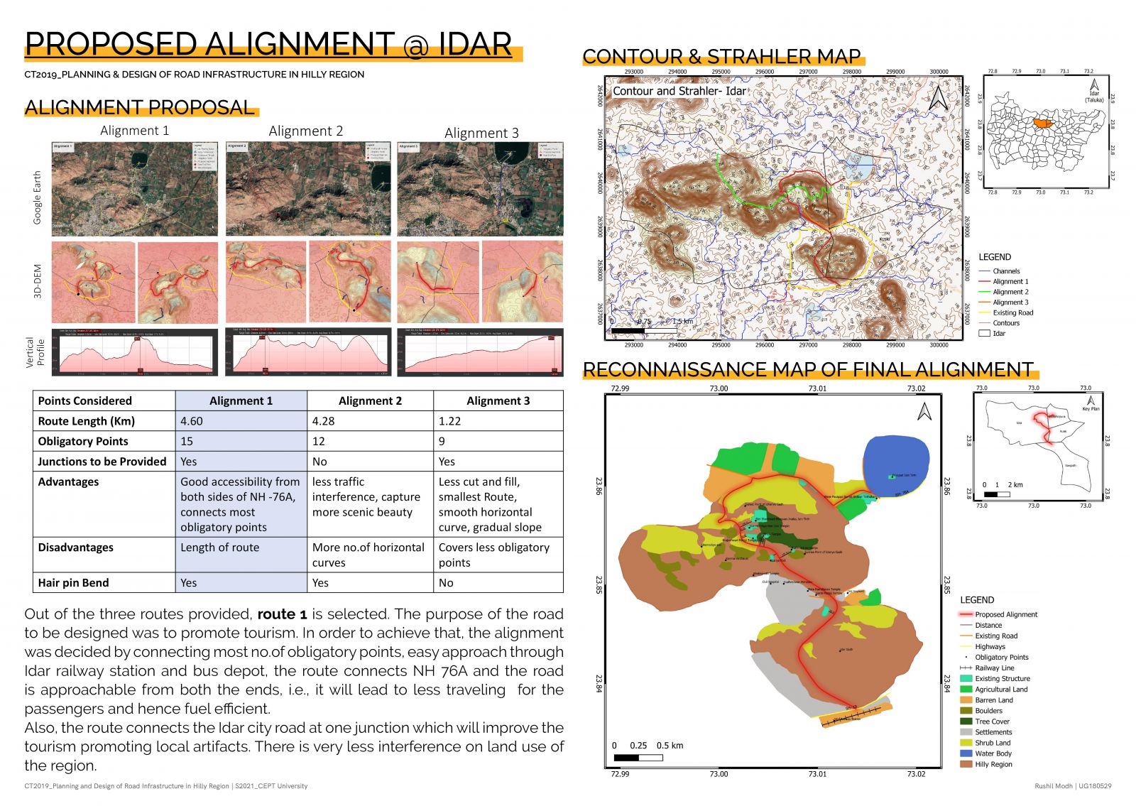
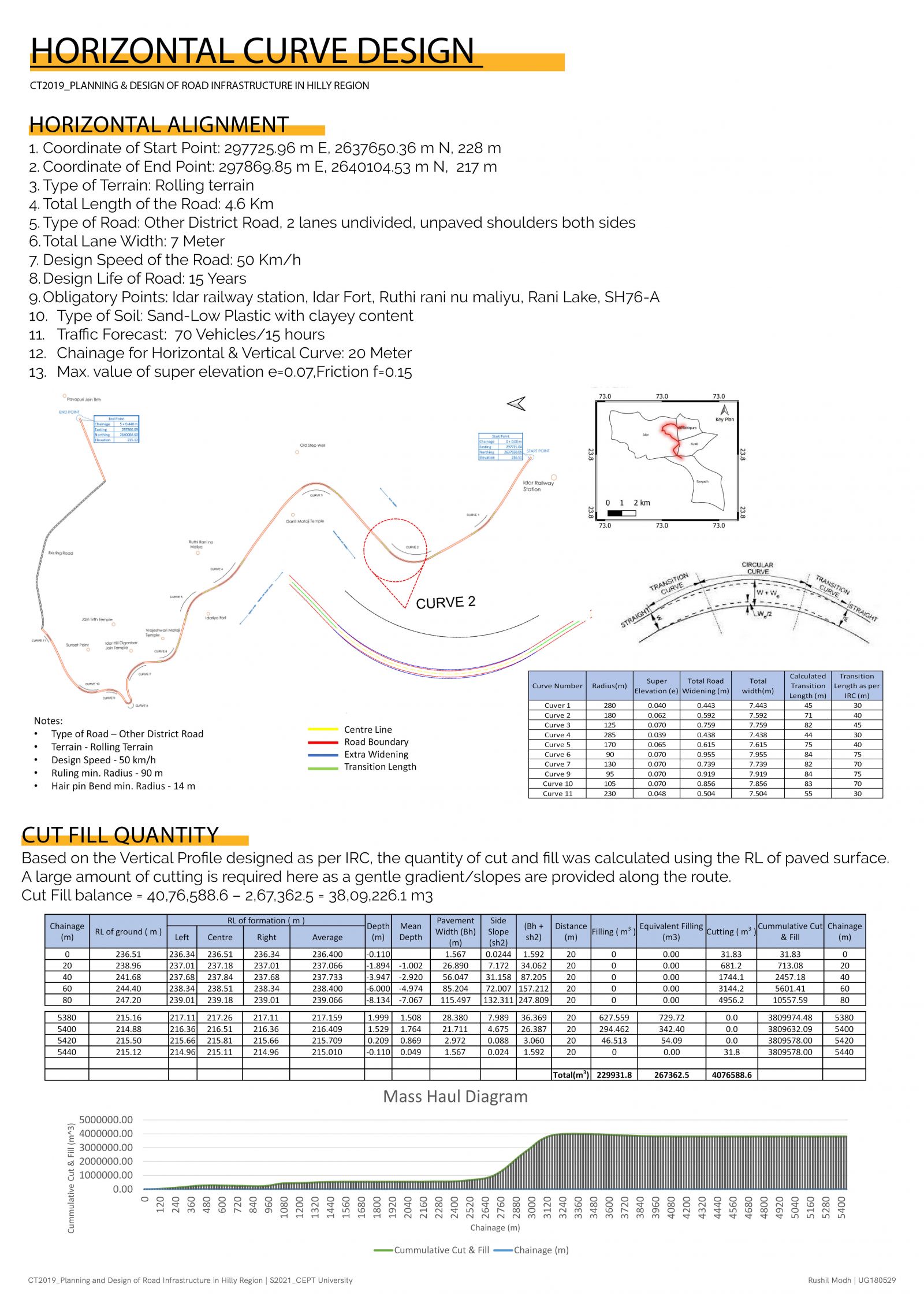
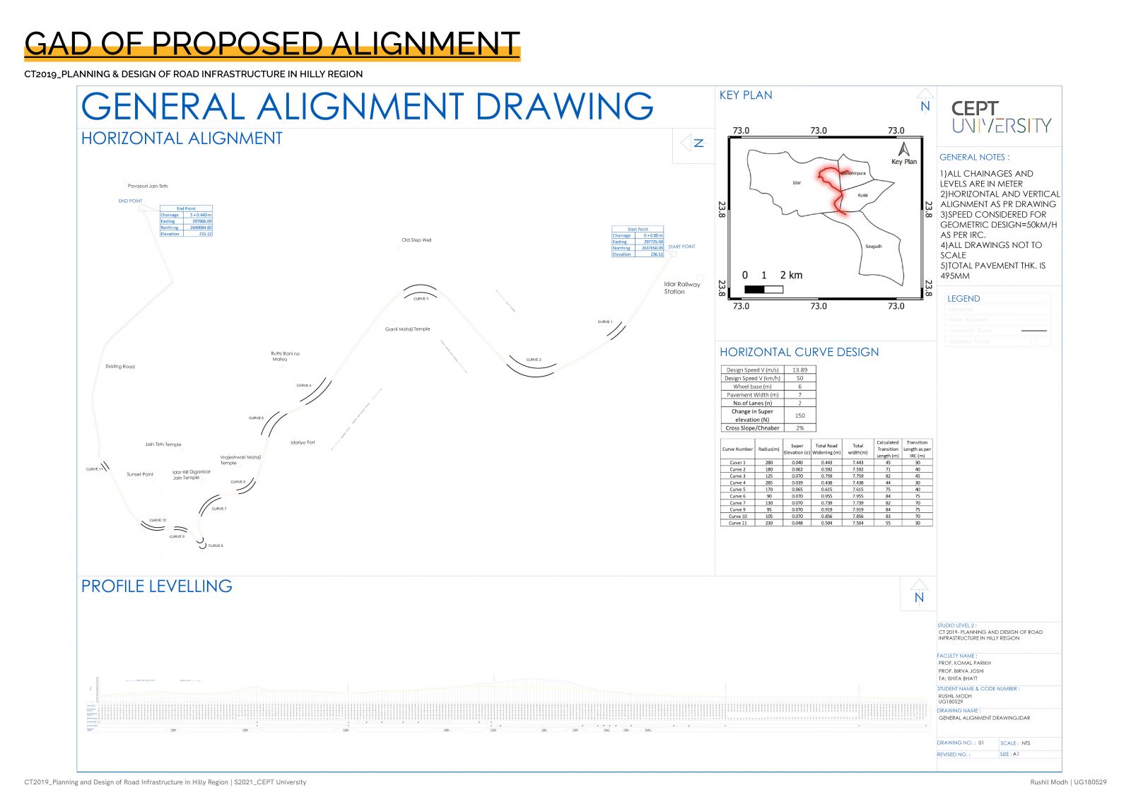
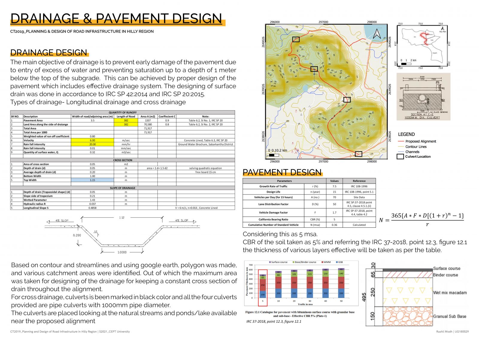
The studio introduces the process of planning and design of road infrastructure in hilly region. In doing so, I explored through various activities and concepts of planning and designing of a road in hilly region and attempts to perform these activities on the case of a hilly road in the Taranga region of Gujarat, India, for which I assessed the existing alignment and then a similar approach toward the road in Idar Gadh where an alternative potential alignment that could link the Idar temple top to the nearest state highway. Along with it, I was also exposed to various concepts, skills, code provisions and ground realities that aided me in making decisions about the potentialities and limitations of various alternative routes. Various methods of representation, codal provisions, environmental factors and site studies were extensively done to understand the region of study and the existing route and the output was achieved using advanced software like Qgis, Context Capture. Click here for Portfolio and detailed Report