Your browser is out-of-date!
For a richer surfing experience on our website, please update your browser. Update my browser now!
For a richer surfing experience on our website, please update your browser. Update my browser now!
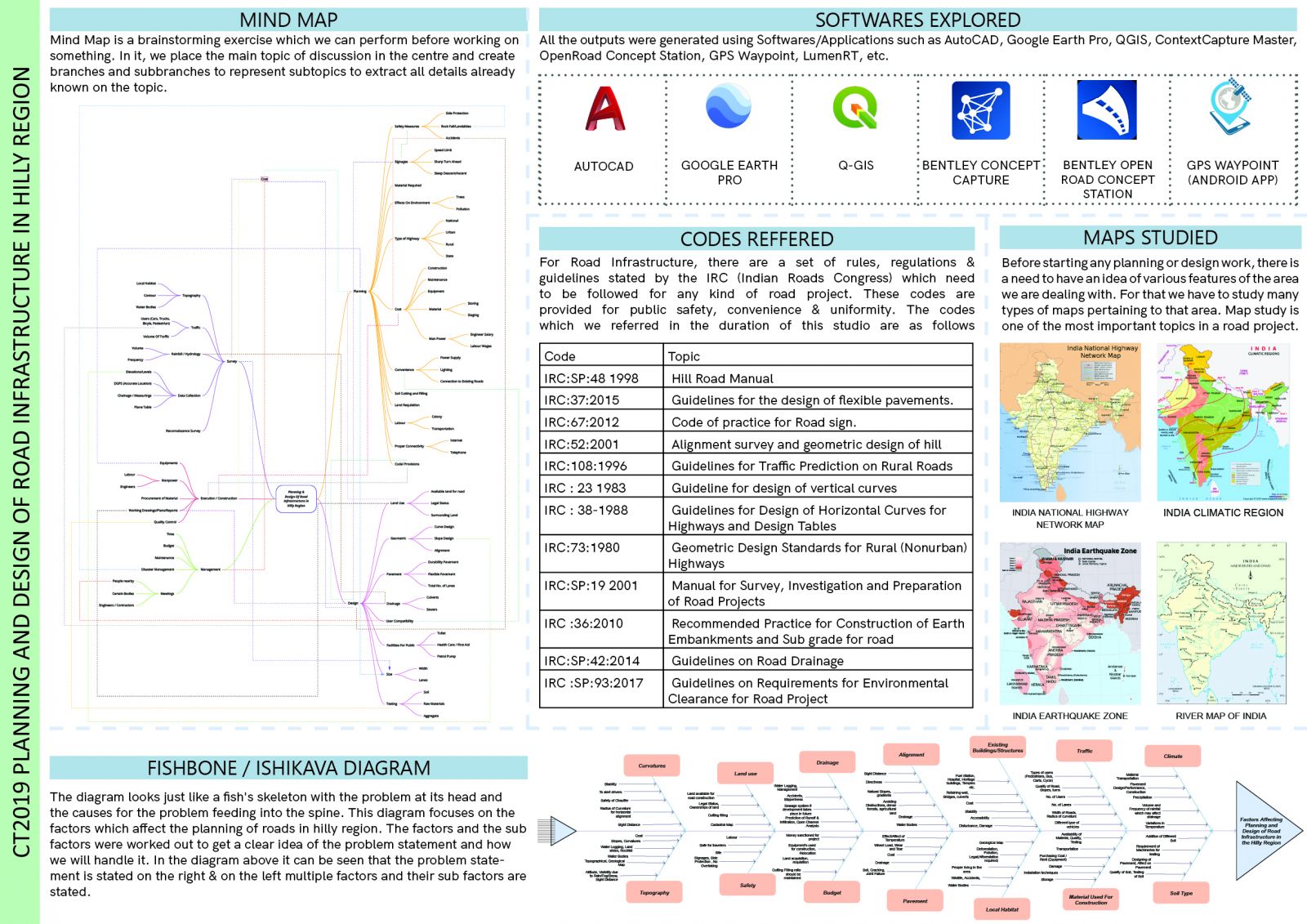
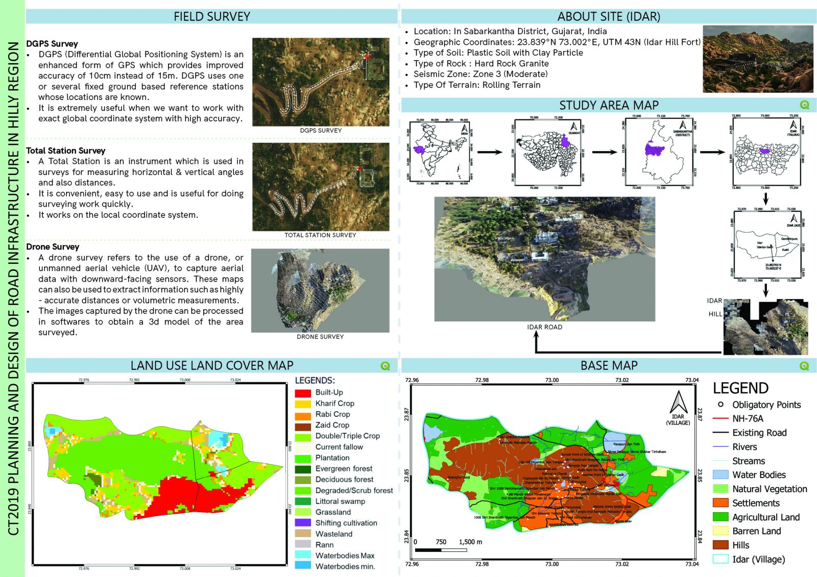
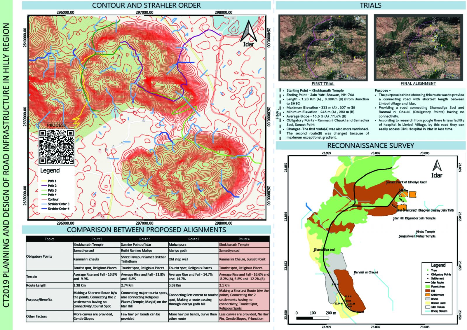
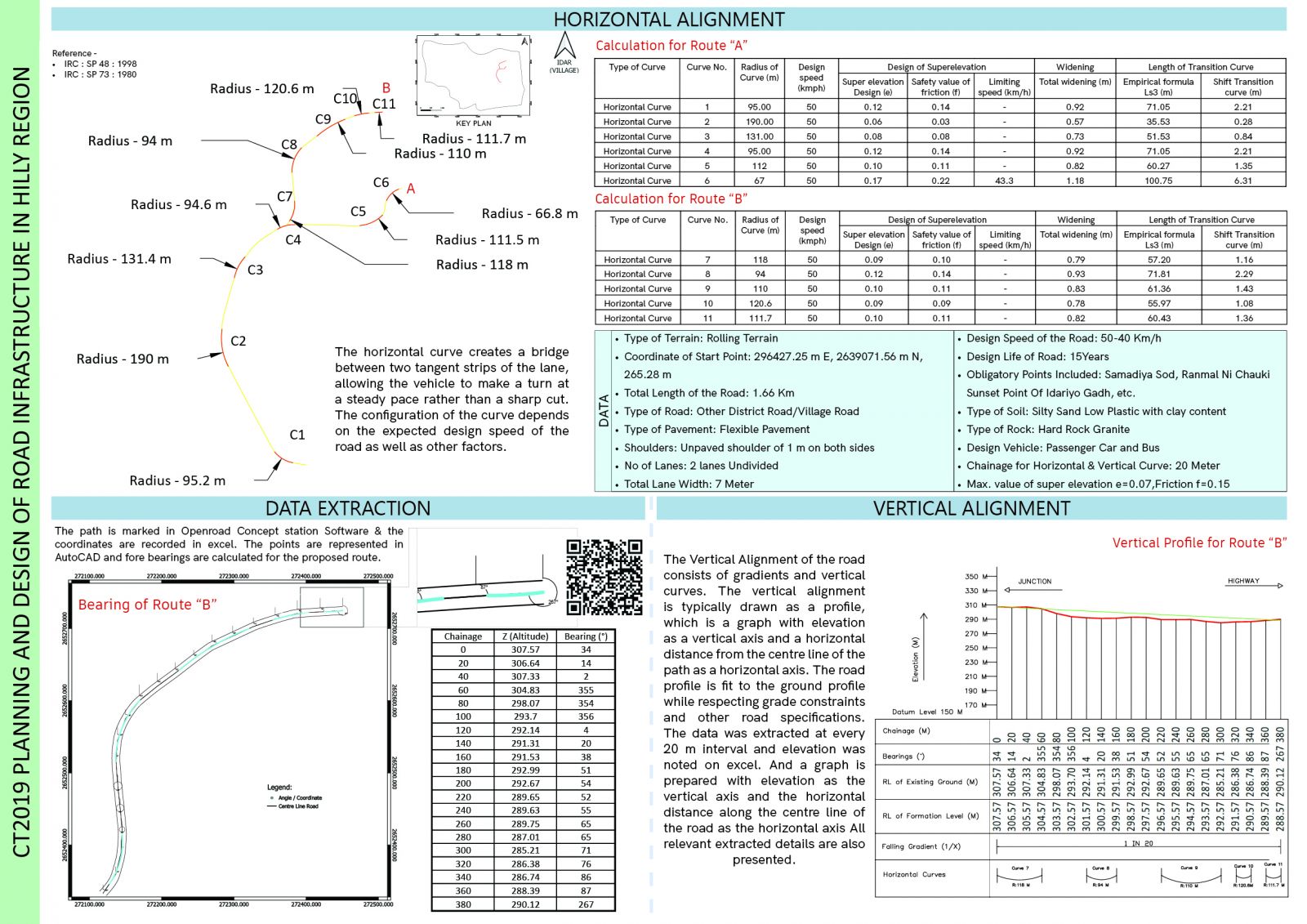
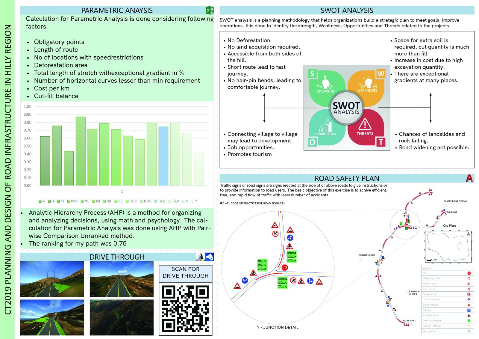
This Studio focuses on the Planning & Designing of road infrastructure in hilly regions. The initial two exercises were brainstorming which included the mind map and fishbone diagram. The curriculum after that was divided into two parts: Planning & Design. Planning of Road is done in a way by studying and preparations of maps. Designing of Road is done considering various aspects and for various, different types of users such as slow-moving to fast-moving vehicles, animals, pedestrians, etc. We were then given the knowledge about the Concepts, Skills, code provisions, and ground realities to help us in making decisions about the potential and limitations of various routes. A road is to be designed considering all the aspects. Testing and selecting route alignments based on civil and highway engineering principles, techniques and codes, technical specification, design of its elements, Quantity Calculations, Parametric Analysis, SWOT Analysis, and Road Safety analysis using advanced design tools as Qgis, Bently Software's, etc. For More Details refer to Portfolio and detailed Report
View Additional Work