Your browser is out-of-date!
For a richer surfing experience on our website, please update your browser. Update my browser now!
For a richer surfing experience on our website, please update your browser. Update my browser now!
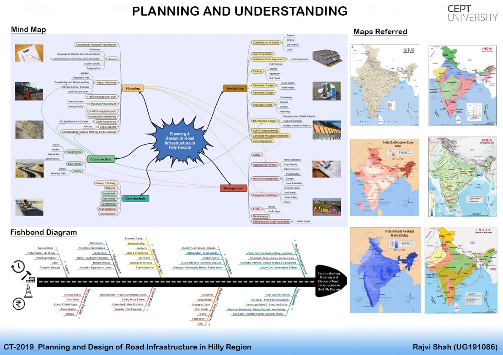
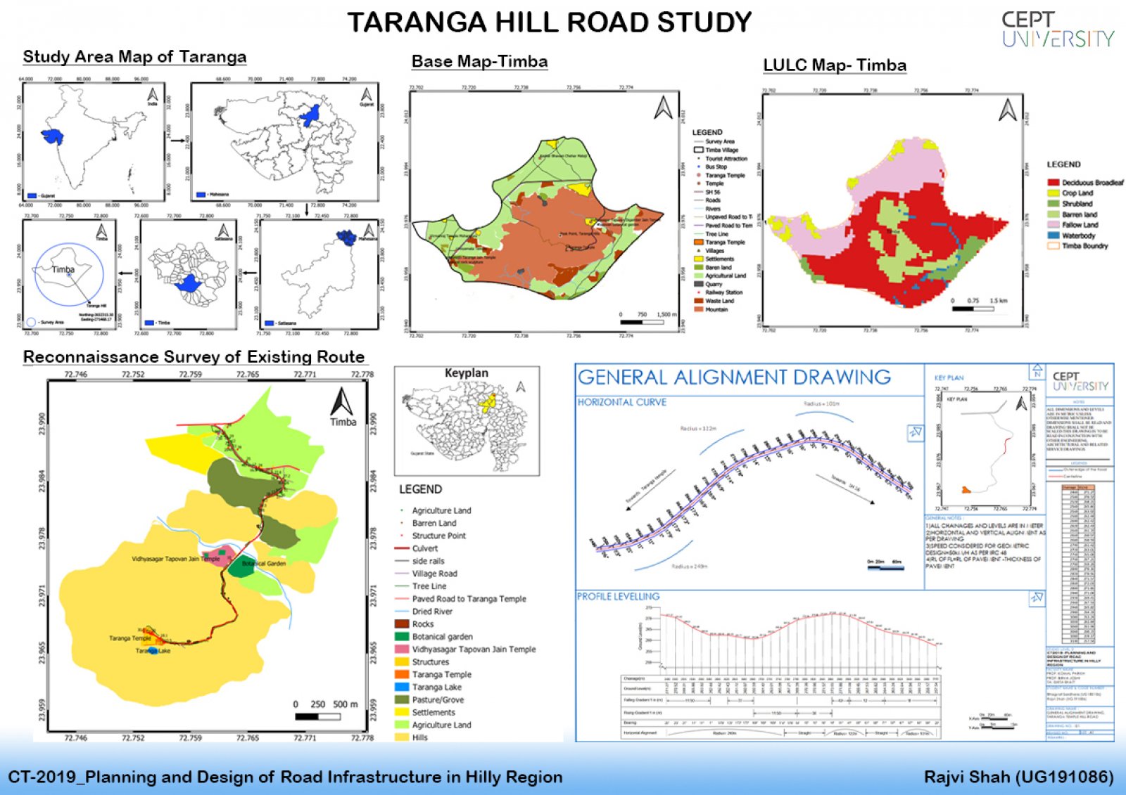
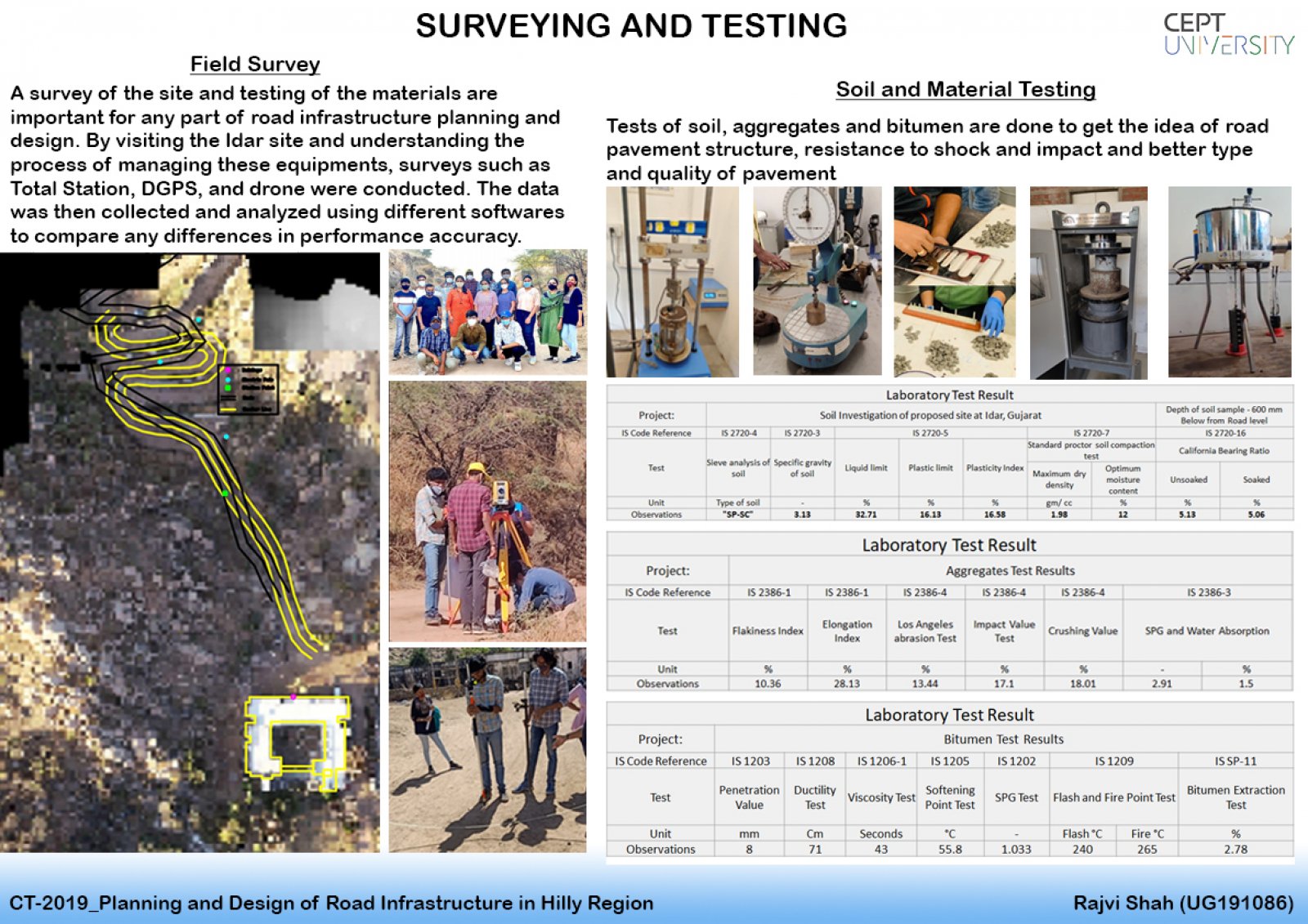
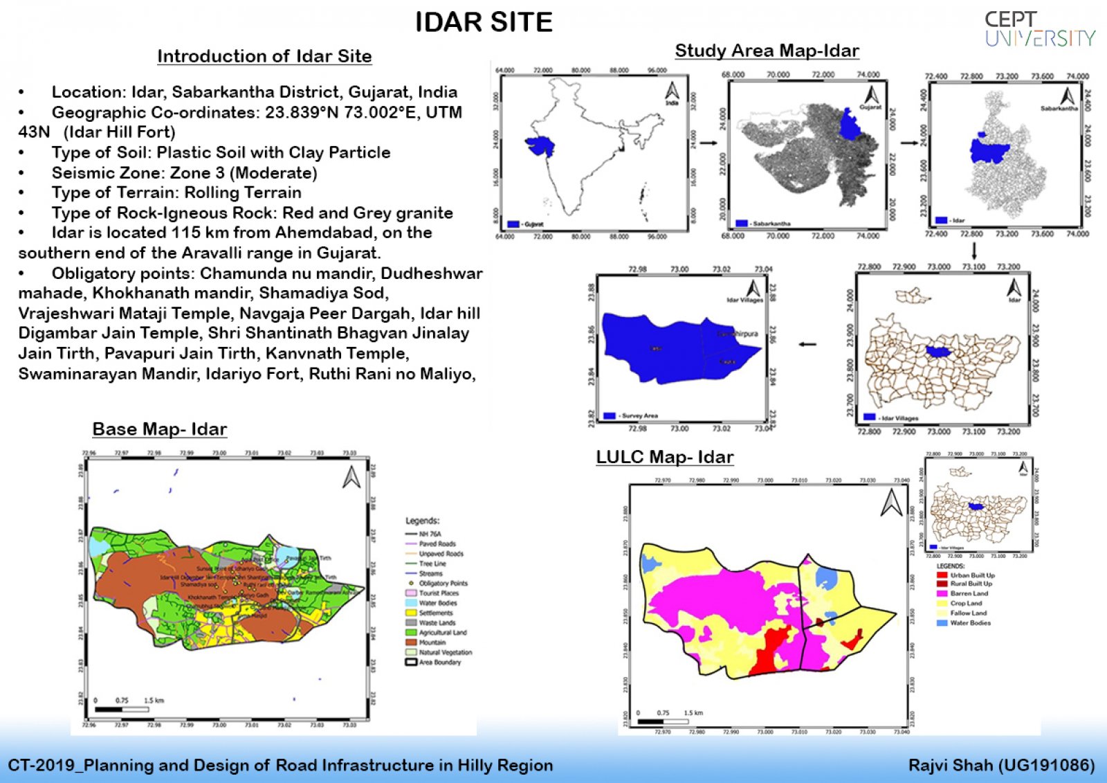
The studio focuses on the process of planning and constructing a road in a hilly area. From slow-moving, vulnerable pedestrians, bikes, and animals to fast-moving vehicles of various types, road design necessitates an appreciation of the often conflicting needs of diverse users. Understanding the user's needs; checking and selecting route alignments based on civil and highway engineering standards, methods, and codes; technical specification; configuration of its components, quantity calculations; parametric tests, and road safety research using advanced design tools including Open-Road, AutoCAD, Google Earth, and QGIS. All of these aspects were first practiced on a case study for Taranga Hill Road after applying them to the planned alignment at Idar. Click here for Portfolio and detailed Report.