Your browser is out-of-date!
For a richer surfing experience on our website, please update your browser. Update my browser now!
Severity: Notice
Message: Undefined offset: 0
Filename: models/Project_model.php
Line Number: 80
Backtrace:
File: /home/portfolio/public_html/application/models/Project_model.php
Line: 80
Function: _error_handler
File: /home/portfolio/public_html/application/models/Project_model.php
Line: 709
Function: get_sem_info
File: /home/portfolio/public_html/application/controllers/Project.php
Line: 112
Function: get_project_detail
File: /home/portfolio/public_html/index.php
Line: 321
Function: require_once
Severity: Notice
Message: Undefined offset: 0
Filename: models/Project_model.php
Line Number: 80
Backtrace:
File: /home/portfolio/public_html/application/models/Project_model.php
Line: 80
Function: _error_handler
File: /home/portfolio/public_html/application/models/Project_model.php
Line: 800
Function: get_sem_info
File: /home/portfolio/public_html/application/controllers/Project.php
Line: 127
Function: increase_project_view
File: /home/portfolio/public_html/index.php
Line: 321
Function: require_once
Severity: Notice
Message: Undefined offset: 0
Filename: models/Project_model.php
Line Number: 80
Backtrace:
File: /home/portfolio/public_html/application/models/Project_model.php
Line: 80
Function: _error_handler
File: /home/portfolio/public_html/application/helpers/utility_helper.php
Line: 131
Function: get_sem_info
File: /home/portfolio/public_html/application/views/includes/header.php
Line: 9
Function: semester_info
File: /home/portfolio/public_html/application/controllers/Project.php
Line: 148
Function: view
File: /home/portfolio/public_html/index.php
Line: 321
Function: require_once
For a richer surfing experience on our website, please update your browser. Update my browser now!
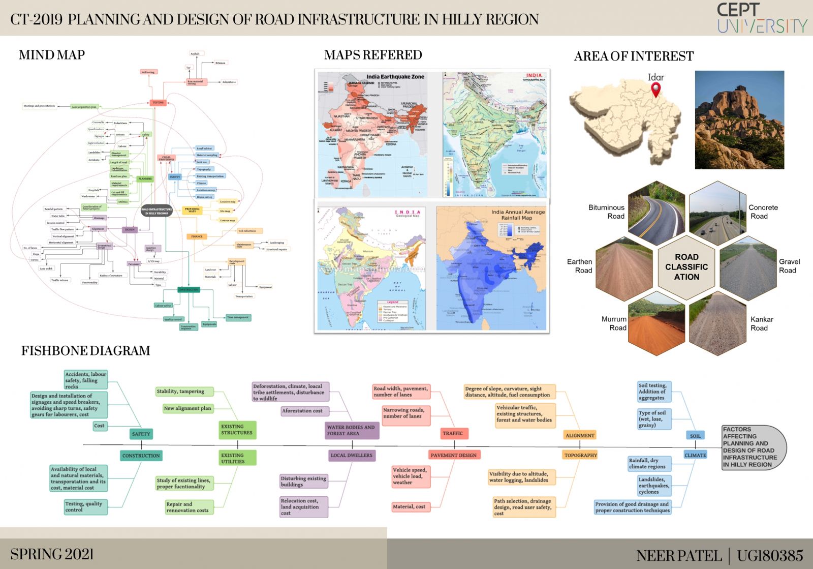
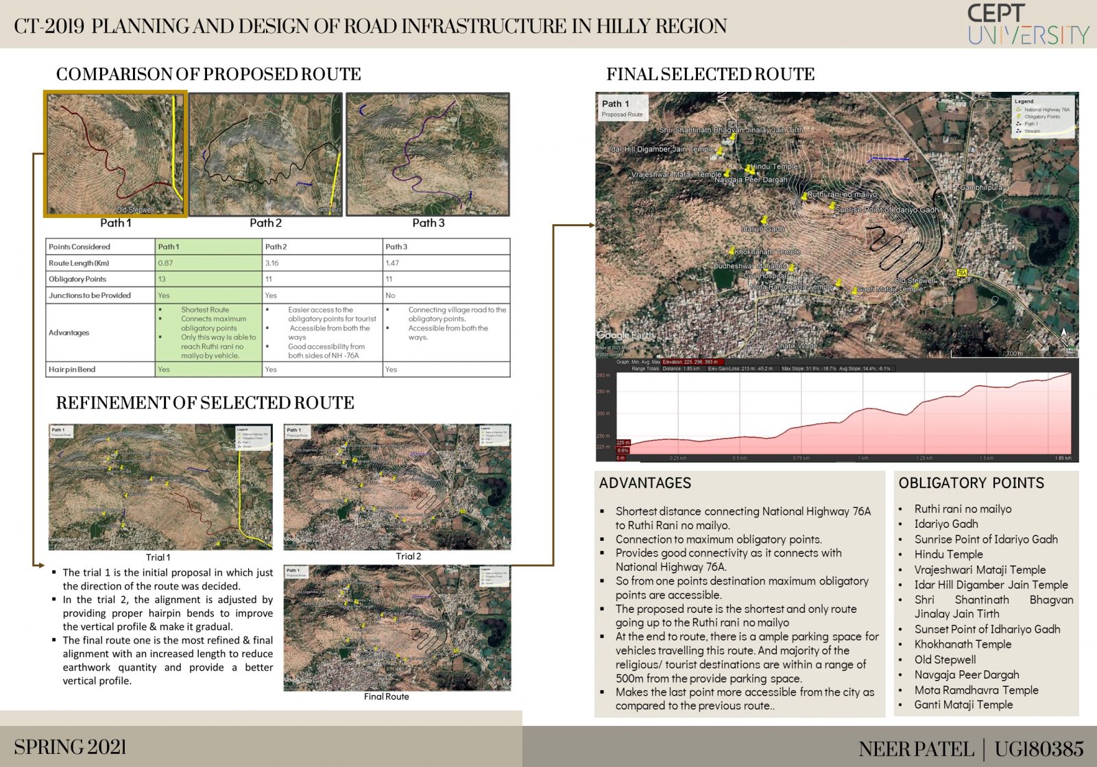
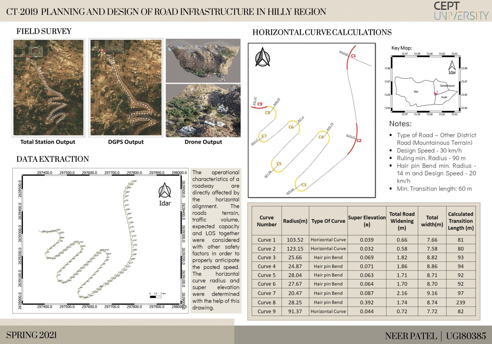
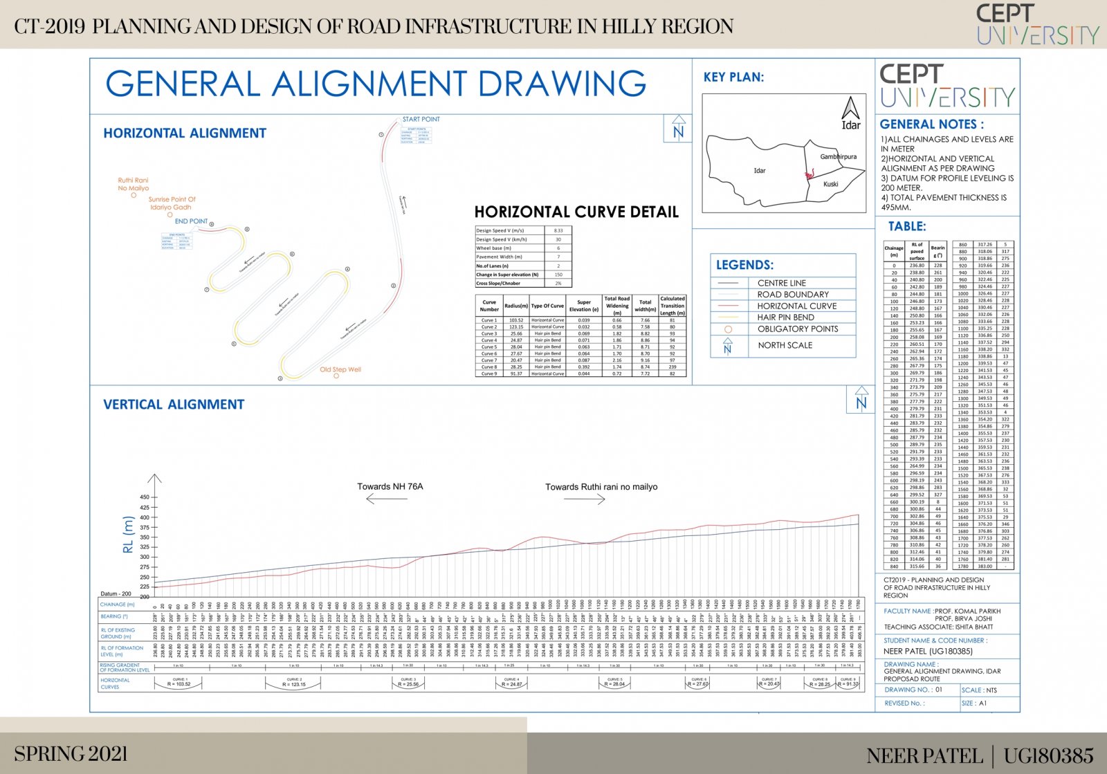
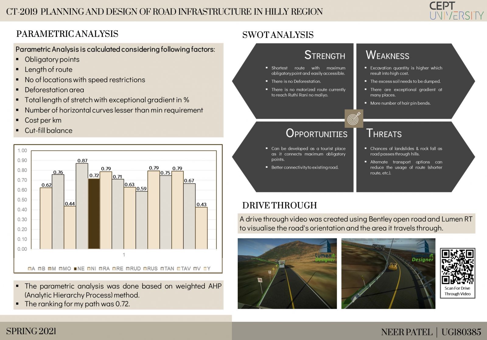
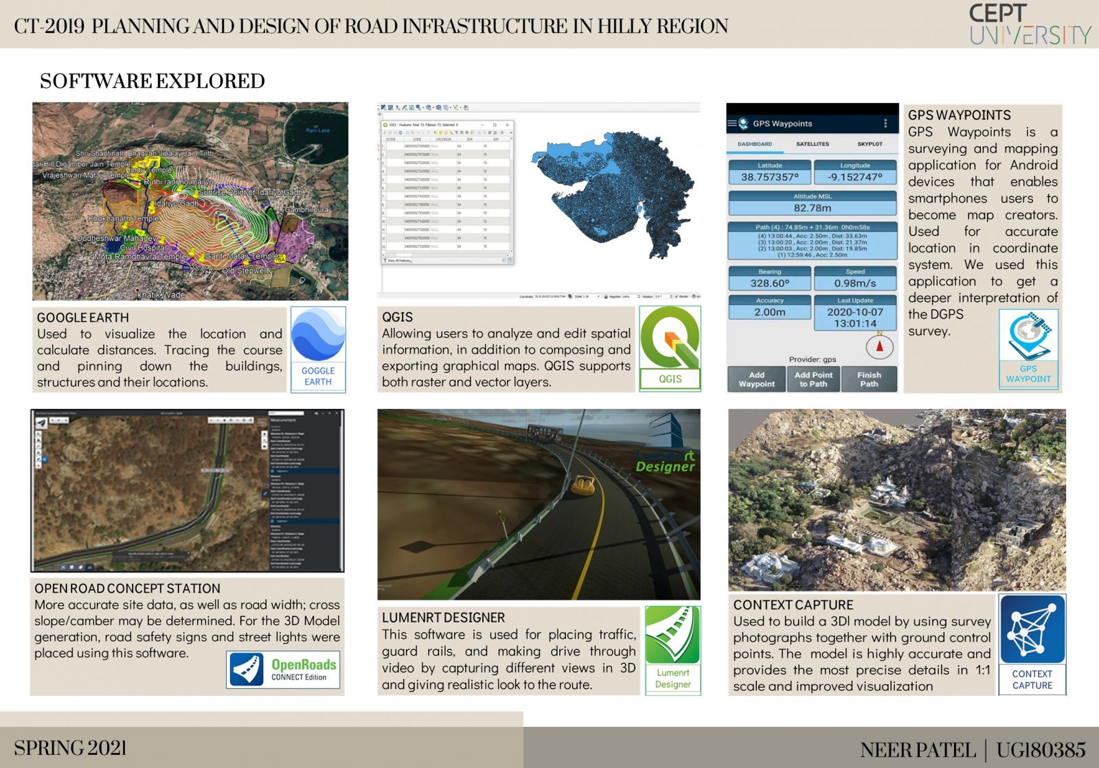
The studio implements the process of road infrastructure planning and construction in a hilly area. Via site visits in Idar, this studio imparted realistic surveying knowledge. We came across a variety of survey forms and their associated results like Total station, DGPS and drone survey. We also learned how to fix a new alignment at Idar hills with maximum Parameters keeping in mind. We also studied about various codal provisions, geometric design, drainage design and pavement design, among other things. We have performed a variety of experiments on a soil sample obtained from Idar in order to lead to the creation of a new alignment. Additionally we learnt how to use various software's such as QGIS, Concept Capture and OpenRoads Concept Station. And finally we had learnt how to make 3D drive through of our proposed route using the above software's.Click Here for Portfolio & Report
View Additional Work