• Home
  • FA
  • LA4010
  • (Chhaon). The Setting of Respite and Shadow

Risav Gupta

LA4010

(Chhaon). The Setting of Respite and Shadow

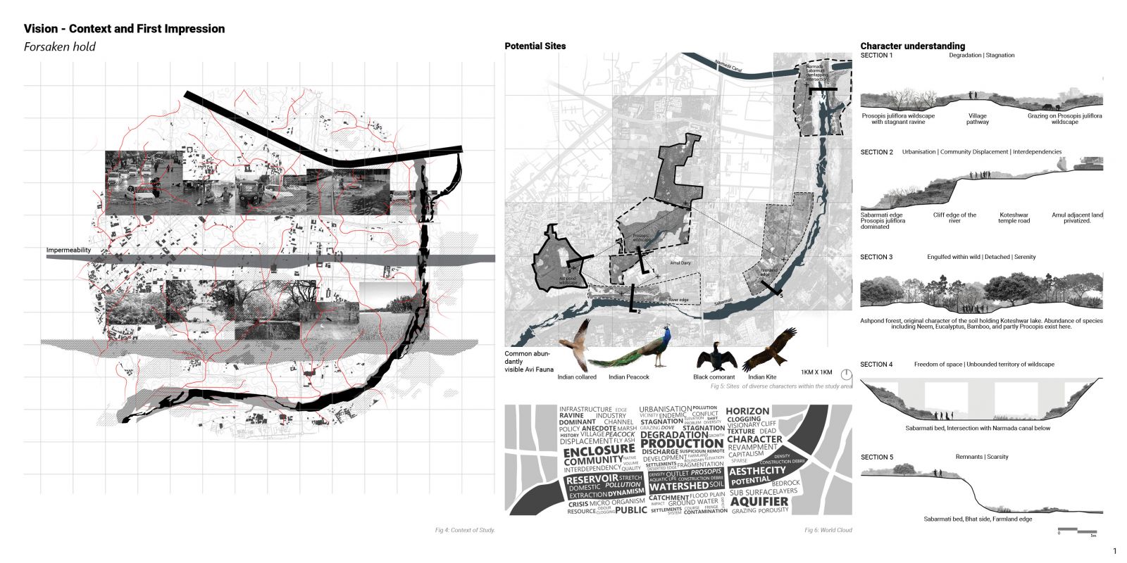
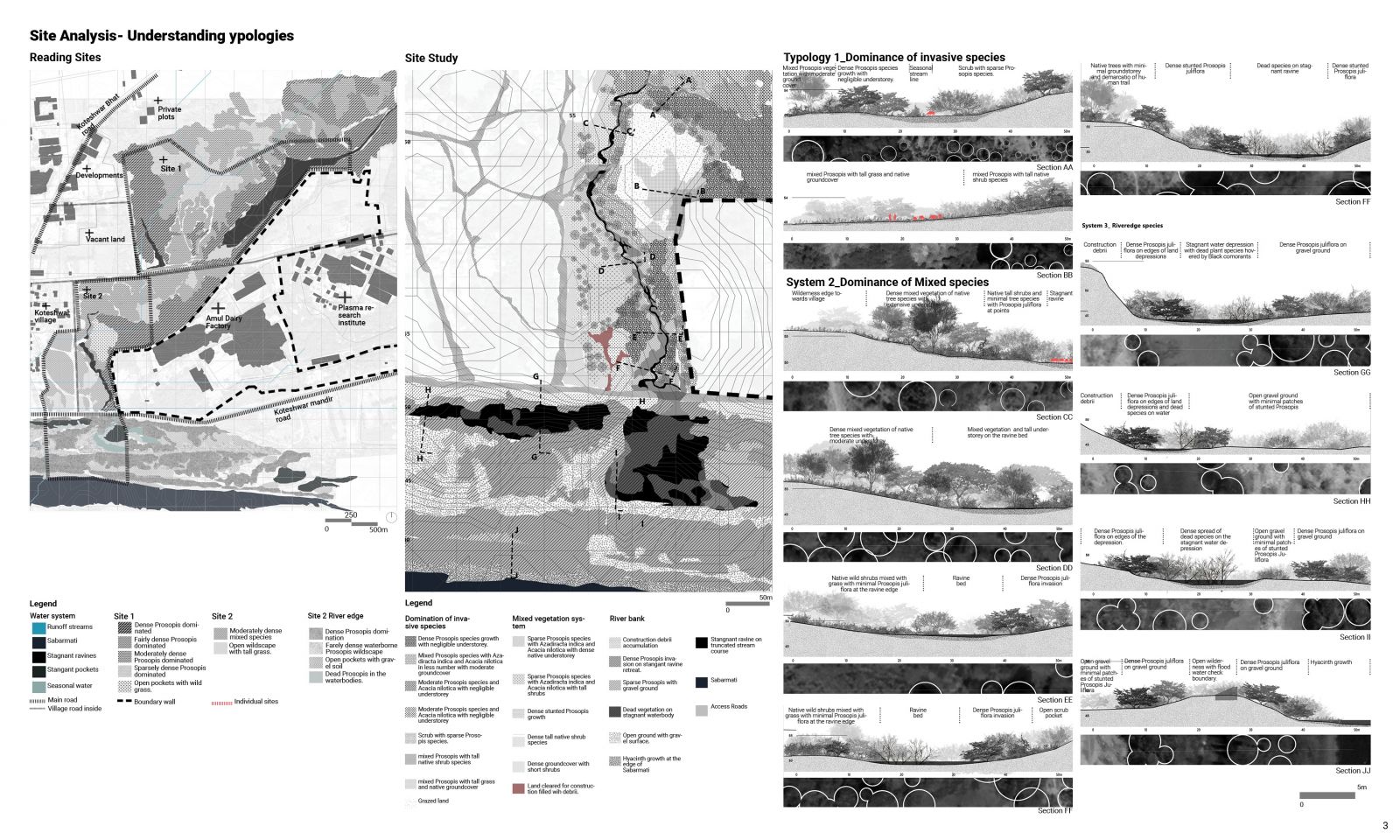
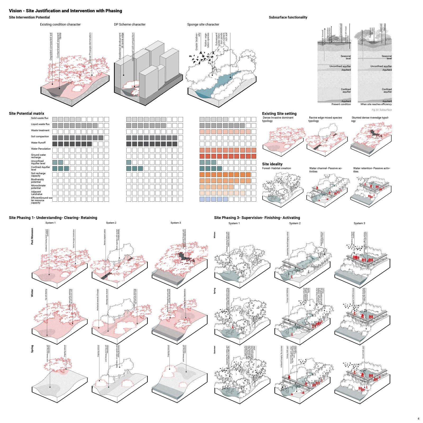
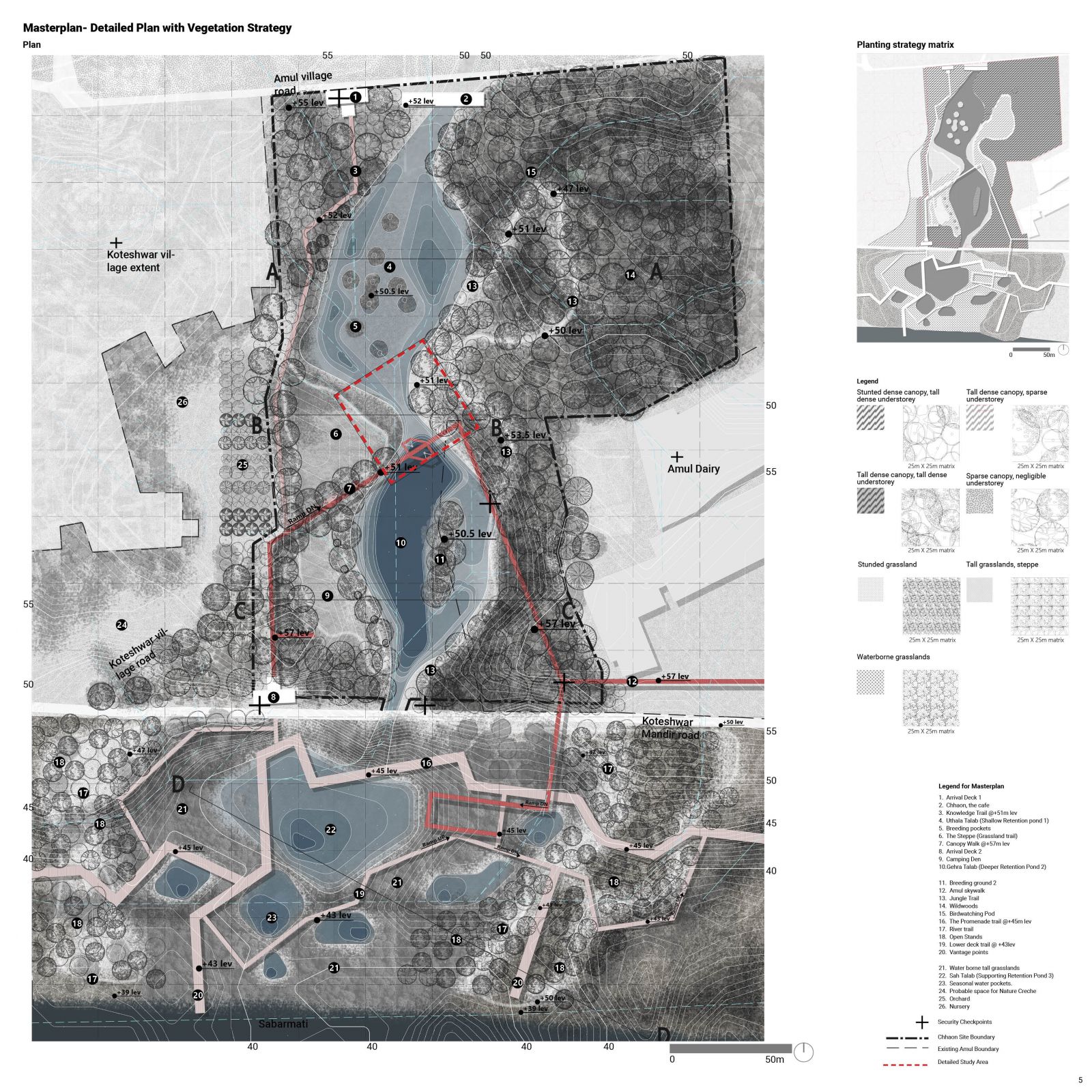
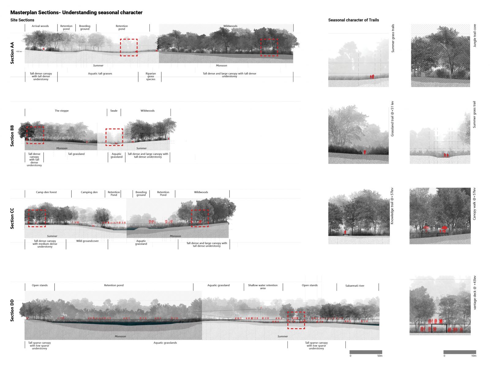
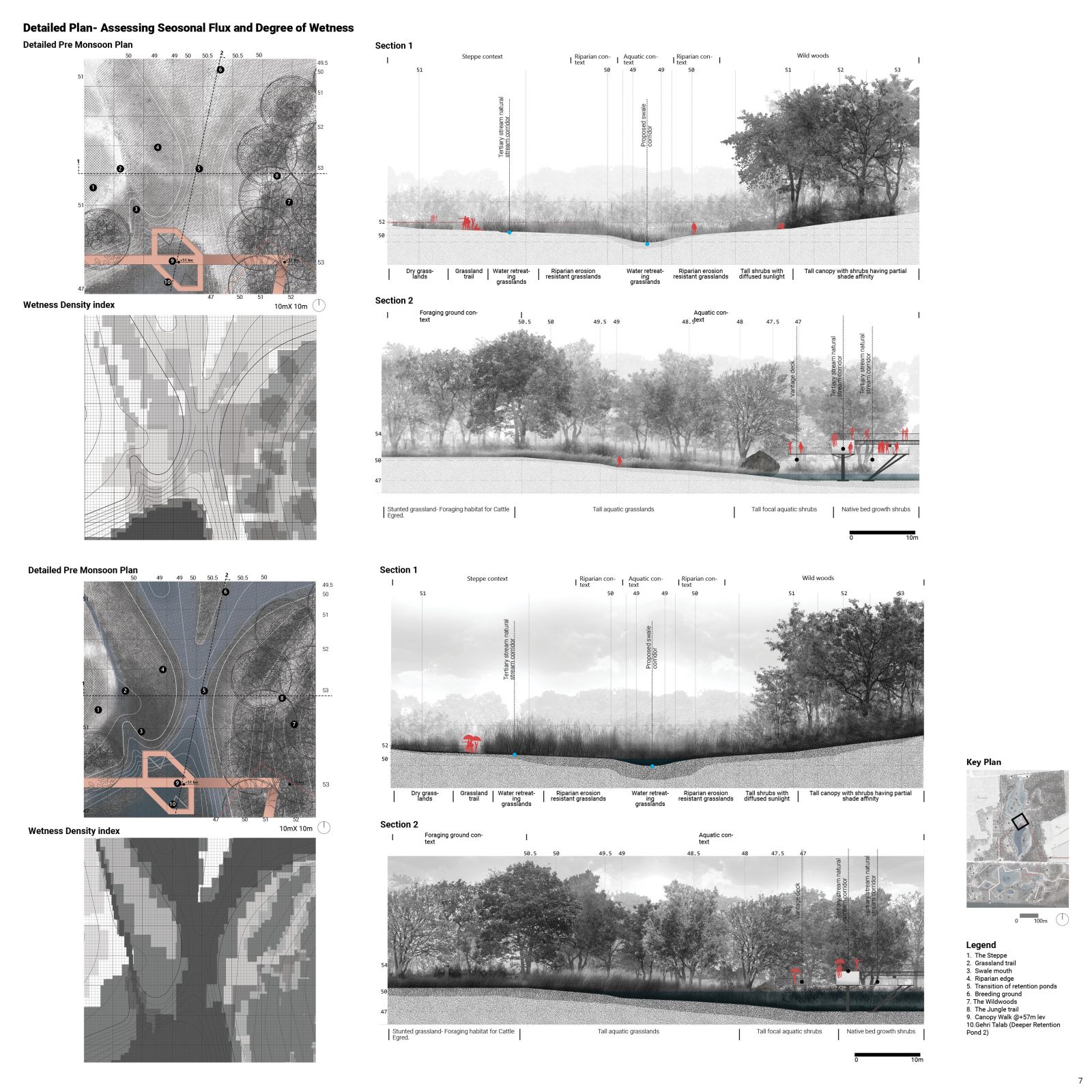
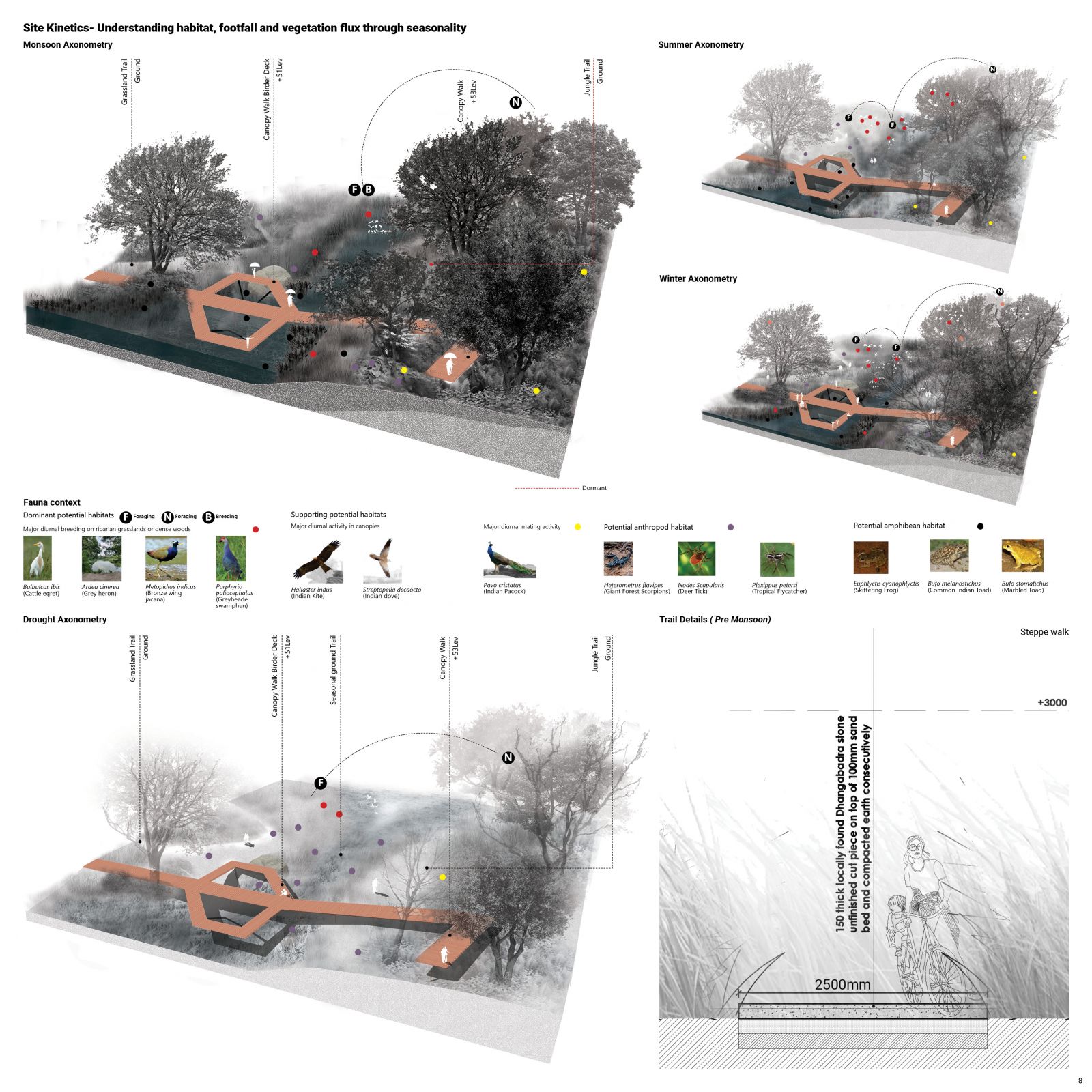
The title “Chhaon” literally meaning shadow has been philosophically denoted here to mean respite that defines the approach and the final character of the site. Ravine landscapes are considered most degraded ecosystems, and its restoration through tree establishment along with soil and water conservation are effective conservation measures. With the proposed development in the Koteshwar -Bhat area, the last remaining and completely disconnected ravine to Sabarmati is under threat. Although degraded, it has a high recharge potential due to the nature of aquifer. Thus, maximizing the site water retention will further allow extensive groundwater recharge over the years through a porous fabric of land. With the era of urban floods due to growing scarcity of sponge sites this intervention is imperative to hold water and at the same time provide a valuable nature respite in the middle of the city. Therefore, as “Chhaon” the site provides respite to one of its protagonists, the ‘water’ traveling distances and reaching the site, and with the shadow of the eventual dense vegetation, the soil conservation establishes ‘natural habitats’. This in turn provides an experiential tranquillity to ‘humans’ who are its secondary protagonists.

View Additional Work

Report Content

The Project starts with an understanding of the current scenario through the graphic forsaken hold denoting loss of water holding sites and water percolation as opposed to an ideal scenario of a sponge site with ample water percolation. As a survey the map shows five potential site to study and the sections simultaneously illustrate their diversities within each other. As a first impression along with the diagrams a word cloud created assists to capture the context. The context of Koteshwar-Bhat is studied in detail through the larger extent map reading truncated natural streams followed by tracing the truncation by locating the stagnant water pockets in the immediate Site of study with its associative vegetation.

Post reading a set of objectives have been streamlined and the key stakeholders have been identified that has helped in achieving a tentative phasing planning. The study also helps to foresee a longer vision of creating an eco corridor through the heart of the city.

The Detailed site adjacent to Amul that consists of certain major stagnant pockets of a ravine are studied in detail in terms of vegetation typology and through a diversity of the latter within two sites the Southern extent of the mastersite is selected for further detailed study. The intricate typologies of vegetation and water condition are studied here and illustrated with the help of the detailed sections.

A comparison between the existing site condition, the DP scheme of 2021 and a conceptualized sponge site through certain water calculations it is noted that the sponge site minimizes the surface runoff and increases ample percolation recharging the aquifer as well as the soil growing potential of being a biodiverse site. This condition has showed results of growth in land value also for projects of this kind. Thus a set of diagrams were made to understand the technique of water recycle and followed by how the detailed phasing can get carried out for the site.

The masterplan showcases the strategized vegetation strategy for supporting water retention, percolation and recharge followed by passive activities and creation of habitats. The plan also shows a detailed network and hierarchy of trails running throughout the site. It also marks the boundary of the detailed site for study.

The sections illustrate the condition of the trails and the vegetation atrocities during summer and monsoon.

The Detailed site showcases definite particular details of species in planting, the activation of the major canopy trail and their response in pre and post monsoon. The data is achieved through a set of sections and a wetness matrix.

The Isometry shows the seasonal flux in four conditions of Summer. monsoon, winter and extreme drought. The illustration focuses on understanding the change in water and wetness, the vegetation and the condition of the habitats. To cater to the strong seasonal flux, the material of the trails have been fixed to provide utmost longevity.

The Planting density model has been studied to understand how the hierarchy of species is working in a single composition with the varying density due to the wetness and shade.

The graphic is an evolved version of the longer vision graphic showcased earlier that focuses on displaying the essence of three major micro ecosystems created in the site and how that is the toolkit to be used as a prototype for developing the wilderness adjoining the riparian corridor of Sabarmati before it is completely lost.

Project Video