Your browser is out-of-date!
For a richer surfing experience on our website, please update your browser. Update my browser now!
For a richer surfing experience on our website, please update your browser. Update my browser now!
What
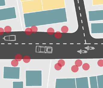
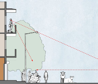
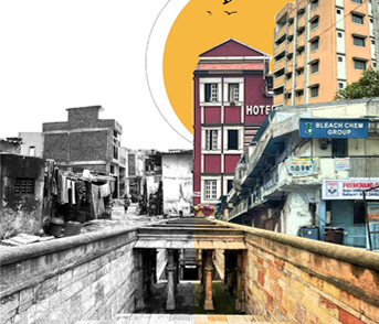
The exercise develops a nuanced understanding of various built form and typologies in the city. The students were asked to prepare an urban structure map showing prominent nodes, edges etc in their precinct, prepare figure ground, building heights, cross sections etc. As part of understanding typology, students prepared a built form matrix of the predominant typologies of various uses ( Residential, commercial etc ).
Why
It is essential to understand the various built forms that inhabit our cities and critically examine why a certain typology takes precedence over the others and what factors shape the same.
How
Students build upon their digitized buildings layer and primary survey data pertaining to building uses, heights, number of units, land ownership, parcel size and use to conduct analyses and generate maps in GIS.
View Other Work