Bhavya Trivedi

UR3596

Space, Territory, Time

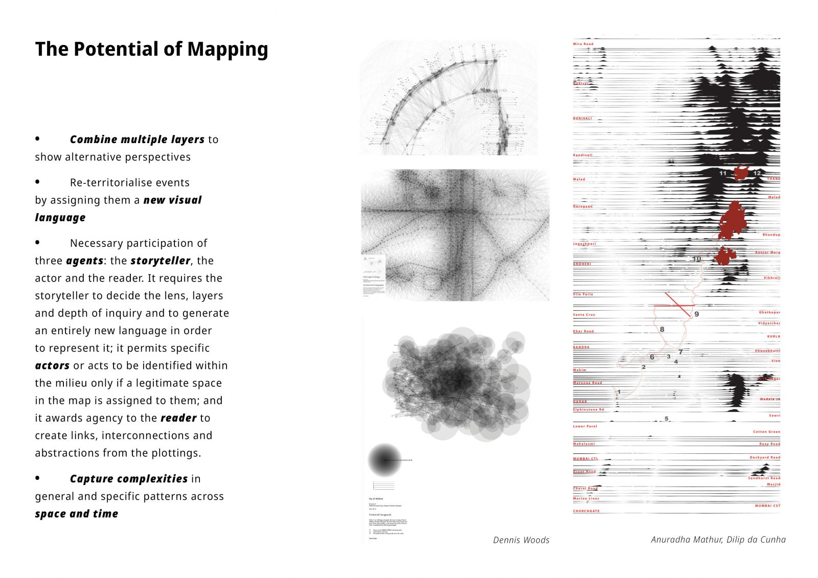
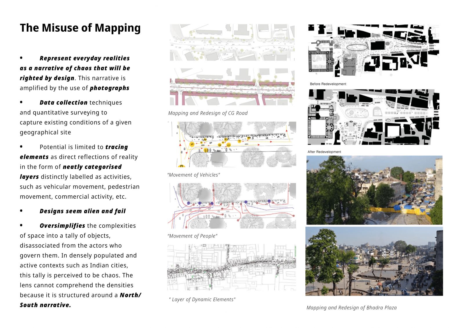
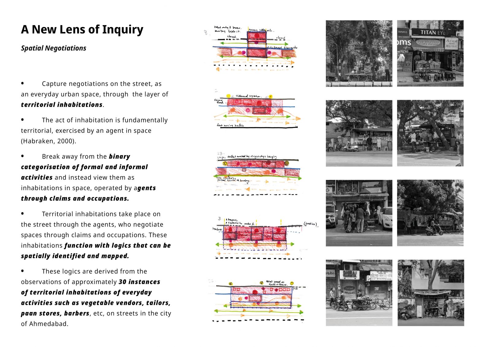
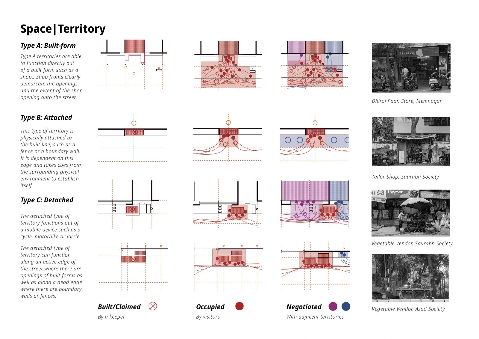
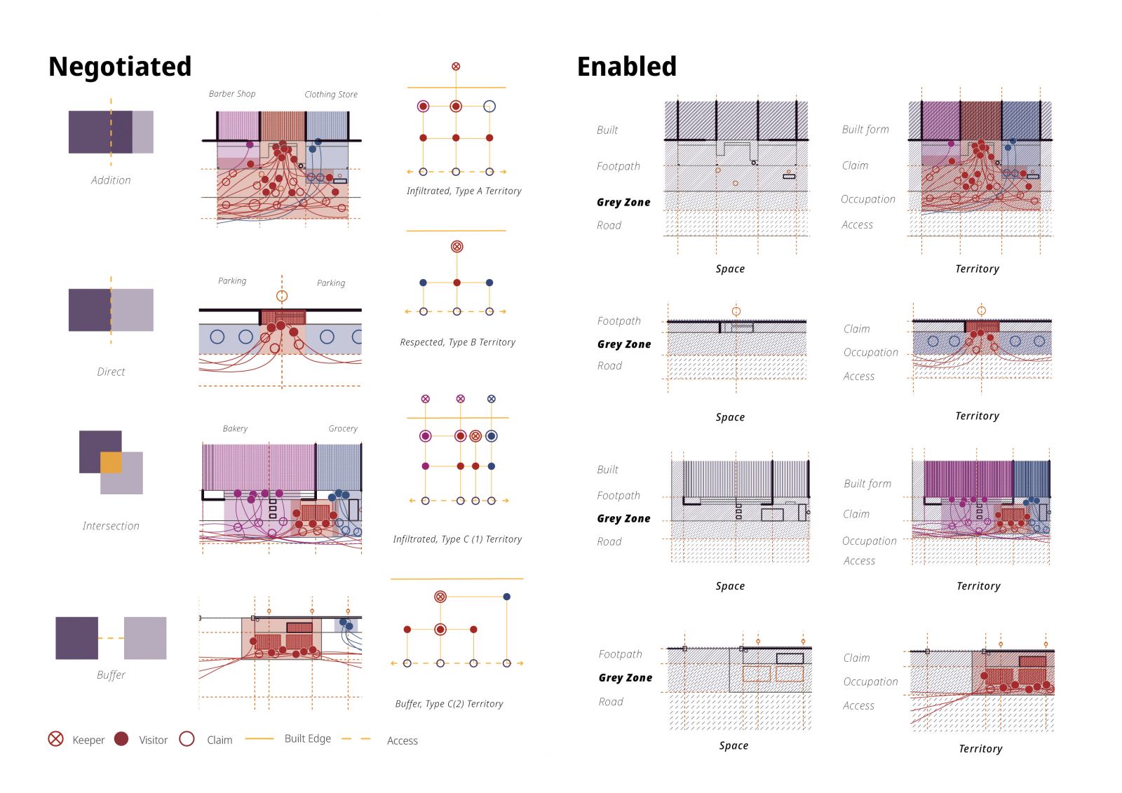
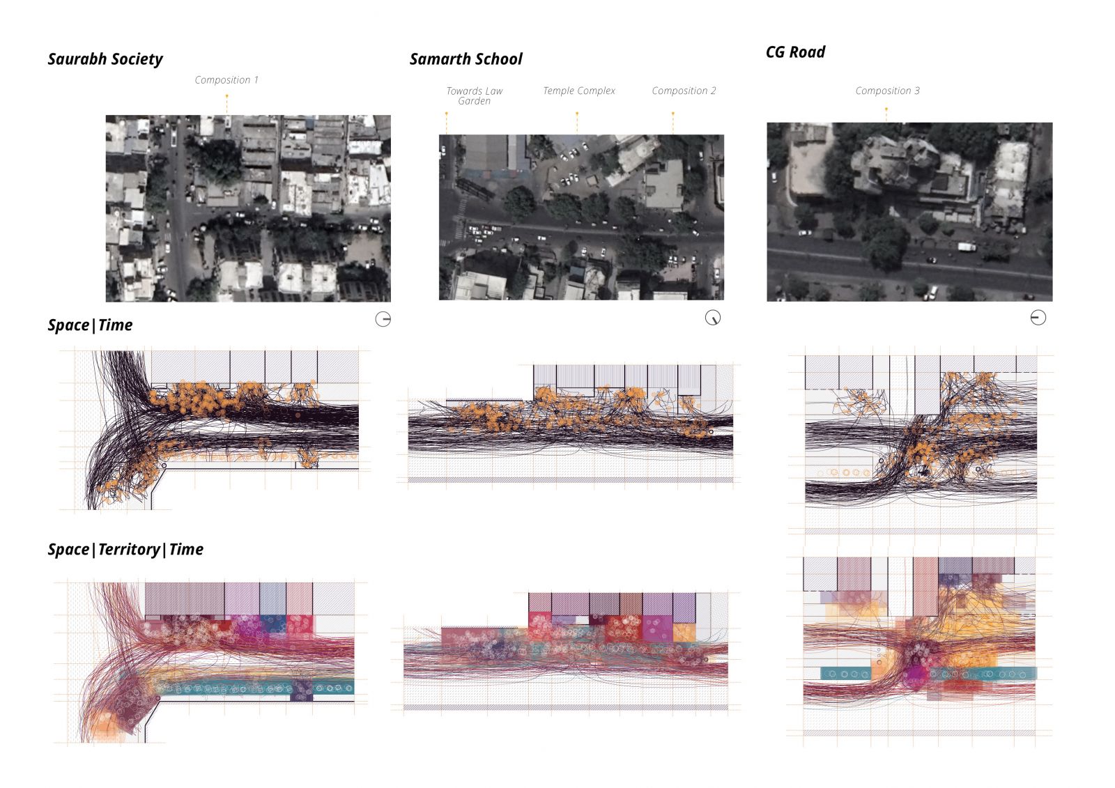
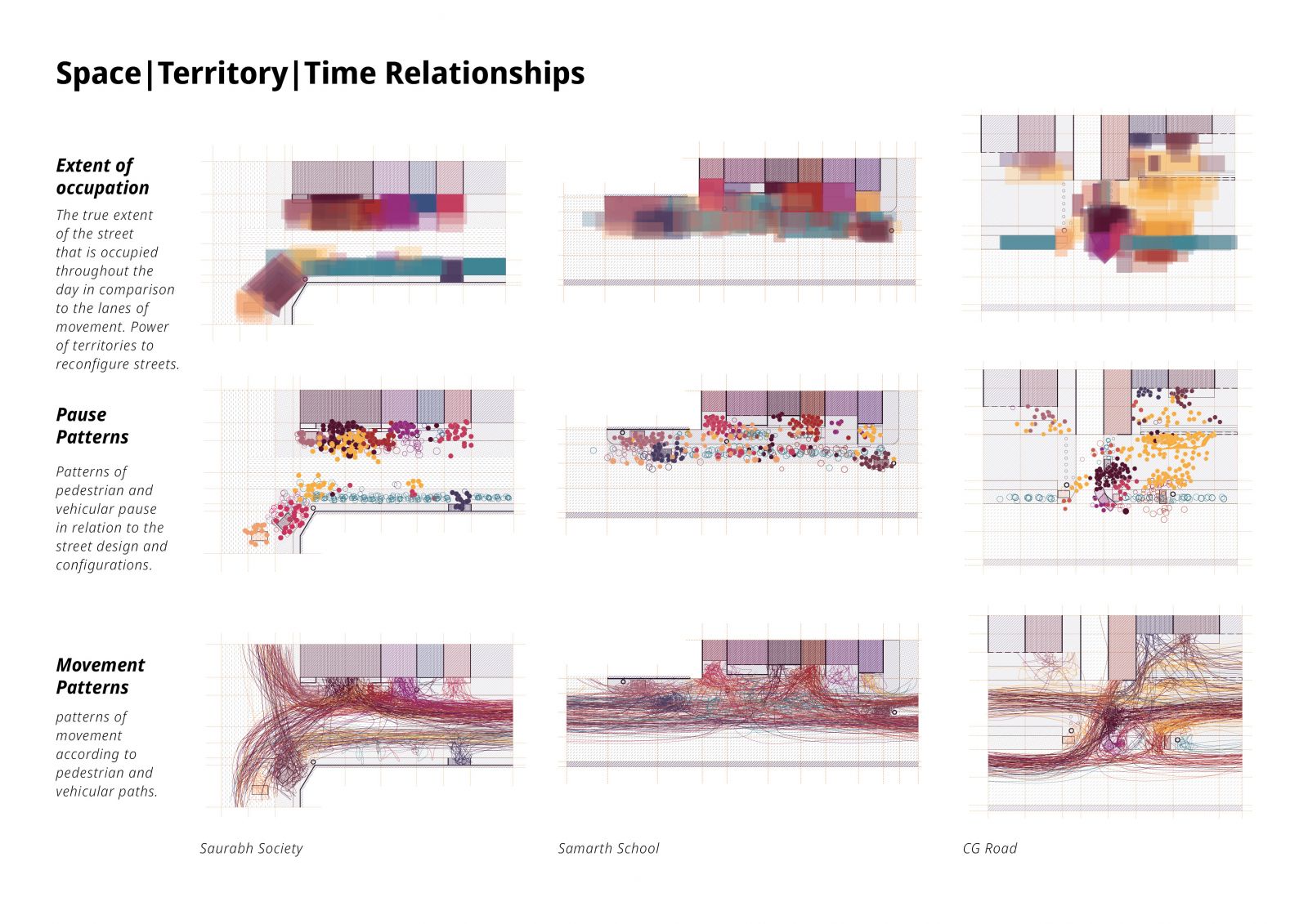
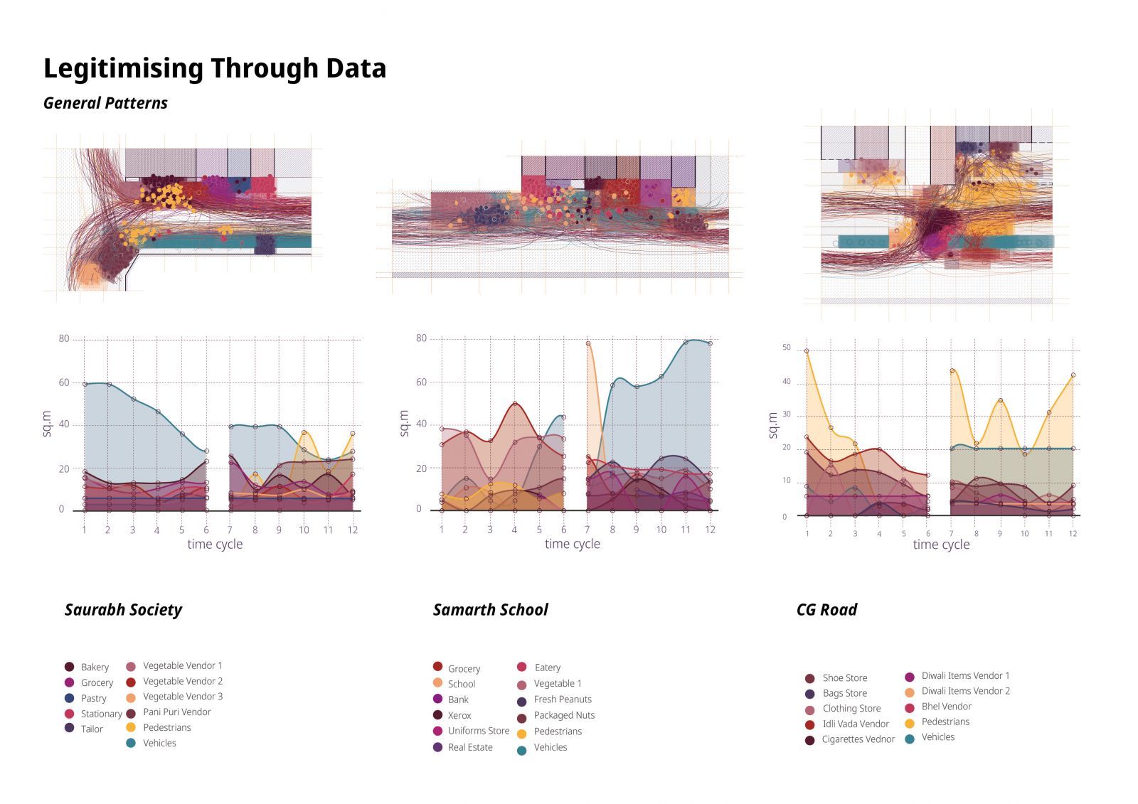
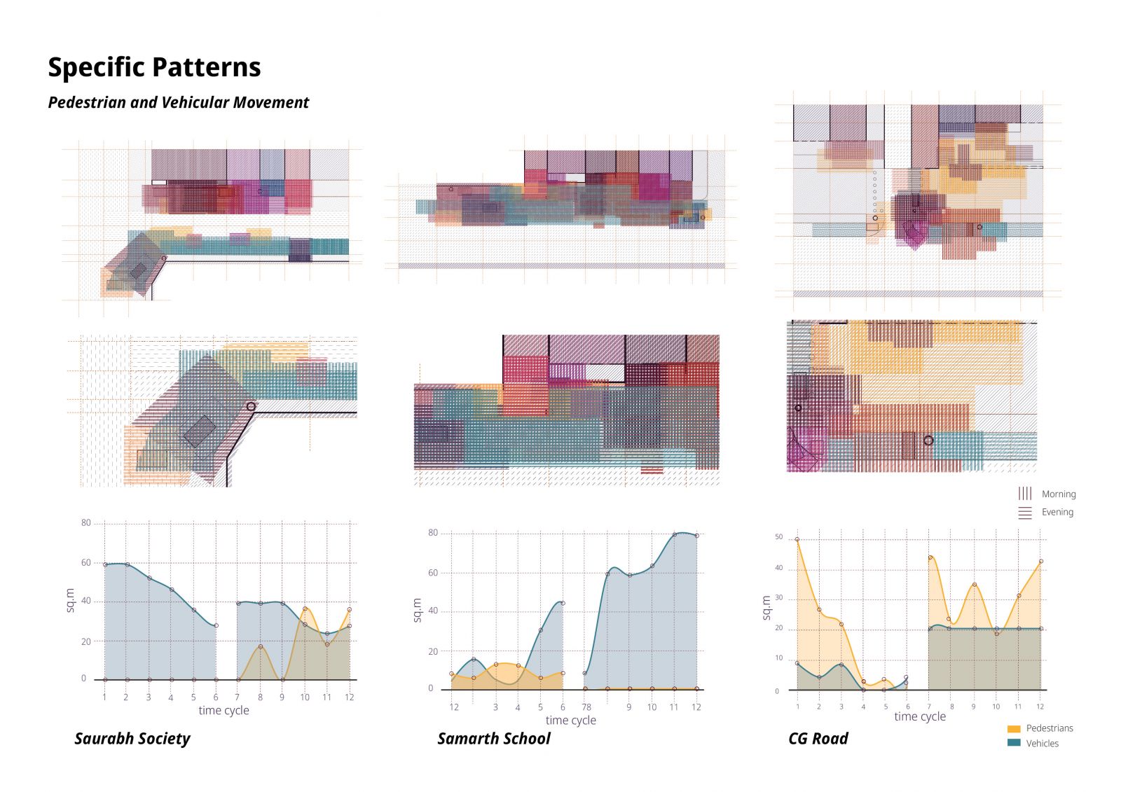
The study proposes a mapping method that is appropriate to the Indian context. There is a vital relationship between space and territory that is characterised by spatial negotiations. These negotiations cannot be dismissed in the representation of urban spaces because they have the power to reconfigure streets despite strict design interventions. Representations of the Indian context need to make the relationships between space, territory and time explicit to accurately represent everyday realities in general and specific patterns. Such visual vocabularies have the potential to inform urban design processes and as a result impact the experience of everyday life for the inhabitants of the city.

View Additional Work

Report Content

Maps have inventive potential to induce ‘unthinking’ and by implication, a ‘rethinking’ through the ability to capture complexities in space and time.

Presently, maps are misused to represent everyday realities as a narrative of chaos that will be righted by design. This lens of mapping is borrowed from redundant colonial ideologies that categorise cities of the Global North as neatly designed solutions and cities of the Global South as problematic geographies.

Through an alternative lens of inquiry, the street, as an everyday urban context, is seen as a geographical milieu that accommodates various acts of negotiations undertaken by agents through inhabitations in space. Habraken proposes the act of inhabitation as being territorial, exercised by an agent in space (2000), rendering any act of occupying space as a territorial act. This lens enables the milieu to break away from the categorisation of formal and informal activities and instead view them as inhabitations in space, operated by agents through claims and occupations.

There are three types of territories that function on the street based on their physical characteristics and patterns of establishment. They are established by 'keepers' through acts of claim and they operate through acts of occupation by 'visitors'.

Territorial inhabitations take place on the street through the agents, who negotiate spaces through claims and occupations. These inhabitations function with logics that can be spatially identified and mapped. The street as an urban space is an enabler in these territorial inhabitations. It is as combination of habitable lanes, each lane offering opportunities of claim and occupation for agents, held together by built form and built edges. The ‘grey zone’, a lane where temporary occupations take place, is an inherent part of the street.

Territories function in space and over time. Time, in the Indian context, brings a flux of activity at crucial points in the day. Time is experienced by territories in ‘cycles’. A time cycle is a set of minutes in which a combination of visitors occupy the space. A time cycle ends when these agents leave and are replaced by new ones.

The complexity of everyday urban contexts is deeply layered, and maps are a suitable tool to deconstruct this complexity and present it in a comprehensible manner. Representing dynamisms created by time is imperative for a mapping method to be appropriate for such a complex context

Studies of street contexts through this method of mapping can reveal further variations in complexities in the role of the street as an enabler of territorial inhabitations.

General and specific patterns are necessary to understand a context in totality. Spatial quantifications that emerge as a result of space, territory, time mapping are a repository of data that can be further analysed, juxtaposed and compared to reveal more detailed patterns.

Time specific data can reveal patterns related to individual contexts that can then be compared. This specific extraction juxtaposes pedestrian and vehicular occupations on 3 street contexts in the layers of space, territory and time.