Your browser is out-of-date!
For a richer surfing experience on our website, please update your browser. Update my browser now!
For a richer surfing experience on our website, please update your browser. Update my browser now!
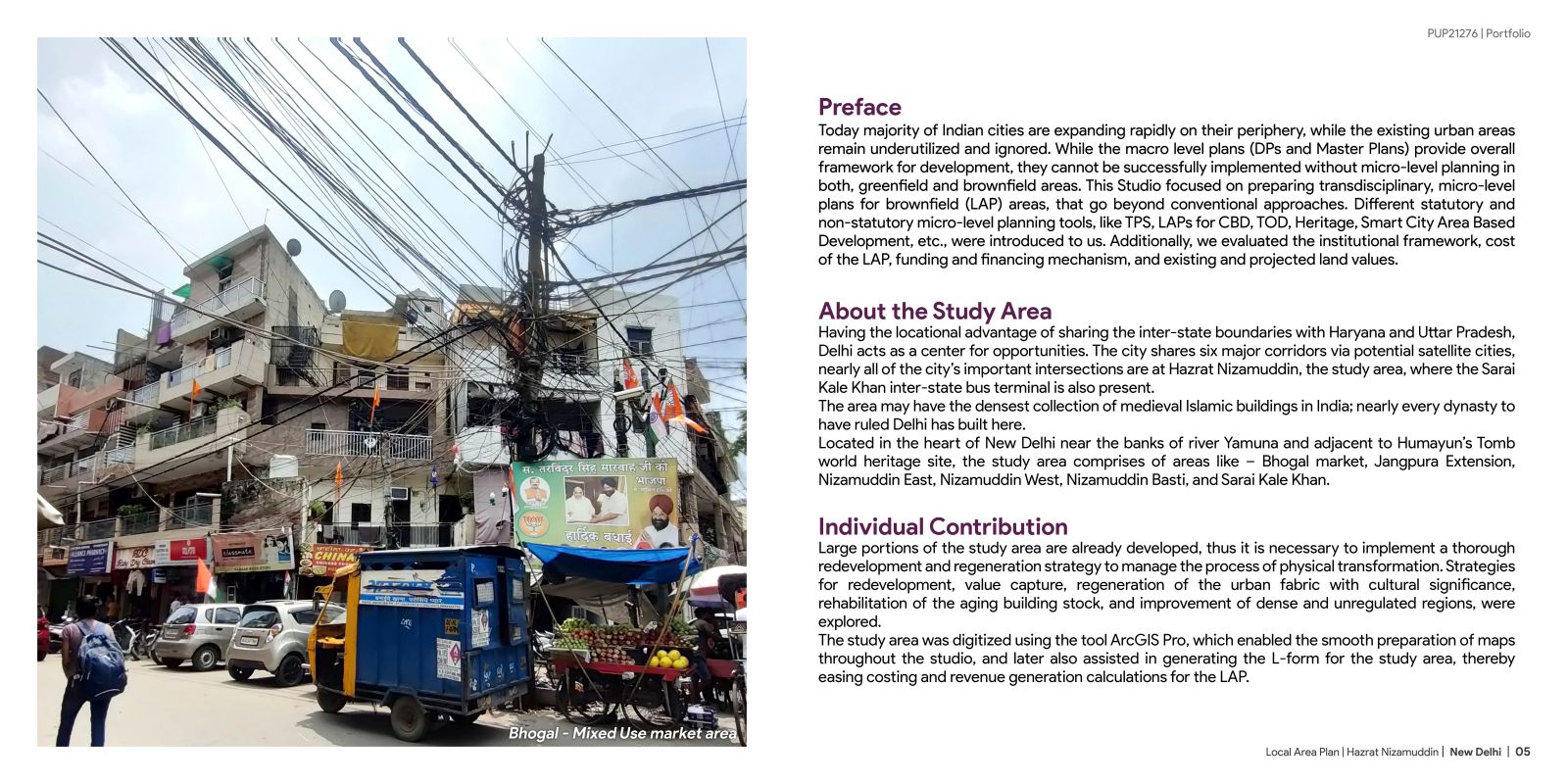
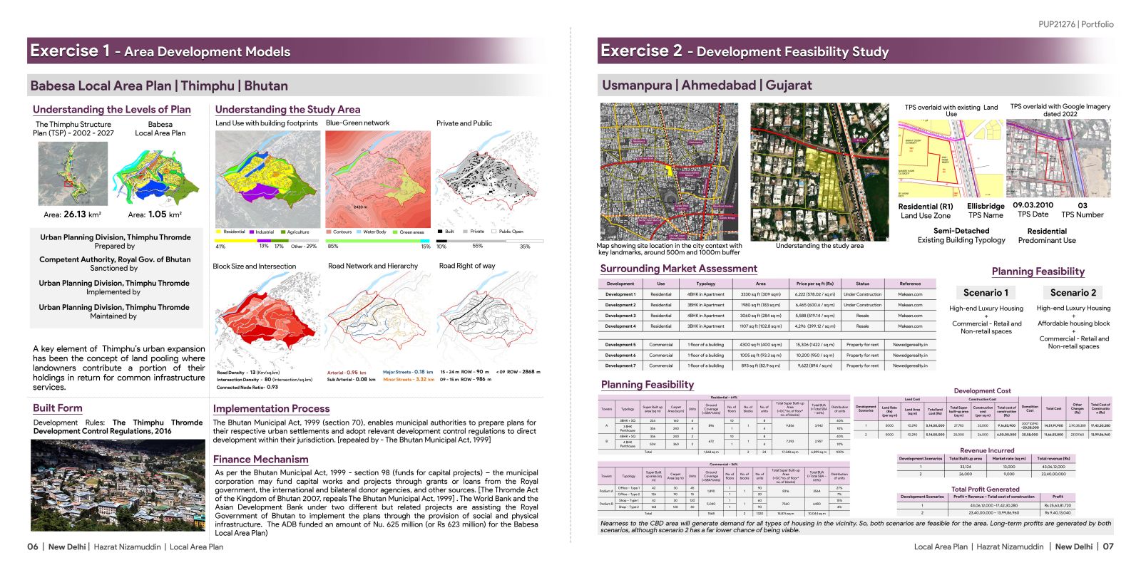
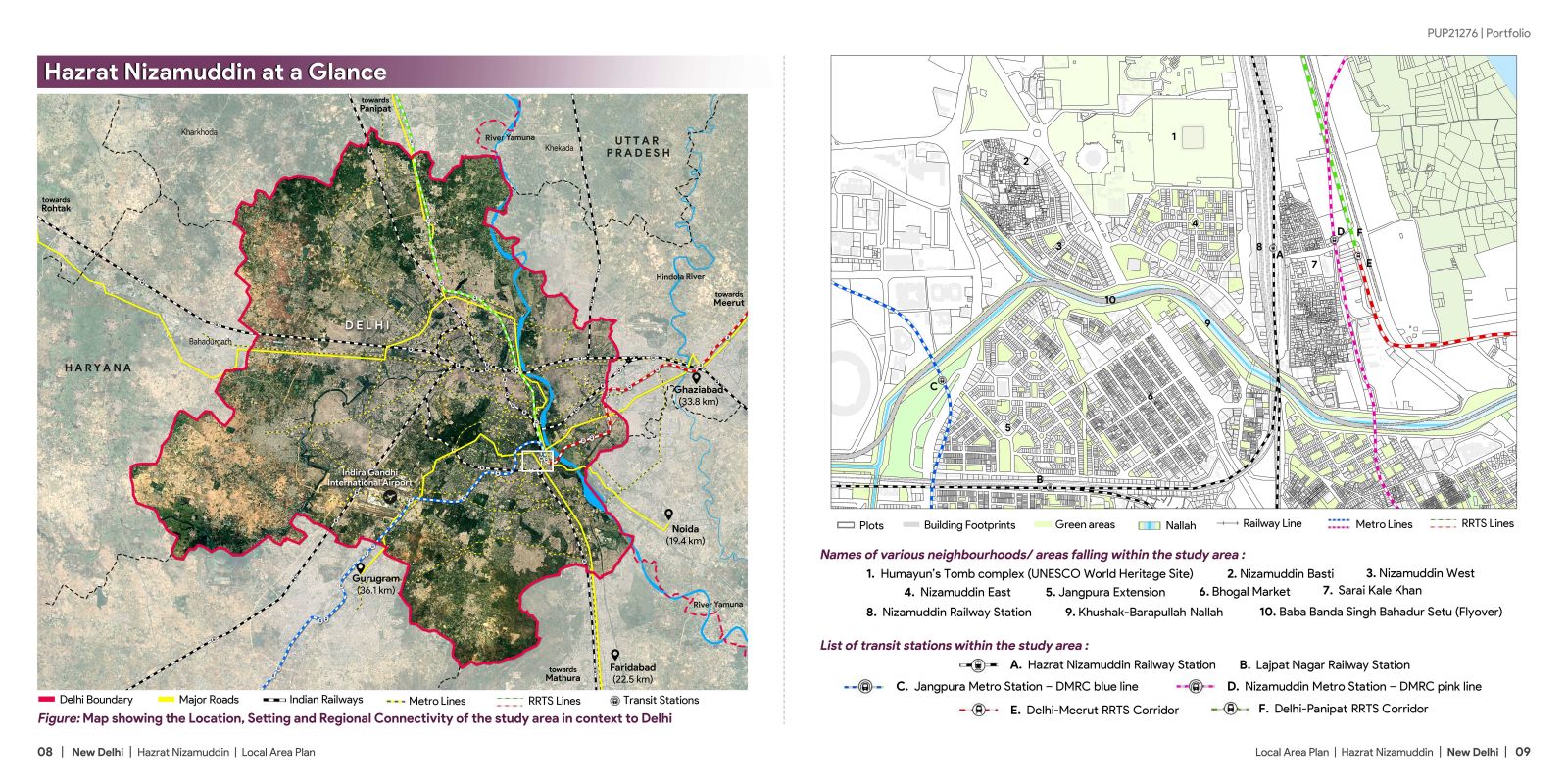
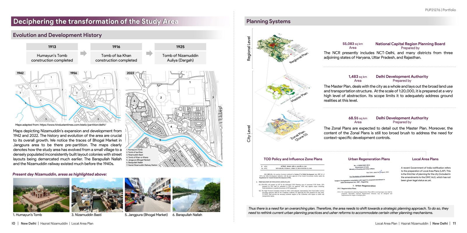
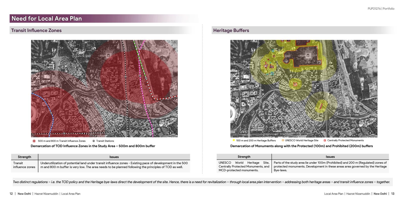
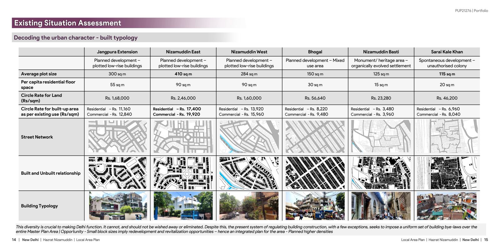
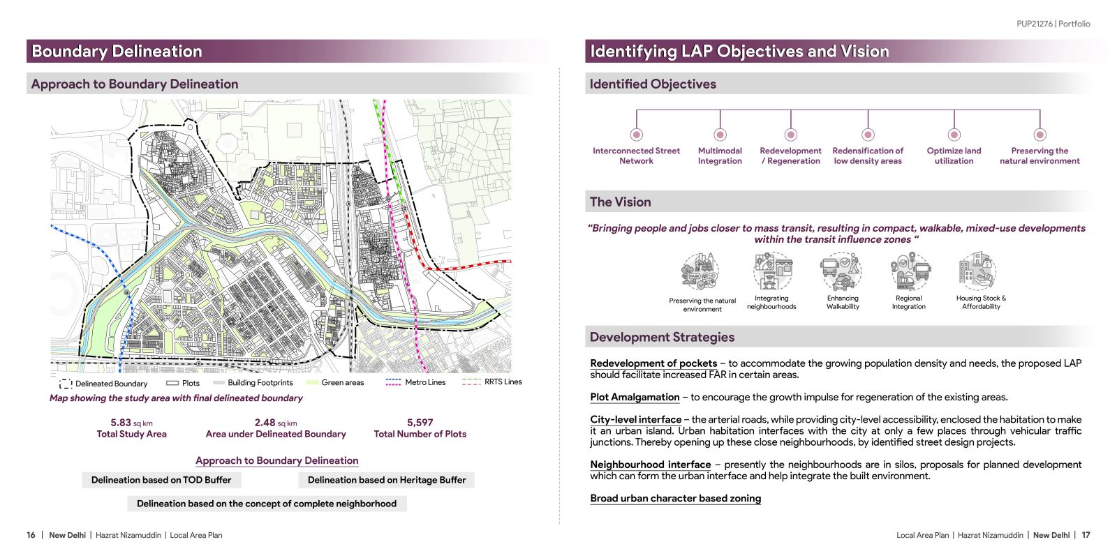
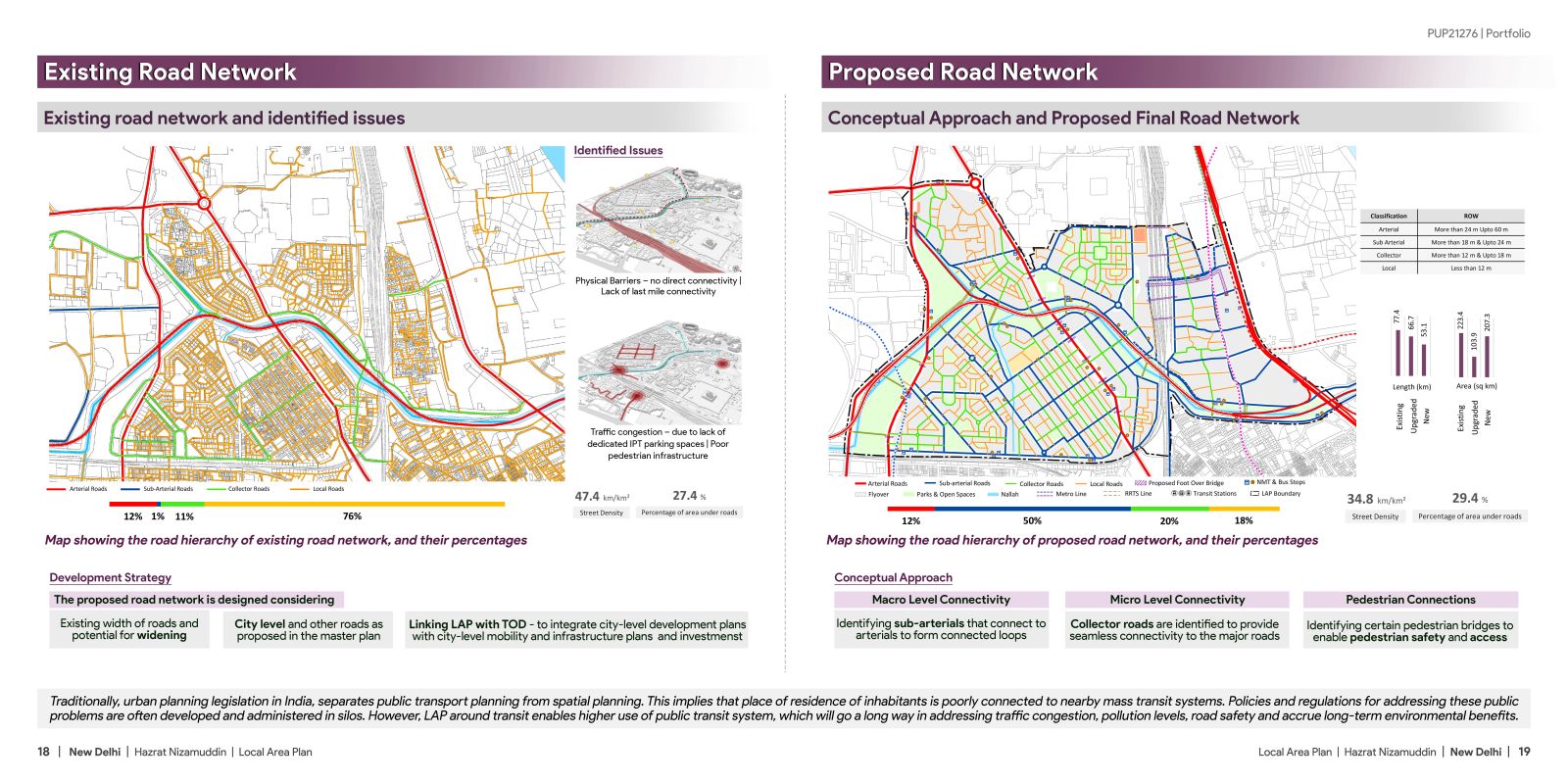
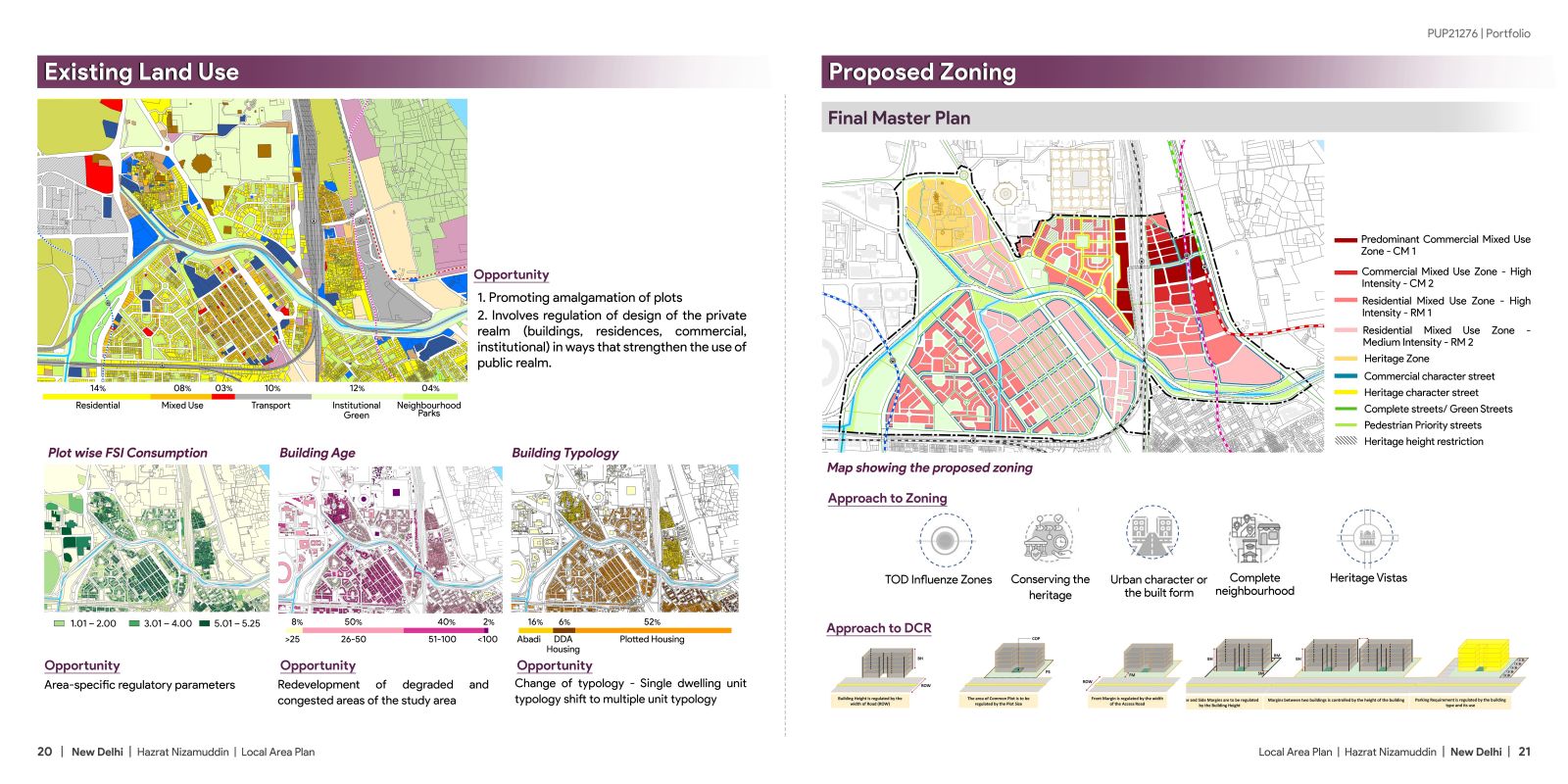
Today majority of Indian cities are expanding rapidly on their periphery, while the existing urban areas remain underutilized and ignored. While the macro-level plans (DPs and Master Plans) provide an overall framework for development, they cannot be successfully implemented without micro-level planning in both, greenfield and brownfield areas. This Studio focused on preparing trans-disciplinary, micro-level plans for brownfield (LAP) areas, that go beyond conventional approaches. Located in the heart of New Delhi near the banks of river Yamuna and adjacent to Humayun’s Tomb world heritage site, the study area comprises of areas like – Bhogal market, Jangpura Extension, Nizamuddin East, Nizamuddin West, Nizamuddin Basti, and Sarai Kale Khan.