Your browser is out-of-date!
For a richer surfing experience on our website, please update your browser. Update my browser now!
For a richer surfing experience on our website, please update your browser. Update my browser now!
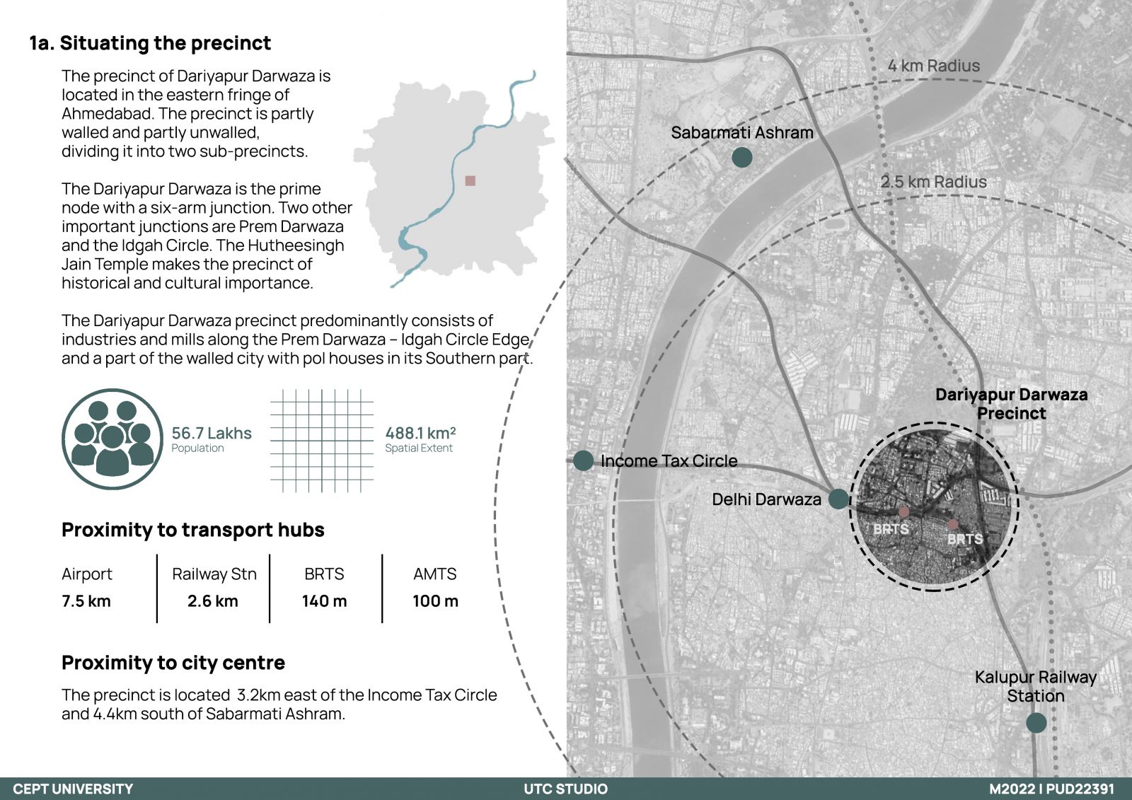
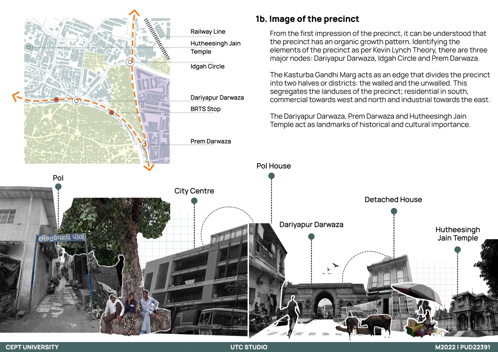
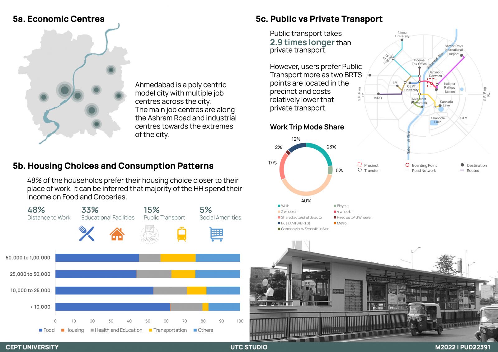
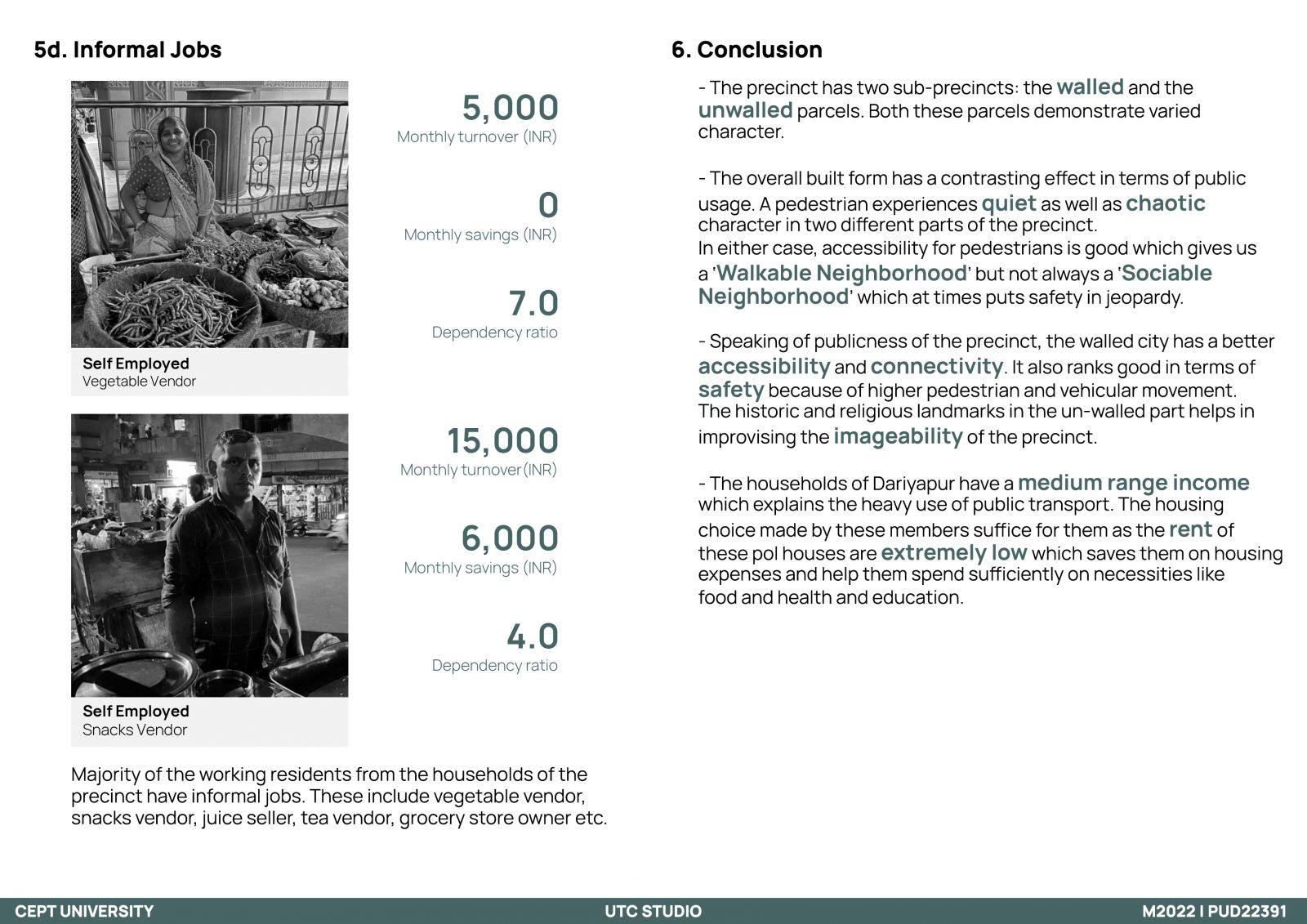
Through the evolution of Ahmedabad, Dariyapur has undergone some changing patterns in terms of land usage. The precinct sits on ‘the Wall’ of the Ahmedabad walled city, by the Kasturba Gandhi Marg, dividing it into two halves. One part of the precinct encompasses residential (traditional pol houses) mixed with commercial storefronts while the other half is a commercial market. The dominant housing typology is the heritage pol houses and housing choices in consideration of their jobs and livelihood have been studied. These choices are also affected by the location, availability of transport and the physical structure of the precinct. The spatial form is majorly dependent on land use patterns, street networks, connectivity, accessibility etc. An attempt has been made to decipher a link between these two halves and also the living choices of the people of Dariyapur to decode its liveability and desirability.