Your browser is out-of-date!
For a richer surfing experience on our website, please update your browser. Update my browser now!
For a richer surfing experience on our website, please update your browser. Update my browser now!
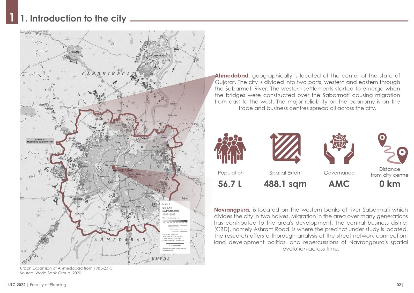
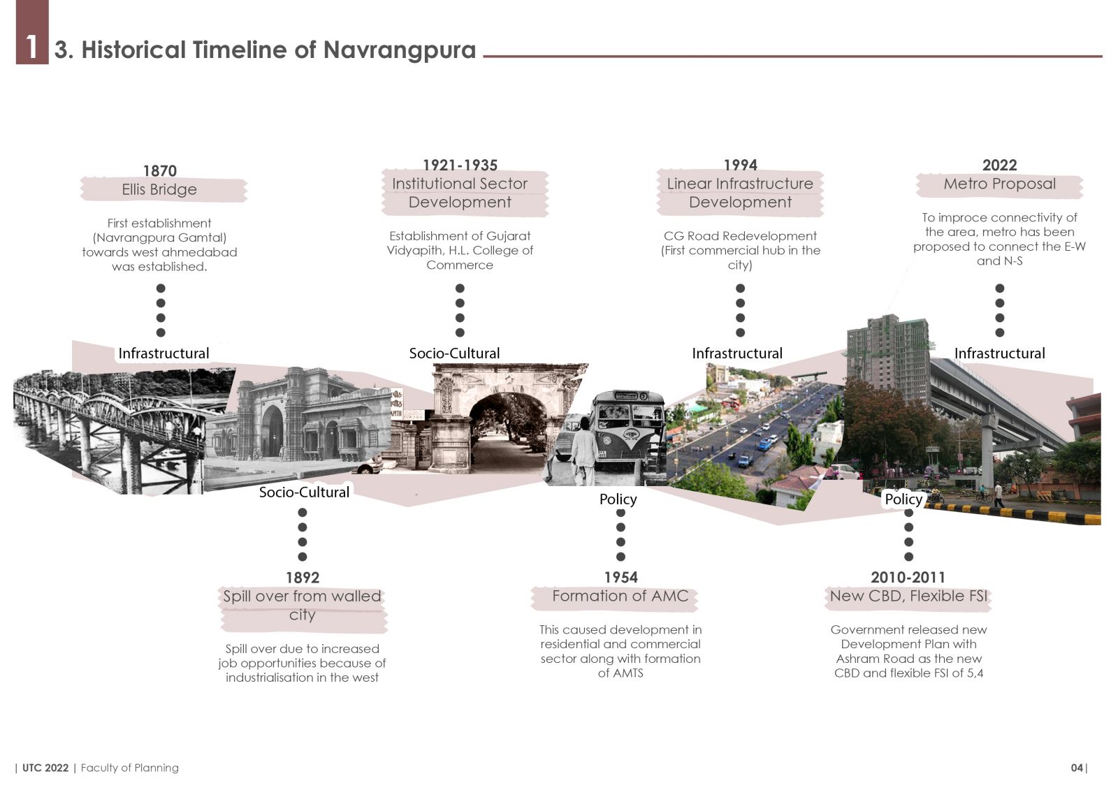
A city's evolution, whether social or spatial, depends on a number of aspects. In the case of Ahmedabad, various policy interventions, social, cultural, and political developments have had a considerable impact on the rise in commercial activity in and around the city center, aka Ashram Road.
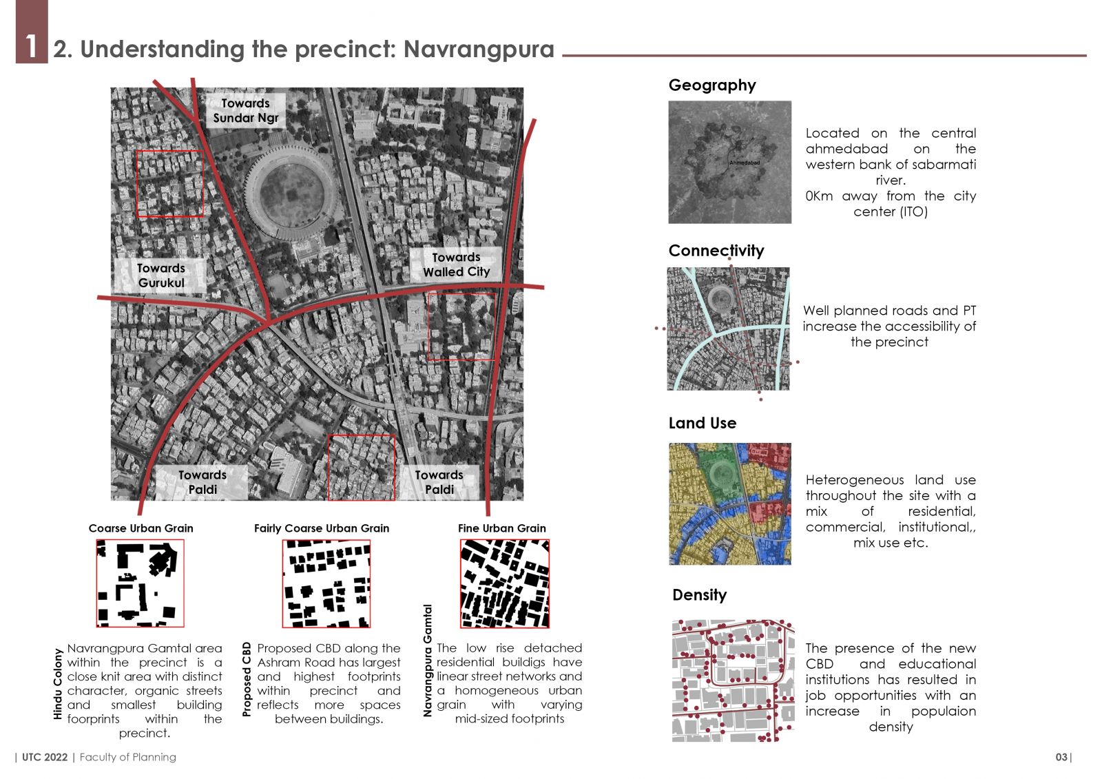
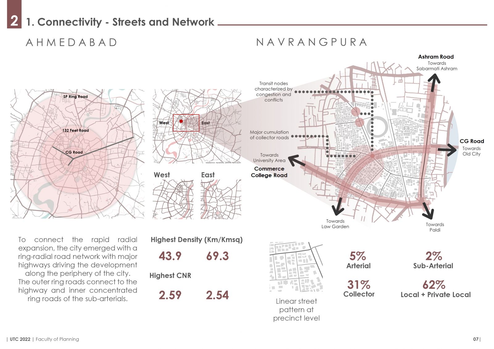
This portfolio contains a comprehensive analysis of a one square kilometer area in Navrangpura, one of Ahmedabad's earliest settlements located in the western side of the city. Migration in the area over many generations has contributed to the area's development. The central business district (CBD), namely Ashram Road, is where the precinct under study is located. The research offers a thorough analysis of the street network connection, land development politics, and repercussions of Navrangpura's spatial evolution across time. While infrastructural services, housing typologies and land use have changed over a few decades, the core of the dense residential region has not.