Your browser is out-of-date!
For a richer surfing experience on our website, please update your browser. Update my browser now!
For a richer surfing experience on our website, please update your browser. Update my browser now!
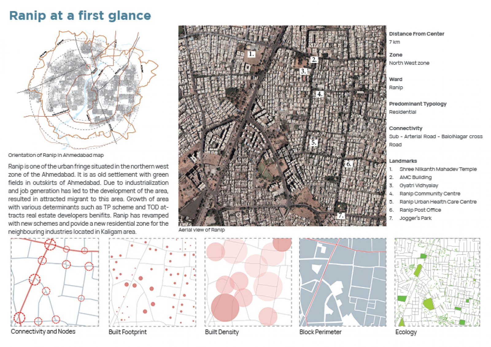
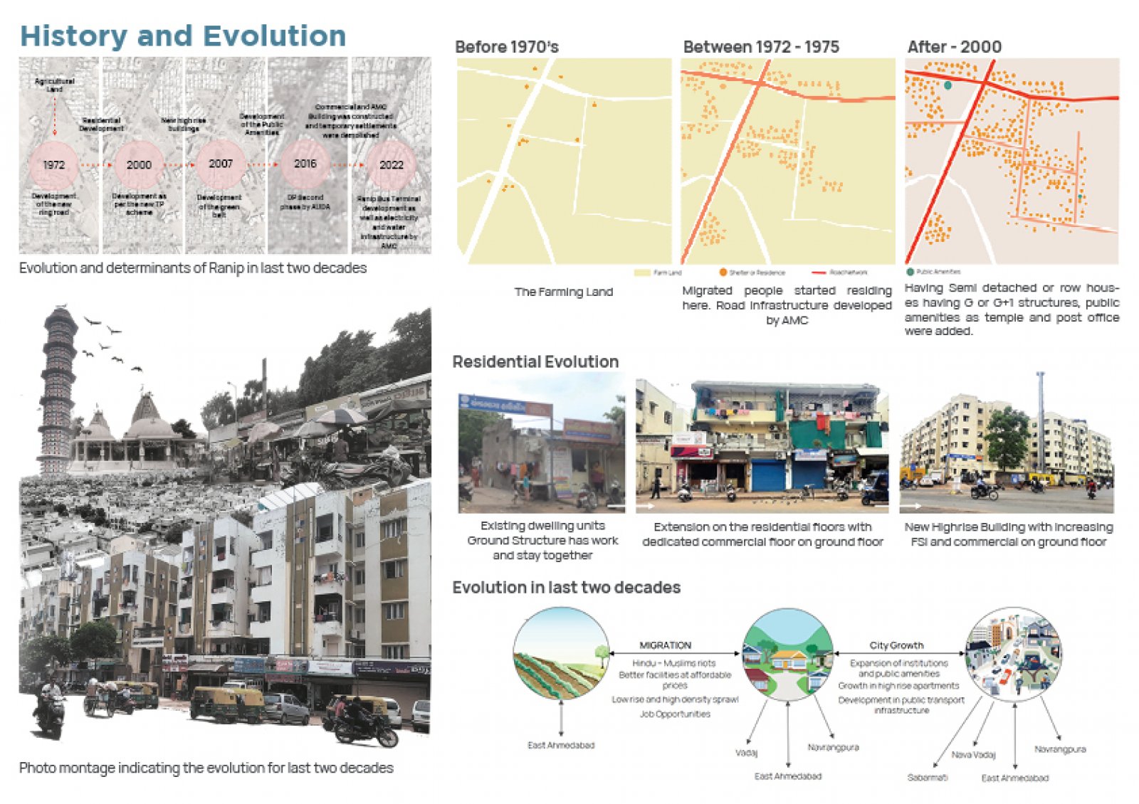
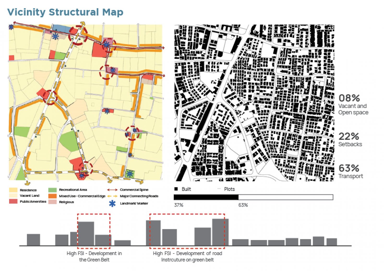
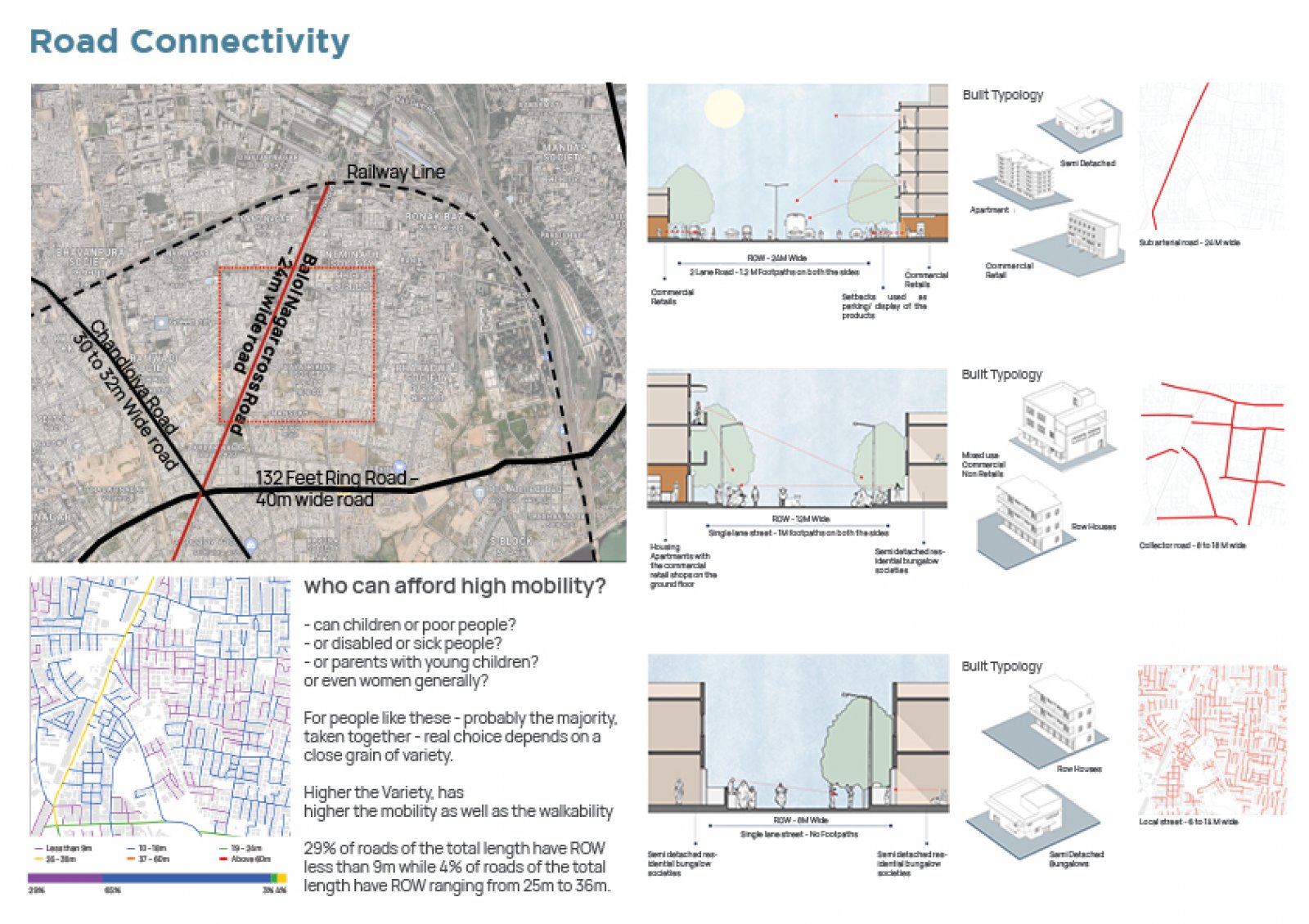
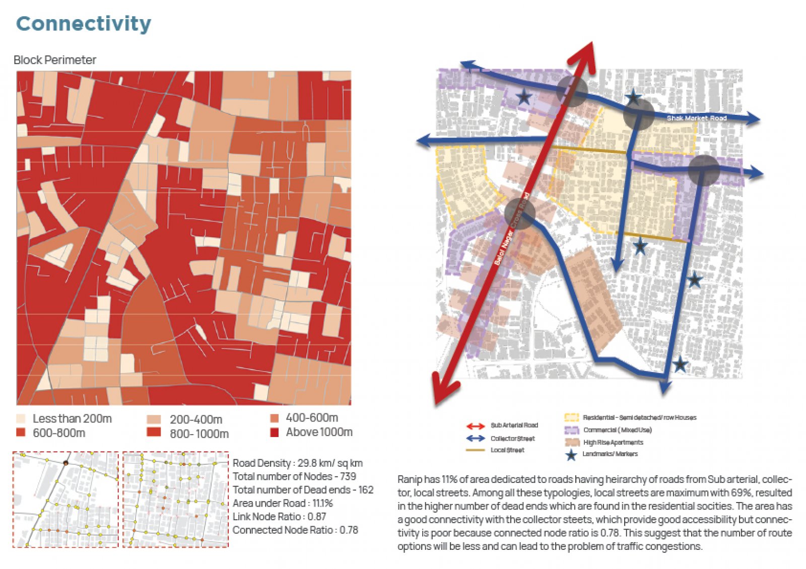
The study is to comprehend the urban structure of the Ranip area, a one-square-kilometer area in Ahmedabad's northwest. Sabarmati, New Ranip, Chandlodiya, Nava Vadaj, and Naranpura are nearby neighborhoods. It encountered 132 Feet Ring Road, which further connects ranip through a sub-arterial road named Balol Nagar cross road. The three reports address the Planners, Government Officers - Policy Makers, and Architects for understanding the determinants that resulted in the urban development of the whole area. It focuses on understanding spatial development in terms of its physical character, connectivity with street networks, and land development and further discusses it by splitting it into three sections. Section 1 discusses the transformation in the last 20 years, analyzed by finding the determinants that lead to urban development. Section 2 focuses on the road network and connectivity of Ranip at the city and micro levels. It analyzes the accessibility and connectivity in Ranip through the findings of link node ratios and connectivity node ratios. These further lead to the discussion of land use and built form as streets and built-form connected in section 3. It is analyzed by understanding the determinants such as FSI, property price, and per capita usage in Ranip. The study was conducted through primary research involving site visits, peer interviews with locals, and the use of secondary materials such as books, papers, and GIS (Geographical Information System) software.