Your browser is out-of-date!
For a richer surfing experience on our website, please update your browser. Update my browser now!
For a richer surfing experience on our website, please update your browser. Update my browser now!
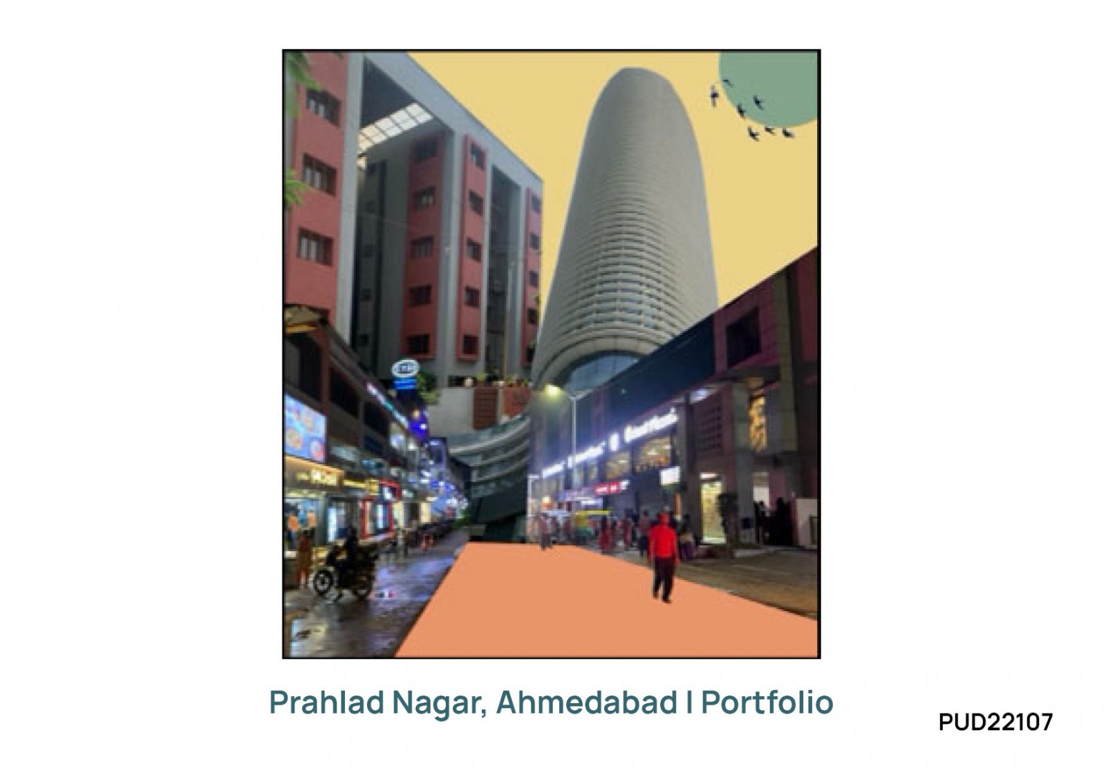
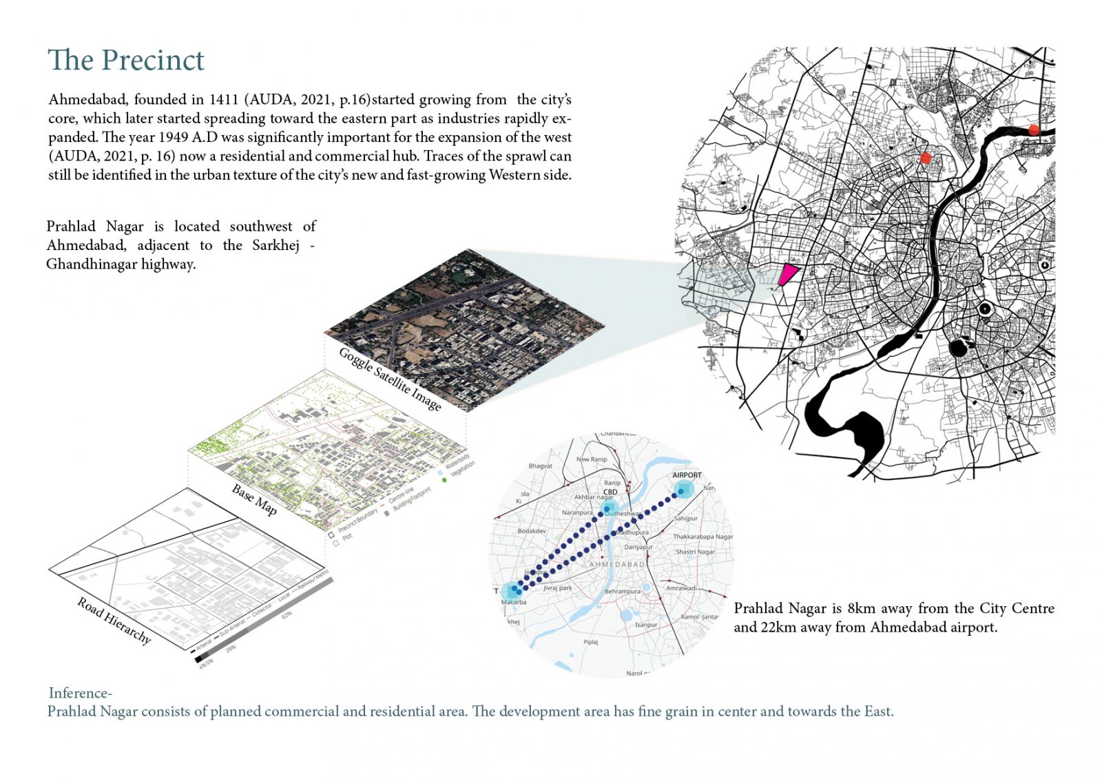
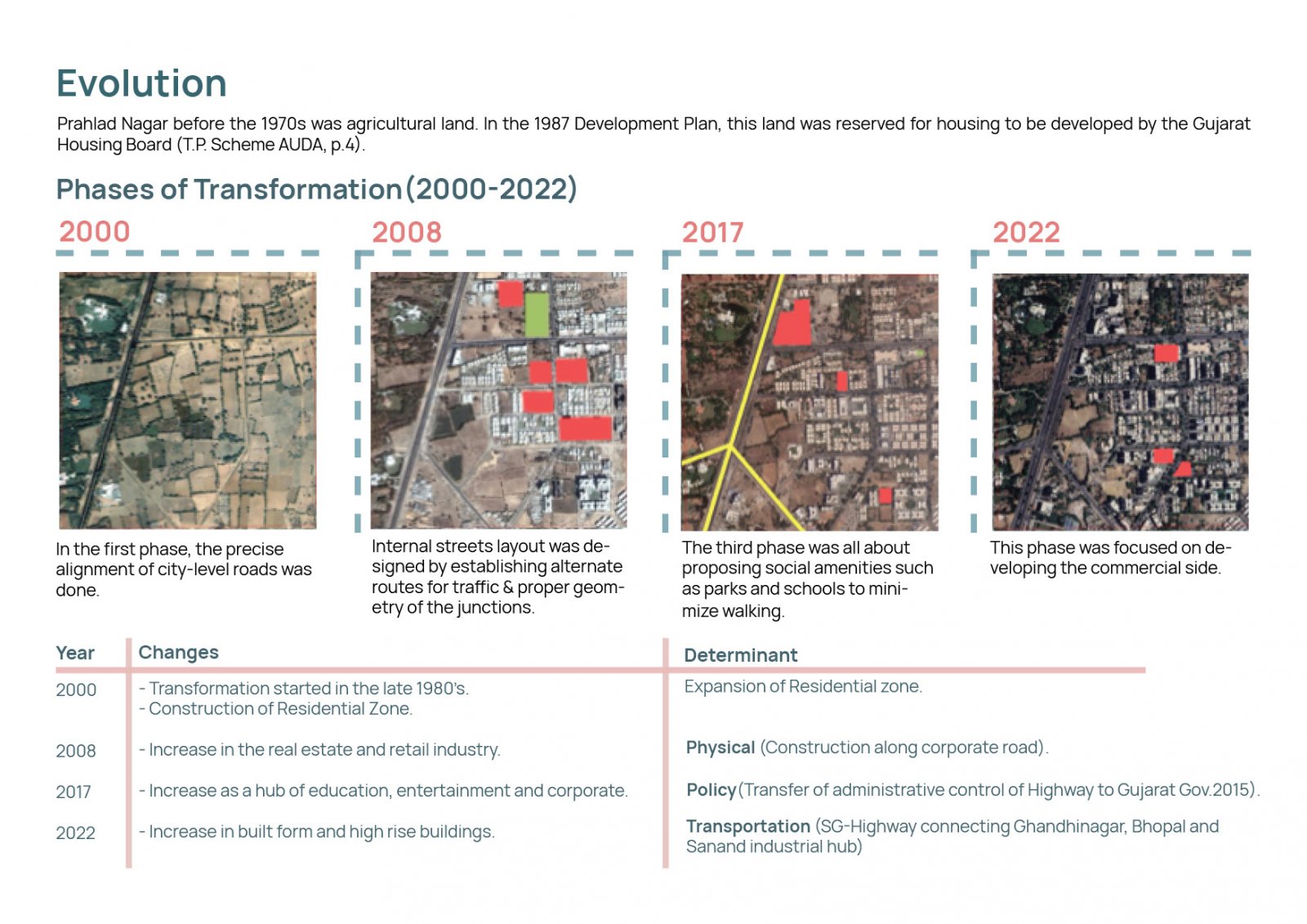
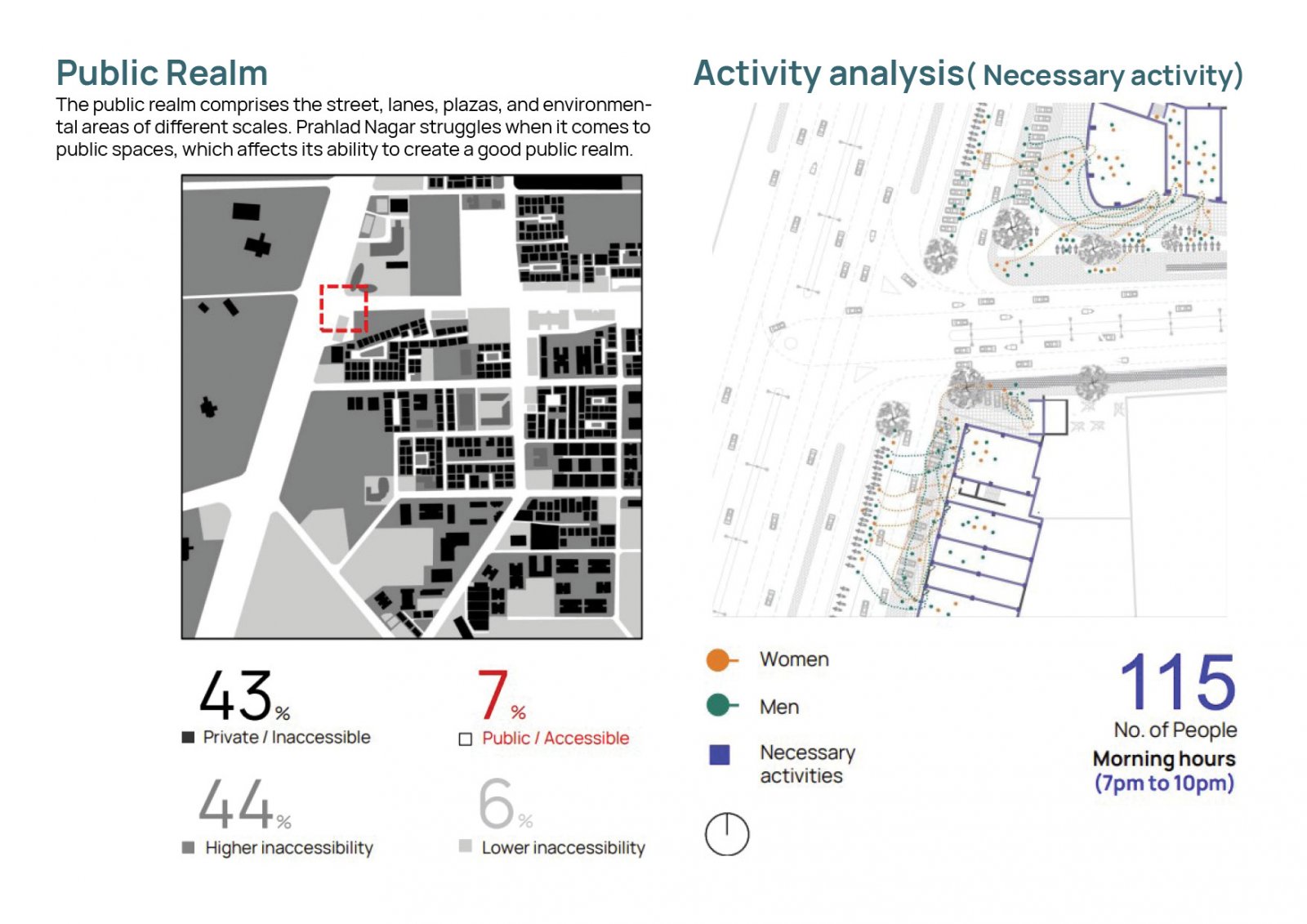
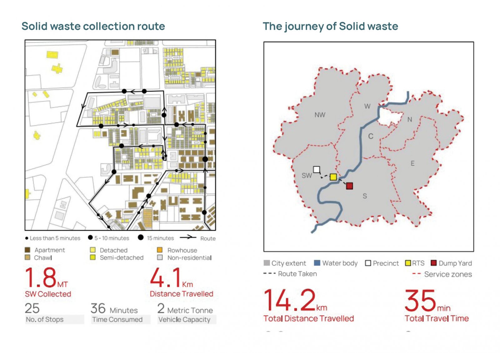
The portfolio is an analysis of one square kilometer of area i.e. precinct, located in the southwestern part of Ahmedabad known as Prahlad Nagar. Located adjacent to the Sarkhej Gandhi Highway. Prahlad Nagar before the 1970s was agricultural land. In the 1987 Development Plan, this land was reserved for housing to be developed by the Gujarat Housing Board. It serves the housing and infrastructure needs of industrial development that is happening in the southwest part of AUDA. This land experienced a remarkable transformation in the last 20 years, i.e. 2000 to 2021, evolved into a residential cum High Order Commercial Area due to various determining factors.