Simran Dhariwal

UP4002

Understanding The City, Ahmedabad

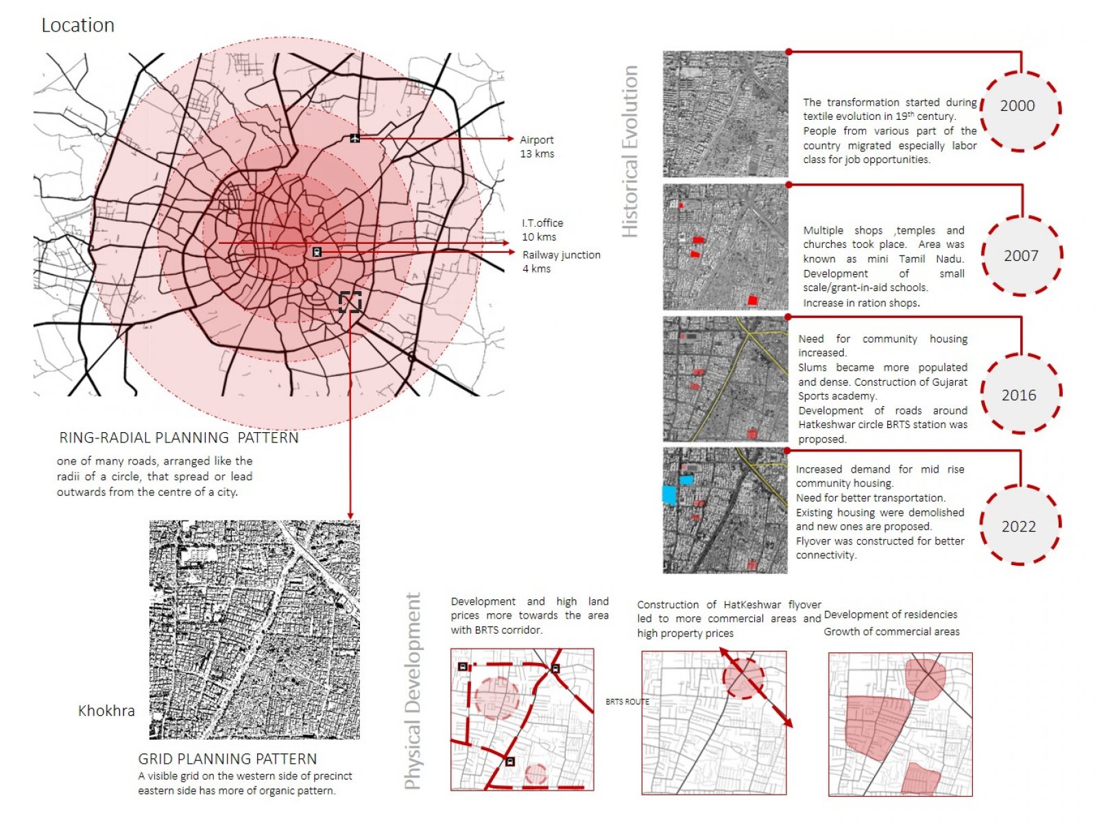
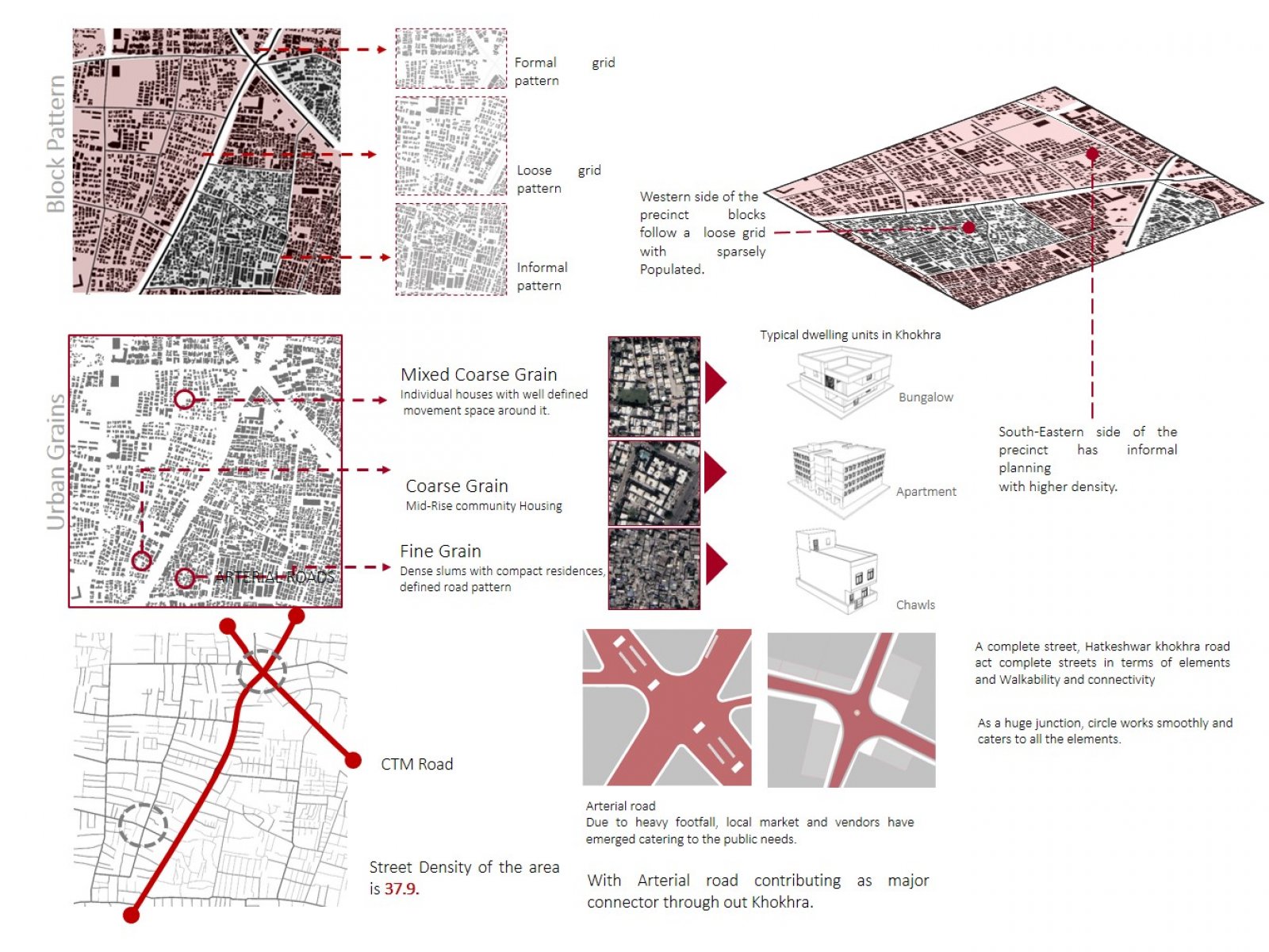
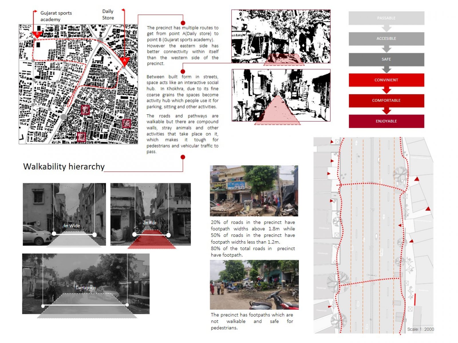
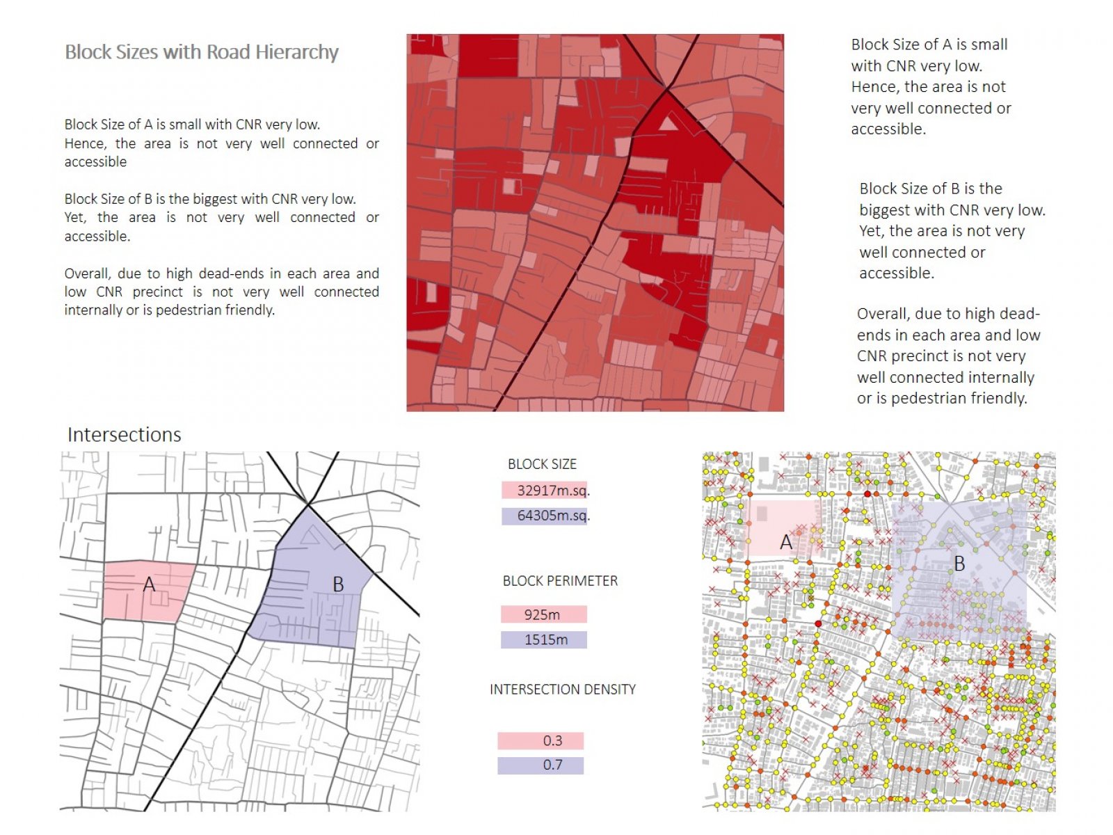
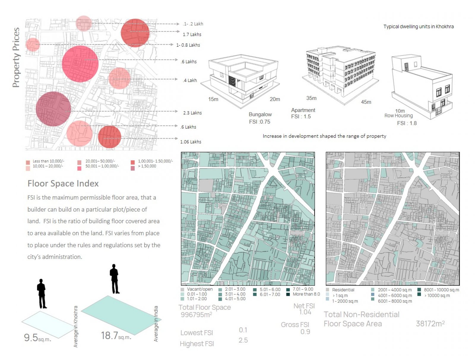
The city has gone through critical changes that occurred throughout 20 years, resulting in delayed infrastructure expansion. Socioeconomic considerations influenced the geographical changes significantly. People as a community contributed to the area's evolution by establishing institutes, houses, temples, and churches. People and development respond differently to the region because it generates a contrast of settlement types. On one side, development and accessibility are greater, whereas, slums and dilapidated roads abound. This affects the market and the kind of stores that exist and forms a chain reaction, preventing further growth. This has an impact on people's affordability. 


Report Content

Locating Khokhra within the city of Ahmedabad. Grid Planning pattern, A visible grid on the western side of the precinct's eastern side has more of an organic pattern. And discussing its evolution and history. The physical development of the precinct.

Various types of the urban fabric and urban grains of Khokra. The precinct. The western side of the precinct blocks follows a loose grid with sparsely Populated. The South-Eastern side of the precinct has informal planning with higher density. Arterial road contributes as major connector throughout Khokhra.

The roads and pathways are walkable but there are compound walls, stray animals, and other activities that take place on it, which makes it tough for pedestrians and vehicular traffic to pass. Between built forms in streets, space acts like an interactive social hub. In Khokhra, due to its fine coarse grains, the spaces become activity hubs that people use for parking, sitting, and other activities. The precinct has footpaths that are not walkable and safe for pedestrians.

Block Size of A is small with CNR very low. Overall, due to high dead-ends in each area and low CNR precinct is not very well connected internally or is pedestrian friendly.

Built up of the precinct is 37% but there is no public space. 10% of public space comes under streets and nodes. Hence, streets act as public spaces for people. Connecting 6 ROWs becomes a vital junction for the public to transition through areas.

Mixed used buildings with commercial on the ground floor and apartments on the floor above. They are environments for interaction and exchange of ideas that impact the quality of the urban environment. Acts like a public space due to high footfall and user activities.

People are more comfortable using shaded spaces like under the flyover than benches. The area is very active as their people use it throughout the clock by vendors as well as people Multiple activities happening at one junction makes it more accessible and friendly. Arterial and sub-arterial roads carry most of the activities among all the streets.

Less availability of space led to high prices and poor living conditions. There is no recreational or open space within the precinct. Due to overcrowding, there is floor space per capita is very low. High density in the precinct creates pressure on infrastructure and amenities. Lack of affordable housing.

The waste generated in slums and chawls is lesser than in other households. The average bin size in this area is 7lts. While the time of waste collection is throughout the day, there are improper places where waste is collected, leading to waste along streets. Due to the weak connectivity of roads, there are many areas/households left by trucks to collect garbage. Open dump yards for Chota hathi creating unhygienic conditions.