Your browser is out-of-date!
For a richer surfing experience on our website, please update your browser. Update my browser now!
For a richer surfing experience on our website, please update your browser. Update my browser now!
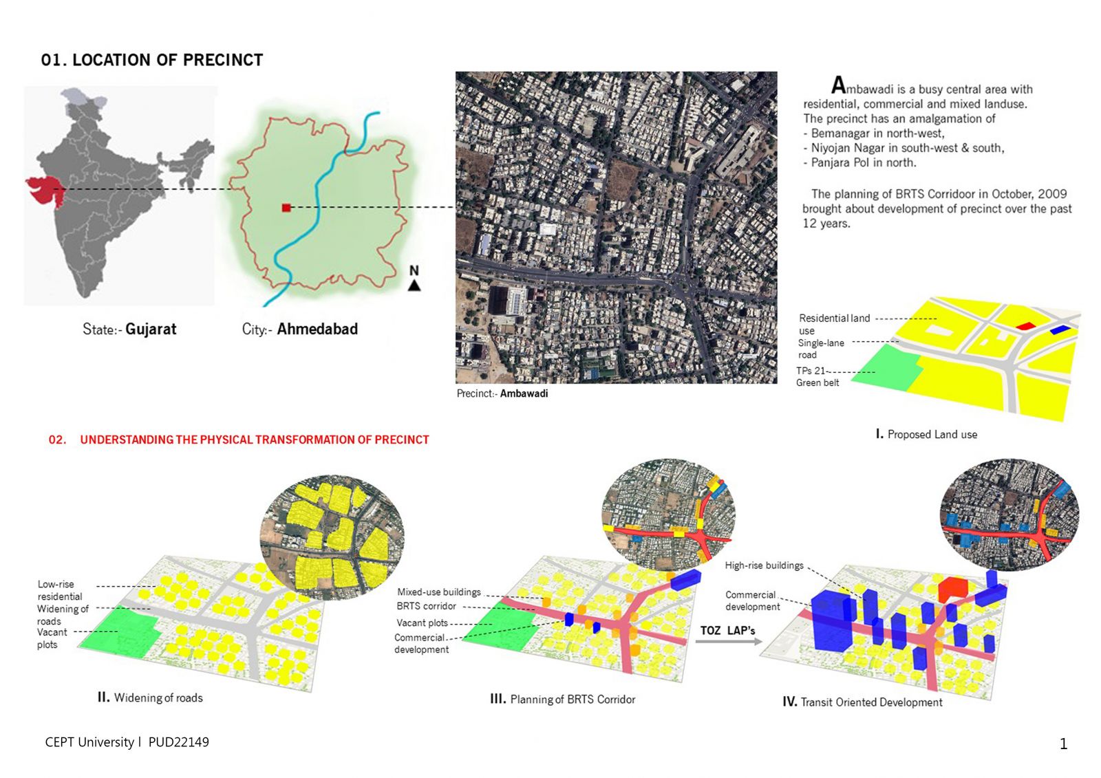
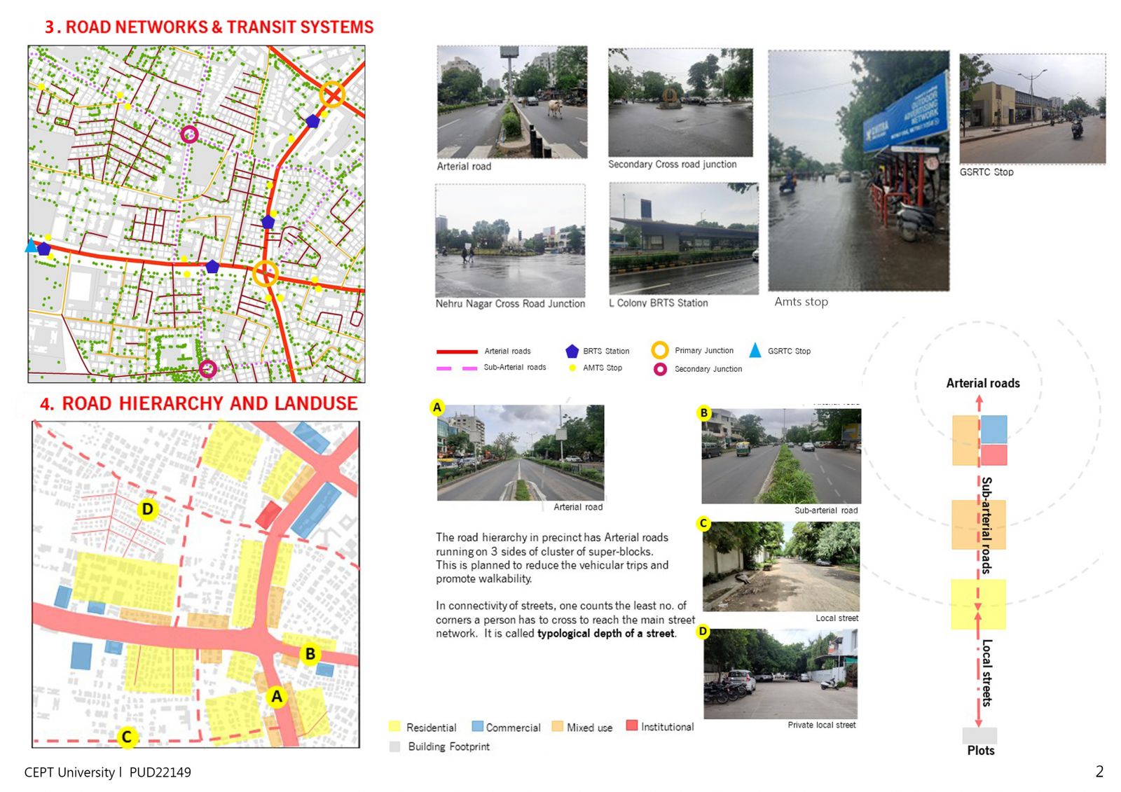
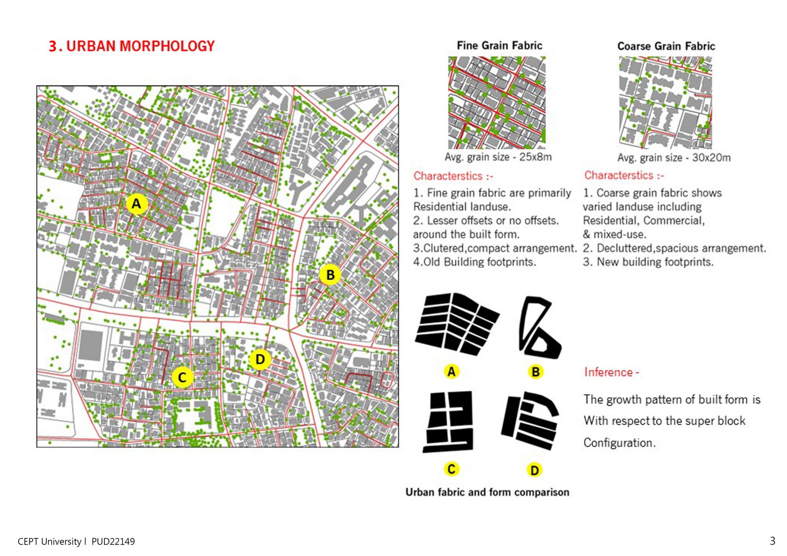
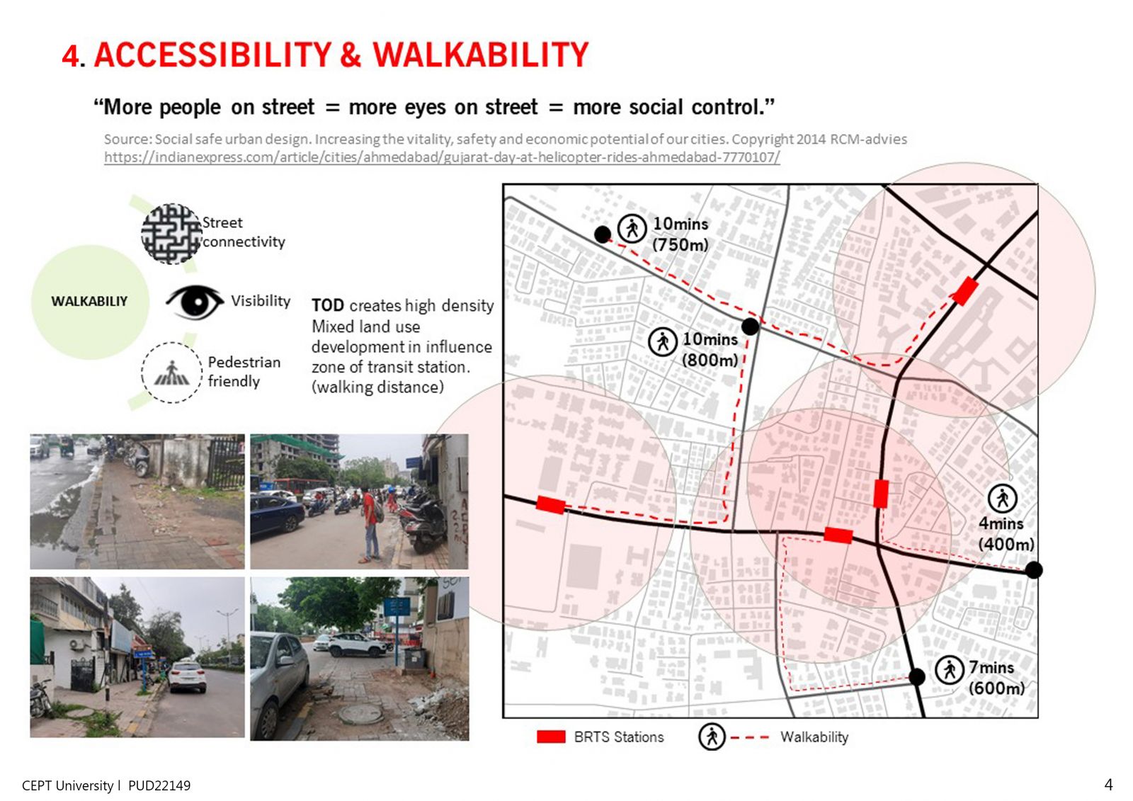
Understanding the city studio included observation, analysis and mapping the city. It involved study of 1km x 1km precinct, initially on basis of the satellite imagery and then mapping on site with GIS generated maps. The entire studio was focused on analytical study and critical thinking related to urban planning. This studio improved self studying, self analyzing skills as well as was a good brief to urban planning fields including - Urban design, Urban transportation, Urban infrastructure, etc.