Your browser is out-of-date!
For a richer surfing experience on our website, please update your browser. Update my browser now!
For a richer surfing experience on our website, please update your browser. Update my browser now!
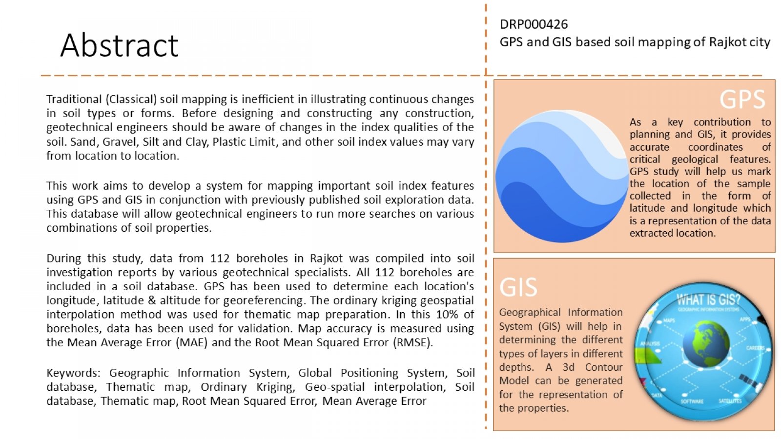
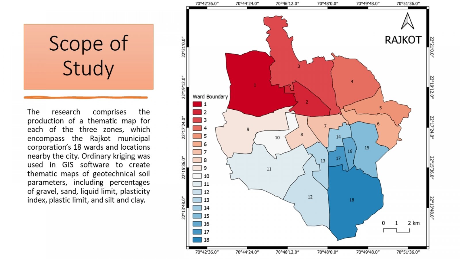
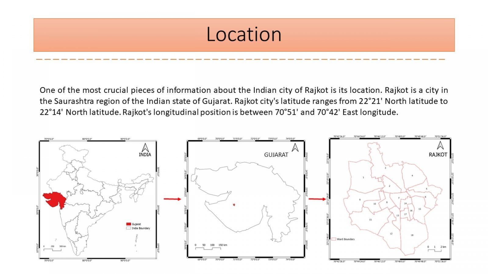
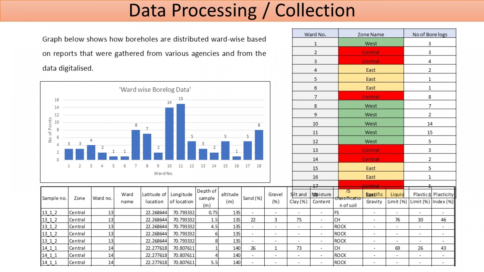
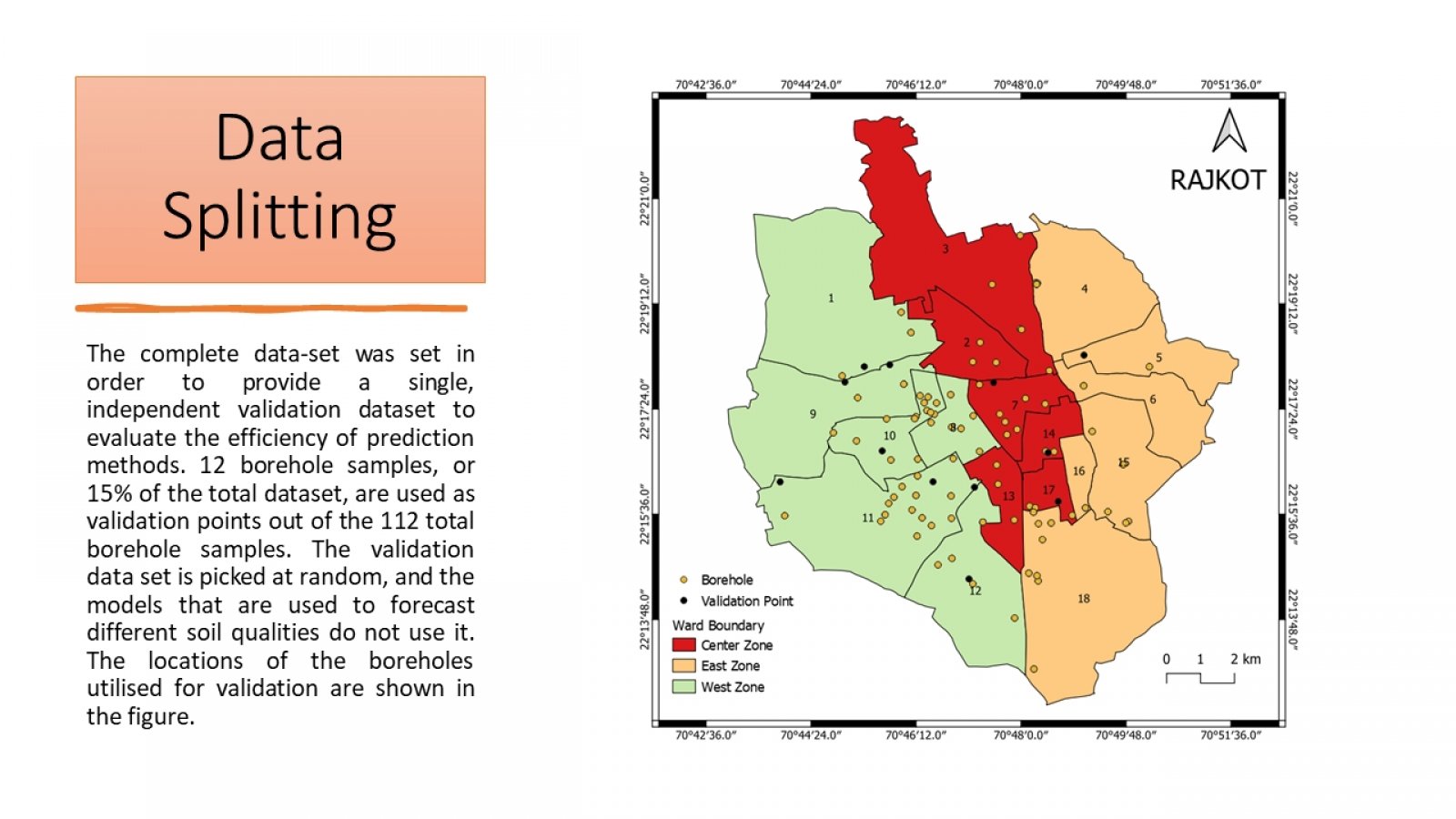
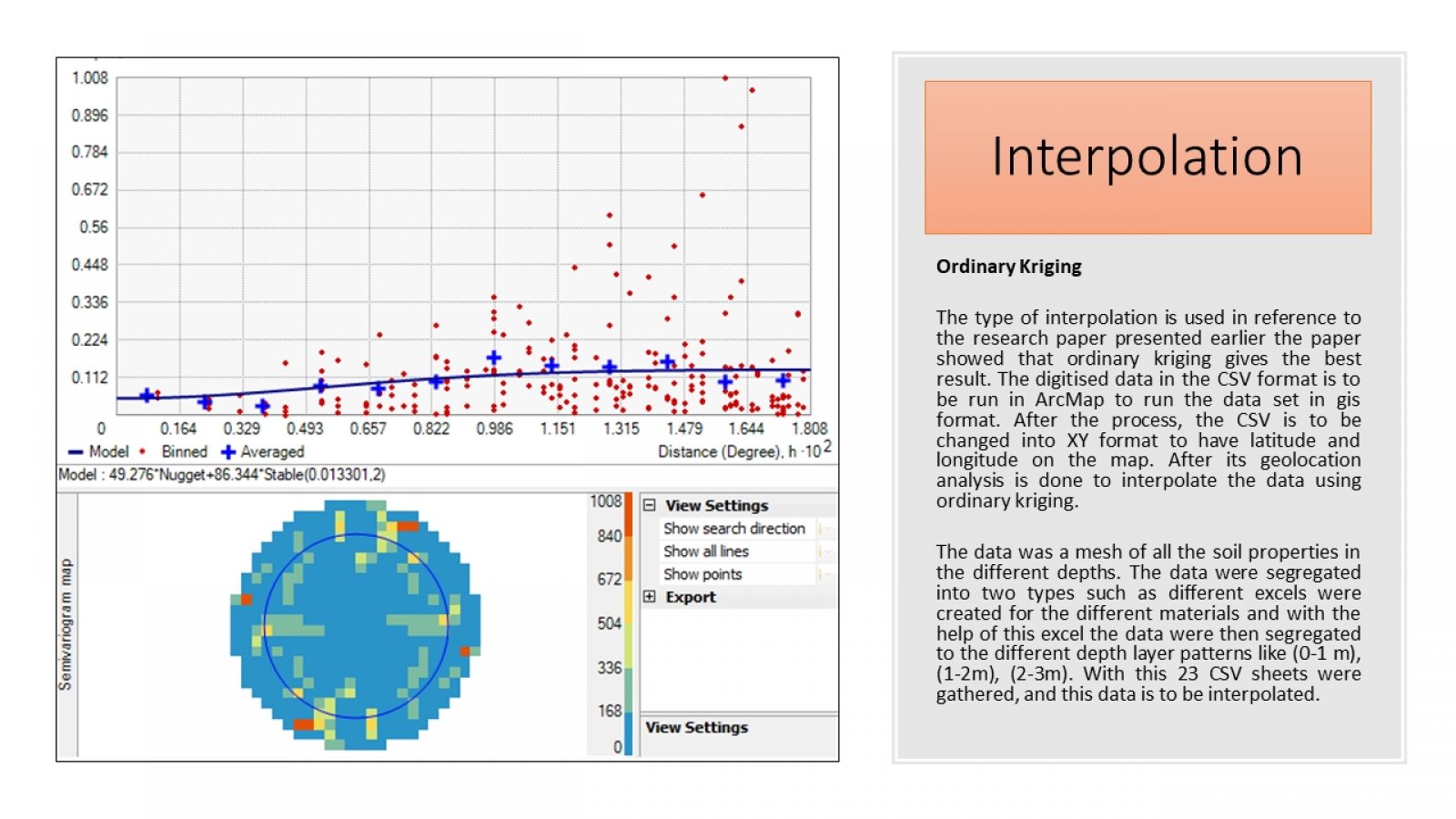
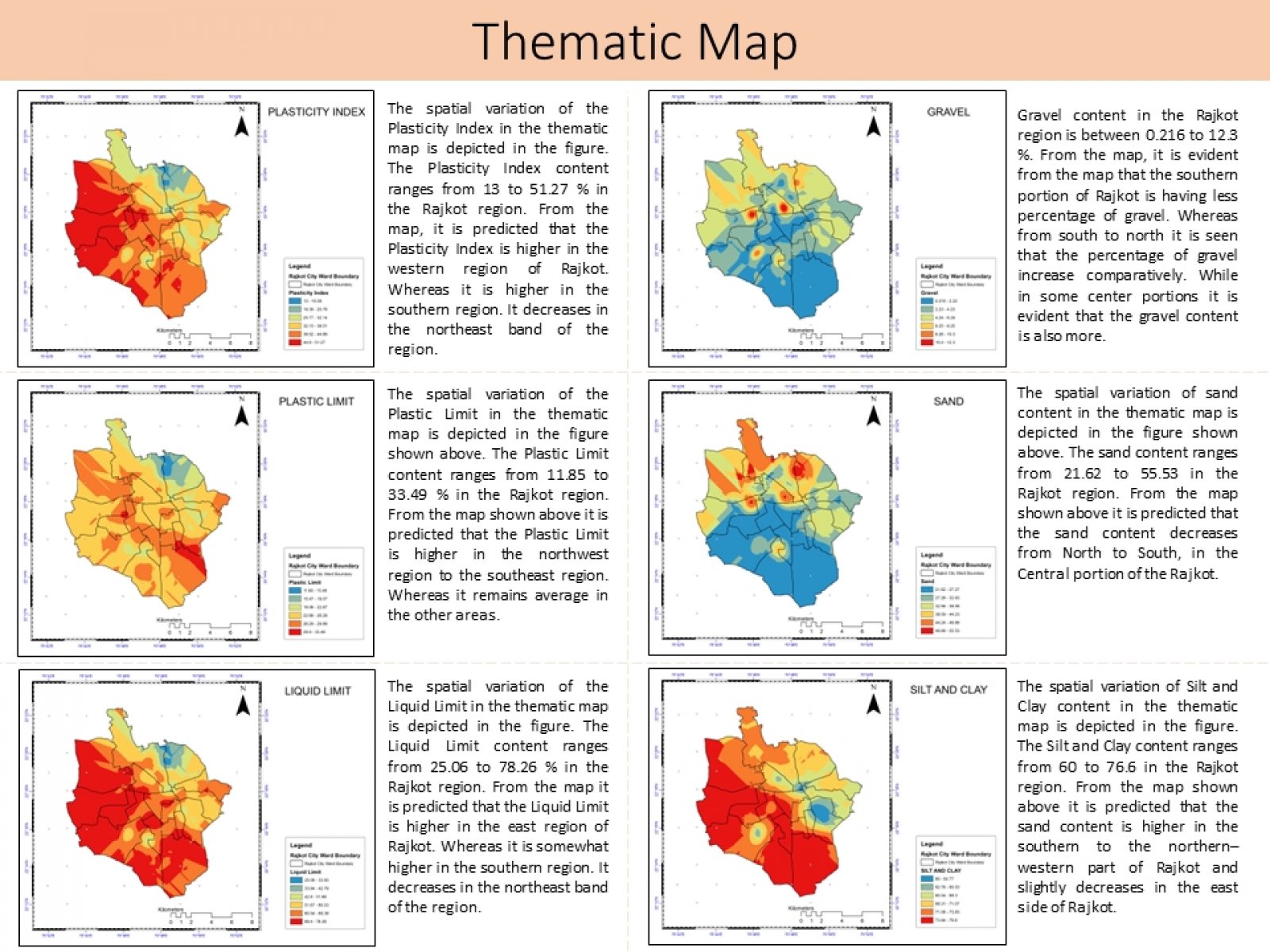
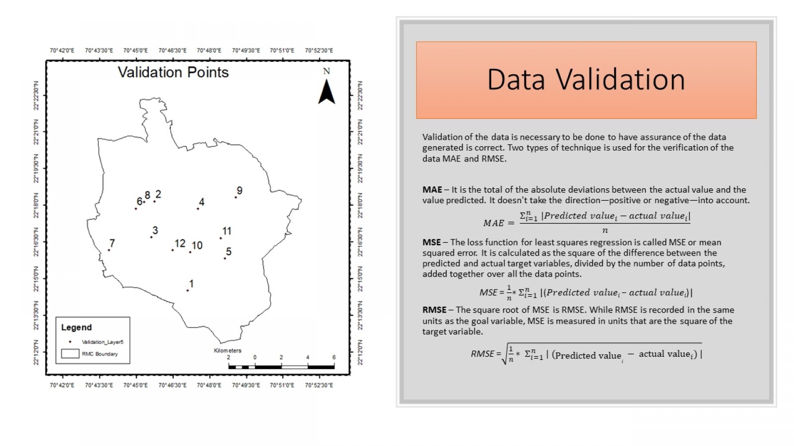
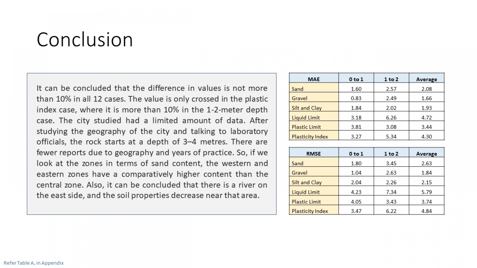
This work aims to develop a system for mapping important soil index features using GPS and GIS in conjunction with previously published soil exploration data. This database will allow geotechnical engineers to run more searches on various combinations of soil properties. During this study, various geotechnical specialists compiled data from 112 boreholes in Rajkot into soil investigation reports. All 112 boreholes are included in a soil database. GPS has been used to determine each location's longitude, latitude, and altitude for georeferencing. The ordinary Kriging geospatial interpolation method was used for thematic map preparation. In these 15% of boreholes have been used for validation. Map accuracy is measured using the mean average error (MAE) and the root means square error (RMSE). Detailed Report
View Additional Work