Your browser is out-of-date!
For a richer surfing experience on our website, please update your browser. Update my browser now!
For a richer surfing experience on our website, please update your browser. Update my browser now!
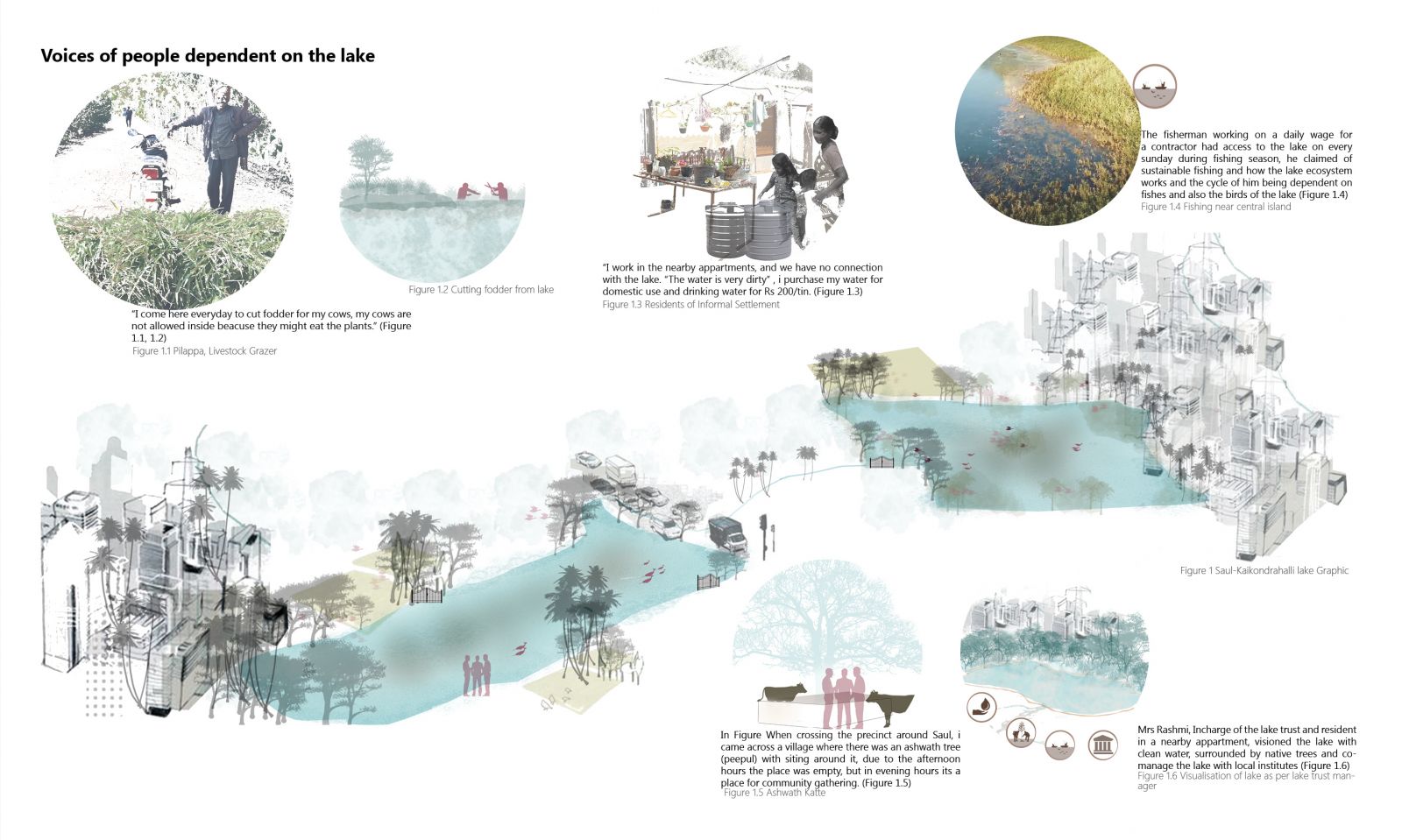
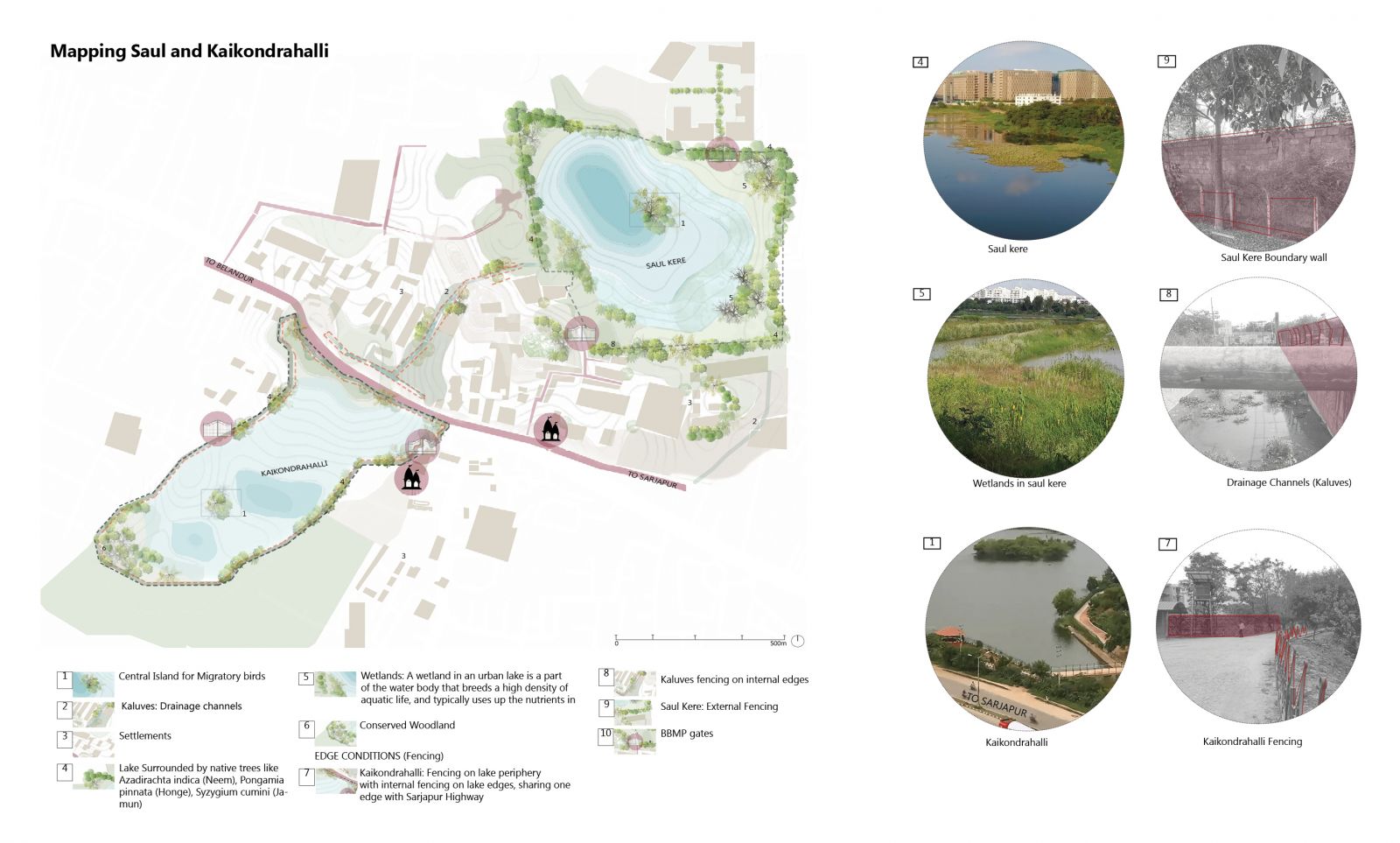
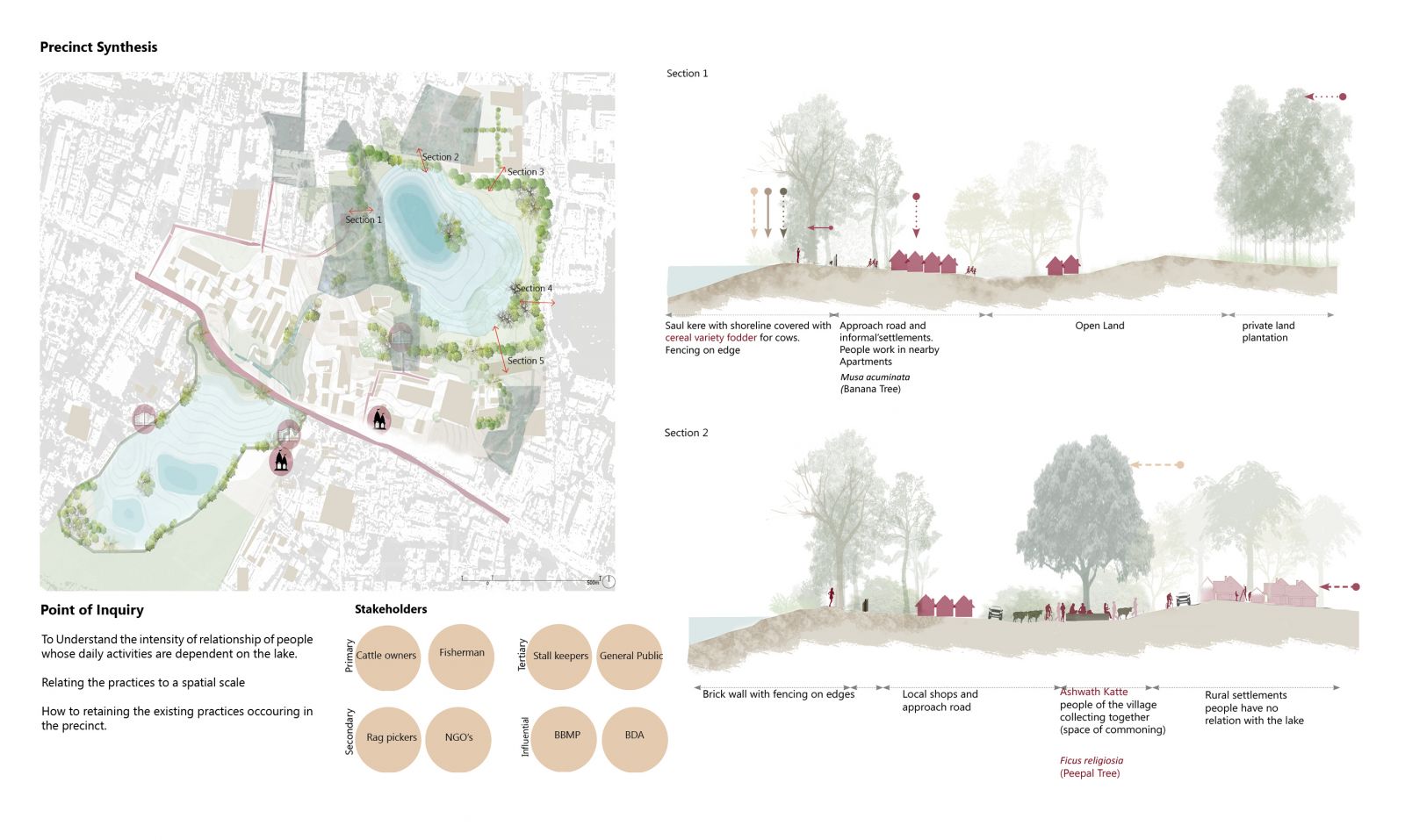
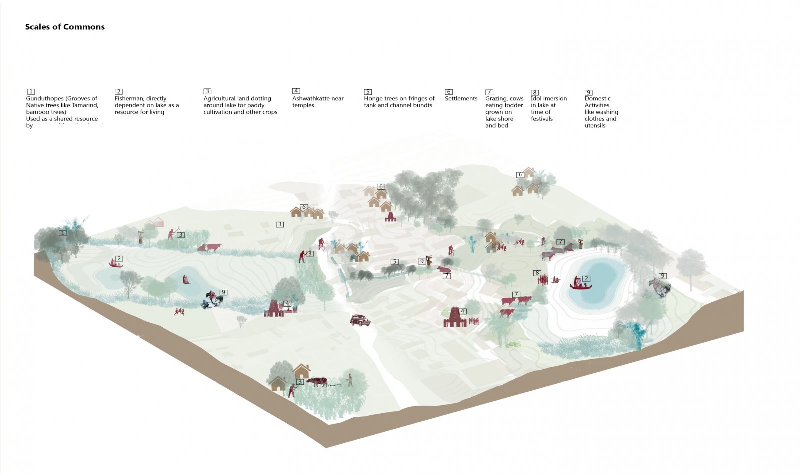
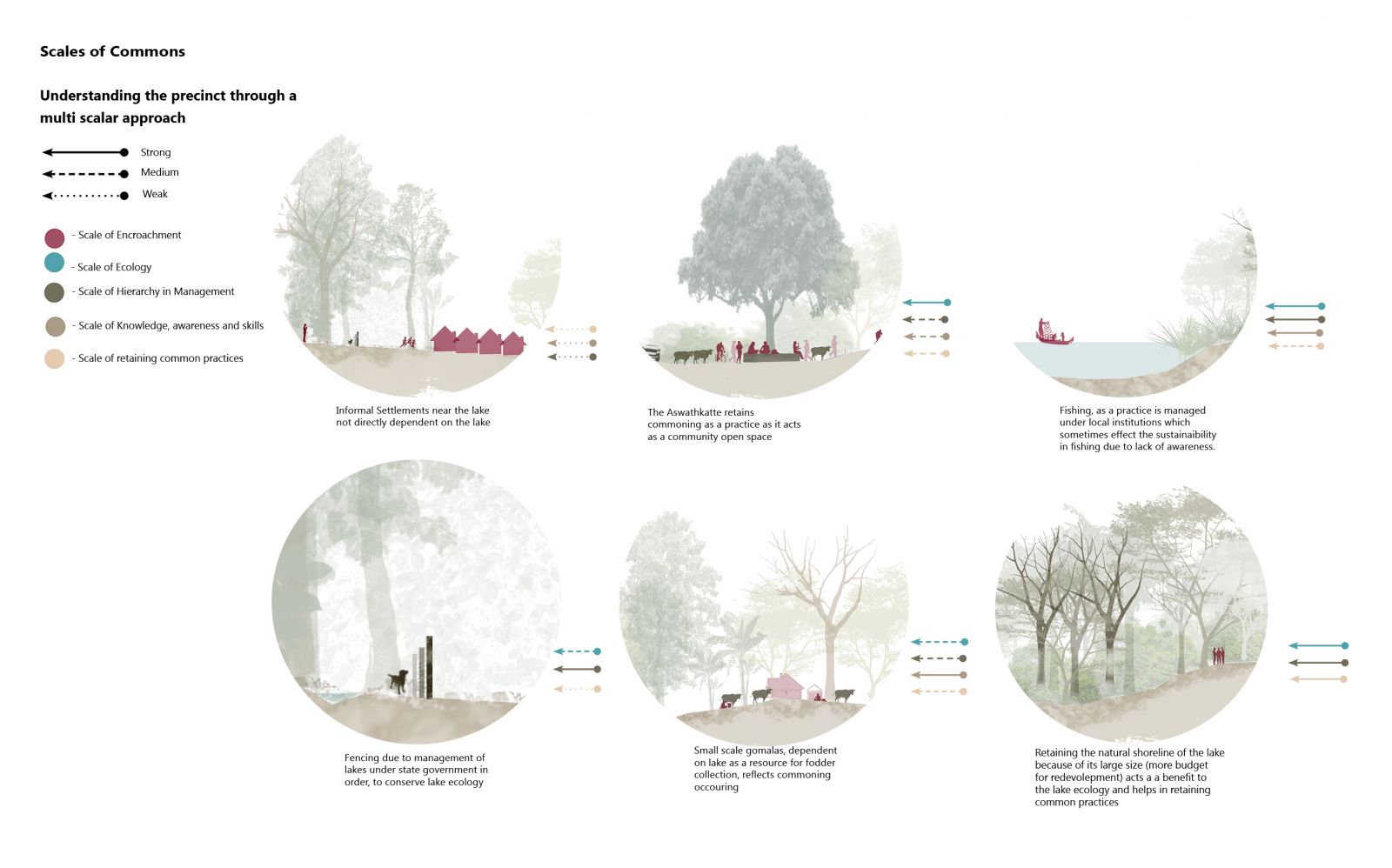
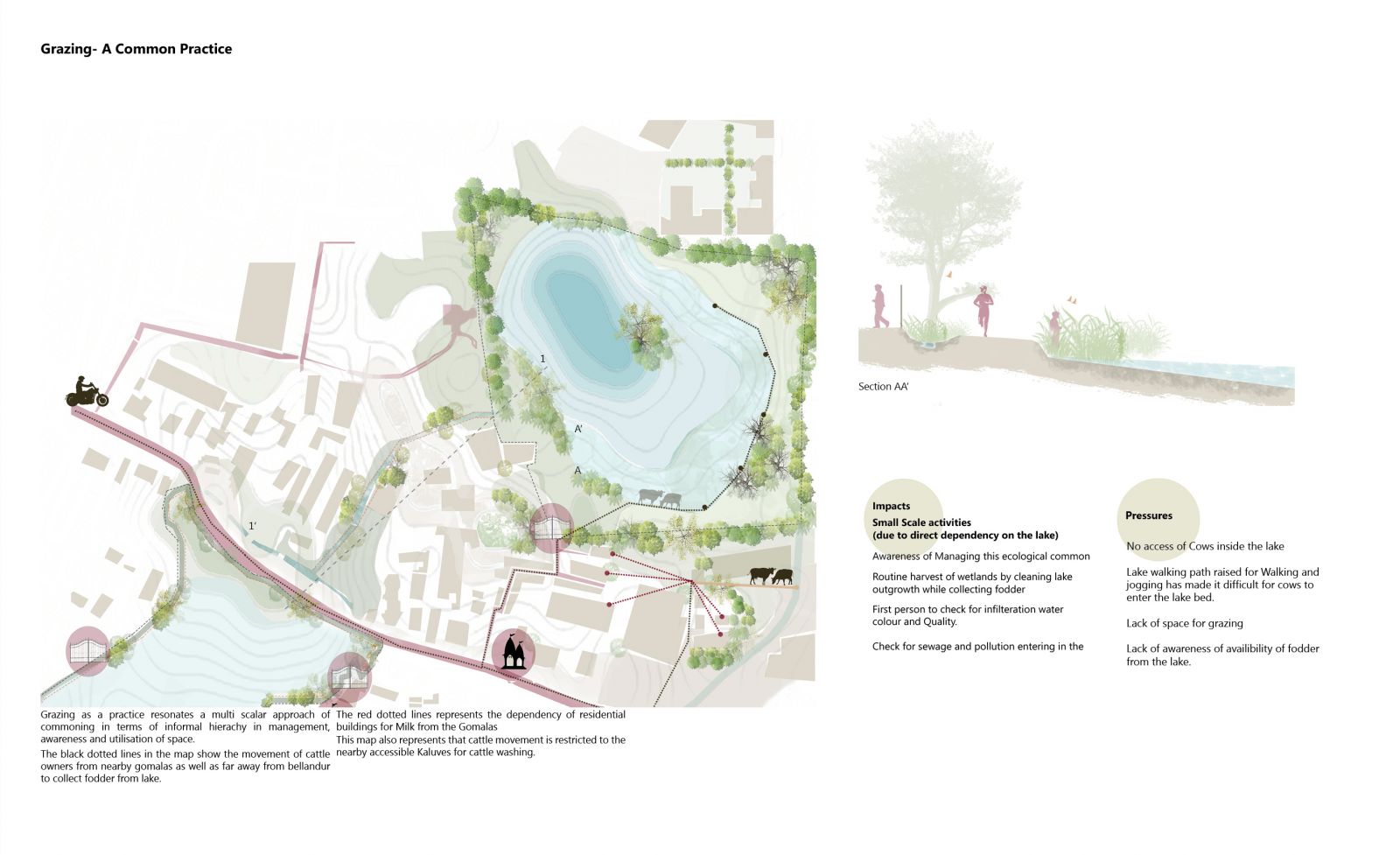
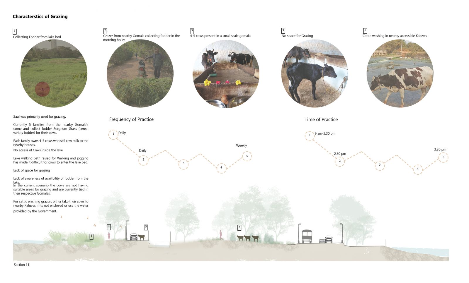
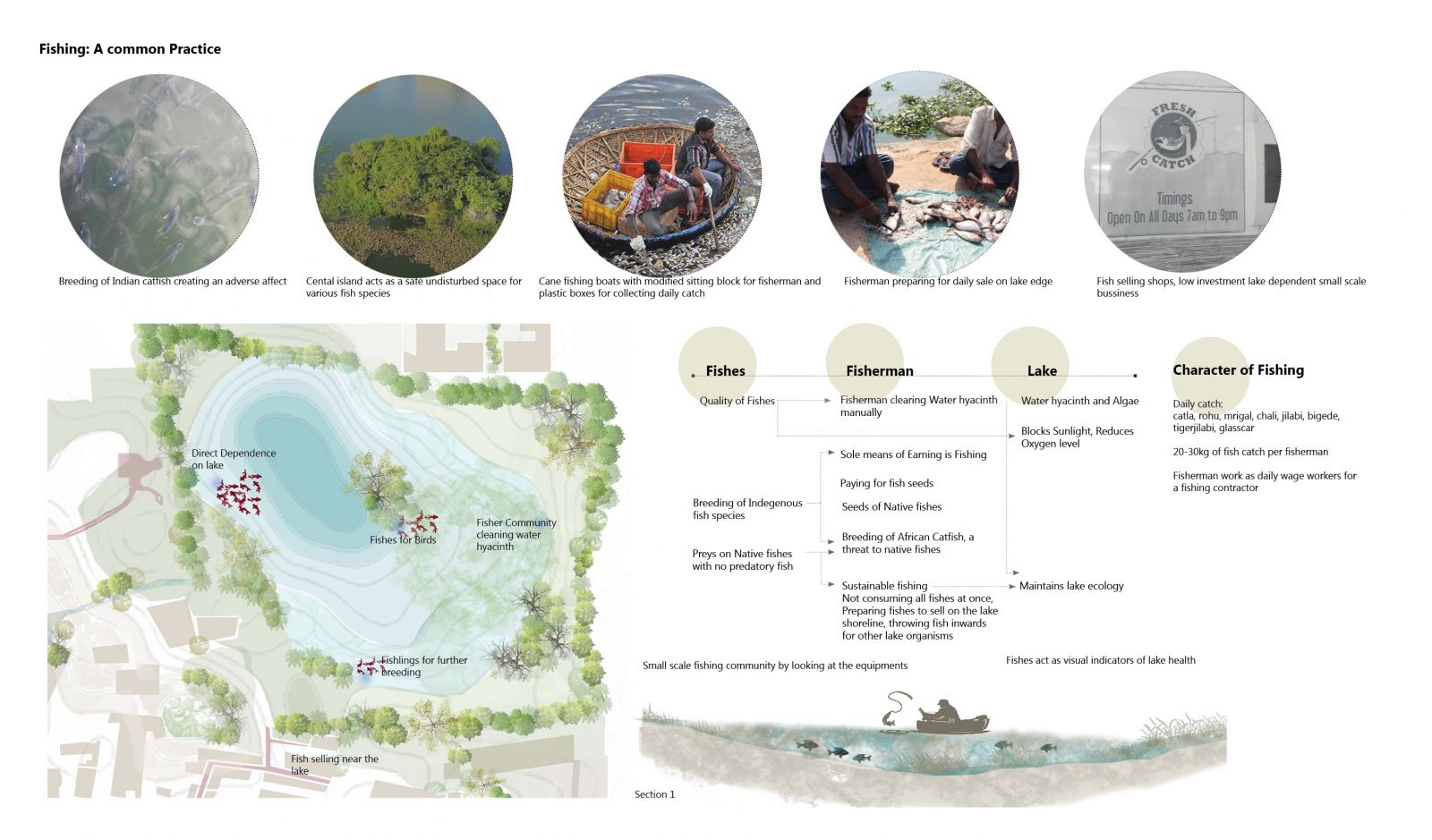
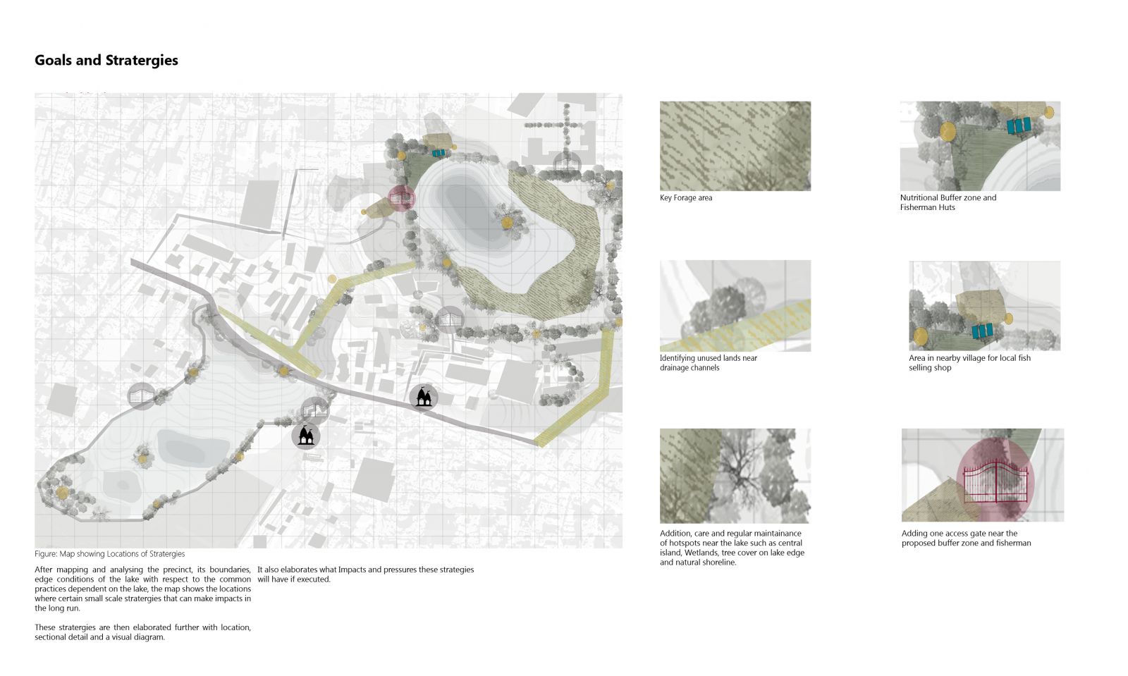
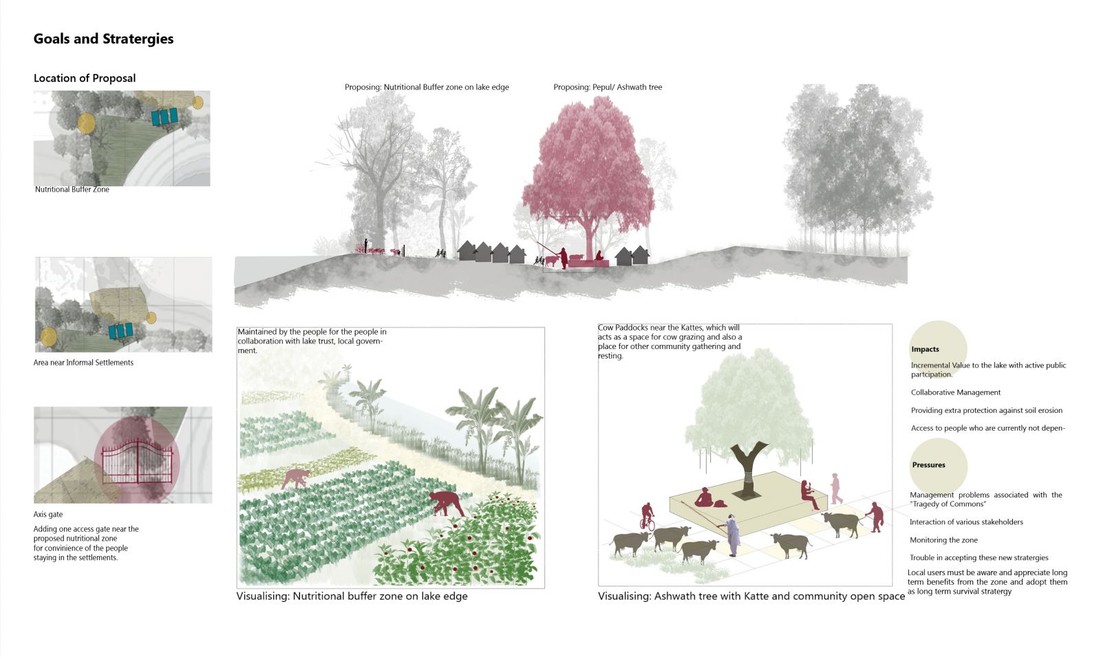
Saul and Kaikondrahalli situated on Sarjapur Road in south east of Bangalore. Once surrounded by agricultural fields this area now consists of several high rise residential buildings, IT parks, restaurants and shopping complex. The Saul Kere like various lakes of Bangalore support Multiple human-landscape relationships. The history of Saul is that once the wetlands around the lake were used for agriculture and cultivation but primarily as a grazing land for cattle. Because of its large size that is 61 acres, and connectivity with Kaikondrahalli at a very close distance, both the lakes together on a regional level creates a microclimate in that area and acts as a breathing ground for nearby residential areas and communities. Apart from that it comprises a variety of native trees creating a biodiversity hotspot for many avifauna species. Several Sacred trees around the lake periphery as well as near the local temples make cultural and spiritual connections for the people. Understanding the landscape of lake and its resource based dependency exists everywhere on multiple scales if we look carefully.
View Additional Work