Risav Gupta

LA4012

Tracing the Bygones

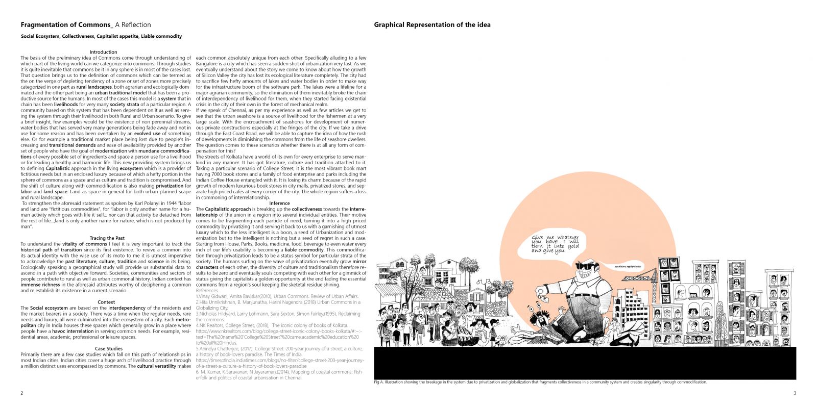
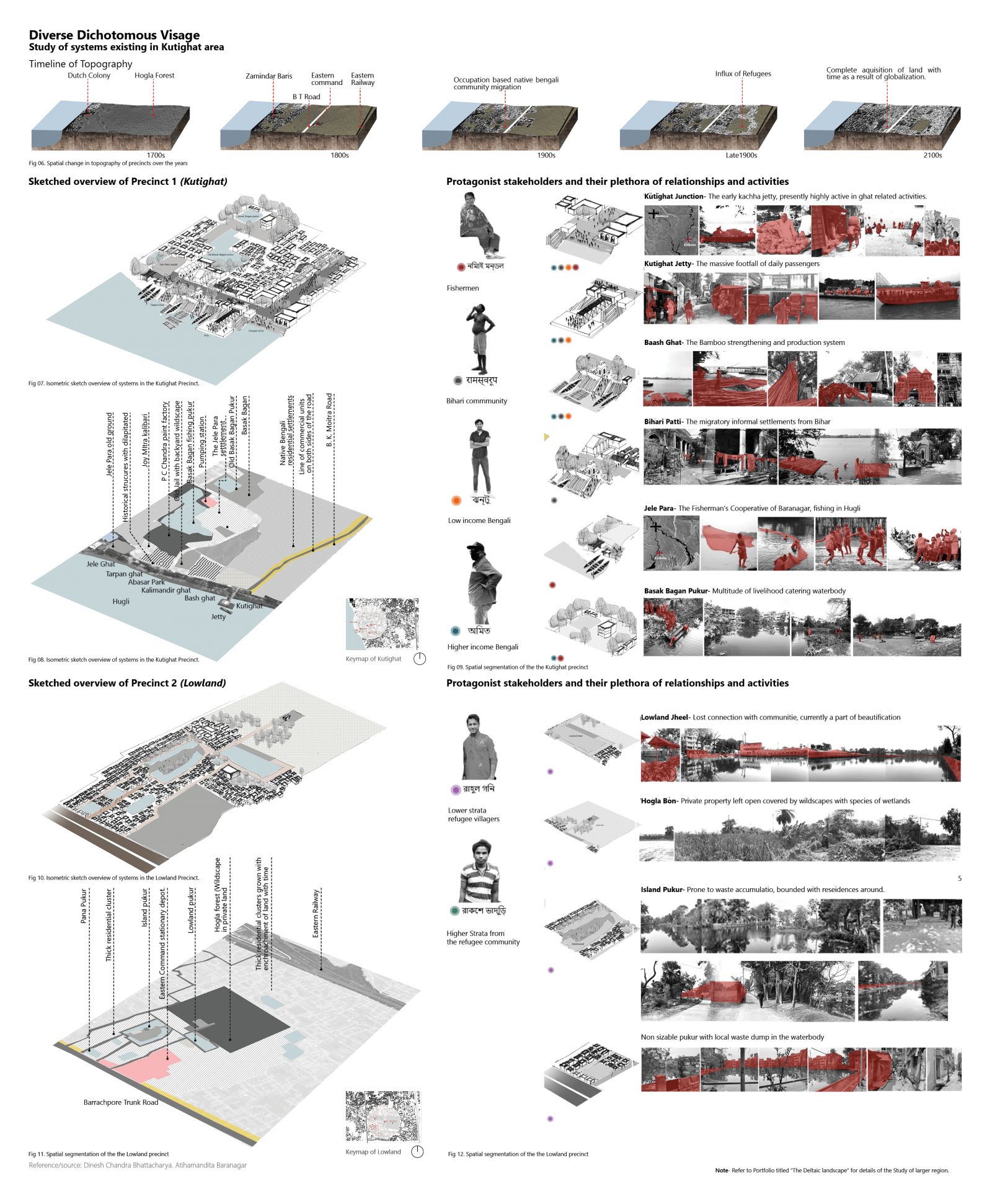
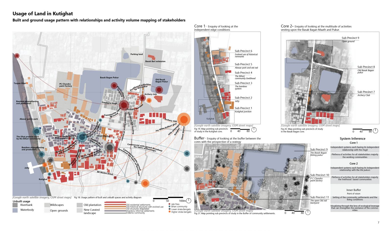
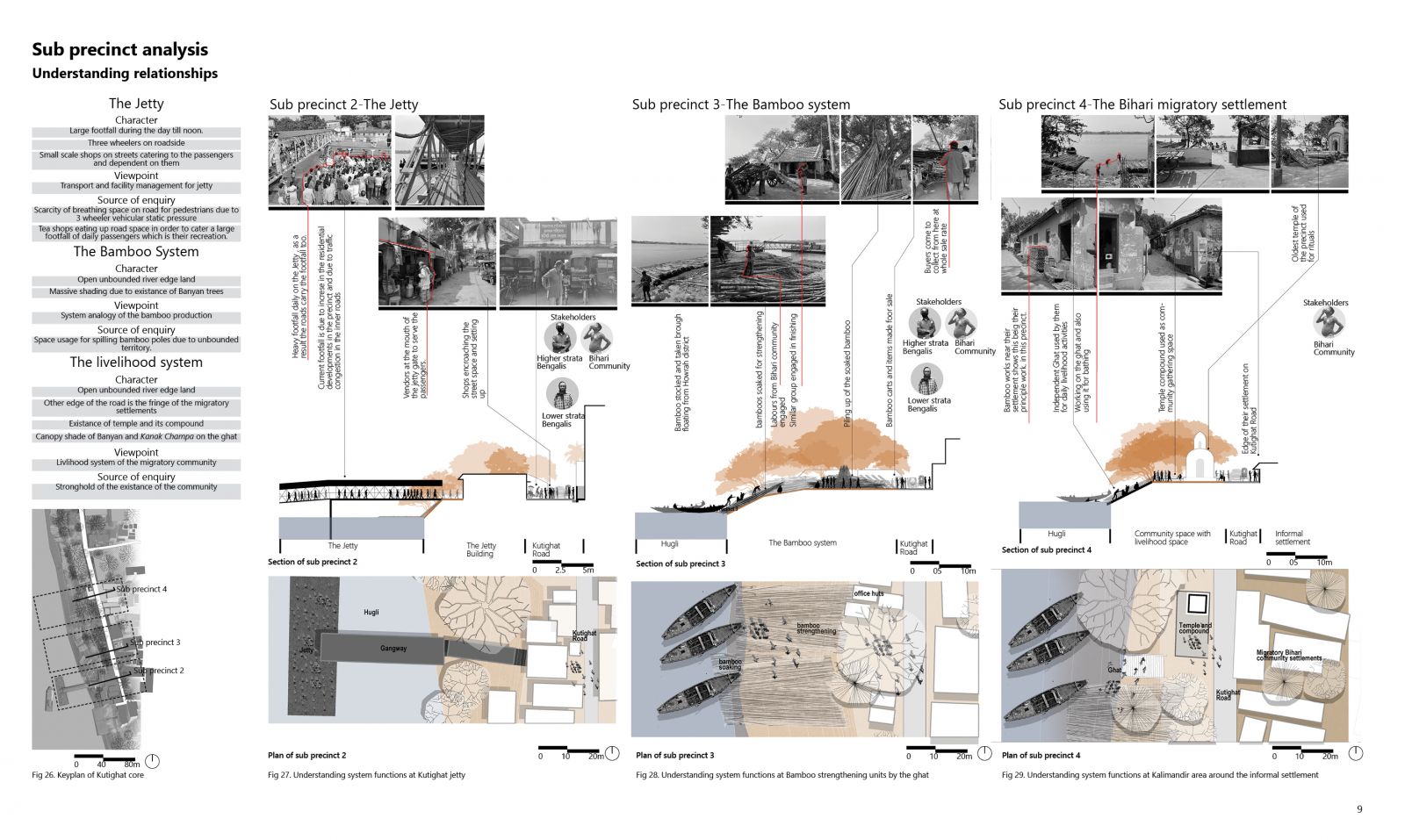
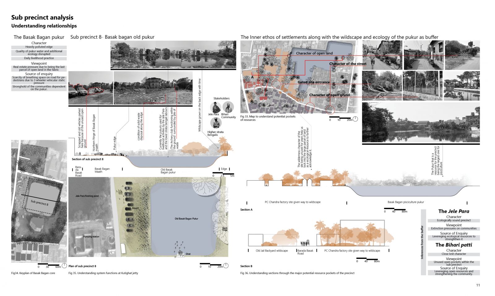
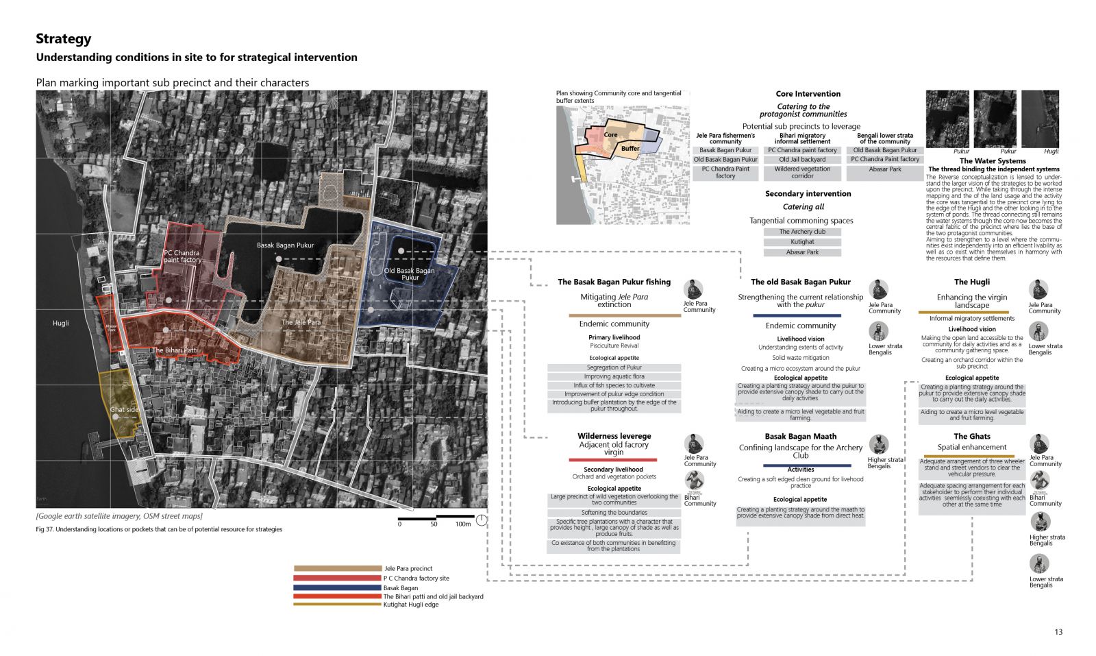
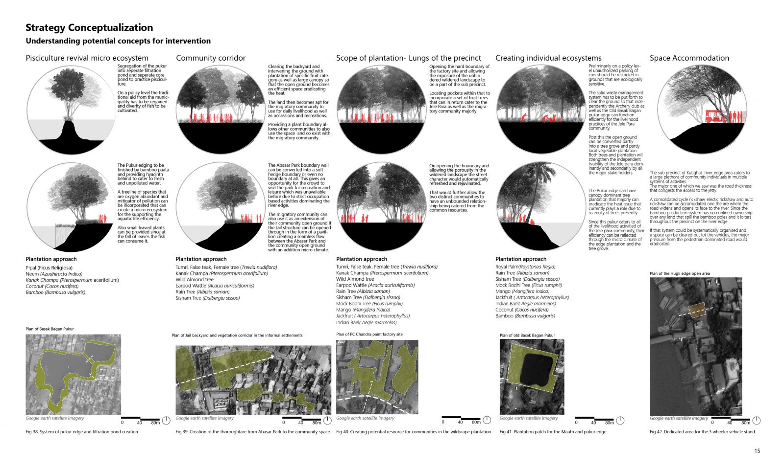
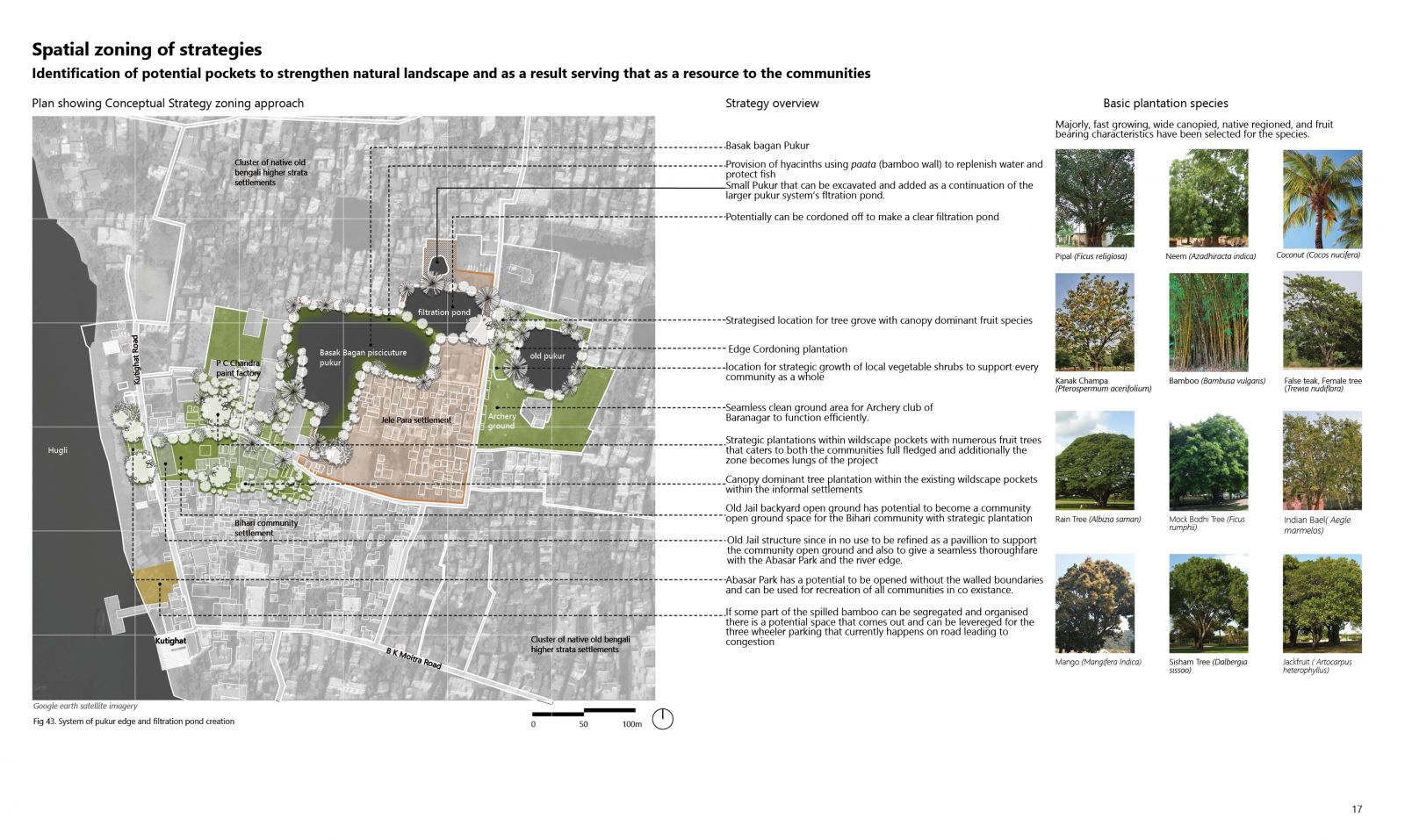
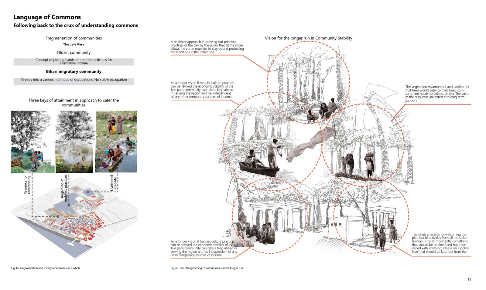
The Project Tracing the Bygones majorly revolve around Kutighat in Kolkata that has evolved its character multiple times in multiple eras. A land on the banks of river Hugli due to its geography invited communities to settle in the past. In Kutighat being on the banks a multitude of occupational systems had their initiation. Independent systems including the Ghats and the protagonist stakeholders were studied. The distinct layer of history plays a key role in defining the activities and also the spatial collectiveness of the communities existing that was further studied and strategized to be strengthened for efficiency as commons.

View Additional Work

Report Content

The whole understanding of commons in this case has been thoroughly picked up from a city’s traditional ecosystem and interrelationships between people from a multitude of strata in the society. This practice provides collectiveness. That collectiveness is somewhere in current scenario rapidly capitalized as a result of which is it fragmented and singularized.

The Study begins with looking into the fabric of North Kolkata which as explained in the portfolio ‘ The Deltaic Landscape’ says that the honour of Socio Cultural fabric has been attached to this fabric because it was geographically apt, altitudinally ideal for the first settlers to start setting up their community in this region. History takes the baton post that where we see multiple layers of communities setting up their neigbourhood which in Bengal is called as Para. Major areas of Baranagar, Kumartuli, Shyambazar and College Street has been studied with Baranagar taken as a part of further intense study.

The Storyboard preliminarily explains us the context of Baranagar in a duality where at one side we are looking into a system that diverges into the Hugli and at another side we are looking into a system that is lower in altitude and is converging into a system of five ponds which showcases a remnant of prehistoric wetland forest ecology that Kolkata was under. We are able to visualise that in the topographical map evolution. From there at first in the Kutighat precinct by the Hugli we start seeing systems that are independent of eachother on the edge as well as systems that are highly dependent as well as set of ponds inside the precinct which are also of extensive correlation. Whereas on the precinct study of Lowland we are pushed to visualise only one system that helps us recognise how with time the fabric has disconnected completely from the pond systems and has grown as a cluster of singular residential strata with a collectiveness that is lost.

From the overview of the precincts we study the usage pattern of the land both built and ground. According to that we categorize real estate pressures, settlements and Old historical structres from Dutch era that are in plentysome evolved in use some dilapitated into unused land parcels as shown in Fig.18. Along with that we have studied the detailed positioning of the systems understanding the base of the four major stakeholders, the fishermen community of Jele Para, the migratory Bihari community, the lower strata bengali community and the higher strata of the bengali community as shown also in Fig 18. From the base the activities around the site are mapped and the volume of activity and interrelationship has been marked by the size of the circles of respective tone. Further from that the precinct has been divided into two core areas, one looking into the edge conditioning systems in Hugli and the other one looking into the pukurs and maaths in the inner fabric.

This study showcase three sub precincts. In Sub precinct 2 we have studied the system of the Jetty which caters to a large footfall in the area for the water transit. The next system we have studied is the bamboo strengthening system just meters ahead on the Kutighat road from the jetty. We have studied the complete cycle of bamboo brought by water from Howrah district, soaked in river edge silt and then dried and sold for major uses in the city. The bihari labourers are majorly into the roleplay of the complete dynamics of the system. The next system that has been studied is the ghat are that is independently dedicated to the Bihari informal settlement. They use the ghat for their livelihood activities and the temple compound present there is their community open space and ritualistic activities.

This study opens to the other part of the Basak Bagan where we are seeing the Basak Bagan pukur which once was the only source of drinking water for the neighbourhood due to Kolkata at one point carried brakish groundwater due to Hugli. Presently the pukur is used for livelihood activities specially women of the fishermen’s or Jele community and also shared by a set of low income bengali strata group. Solid local and mechanical waste dump is a major scenario that is depleting the quality as well as the ecosystem as shown in Fig 35. Seeing at all the systems we are looking into the buffer area and its ecology that has the major amount of eclogy inclined areas majorly the Jele para Basak bagan fishing pukur and the old paint factory site of P C Chandra that has given way to the wildscape of the site. These systems have been studied as an inference to the other cores so that it helps us visualize towards interventions for the precinct that can look after the communities existence.

At this level after the the study of the systems the inference that is drawn is that the lens of looking into strategies is catering to the communities that exists and because of whom the system exists. And also bifurcating the structure into looking at the water systems that play the allied role in the strategy support that is mapped in Fig 37. A structure has been created which could feed into understanding the character of intervention and the primary system of livelihood each of the communities respond to majorly and what is the appetite that the ecology of the land has so as to cater to any intervention that is strategised. Majorly the dilapitated sites of wildscapes and the pukur edges have been considered as potential zones, along with it a part of the Hugli edge also comes in as a supportive land offering intervention.

Majorly on a broader scale treatment of the Basak Bagan pisciculture pond is thought upon in such a way that the pisciculture can ascend to a much higher scale with efficient and favourable system ingedients as shown in Fig 38 . Next up to see the Jail backyard and the municipality park area can be amulgamated into a thoroughfare of vegetation and open community grounds serving for all the communities in a co existantial language as shown in Fig 39. also looking into unused wildered spaces for plantation scope to create a forest pocket for site to have lungs as shown in Fig 40. Also the other edges of the pukur is intervened with plantation for shading and livelihood ease also to mitigate heat. The Hugli edge is also considered for space allocation if the congestion of the junction can be relieved.

The strategical conceptual interventions have been incorporated in the precinct map where what the spatial character change of the precinct post the intervention could be is showcased as shown in Fig 43. Few specifics of major planting based strategies have been studied as per the geography of the region and incorporated that can suffice as resources for the community for strengthening their holistic existence.

The initial understanding of commons in the first exercise led to an insight that the perspective of collectiveness in a community and in a society are at stake and have almost reached its brink. Be it negligence or be it the newer pressure of globalization and urbanization the commons from the floor of collectiveness is on the verge of eradication. Through my ground truthing and secondary study after looking at the larger picture of the multitude of systems and activity the basic enquiries that oozed out of the precinct is the question of existance of the protagonist communities, if yes then is it independent or through co existance. At the ultimate level the crux of the study revealed that in order to cater to the activities that the systems infer from day to day are dependent on the communities and in order to keep the system efficient the strengthening of those communities is utmost urgent.