Bhavya Trivedi

UR3003

In-Between

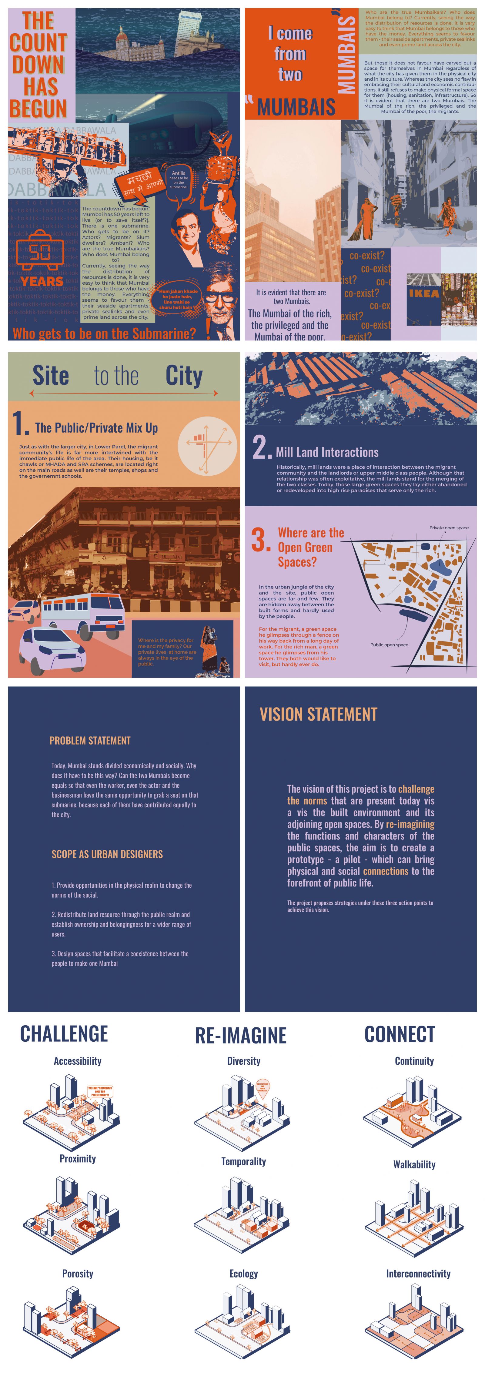
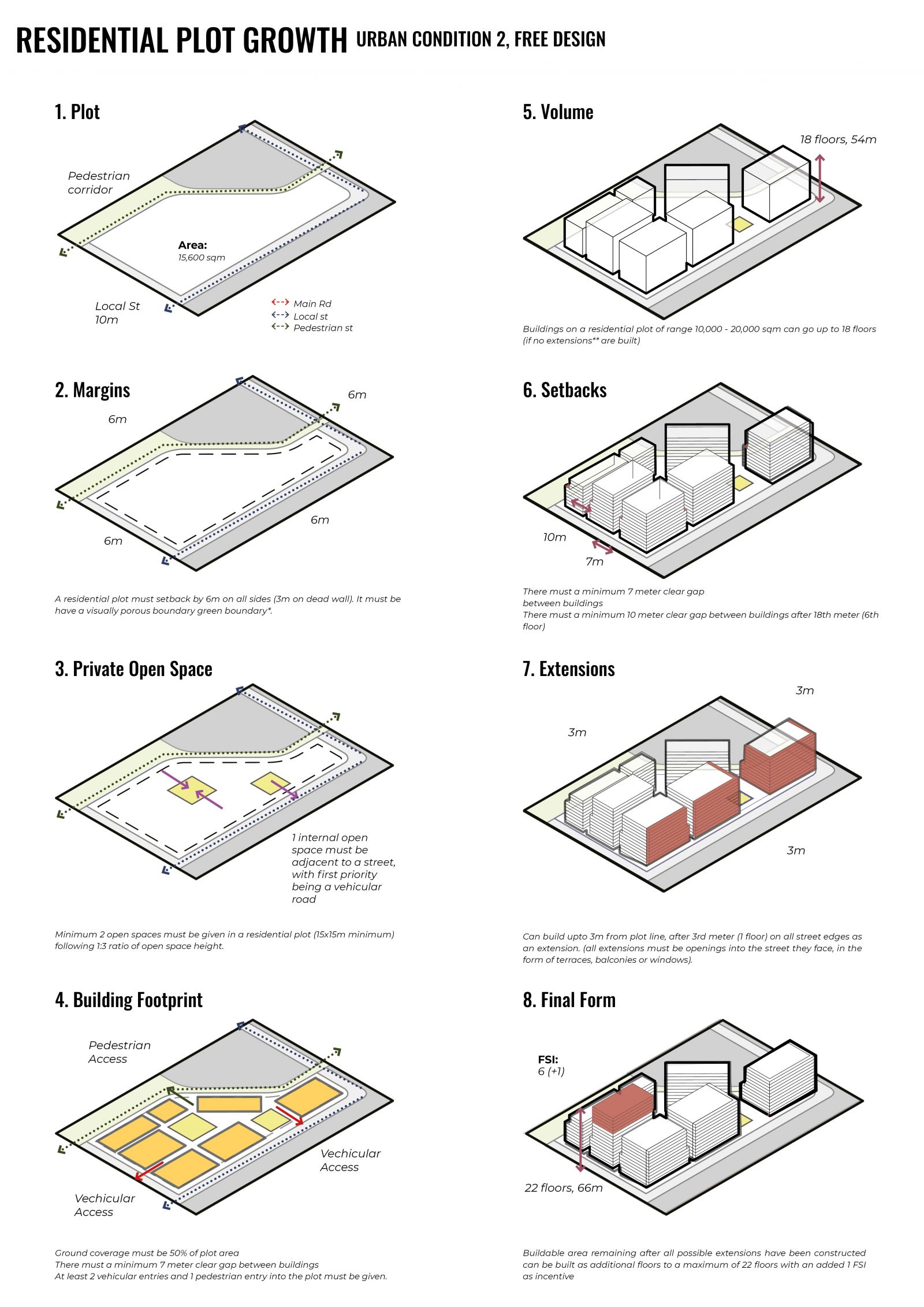
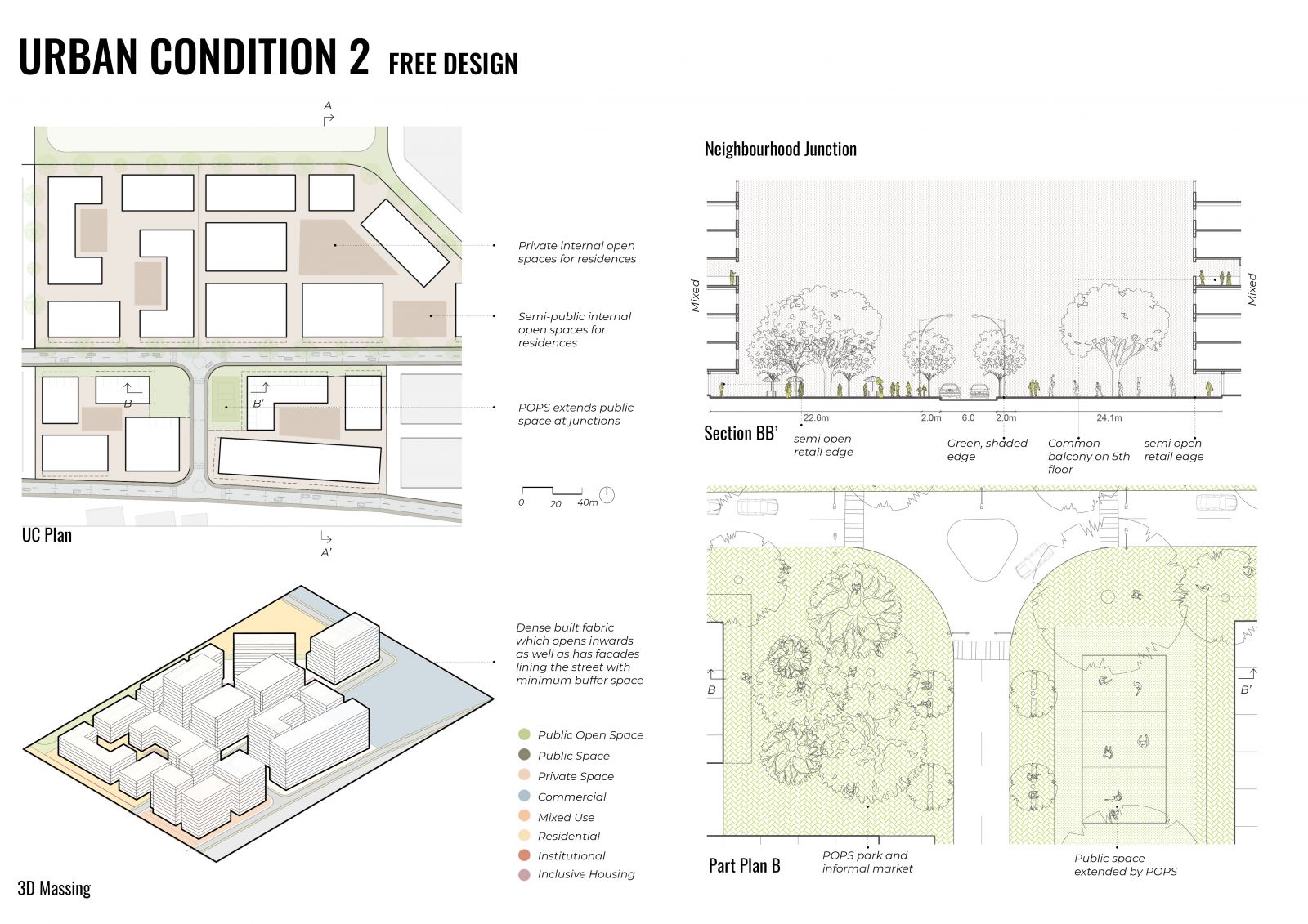
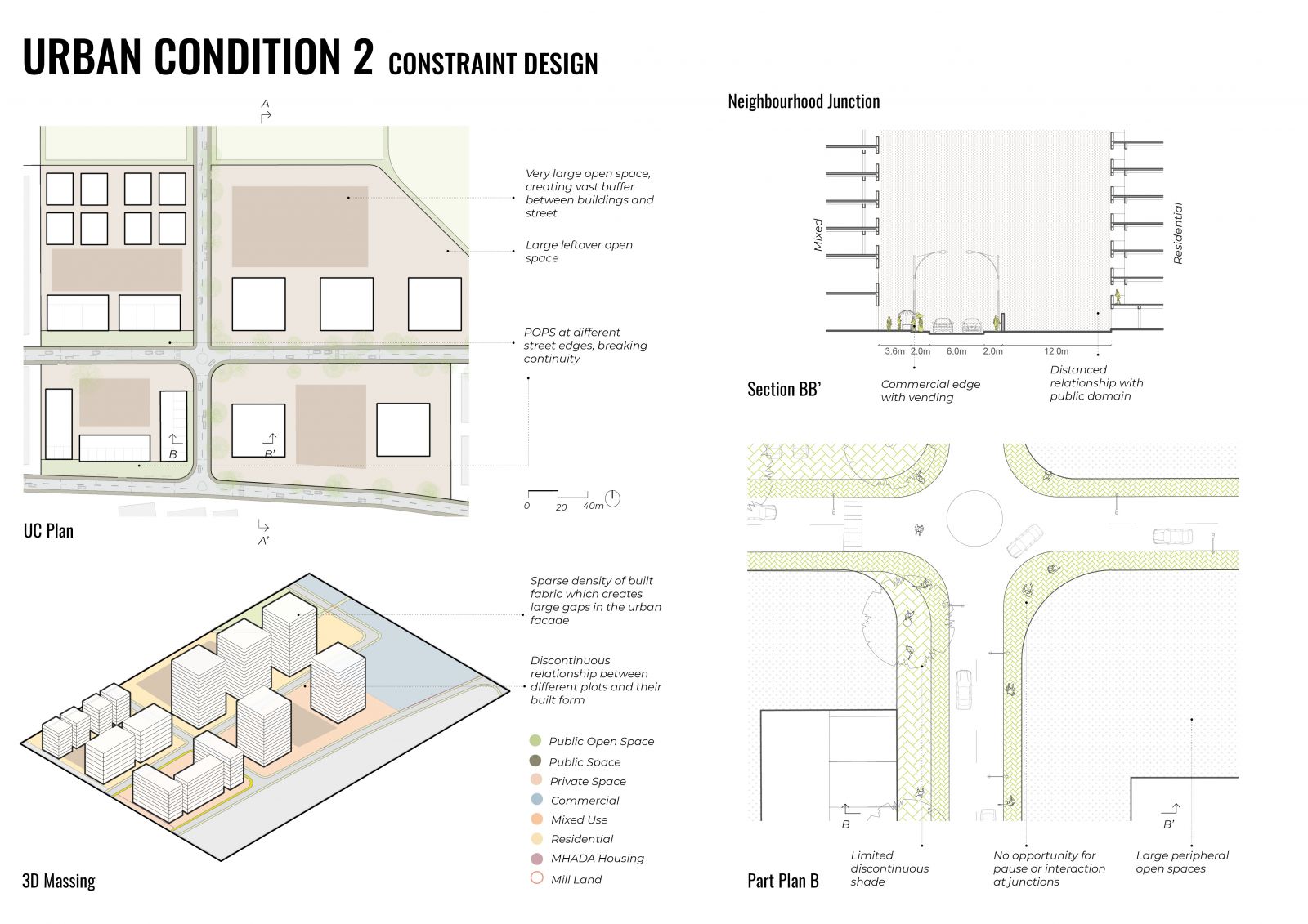
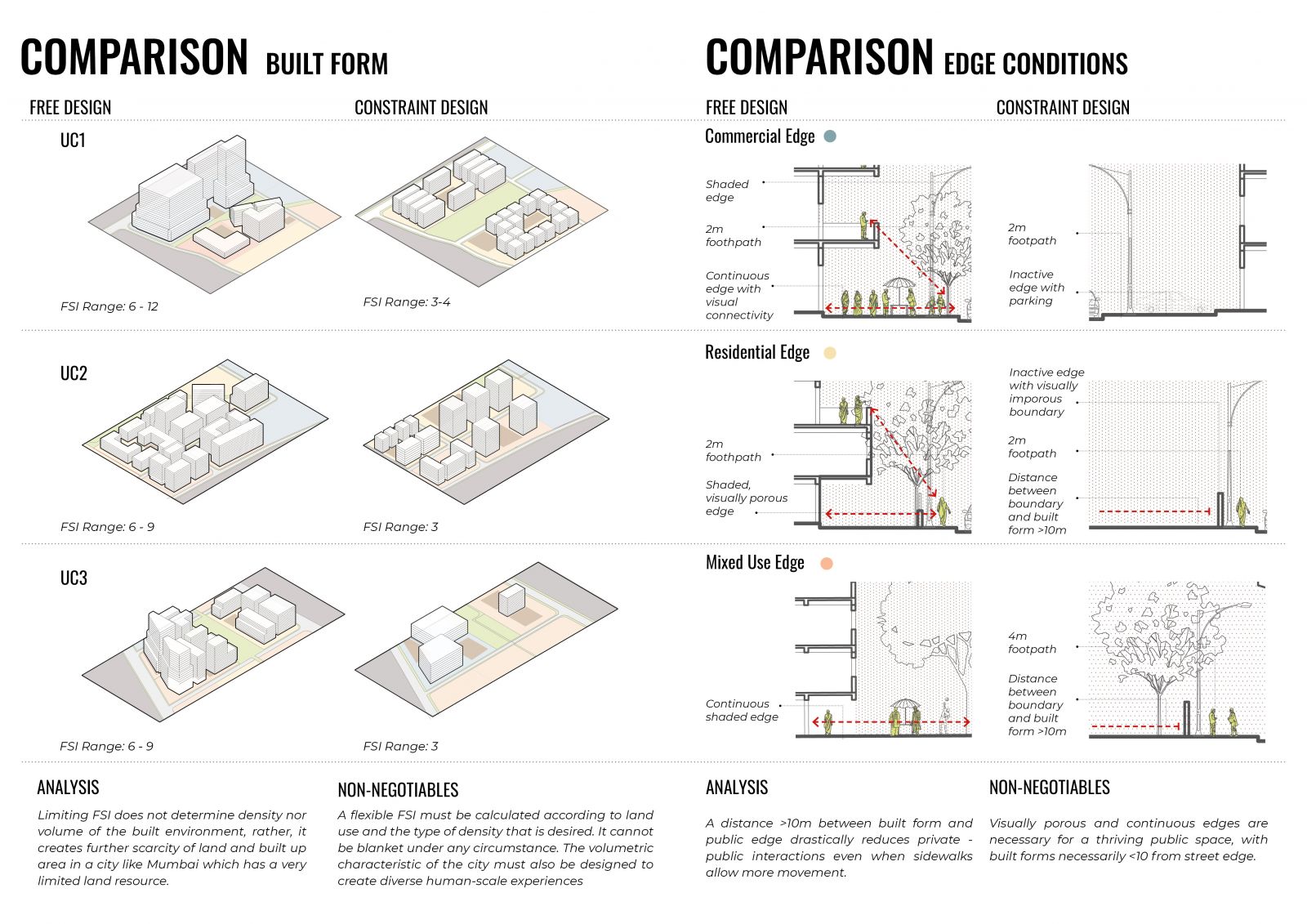
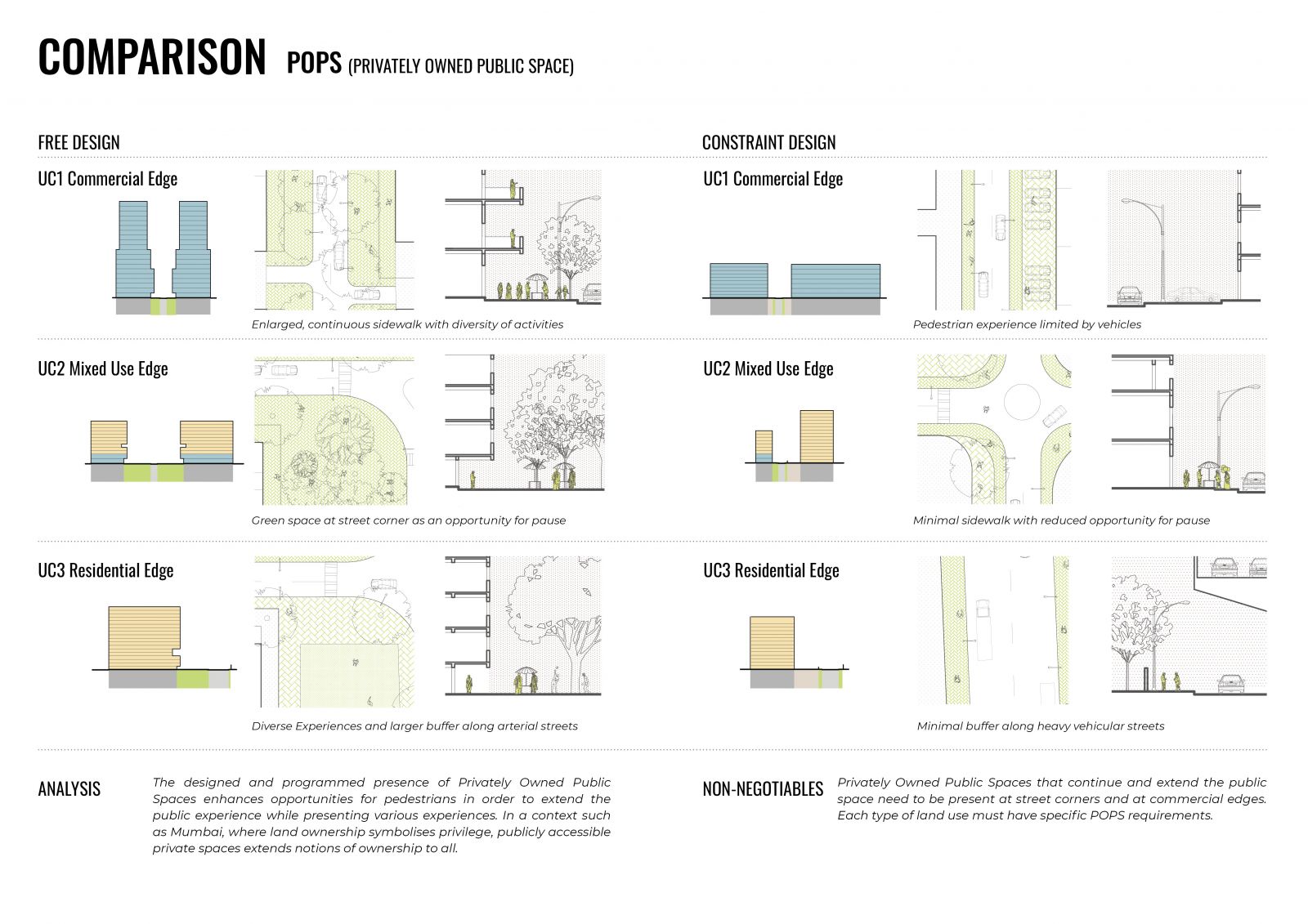
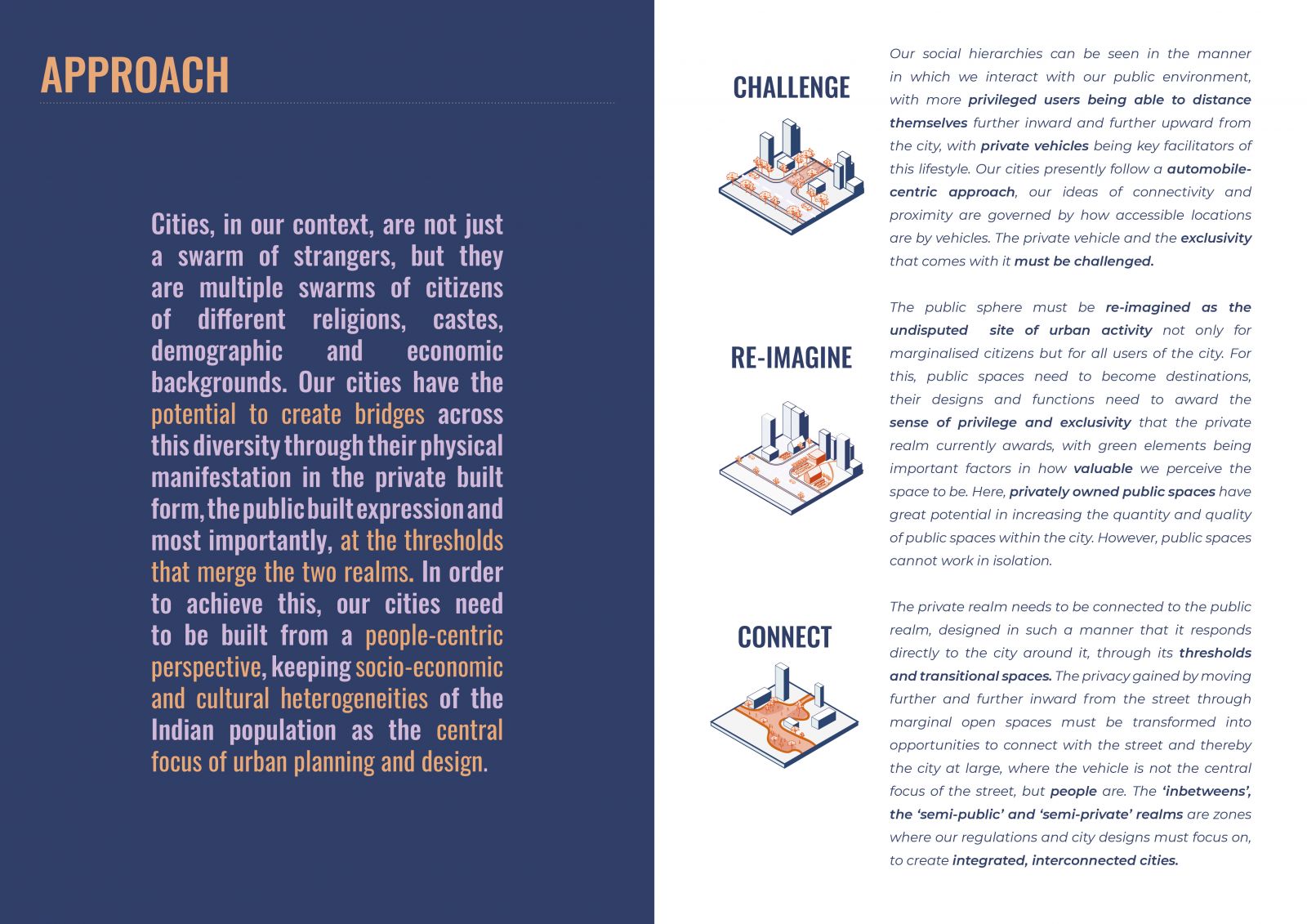
Our social hierarchies can be seen in the manner in which we interact with our public environment, with more privileged users being able to distance themselves further inward and further upward from the city, with private vehicles being key facilitators of this lifestyle. Our cities have the potential to create bridges at the thresholds that merge the private and the public realms. In order to achieve this, our cities need to be built from a people-centric perspective, keeping socio-economic and cultural heterogeneities of the Indian population as the central focus of urban planning and design. The ‘inbetweens’, the ‘semi-public’ and ‘semi-private’ realms are areas in which our urban regulations must focus to create integrated, interconnected cities, where the vehicle is not the central focus of the street, but people are. 

View Additional Work

Report Content

Government interventions on planning levels have been largely unsuccessful in resolving the issues faced by Mumbai. They have mostly been restrictive measures that aimed to limit the growth of the city rather than facilitate it. The case of Mumbai highlights the unpredictability of urban growth and the difficulty of planning cities based on past trends or future predictions wherein planning solutions may sometimes worsen the situation.

The site connects key parts of the city through the arterial Senapati Bapat Road. It is also directly connected to Worli through the PB Road and GK Road. Main pedestrian activity is concentrated on the arterial and subarterial roads where there are commercial edges as well as the locations of public transport systems. Through connections within the site are compromised due to plot layouts and disconnected local road network.

The design manifesto, in a gist, establishes that currently Mumbai is divided into two - a city of the rich, the privileged, and a city of the poor, the migrant communities. It envisions a city that can provide equal opportunities for all users of the city through the expression of the urban environment, proposing strategies to challenge current norms, re-imagine urban experiences and connecting the city.

The Free and Constraint Design masterplans reveal two different focuses of the regulations, free design more towards pedestrian experiences and constraint design more towards vehicular networks.

A typical plot growth of a free design condition follows 8 steps, with specific rules generated for commercial, residential and mixed use plots.

Residential neighbourhoods can become locations for community level interactions between various socio-economic groups. The presence of various hierarchy of spaces to achieve a range of interactions is necessary. Mixed use edges in residential neighbourhoods can becomes locations of social exchange, especially when diverse spaces such as markets, parks or playgrounds can be provided through privately owned public spaces, which add notions of ownership and access compared to publicly owned public spaces.

Currently, residential spaces, especially in exclusive apartment complexes have become a way to detach from the city and its people, allowing citizens of the city to furhter inward and upward from it. Whereas this allows a sense of privacy, it creates further divides in the social fabric of the city.

Various comparisons between free and constraint in design can be made in terms of physical changes and relationship changes.

POPS emerges to be a vital tool in the presence and experience of public space in the city.

What is the way forward?