Your browser is out-of-date!
For a richer surfing experience on our website, please update your browser. Update my browser now!
For a richer surfing experience on our website, please update your browser. Update my browser now!
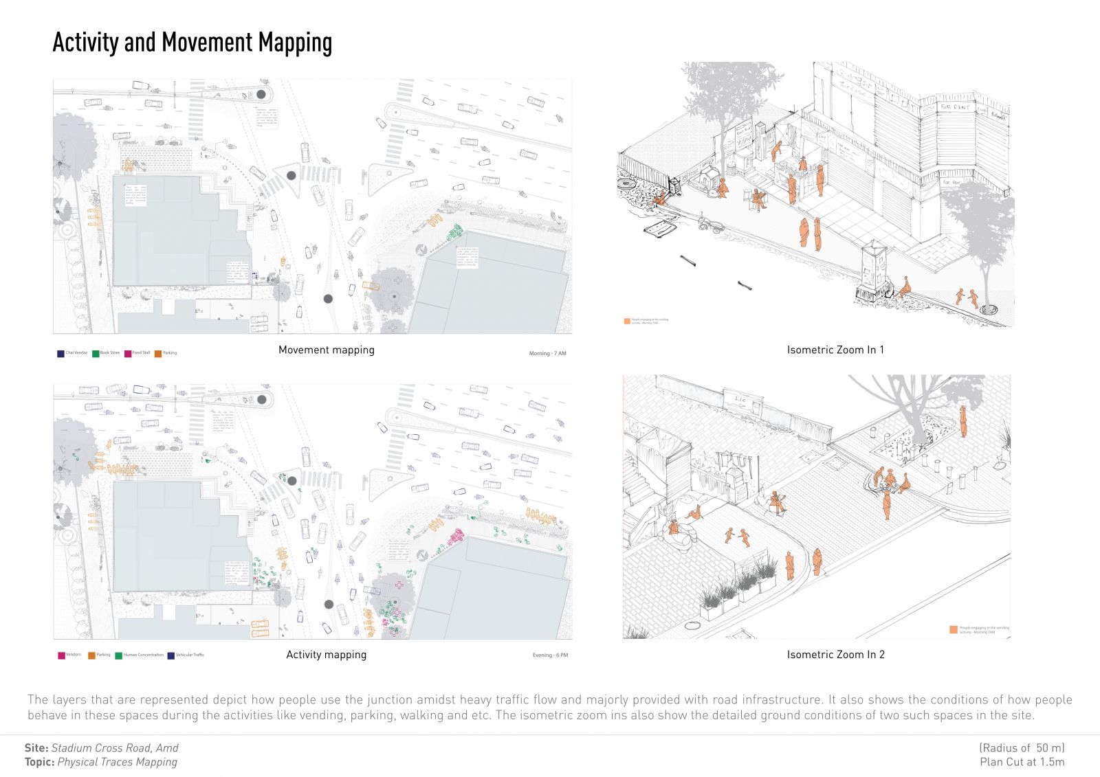
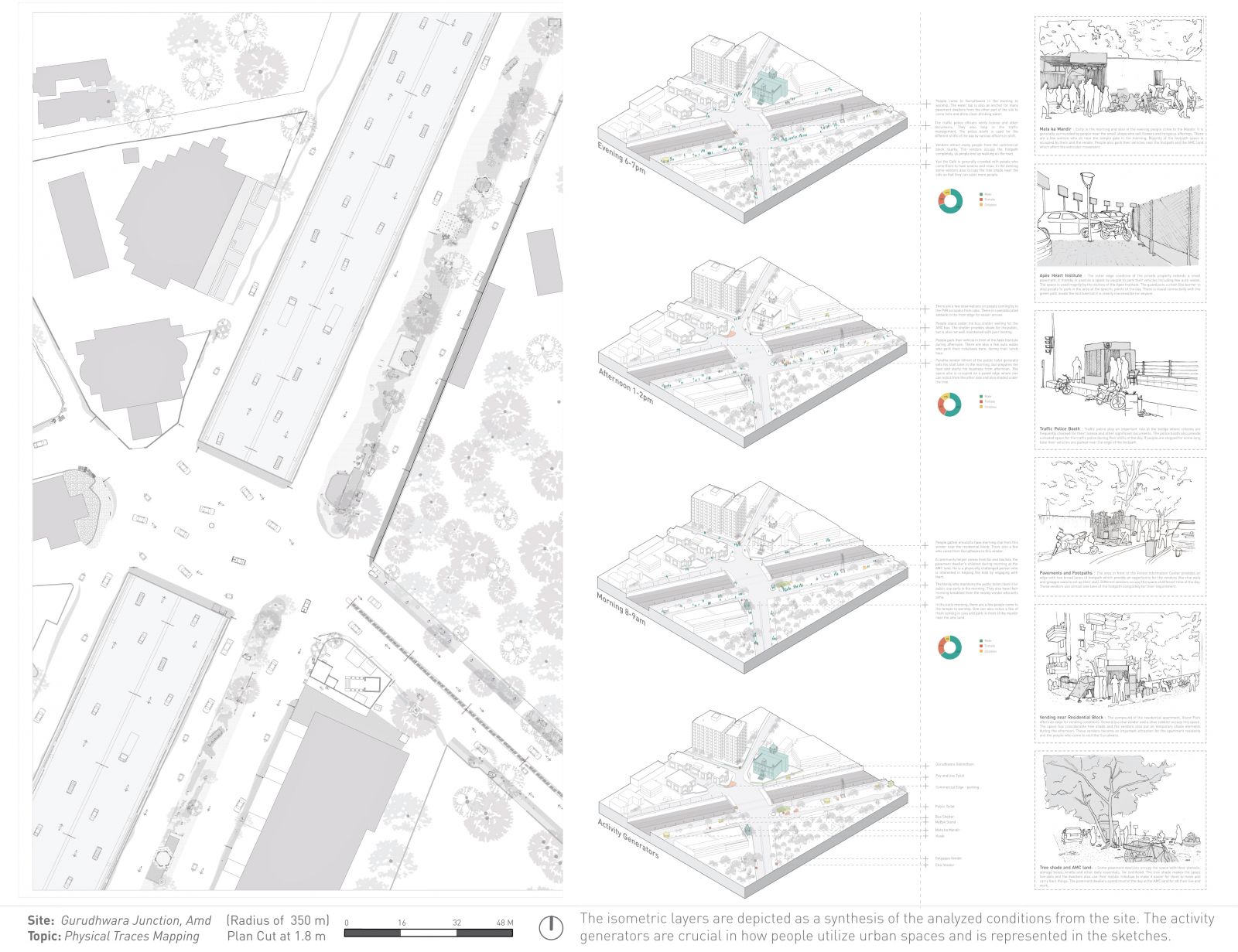
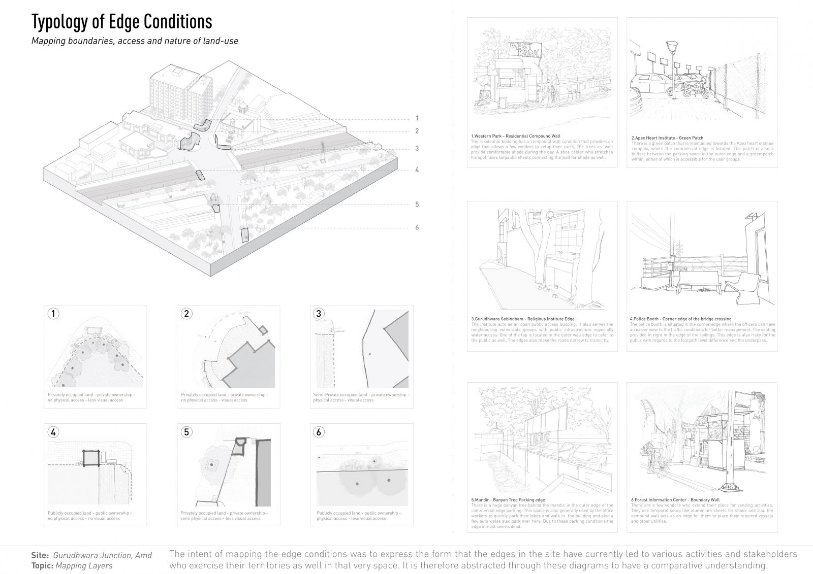
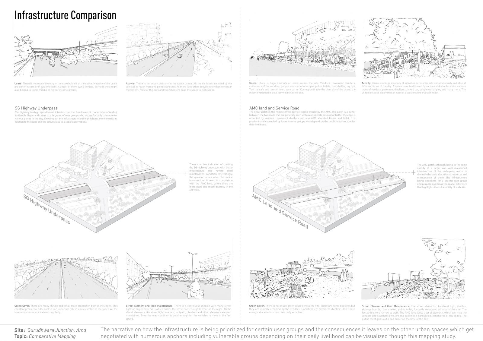
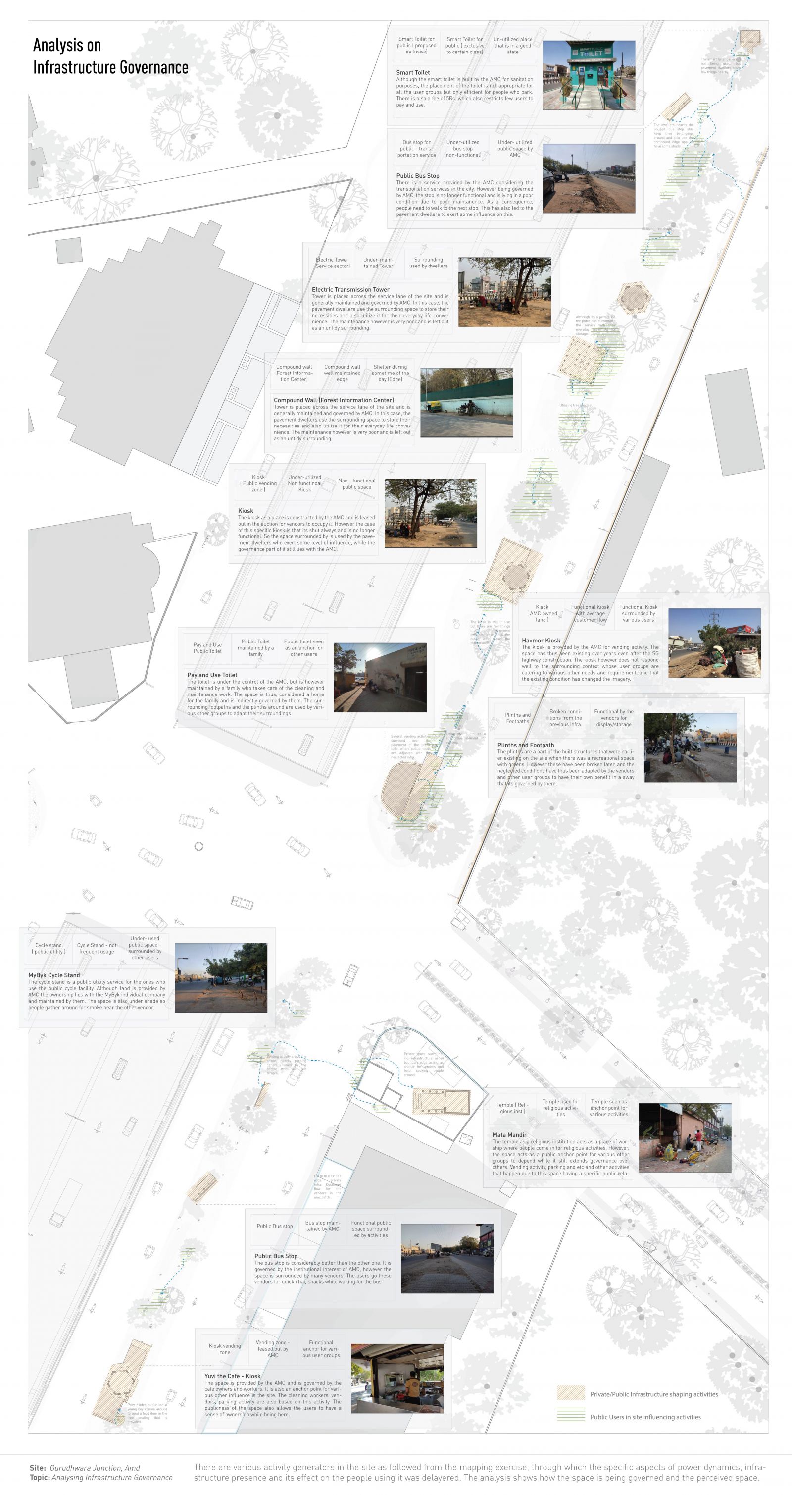
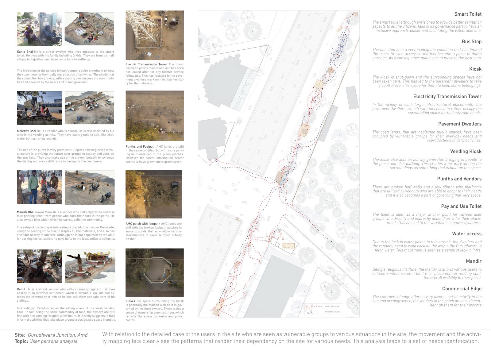
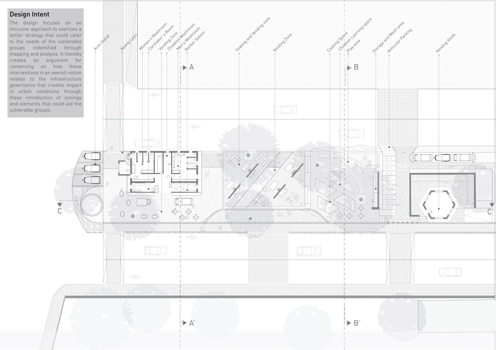
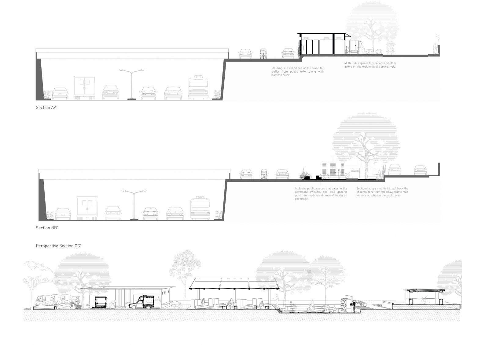
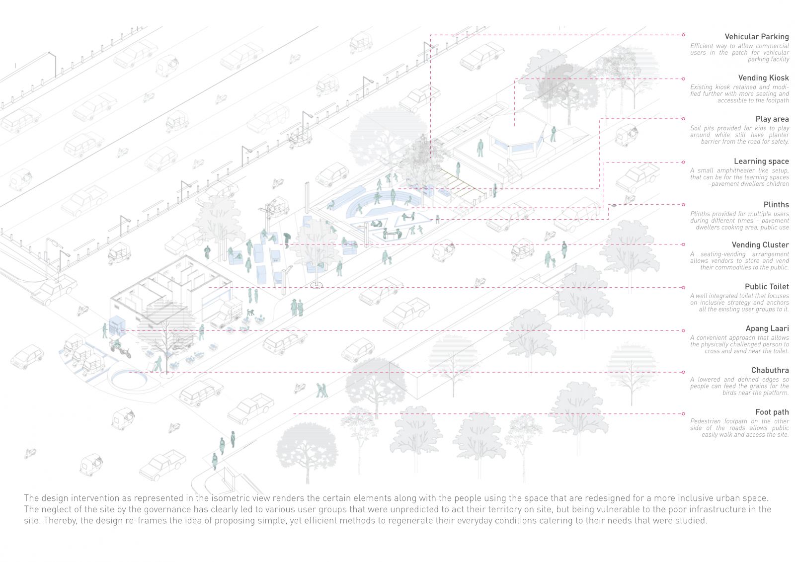
The mapping and analysis focus on observing, depicting and understanding urban spaces which also involve careful representation of the existing conditions. This allows one to examine the user group and the space. The design focuses on an inclusive approach to exercise a better strategy that could cater to the needs of the vulnerable groups identified through mapping and analysis. It thereby creates an argument for conversing on how these interventions in an overall notion relate to the infrastructure governance that creates impact in urban conditions through this introduction of zonings and elements that could aid the vulnerable groups.
View Additional Work