Your browser is out-of-date!
For a richer surfing experience on our website, please update your browser. Update my browser now!
For a richer surfing experience on our website, please update your browser. Update my browser now!
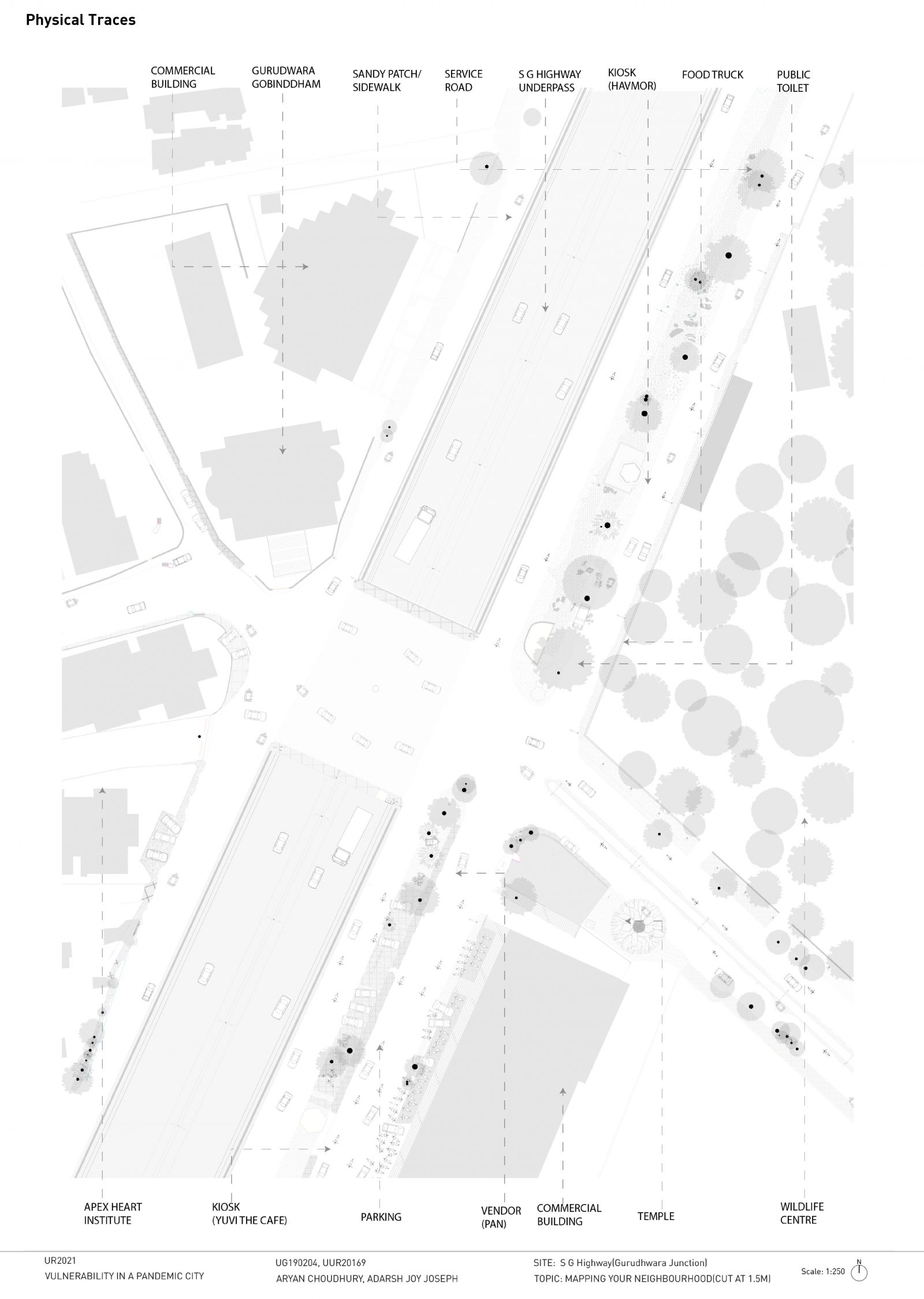
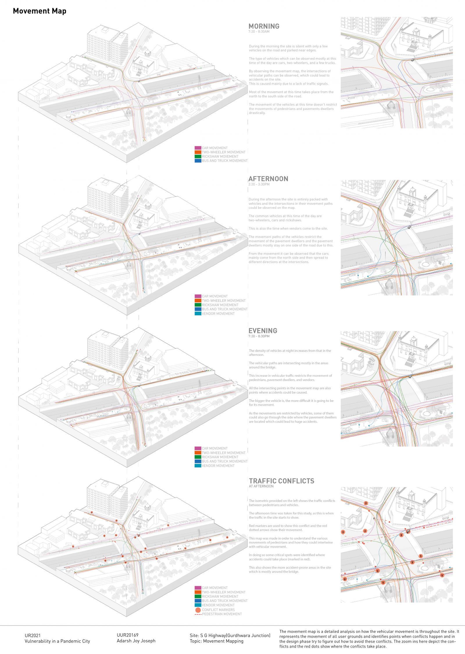
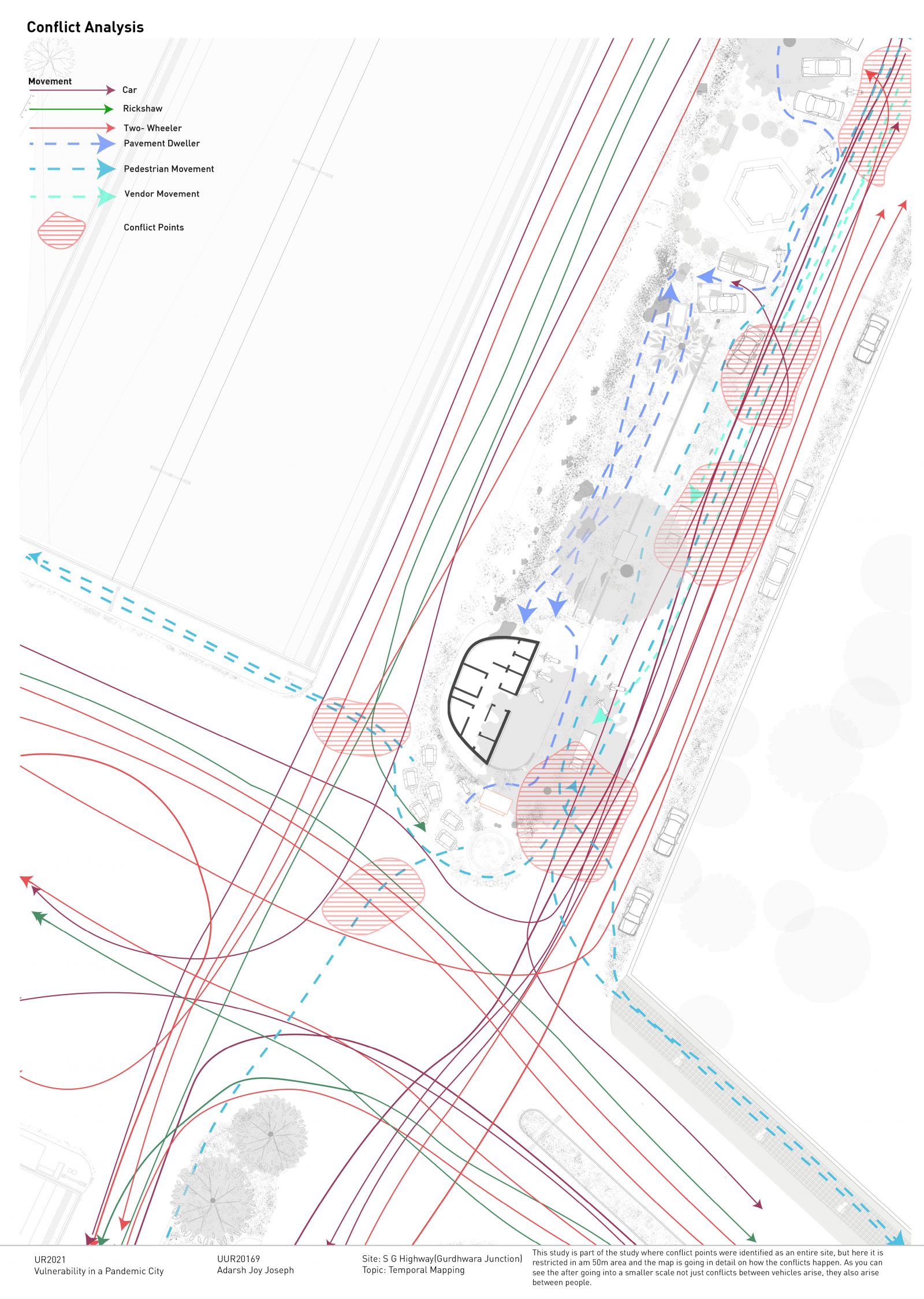
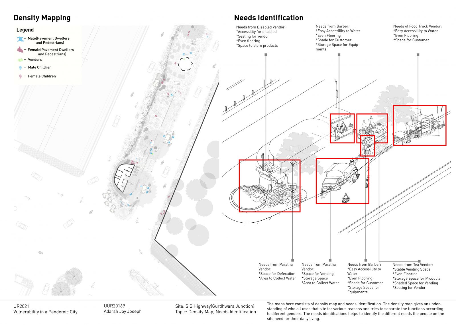
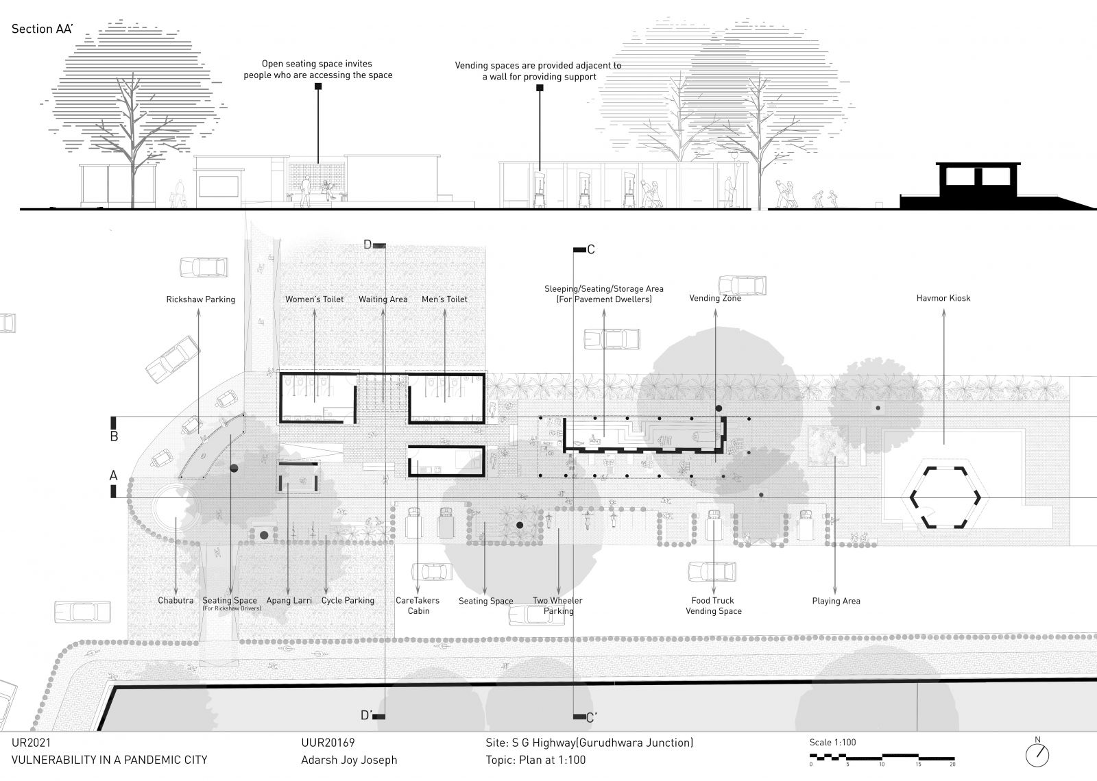
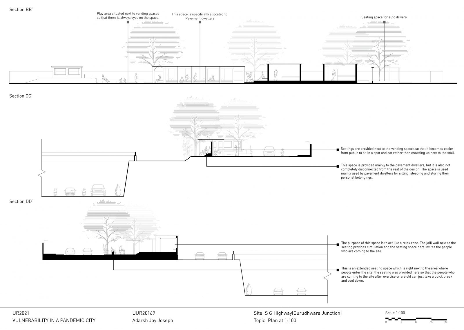
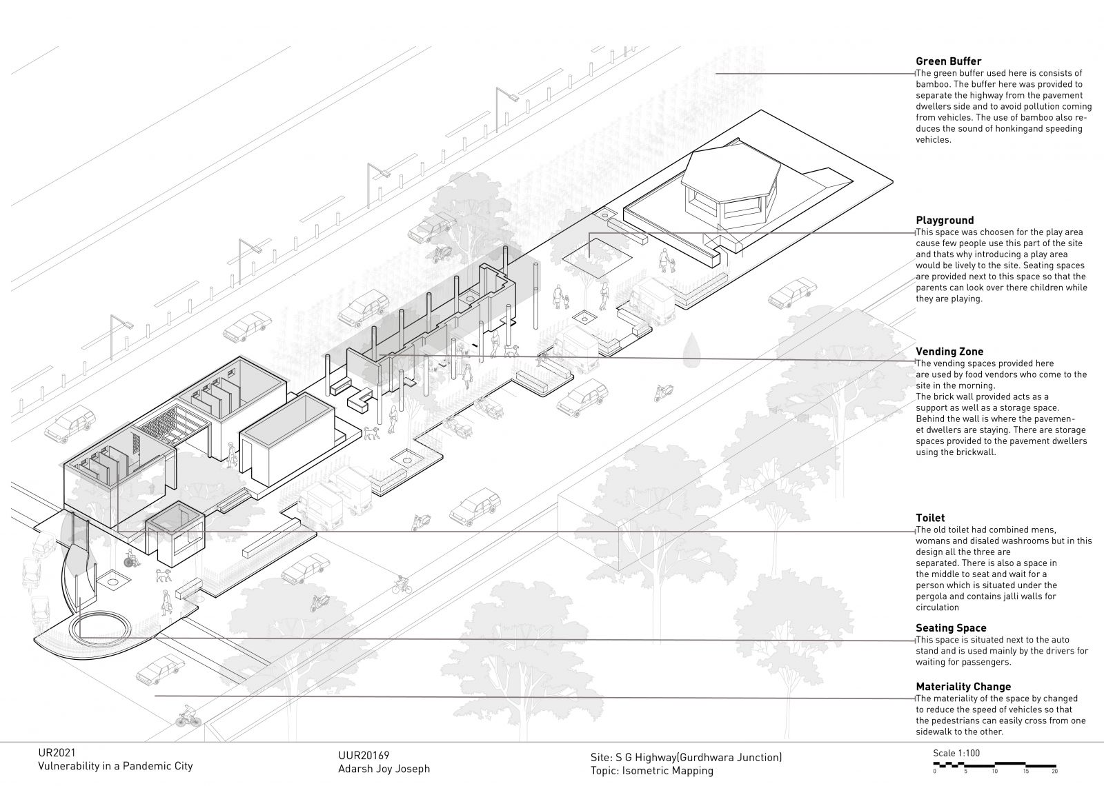
Following the analysis and mapping done on Gurudhwara Junction, it came to light that the site was facing a serious issue with traffic and vehicles. As there was no specified system of parking or organizing the vehicles, the traffic on the site kept getting worse every afternoon. Most of the movements which happen on the site are intertwined with vehicles and the public. So the users of the site are most affected by this traffic and pollution from the vehicles. The proposed design aims to make the site much more welcoming to the public. By providing seating next to the vendors and shade using the surrounding trees, the design is implemented by taking the current physical conditions of the site into consideration. Changing the materiality of the road helps to reduce the speed of the vehicles. Providing green buffer spaces next to the road helps to reduce pollution and defines a boundary between the road and the designed space. A common wall is used as support by both the vendors and pavement dwellers. The needs of the pavement dwellers and vendors are addressed by the design.
View Additional Work