Your browser is out-of-date!
For a richer surfing experience on our website, please update your browser. Update my browser now!
For a richer surfing experience on our website, please update your browser. Update my browser now!
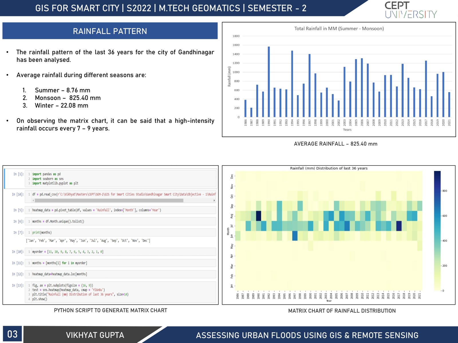
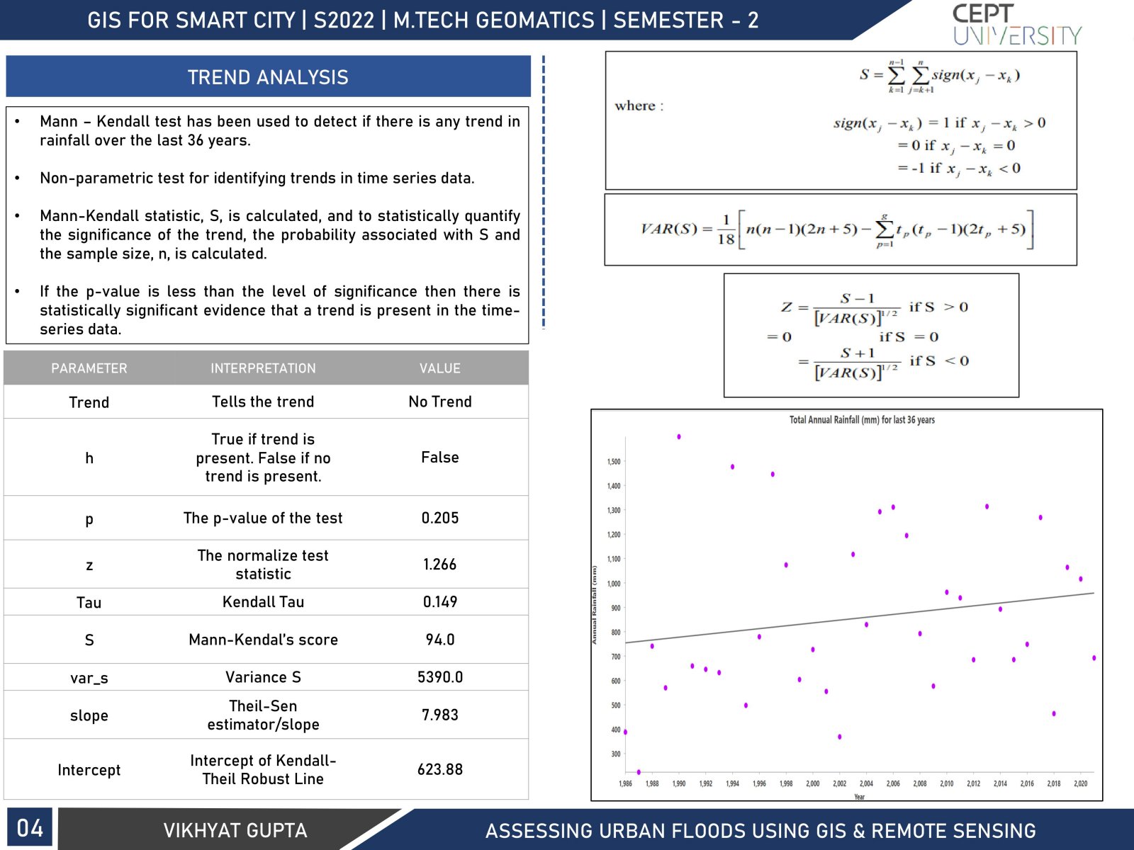
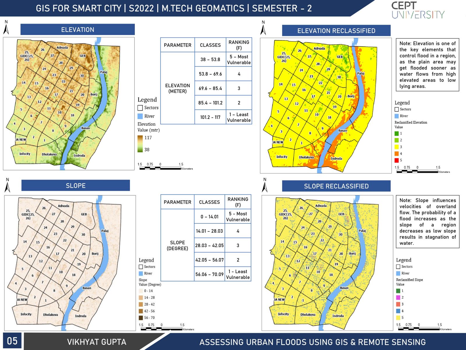
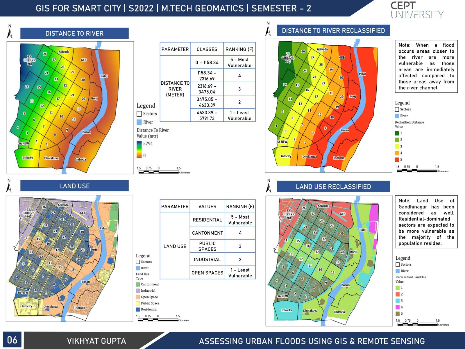
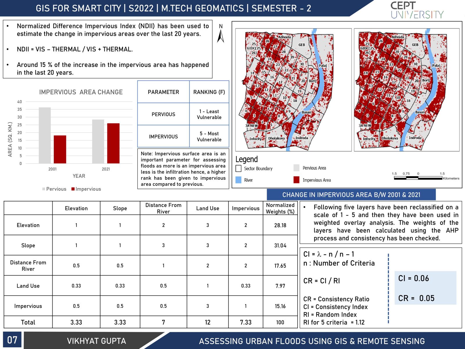
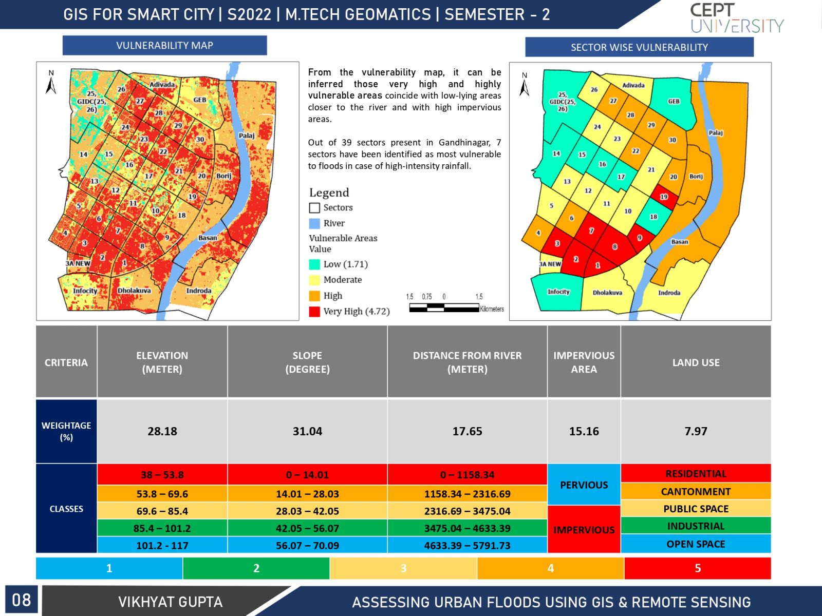
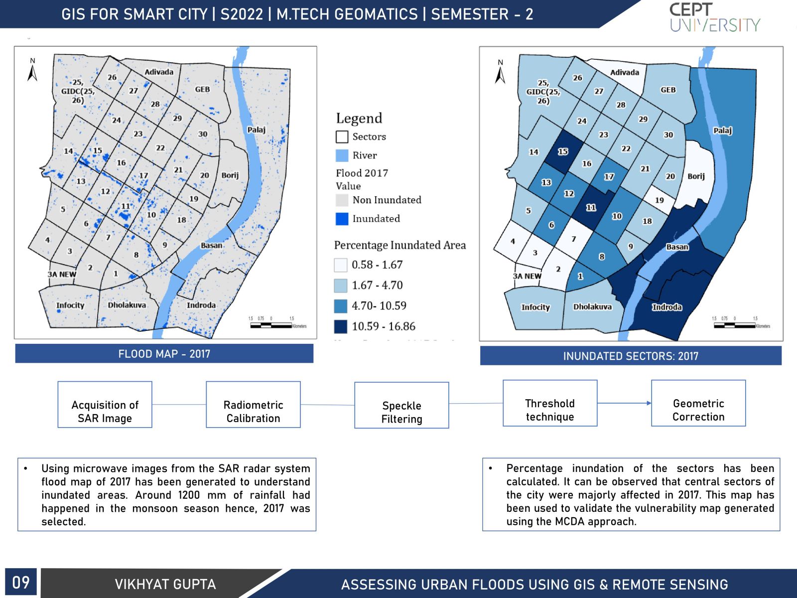
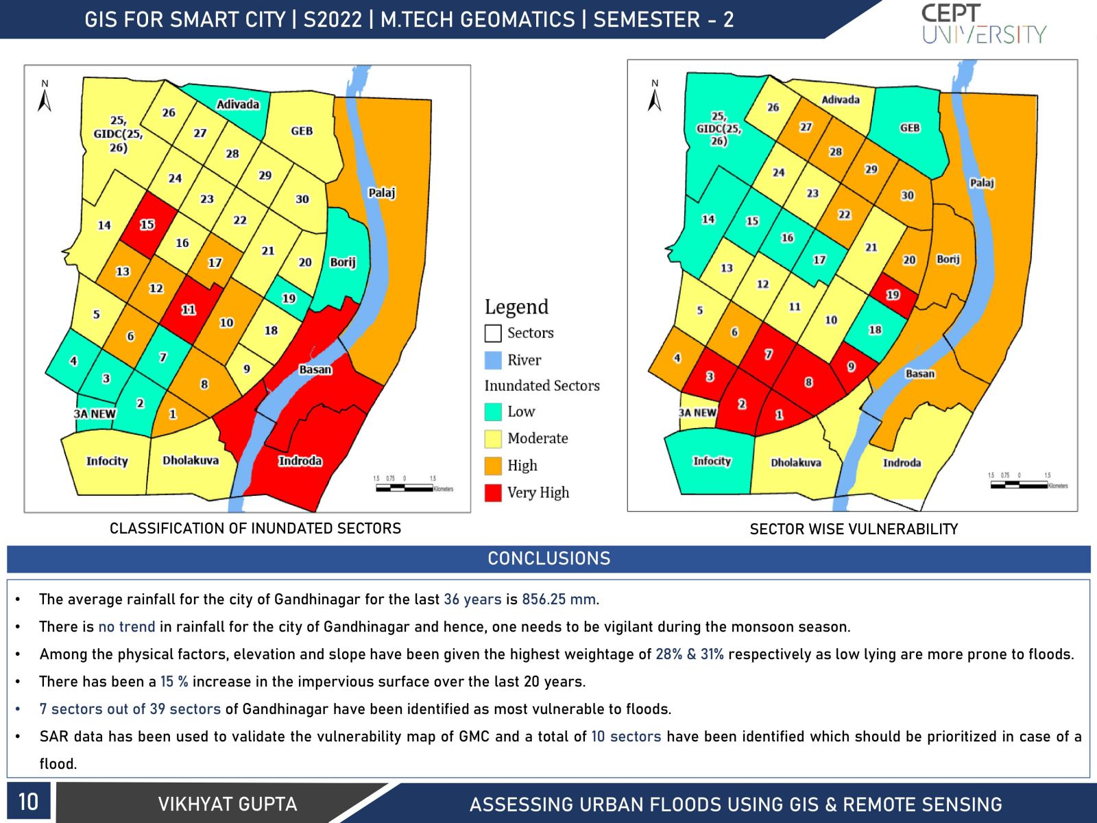
The study focuses on the increasing trend of urban floods in India by taking Gandhinagar as the study area. In 2017 around 1200 mm of rainfall had happened in Gandhinagar during the monsoon season which flooded various sectors of the city hence, this study was carried out to determine vulnerable sectors of the city. The study began by analyzing rainfall patterns in the city and then vulnerable sectors were determined by taking physical factors like elevation, slope, etc. into consideration. After determining vulnerable sectors, it was validated using the flood map of 2017 which was developed using a SAR image.