Your browser is out-of-date!
For a richer surfing experience on our website, please update your browser. Update my browser now!
For a richer surfing experience on our website, please update your browser. Update my browser now!
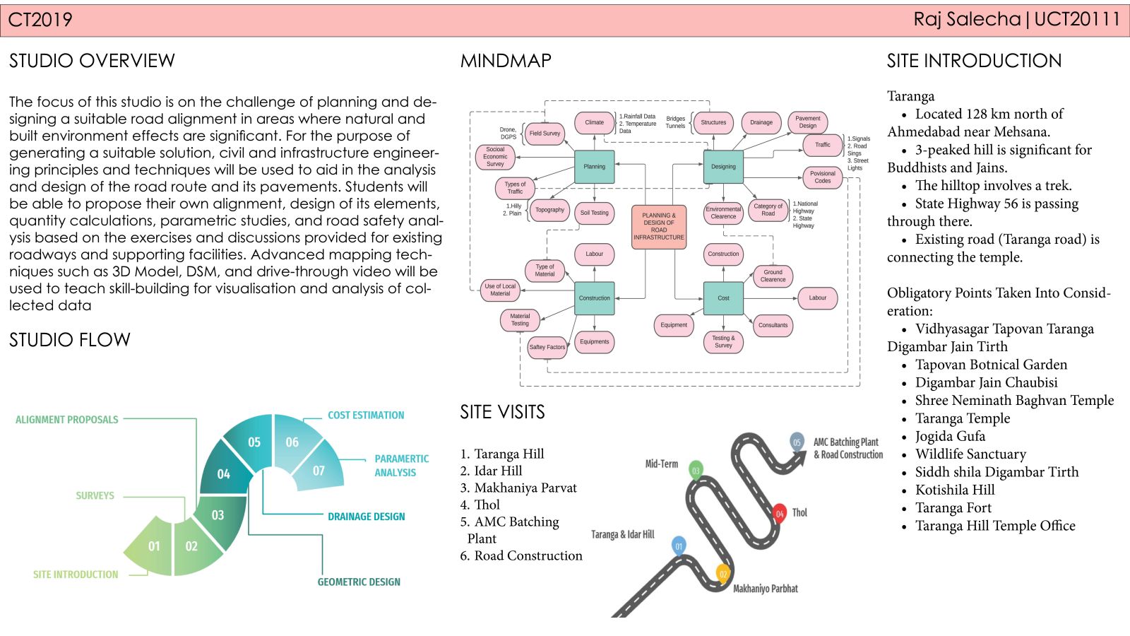
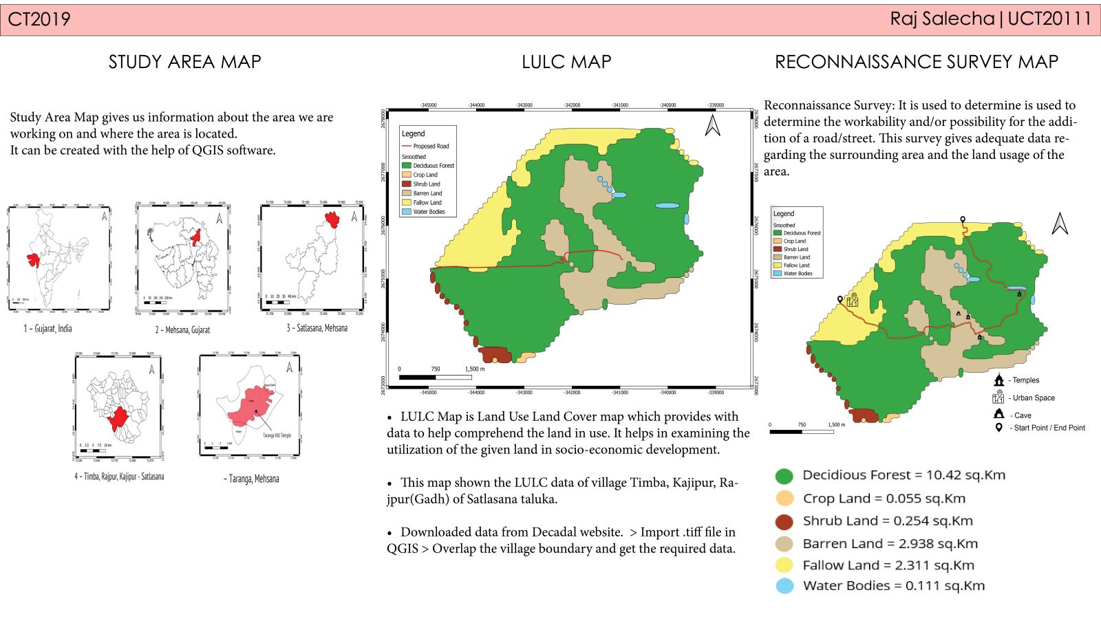
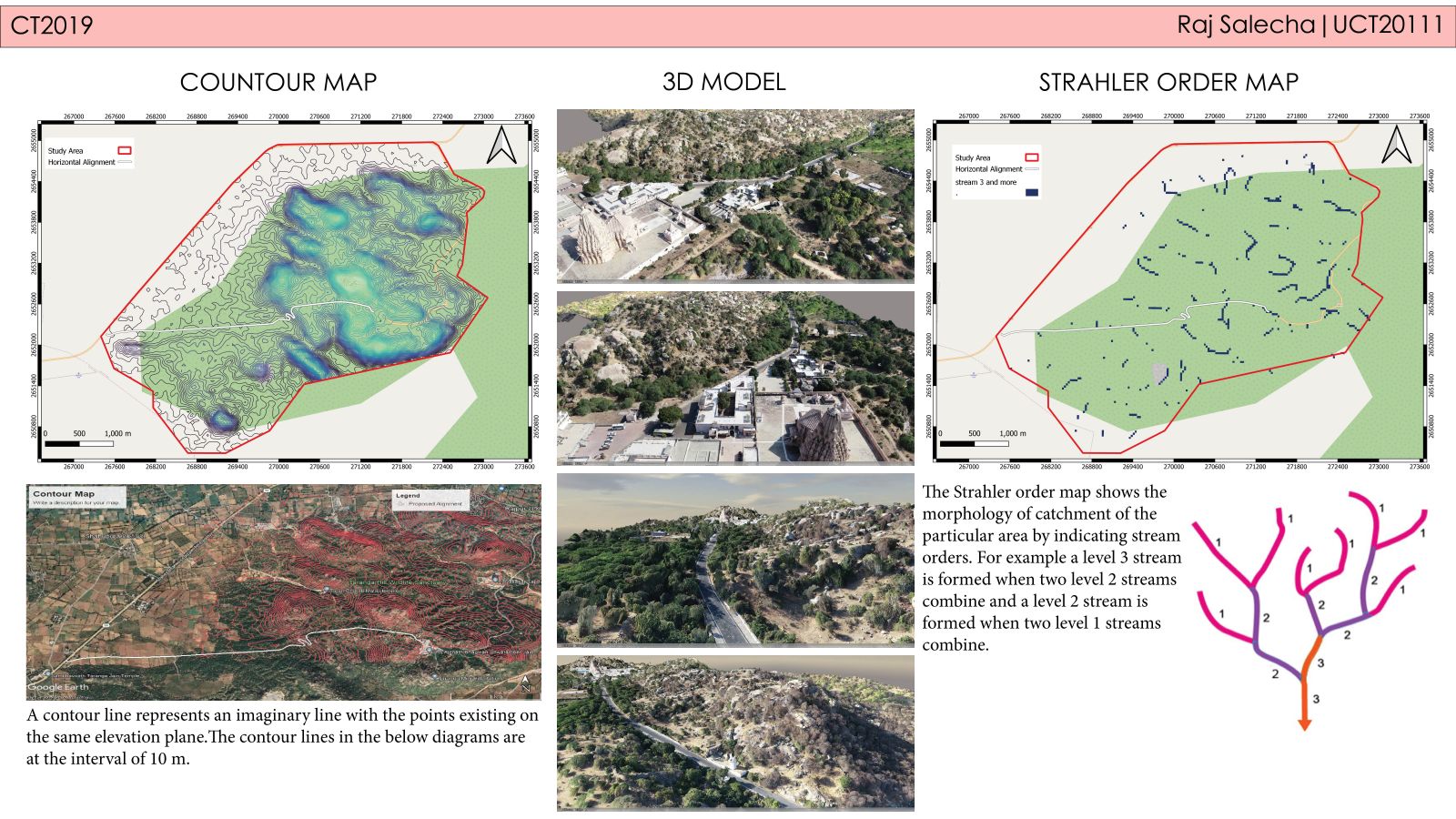
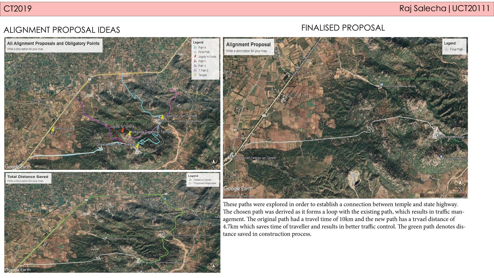
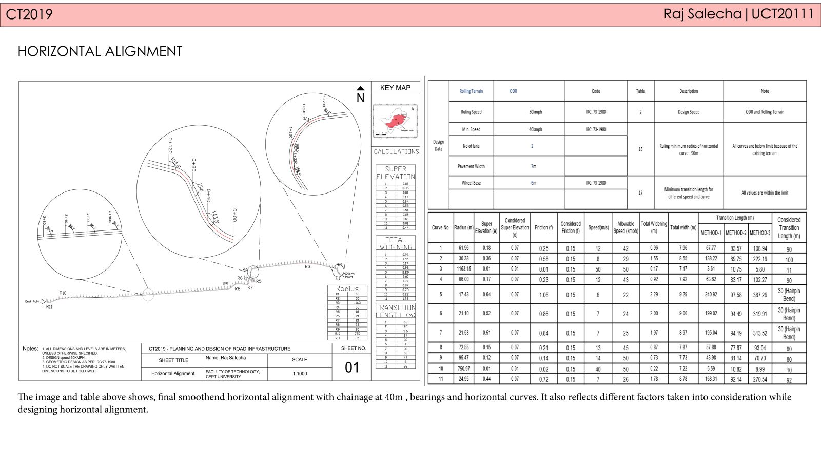
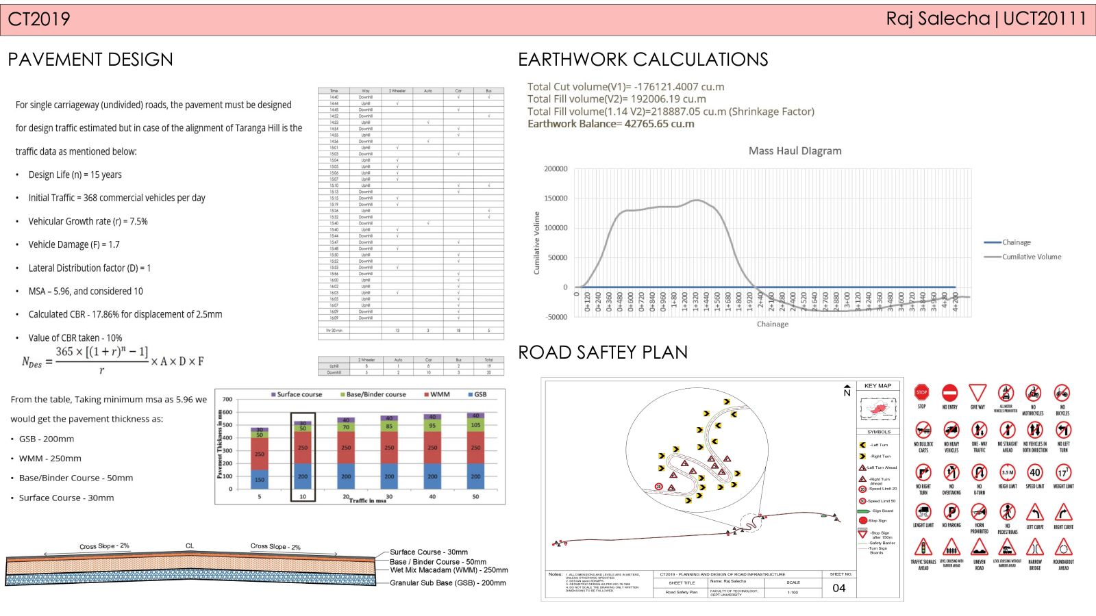
One of the most important factors impacting a country's growth is its transportation infrastructure. The transportation system is regarded as the economy's controller and serves as a critical link between production and consumption. The volume of traffic going on the country's roads might show how far it has progressed. In India, transportation has grown significantly throughout the years, both in terms of distance travelled and system output. With such growing demand of road infrastructure development in India, it is defined that an engineer equipped with proper skillset can be very useful. This course has been designed to equip the students with knowledge and skills so that they can deal with problems of planning and designing a suitable road alignment in hilly region where natural and built environment effects can be influential. In this semester, the studio has explored the problems of planning and designing of road alignment on Taranga Hill, in Mehsana district of Gujarat. In this studio we are learned the following things: 1. Professional communication techniques such as reading of maps, interpretation of soil and material data.2. Skill building through advanced mapping, material testing techniques and different analysis based on result output. 3. Exposure and skill-building through advanced design tools such as Open-Road designer, Open-Road Concept station, Bentley reality modelling, QGIS, Google earth.
View Additional Work