Your browser is out-of-date!
For a richer surfing experience on our website, please update your browser. Update my browser now!
For a richer surfing experience on our website, please update your browser. Update my browser now!
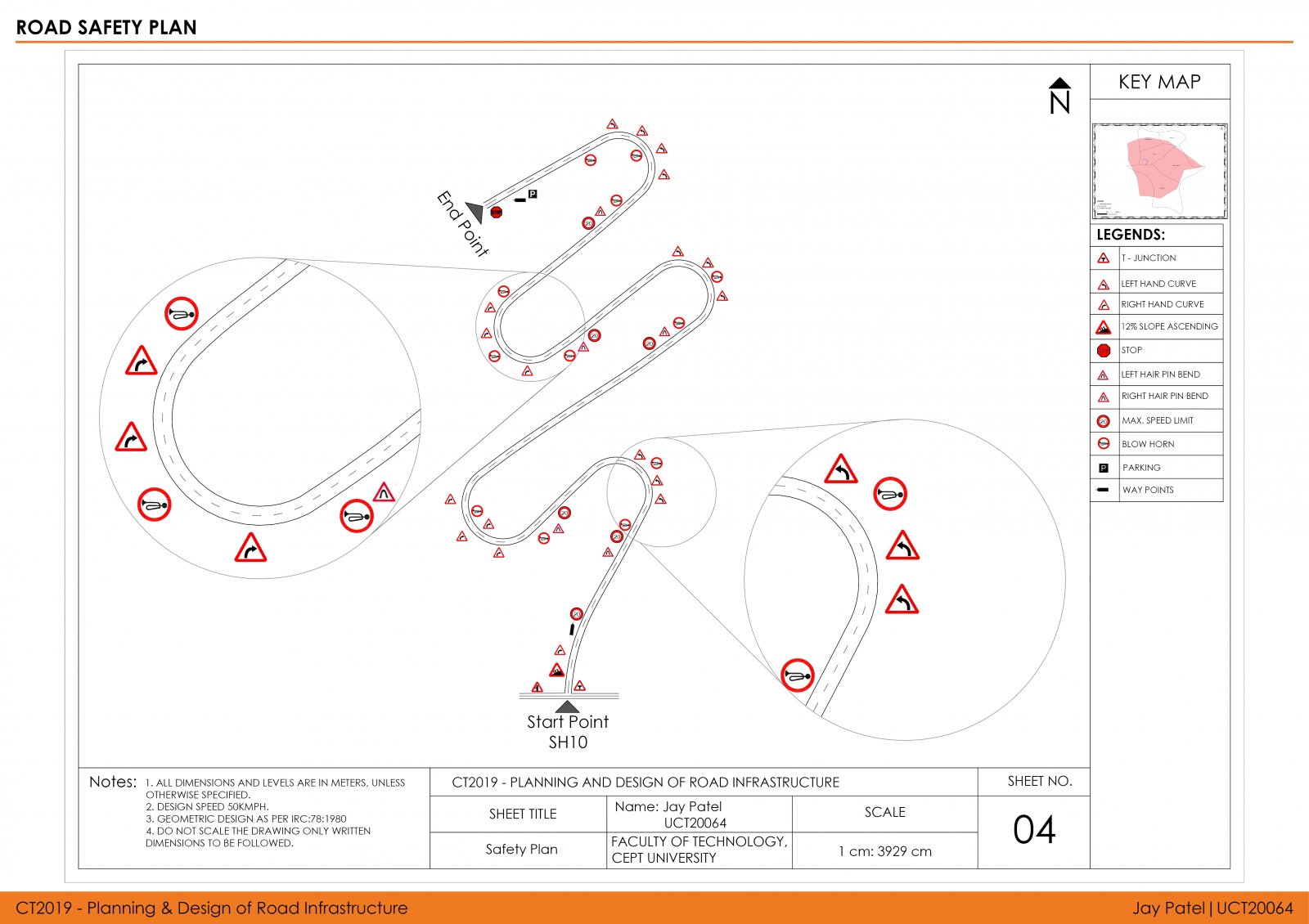
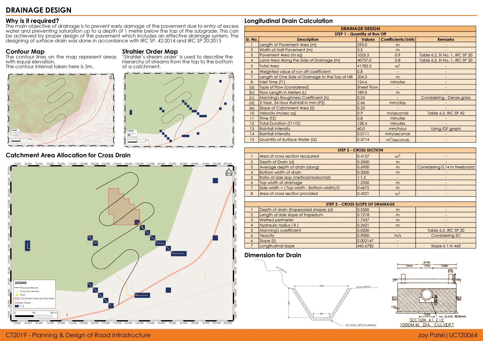
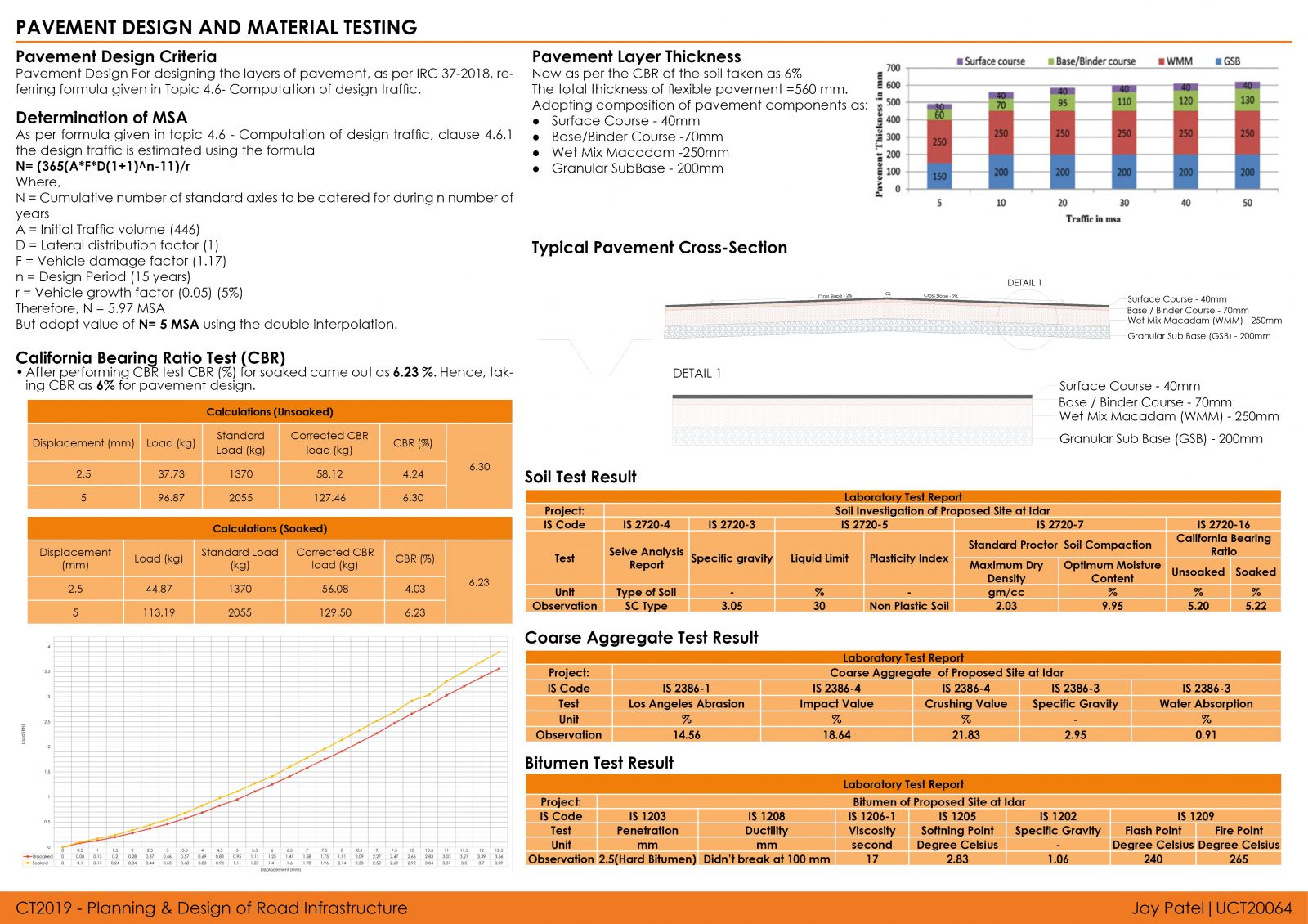
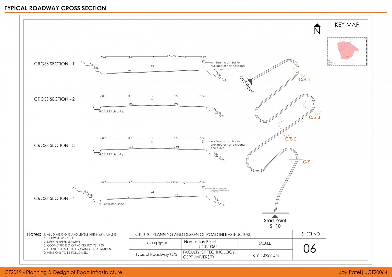
The studio dwells around the problem of planning and designing a suitable road alignment where natural and built environment effects can be influential. The studio has explored the problem of road alignment optimization for the Idar region in Gujarat. An alignment was to be proposed and designed on Idar Hill. The alignment should have a purpose why you design this road and include the nearest obligatory points to give the road more connectivity to the surroundings, while keeping in mind the length of the route, the radius of the curves, land acquisition, and slope of the gradients, etc. Including all these parameters the pavement has to be designed and then its cut-fill balance and costing are analyzed. At last, all the pavements are compared with each other on the basis of these parameters. To accomplish this task, exposure and skill-building used advanced design tools such as Open-Road, Bentley reality modeling, AutoCAD, Google Earth & Q-GIS. Click here for detailed portfolio and report.
View Additional Work