Your browser is out-of-date!
For a richer surfing experience on our website, please update your browser. Update my browser now!
For a richer surfing experience on our website, please update your browser. Update my browser now!
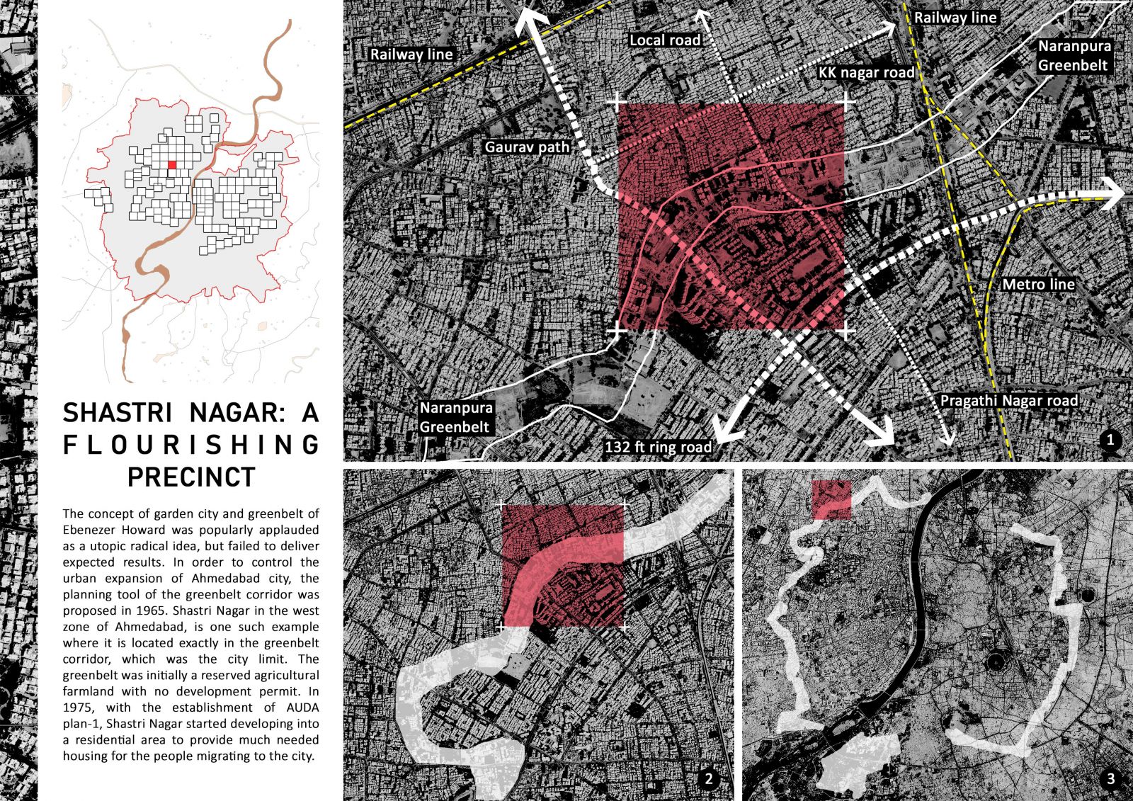
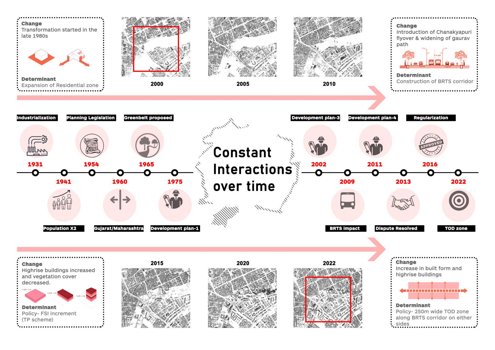
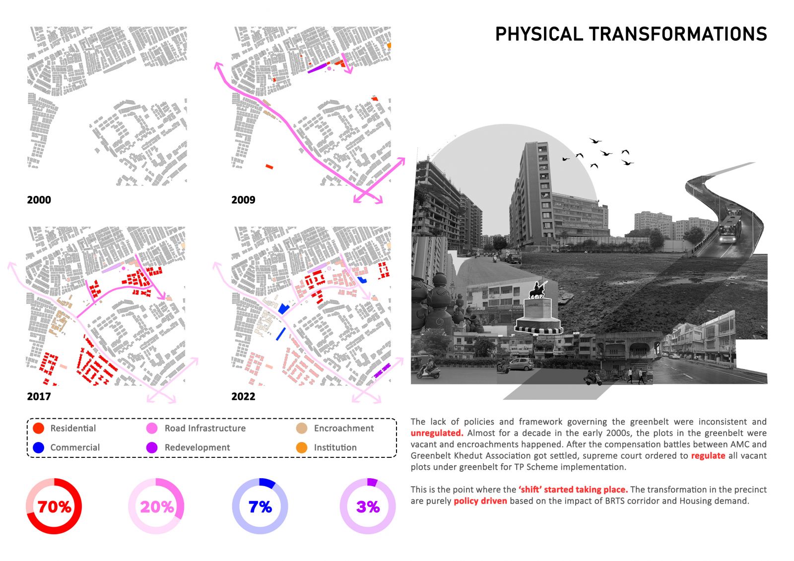
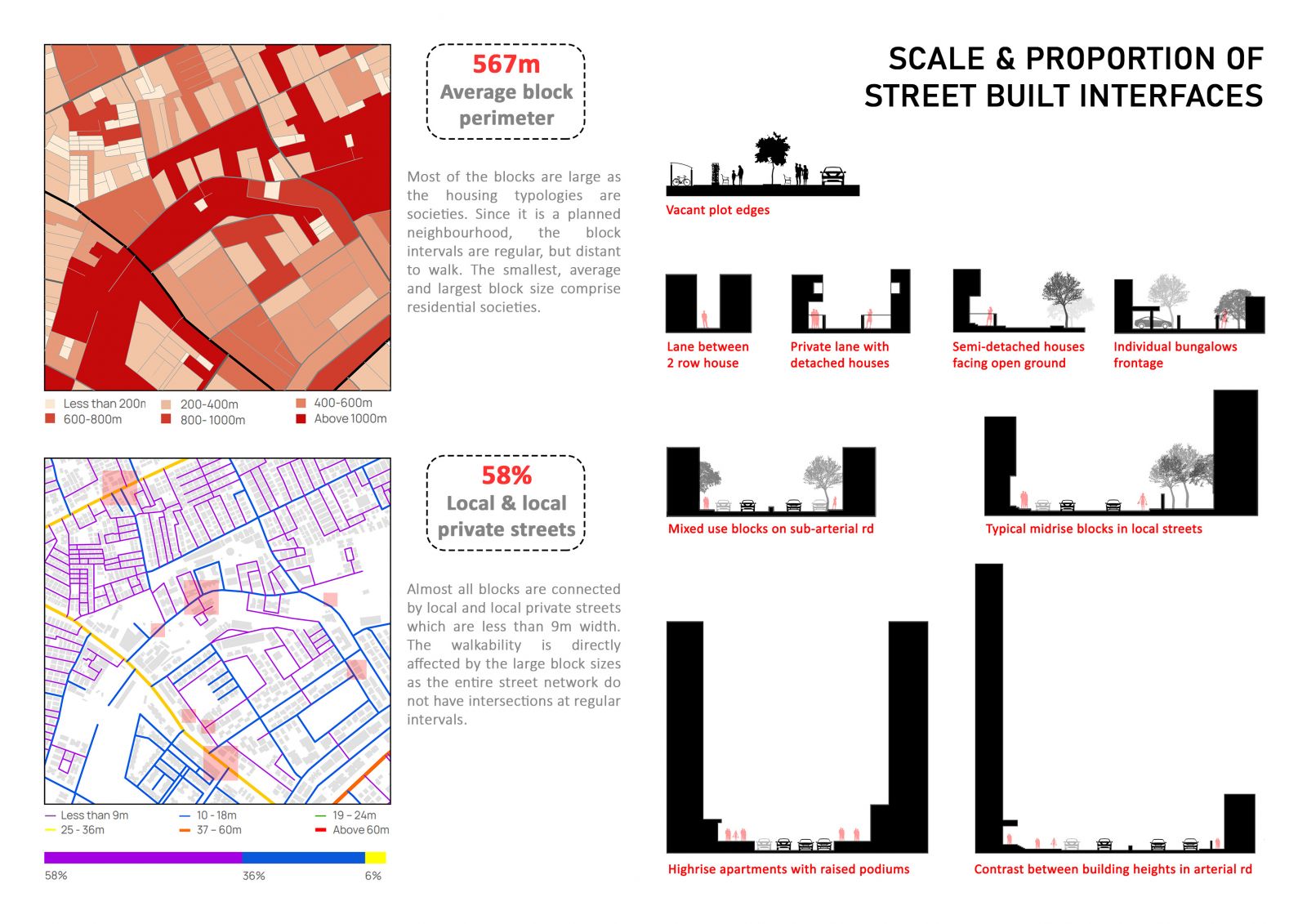
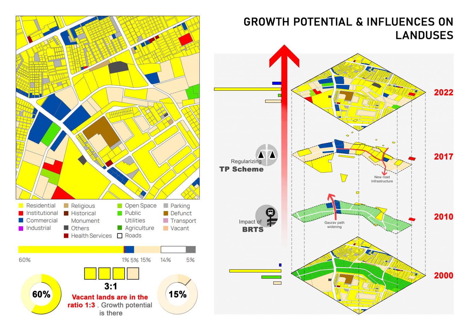
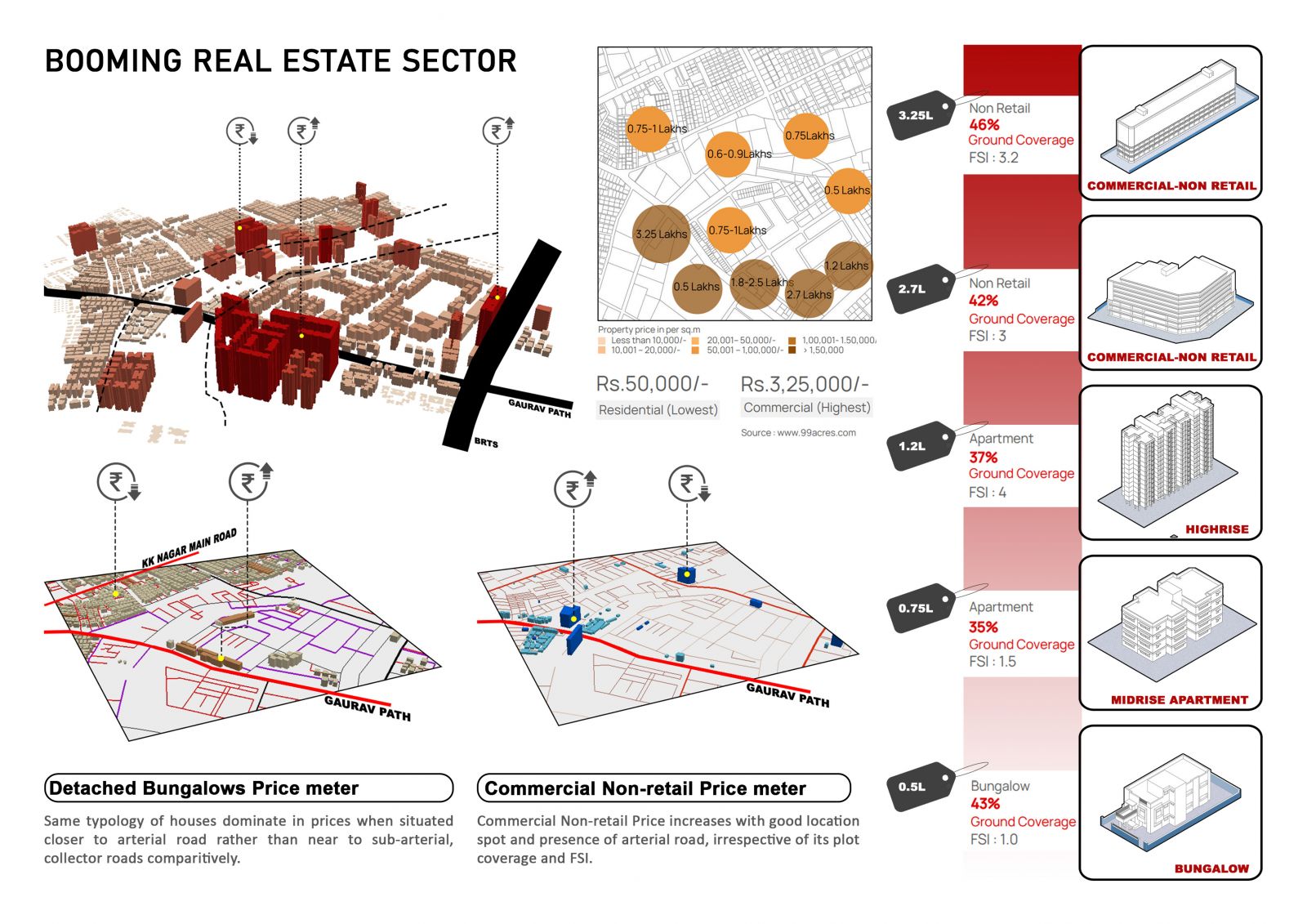
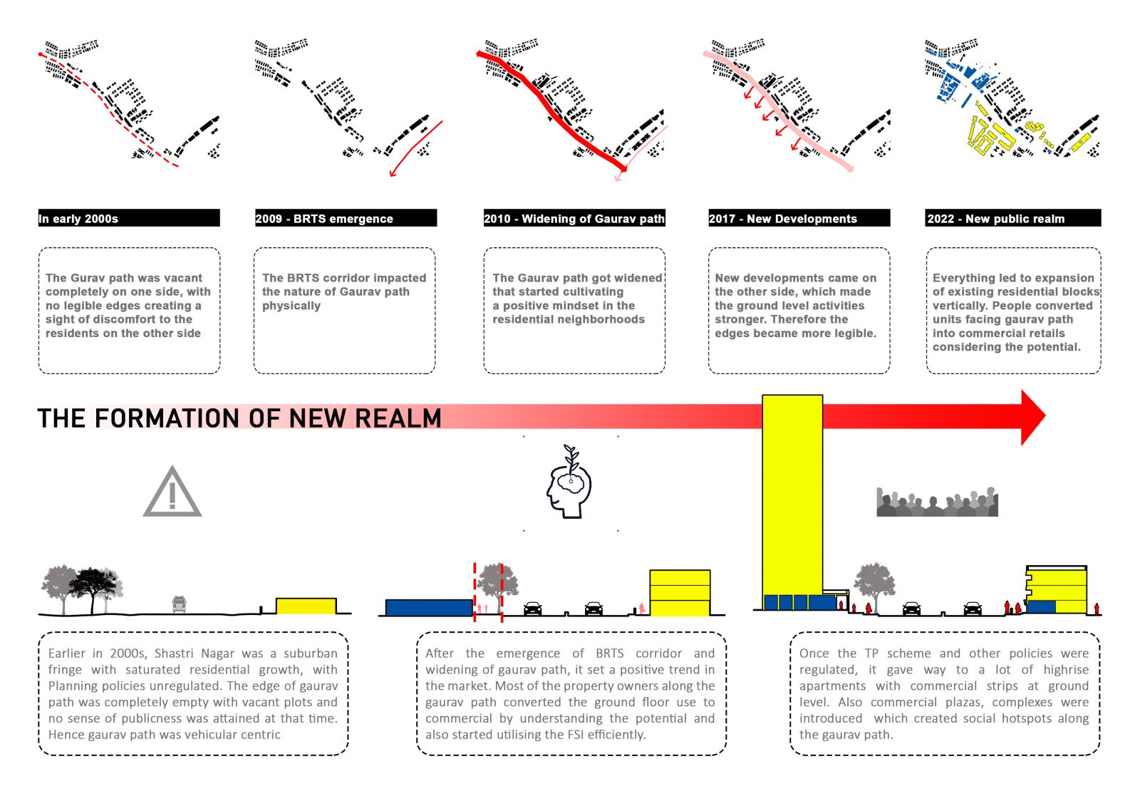
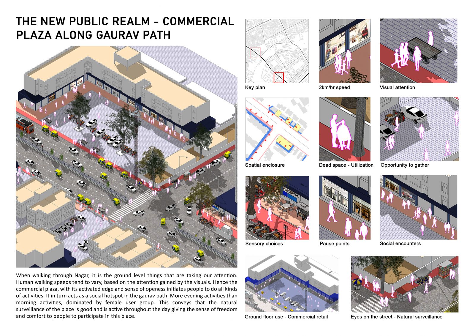
Shastri Nagar is a compact residential area in the northwestern part of Ahmedabad, spread along gaurav path and the BRTS corridor. It is surrounded by Ranip, Ghatlodiya and Chandlodiya which are upcoming growth centers. It is located exactly in the greenbelt corridor of Ahmedabad, which was considered to be the city limit in 1965 (AUDA, 2011). The greenbelt was initially a reserved farmland with no development permit. In 1975, with the establishment of Ahmedabad Urban Development Authority Development plan-1, Shastri Nagar precinct started developing into a residential area. Eventually, the precinct reached a saturation point in the early 2000s and could not expand further. In 2010, the emergence of BRTS created the first physical impact in Shastri Nagar after 10 years, by means of widening the arterial road which is Gaurav path from 20m to 36m. The widening of the road brought many further developments along its stretch. However, due to settling of disputes and some policy changes by the government in 2013 (TOI), supreme court ordered to regulate all vacant lands under greenbelt to TP scheme. This is the point where the ‘shift in urbanization’ started taking place. The Regularization of the TP Scheme in 2017 further acted as a catalyst for the development of Shastri Nagar, with an increased FSI of 4. One-third of vacant lands, less built spaces, high demand for housing and booming real estate market shows the real sign of Potential growth in Shastri Nagar. With the evolving urban fabric and job opportunities in the areas around Shastri Nagar, it created a trend among people to move in the west zone of Ahmedabad. Overall Shastri Nagar was driven by policies and shaped by schemes, but the reality was something unexpected.
