Your browser is out-of-date!
For a richer surfing experience on our website, please update your browser. Update my browser now!
For a richer surfing experience on our website, please update your browser. Update my browser now!
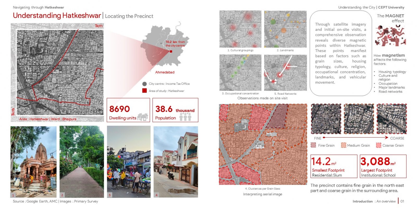
Hatkeshwar, situated adjacent to the walled city of Ahmedabad, predominantly occupies a residential area. This study delves into a one-square-kilometre precinct in the southeaster part of Ahmedabad, examining the history, evolution, street networks, land use, built form, public realm, municipal services, housing, employment opportunities, and transport choices of Hatkeshwar. A comprehensive study is done though readings, on-site survey data, interviews, observations made through the satellite maps, secondary sources and GIS mappings.