Your browser is out-of-date!
For a richer surfing experience on our website, please update your browser. Update my browser now!
For a richer surfing experience on our website, please update your browser. Update my browser now!
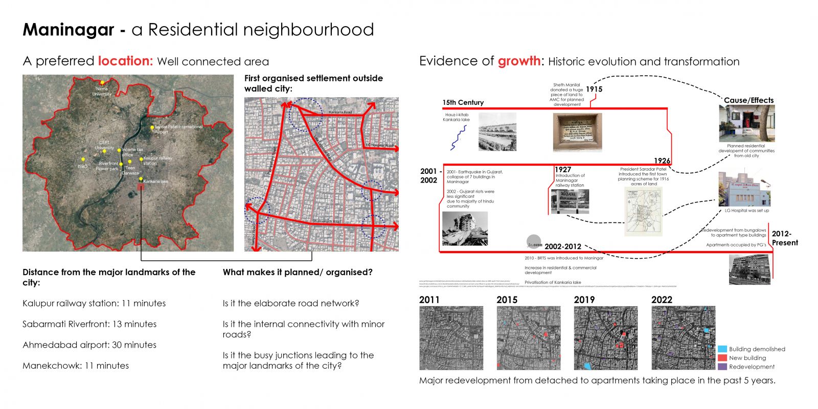
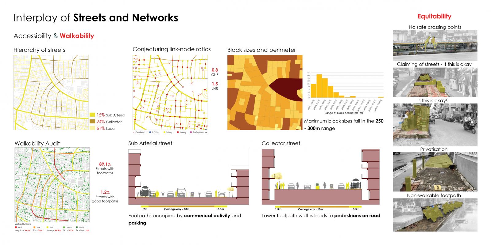
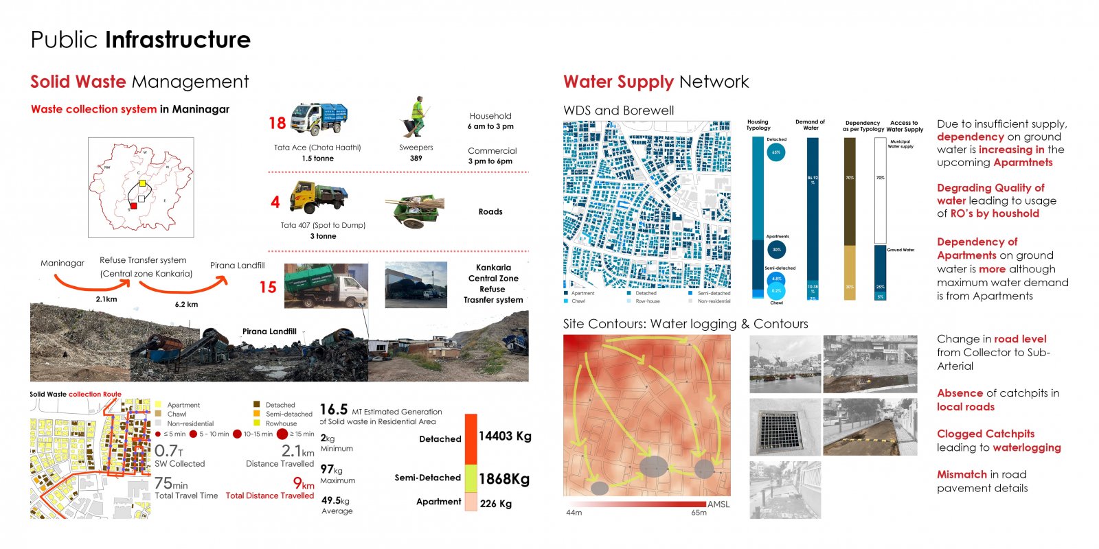
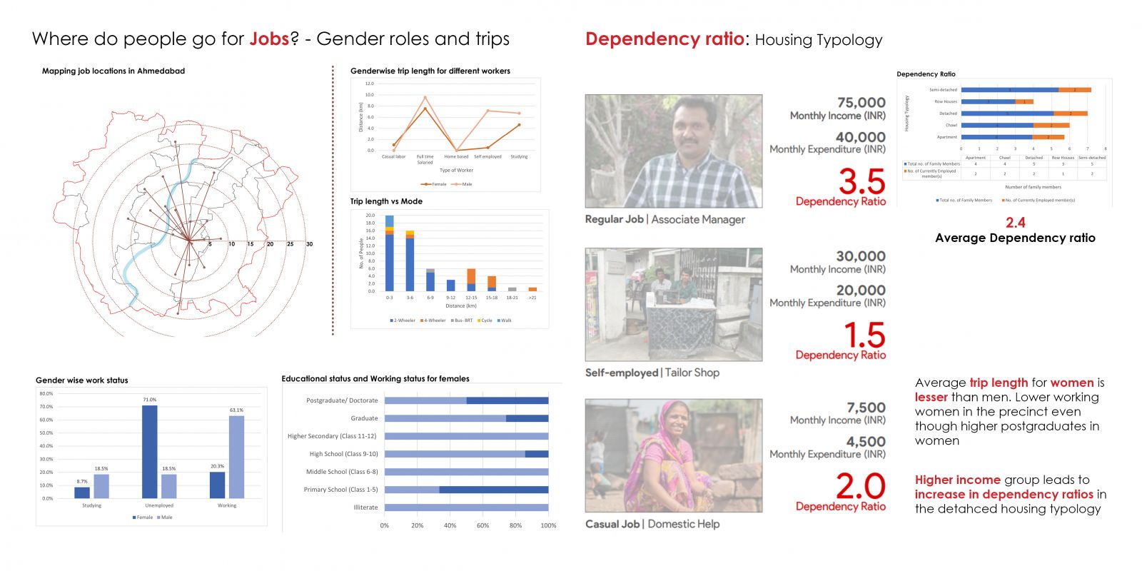
Located in the heart of old Ahmedabad, Maninagar, a one-square-kilometer precinct is the area of study near the Maninagar railway station and south of Kankaria Lake. Once a traditional residential neighborhood, it has unfolded into a bustling hub containing prominent educational and religious institutions. This portfolio delves into Maninagar's urban landscape, structured into sections, discussing the history and transformation, street network, land use and built density of the precinct, infrastructure and the various housing and transport choices. Maninagar's transformation over two decades, from a close-knit residential community to a vibrant urban hub, is marked by evolving land use, infrastructure, and community dynamics. The interplay of streets and networks highlights both strengths and challenges in accessibility and walkability. As a low-rise, mid-density residential neighborhood, Maninagar's changing landscape demonstrates a complex relationship between land use, property values, and population density, shaping a multifaceted urban environment.