Your browser is out-of-date!
For a richer surfing experience on our website, please update your browser. Update my browser now!
For a richer surfing experience on our website, please update your browser. Update my browser now!
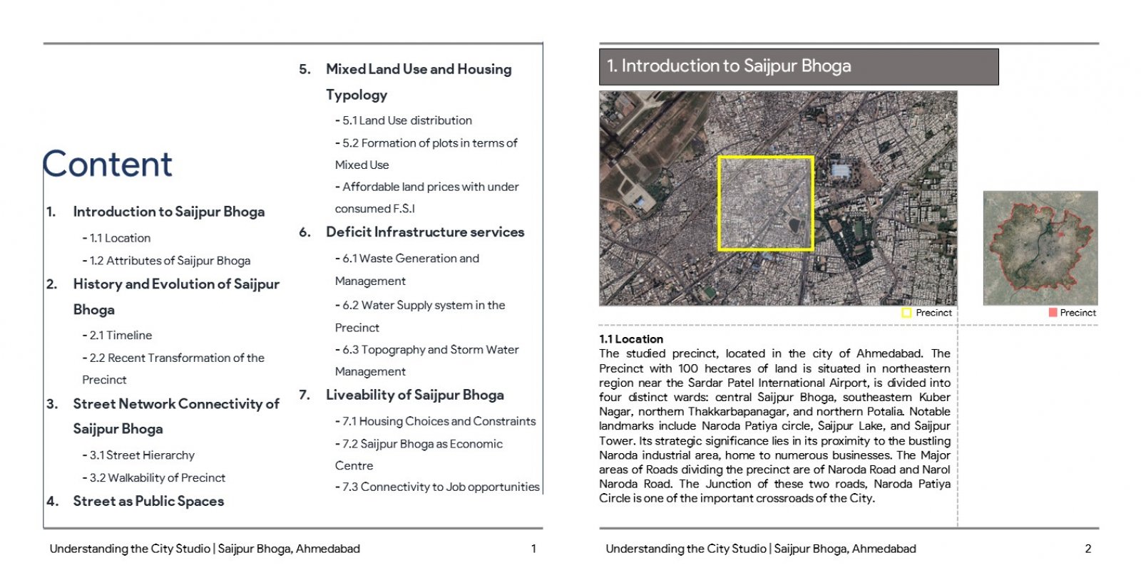
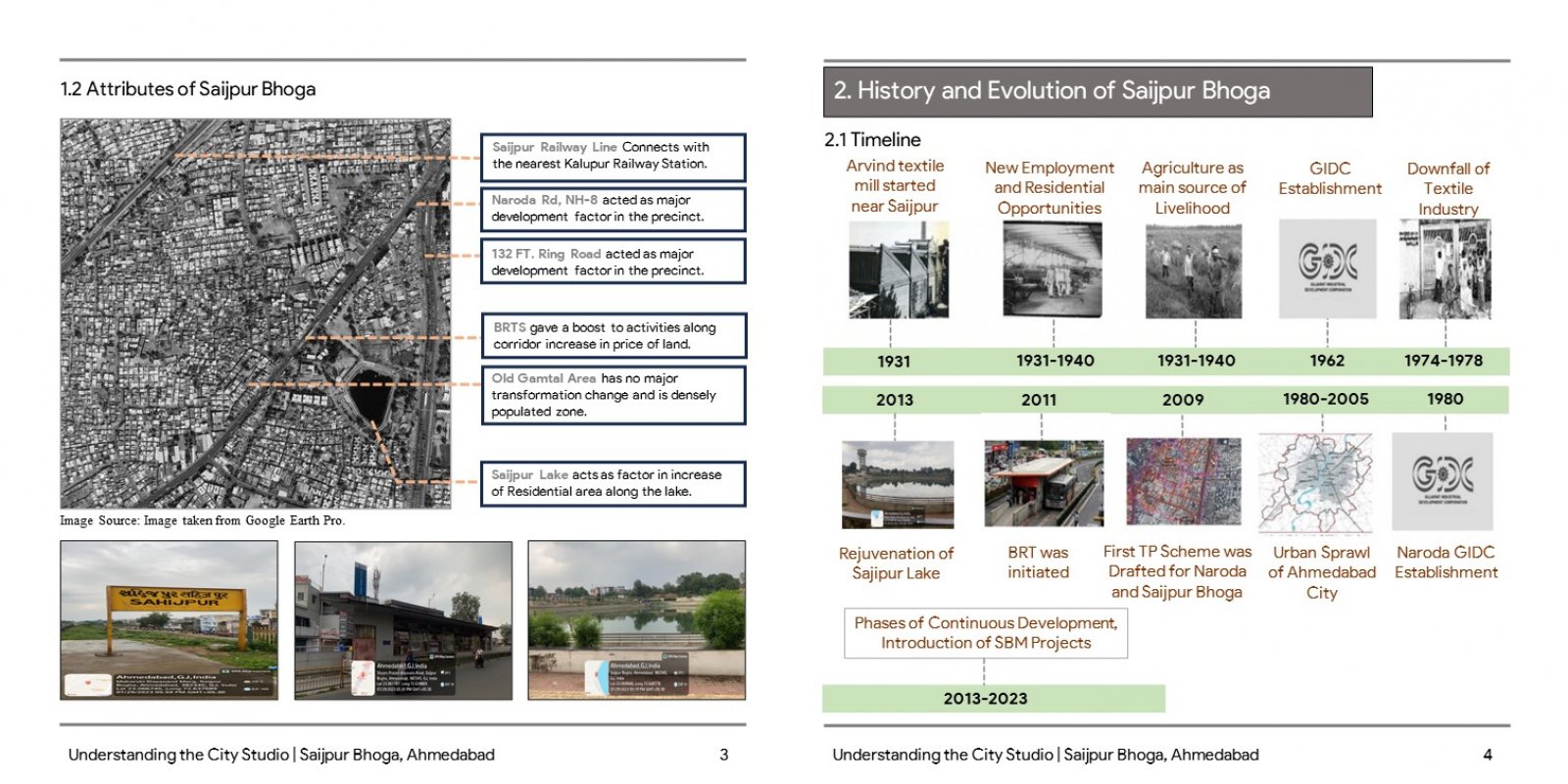
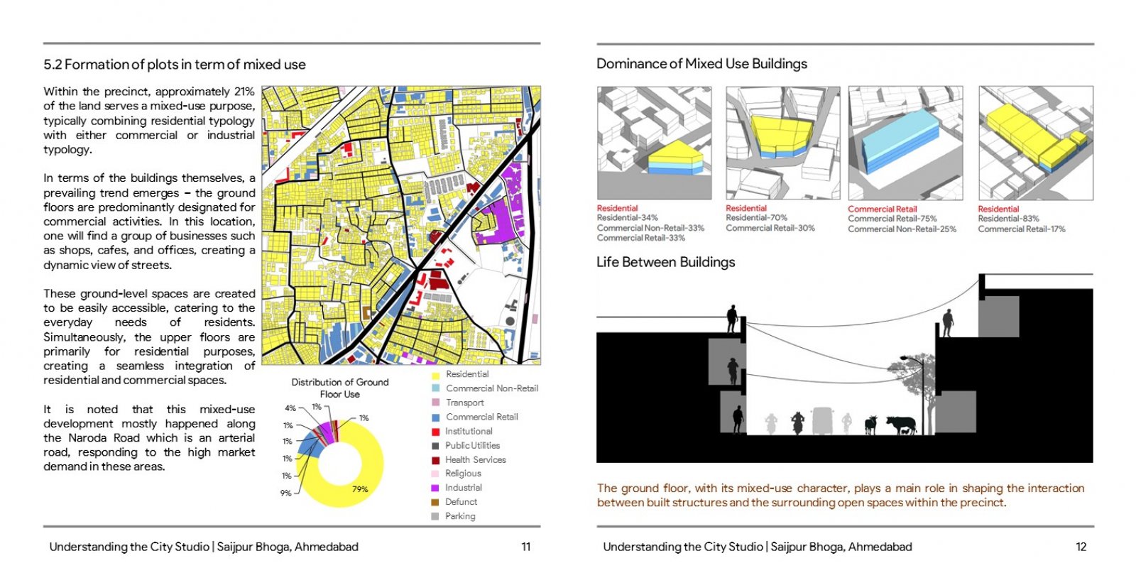
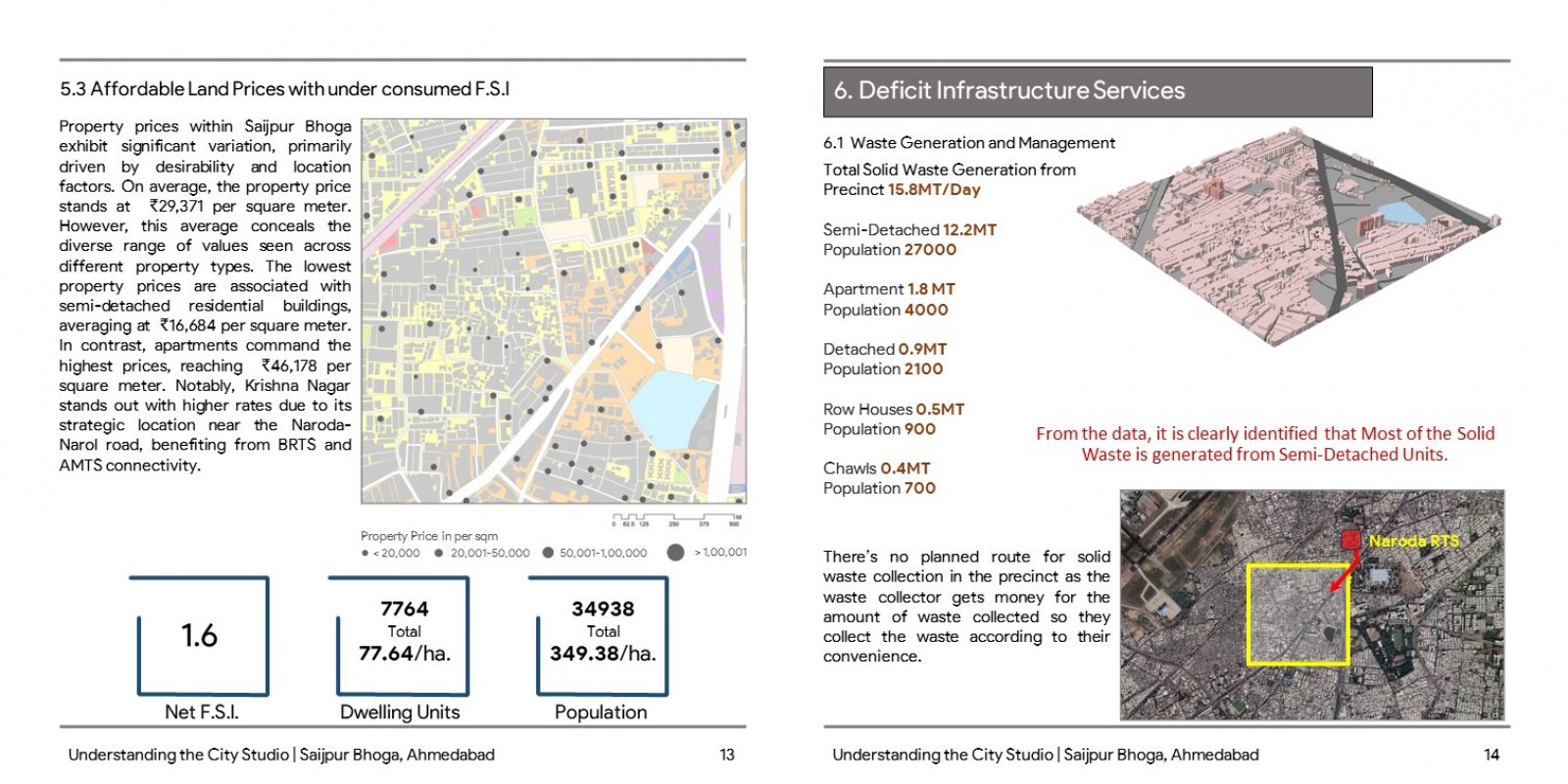
Saijpur Bhoga's evolution from rural to urban was spurred by the Naroda Industrial Area's rise in the 1960s, drawing in laborers needing housing. Governance initiatives and infrastructure development from 1990 to 2015, like Town Planning Schemes and roads, accelerated urbanization. The Bus Rapid Transit System (BRTS) in 2007 bolstered transportation, fostering residential, healthcare, and commercial expansion. Vital roads—Naroda Road and Narol Naroda Road—link it to Ahmedabad. Diverse land usage spans residences, mixed-use areas, and more. Housing transformed from semi-detached homes to towering apartments, fostering a dynamic landscape. Vibrant ground-level commercial hubs promote community engagement. Varied property prices and high density spur vertical growth, ensuring ongoing development. “Understanding the city” studio involved studying a precinct named Saijpur Bogha, of which a part area of 1 square kilometer was studied through different parameters that made understanding of neighbourhood better.
