Your browser is out-of-date!
For a richer surfing experience on our website, please update your browser. Update my browser now!
For a richer surfing experience on our website, please update your browser. Update my browser now!
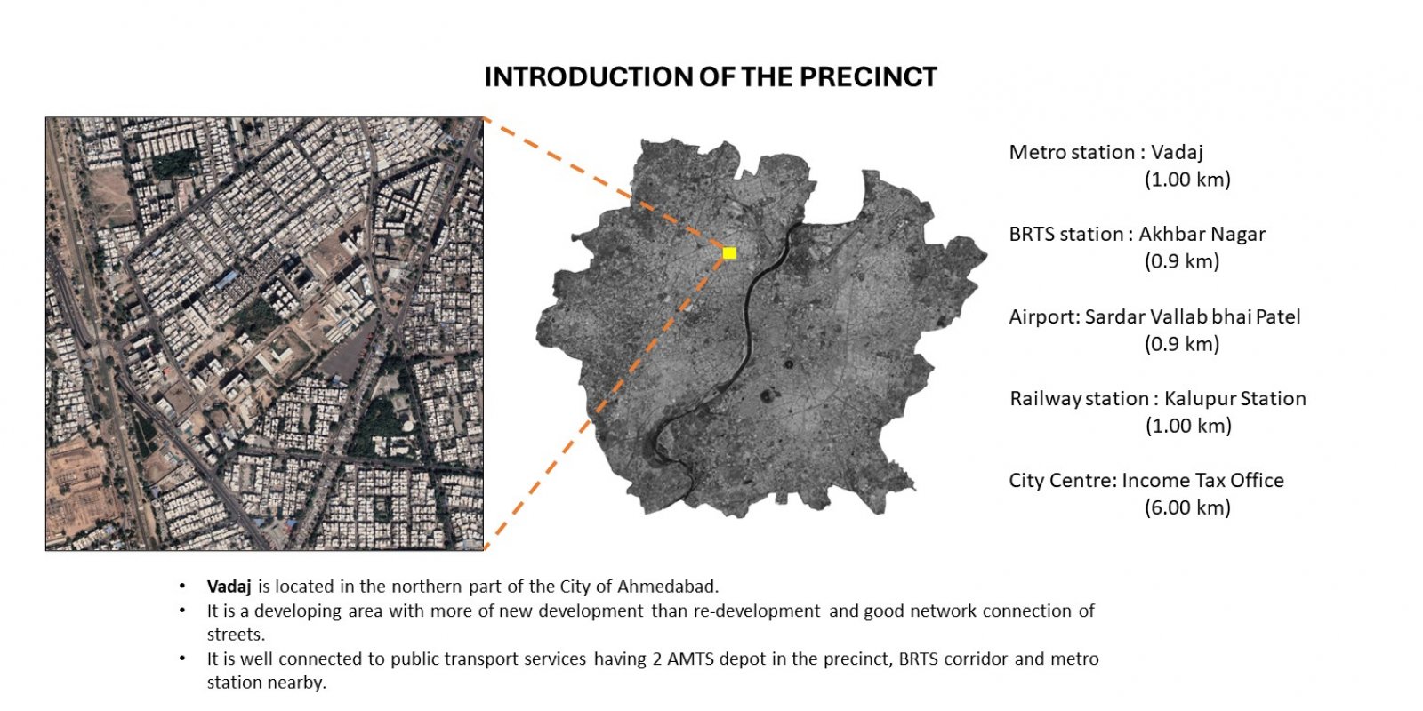
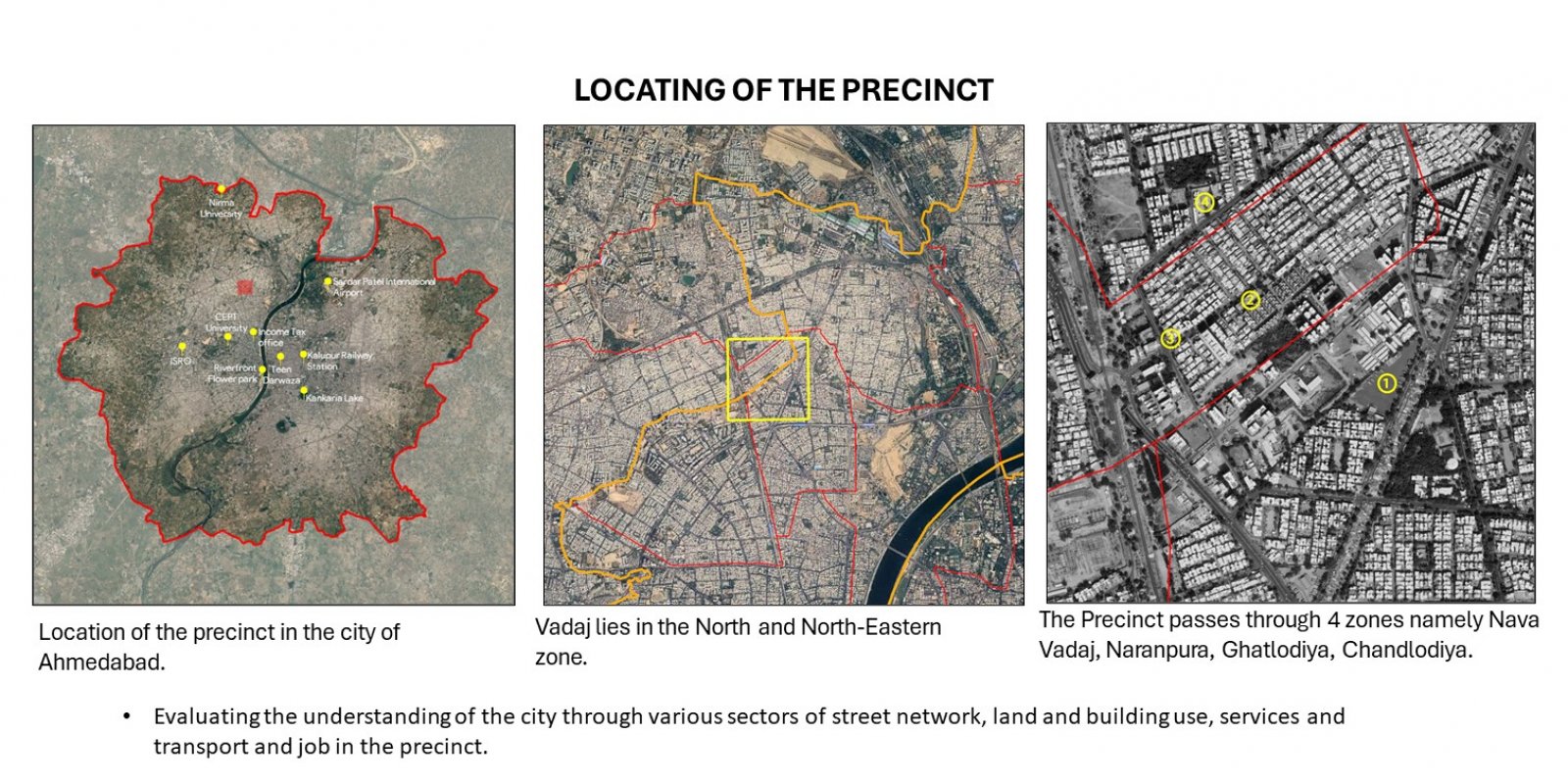
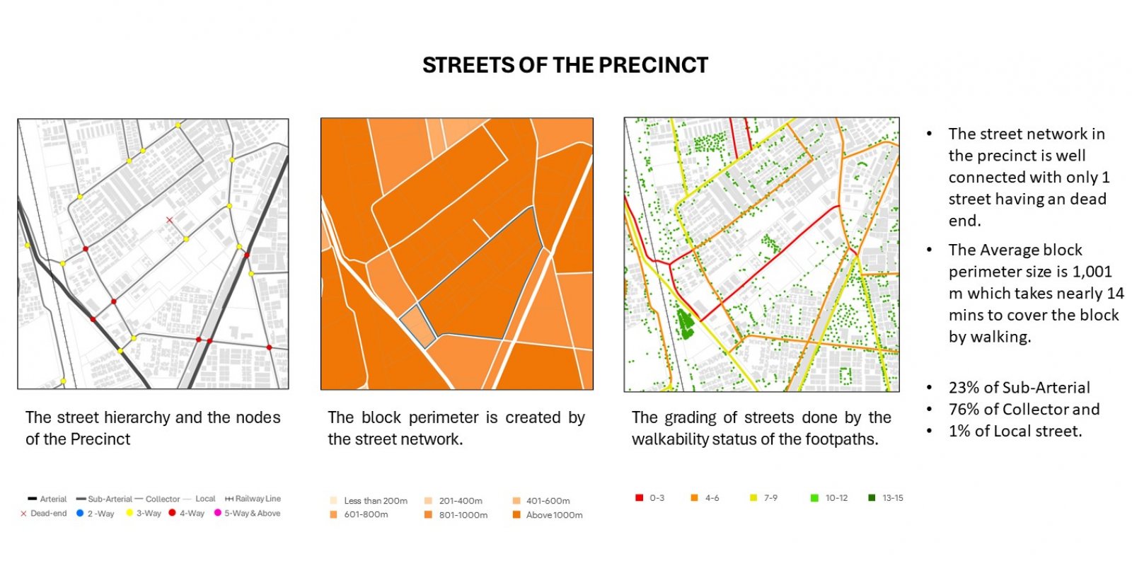
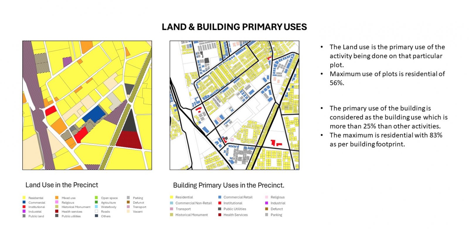
the transformation of Vadaj, a district in Nava Vadaj, located in the Northern part of the Ahmedabad city of Gujarat, over a period of two decades. It focuses on the development, historical evolutions and locating the area with its landmarks, streets and wards and zones. The precinct has 4 wards passing through namely: Nava Vadaj, Chandlodiya, Ghatlodiya, and Naranpura in the North and North Western Zone. The report documents the changes in the infrastructure, government initiatives, connectivity as well as housing patterns, and their effects on the local community. Mainly focusing on the housing patterns change like development of apartments and mixed use building and plot. The uses and advantages of having a mixed used plot or building and various functions of it. It also states about the street network and factors related to connectivity where it states about the streets and overall networking system. Engaging the terms like CNR (Connected Node Ratio), LNR (Link Node Ratio), accessibility, walkability and safety. The increasing connectivity due to the GMRC metro line. It focuses on the various land uses and building uses and the factors related where it states about the area and its desirability and prices of the property, also about the built density and population density spread in the precinct and showing the data using the sources of primarily surveys and secondarily with the help of google maps, Google Earth, ArcGis, AMC and AUDA website.to draw the conclusions.