Your browser is out-of-date!
For a richer surfing experience on our website, please update your browser. Update my browser now!
For a richer surfing experience on our website, please update your browser. Update my browser now!
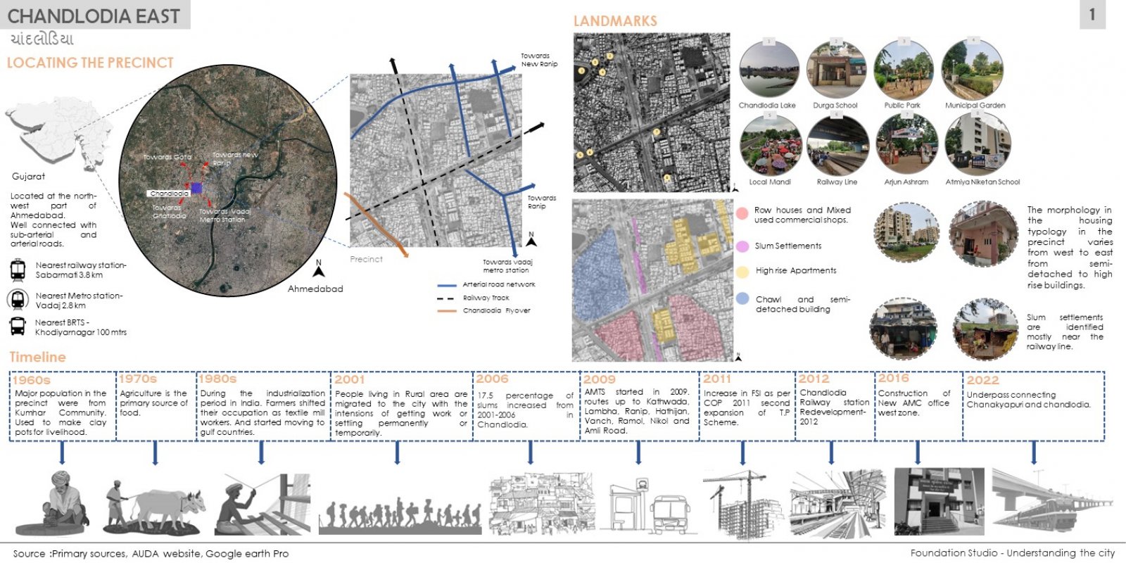
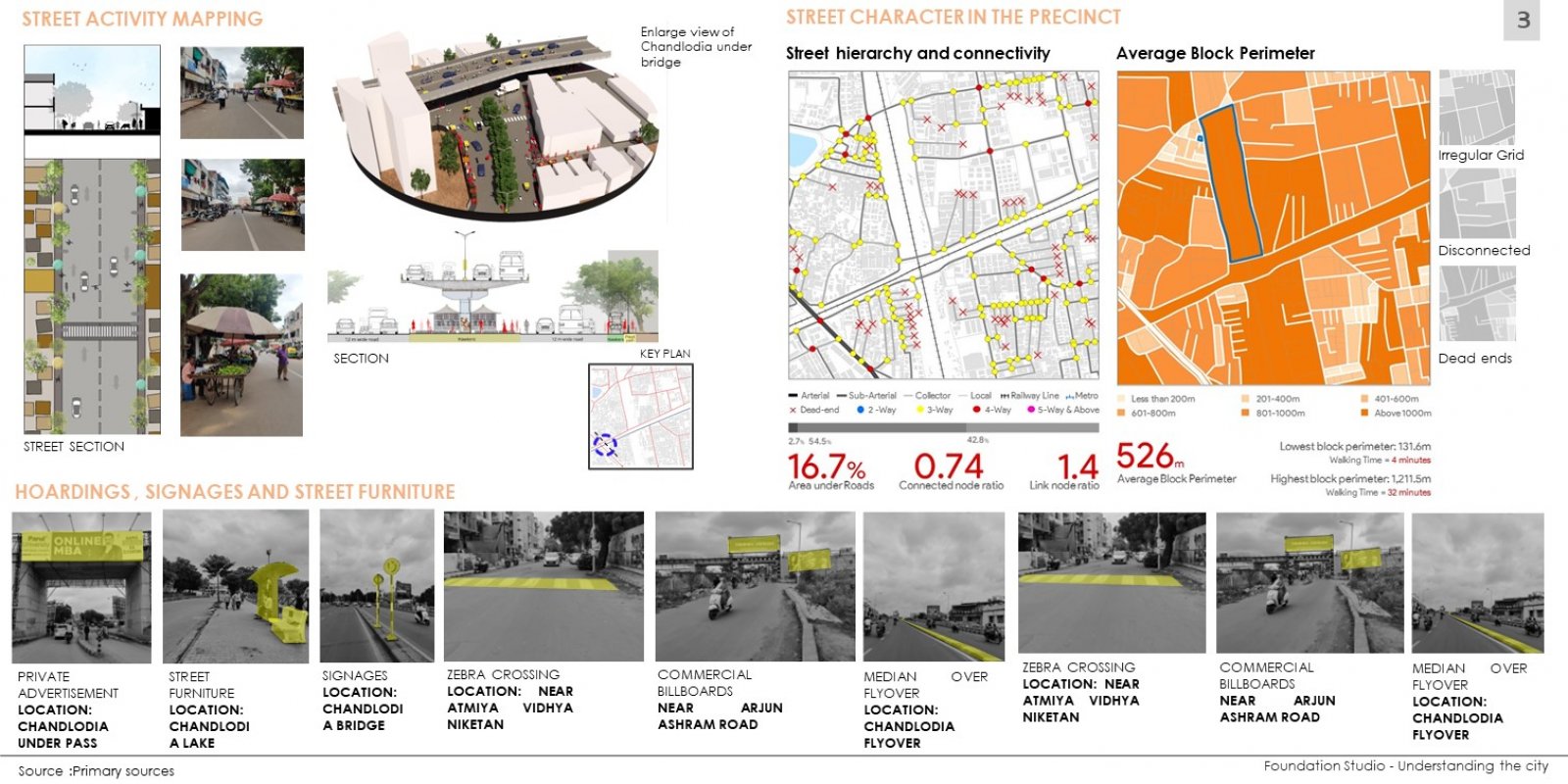
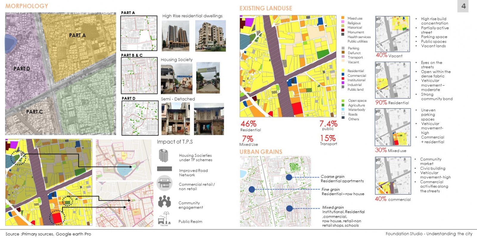
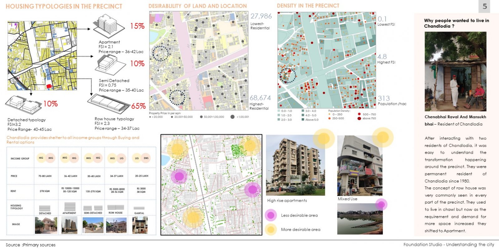
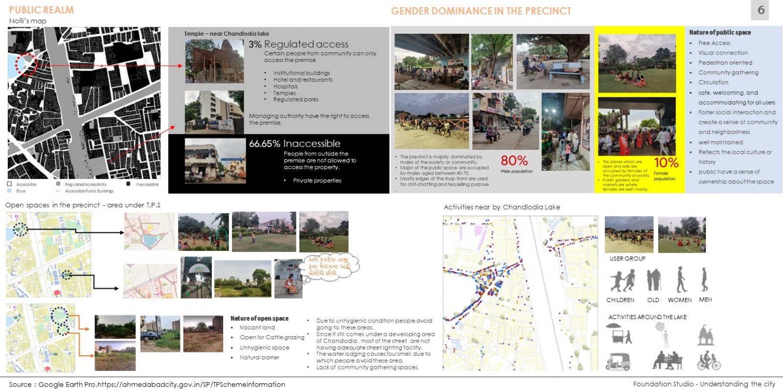
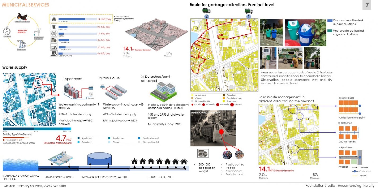
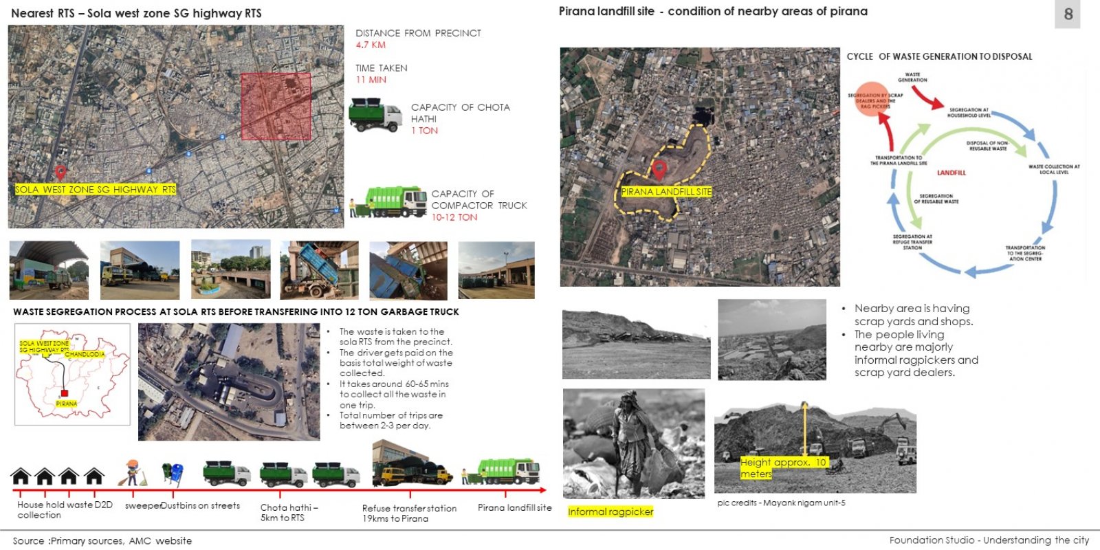
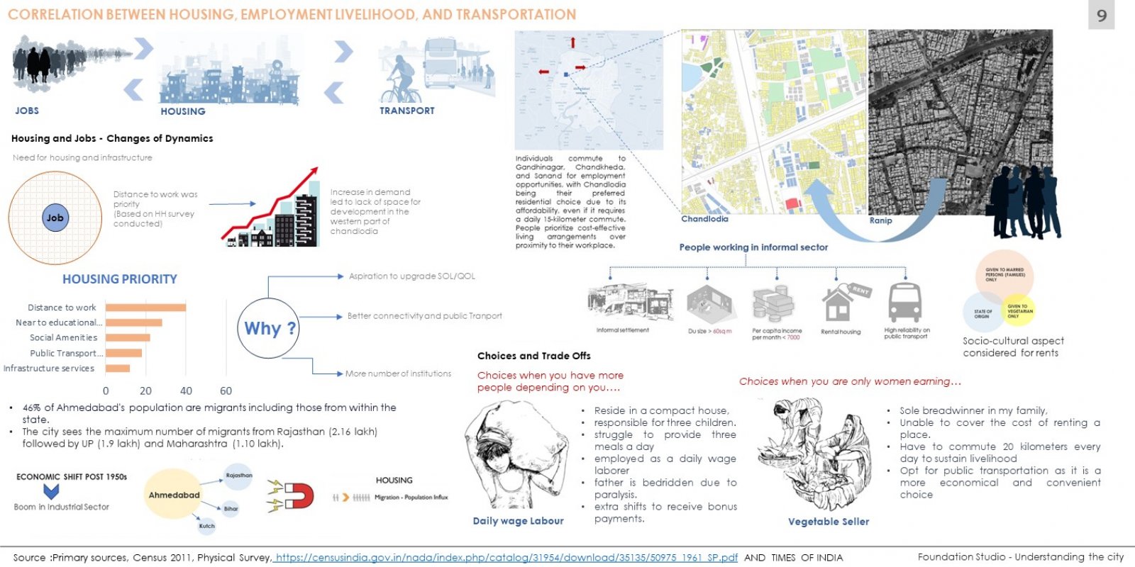
The first step to beginning an urban study is observation and exploration, which is a combination of off site studies via satellite imagery and on site perception studies. The final output of the exercise is a base map and a photo essay. Each student is assigned a one sq.km area, a precinct in the city. They map and make key observations about their area in order to familiarize themselves with scale, urban fabric and form typologies. Mapping in urban design and planning is the act of tracing and therefore spatially recording the urban form via satellite imagery. GIS enables students to document, collate, manage, analyze and create multiple data sets, which leads to a robust and nuanced understanding of settlements. Satellite imagery facilitates an understanding of the urban grain. This is followed up with a first-hand site visit and photo essay, which aims to document the first impression of the study area.