Your browser is out-of-date!
For a richer surfing experience on our website, please update your browser. Update my browser now!
For a richer surfing experience on our website, please update your browser. Update my browser now!
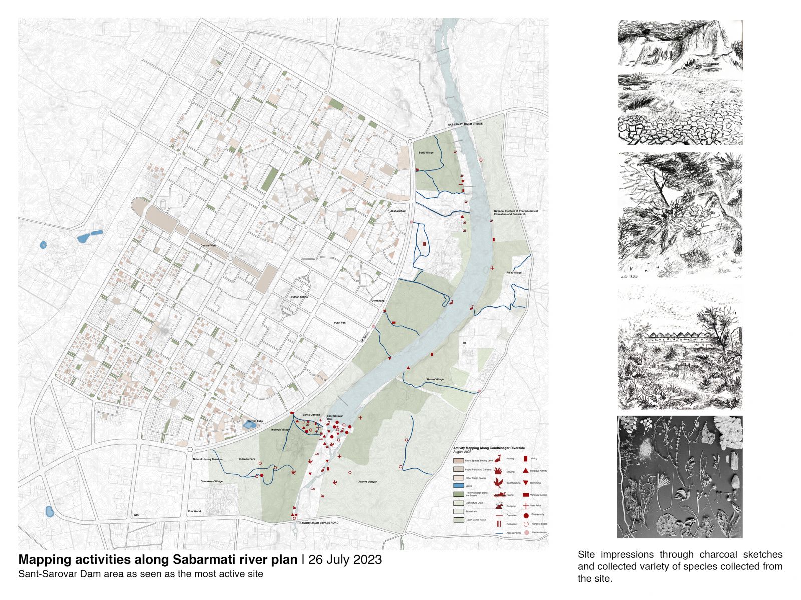
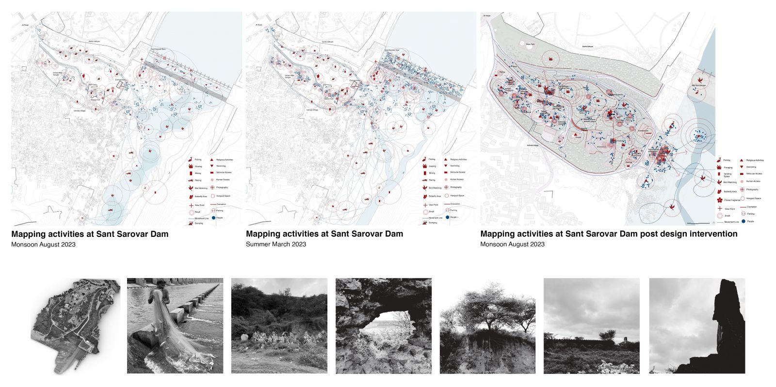
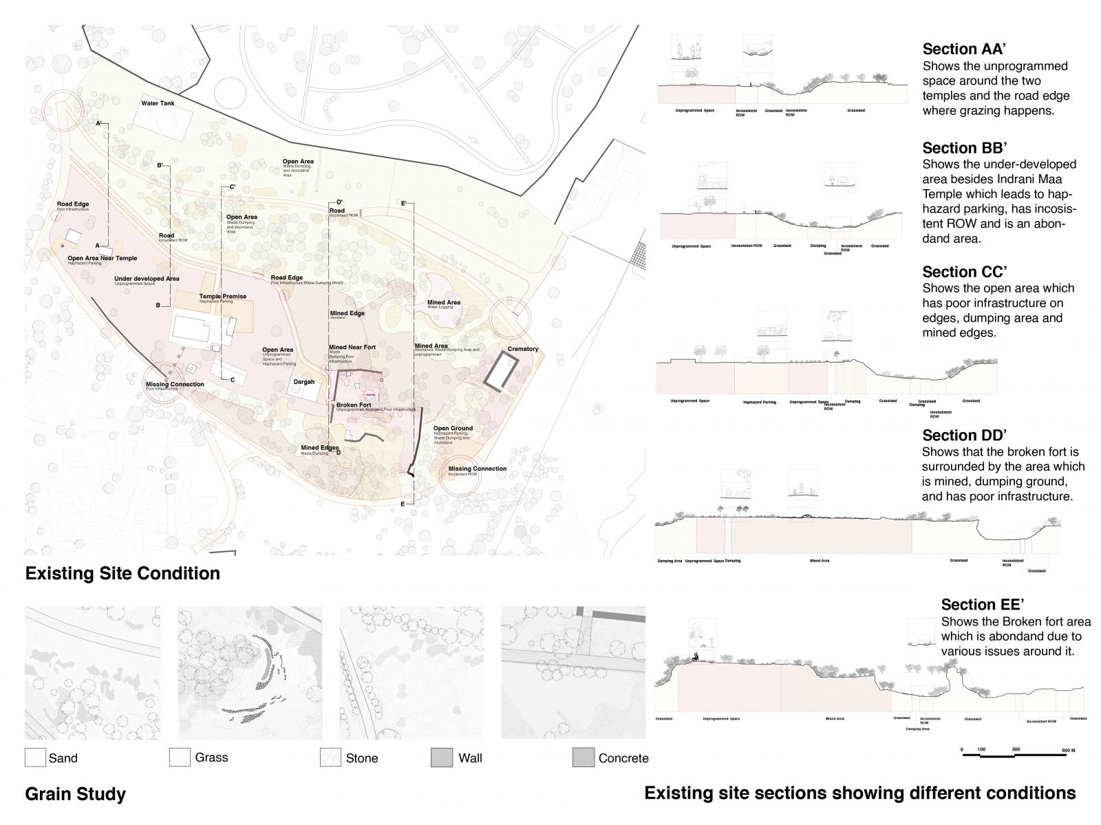
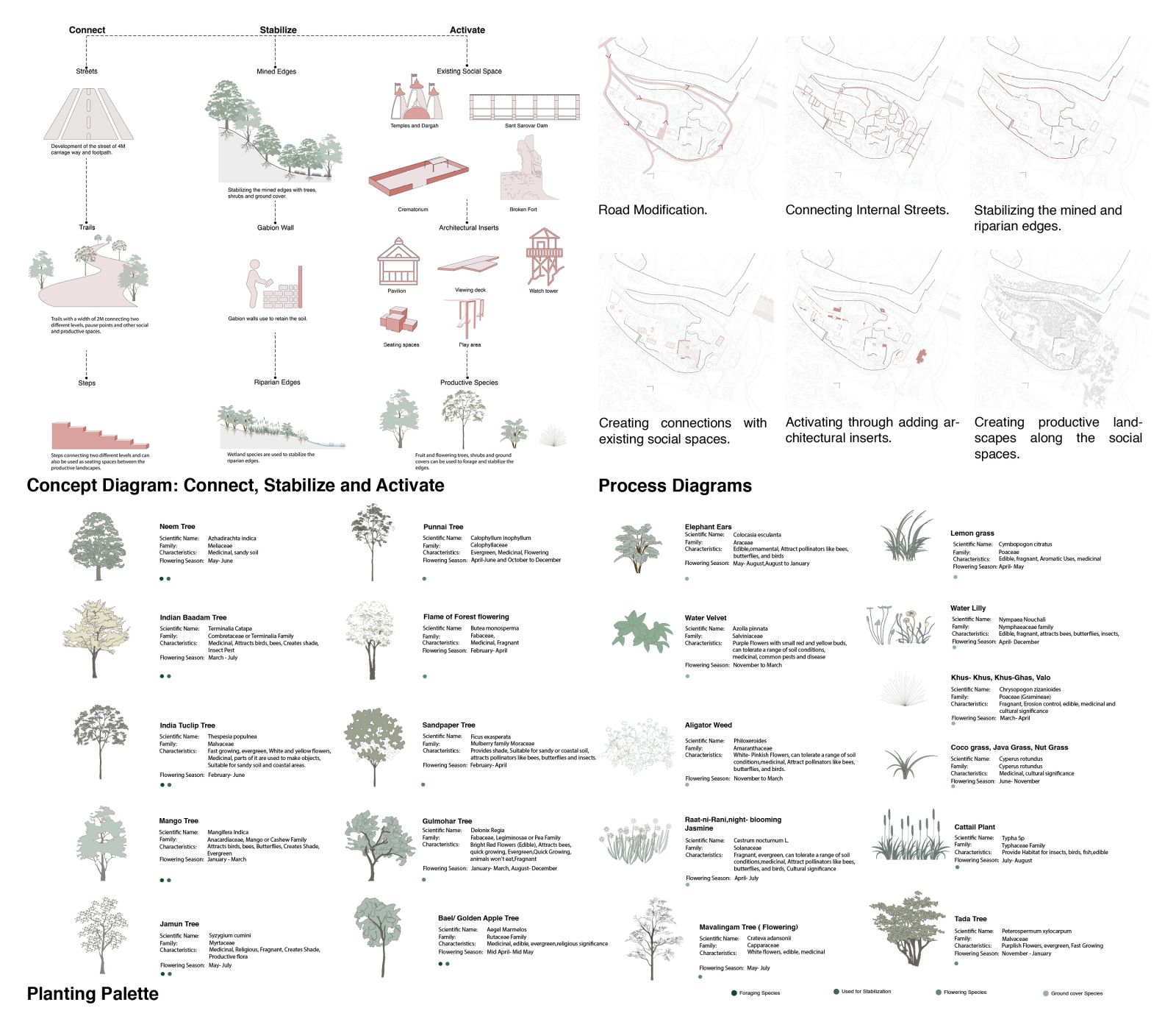
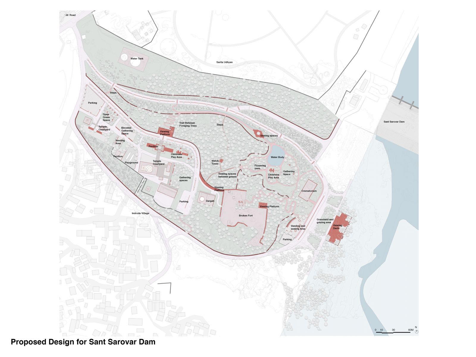
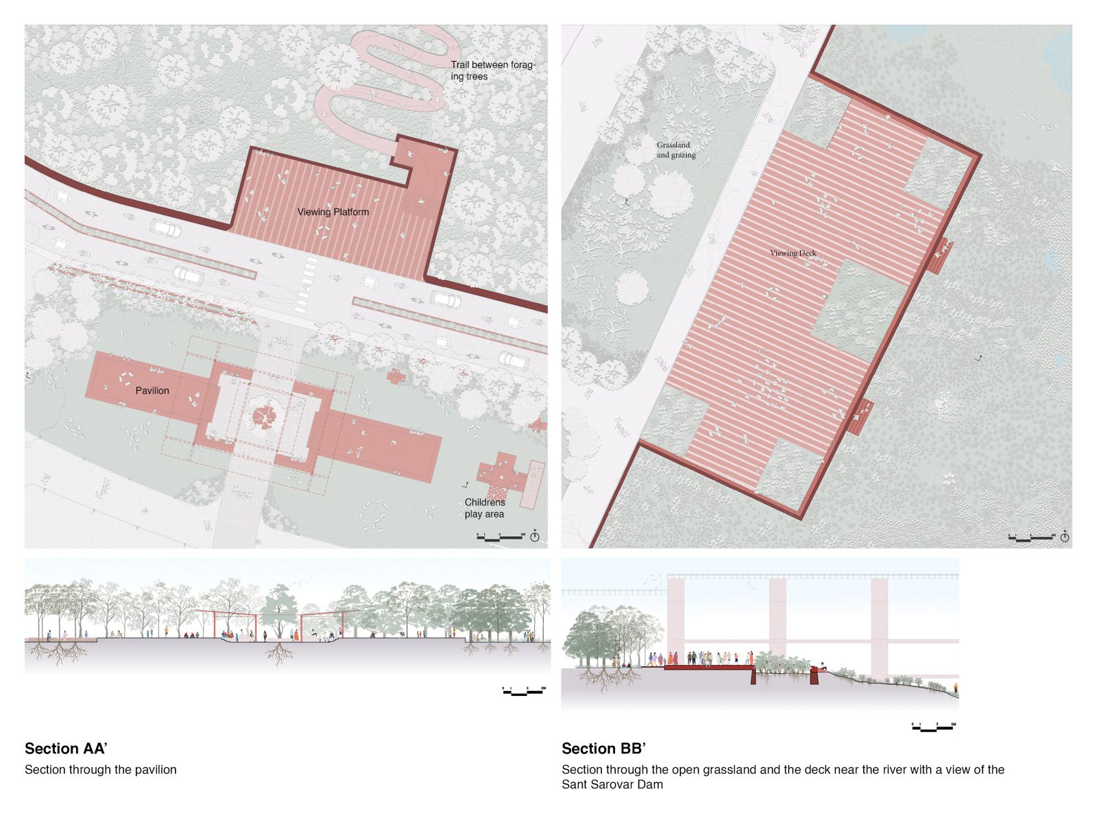
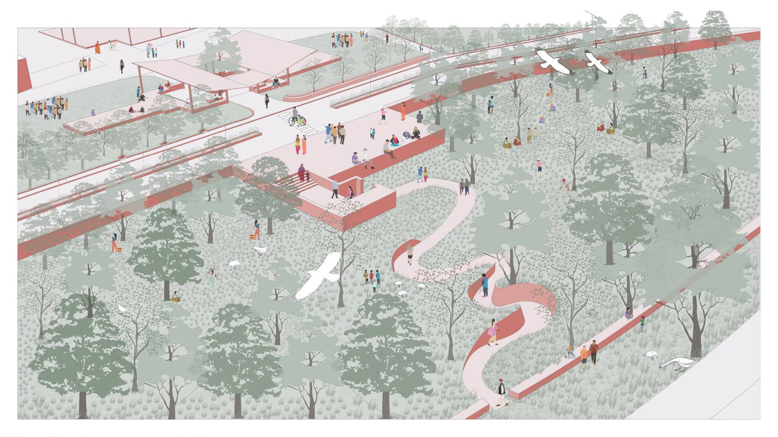
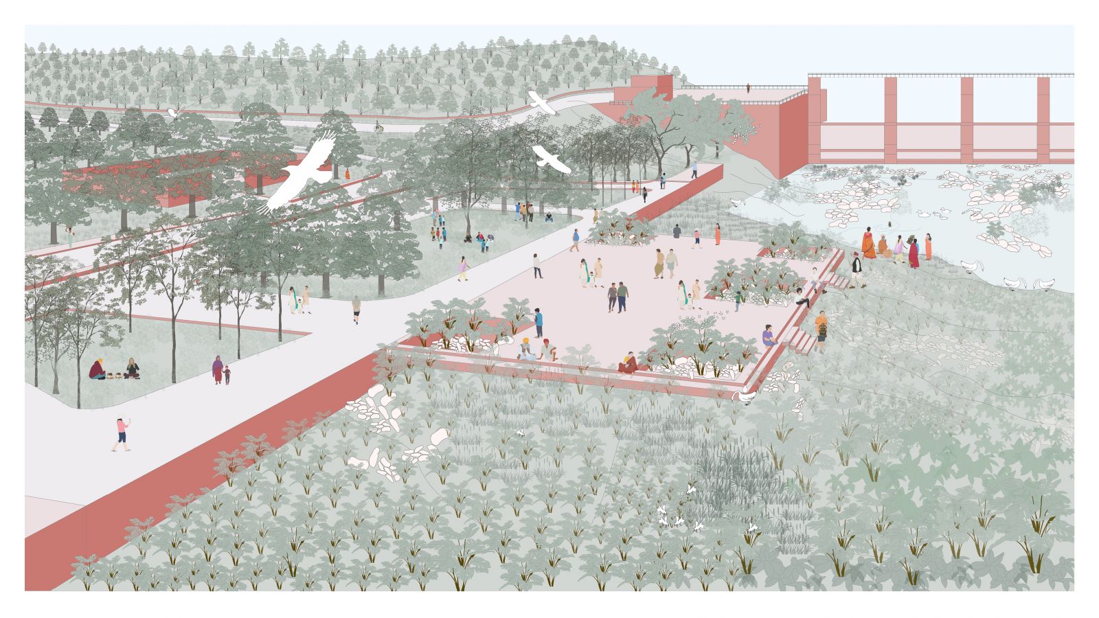
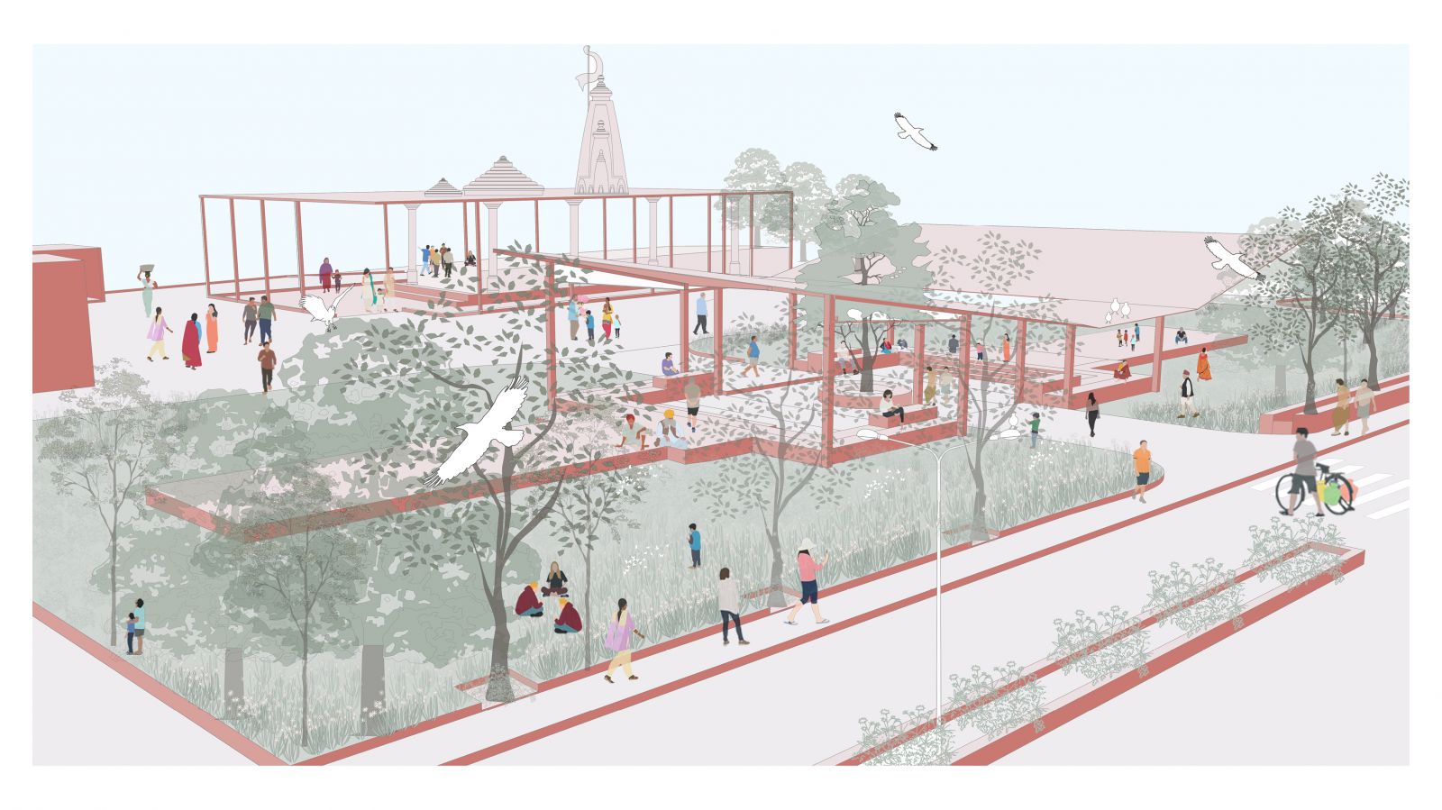
The project aims to strengthen the route from ‘Jh’ road to the Sant Sarovar Dam in Gandhinagar. Various activities were mapped along the corridor of the riverside and amongst the different probable spots, the Sant Sarovar Dam site has most of the activities and human engagement and that’s where the design is incorporated. Activity mapping was done of two different seasons to know the activities such as fishing, post-mining, religious activities, dumping, grazing etc. Moreover, delving into the existing conditions of the site were also studied to understand the different features of the land, contours and its variation which the site offers. Ground features were also studied in detail such as the post-mining site, dump yard, construction debris etc. The vision for Sant Sarovar Dam goes beyond functionality, the design seeks to incorporate the spaces which are productively and socially activated, which leads to the introduction of foraging species and building relationships and exaggerating the activities by providing social spaces such as the temple courtyards, pavilions, viewing platforms, vending spaces, play area, steps and trails which connect two different levels and pause points.
View Additional Work