Your browser is out-of-date!
For a richer surfing experience on our website, please update your browser. Update my browser now!
For a richer surfing experience on our website, please update your browser. Update my browser now!
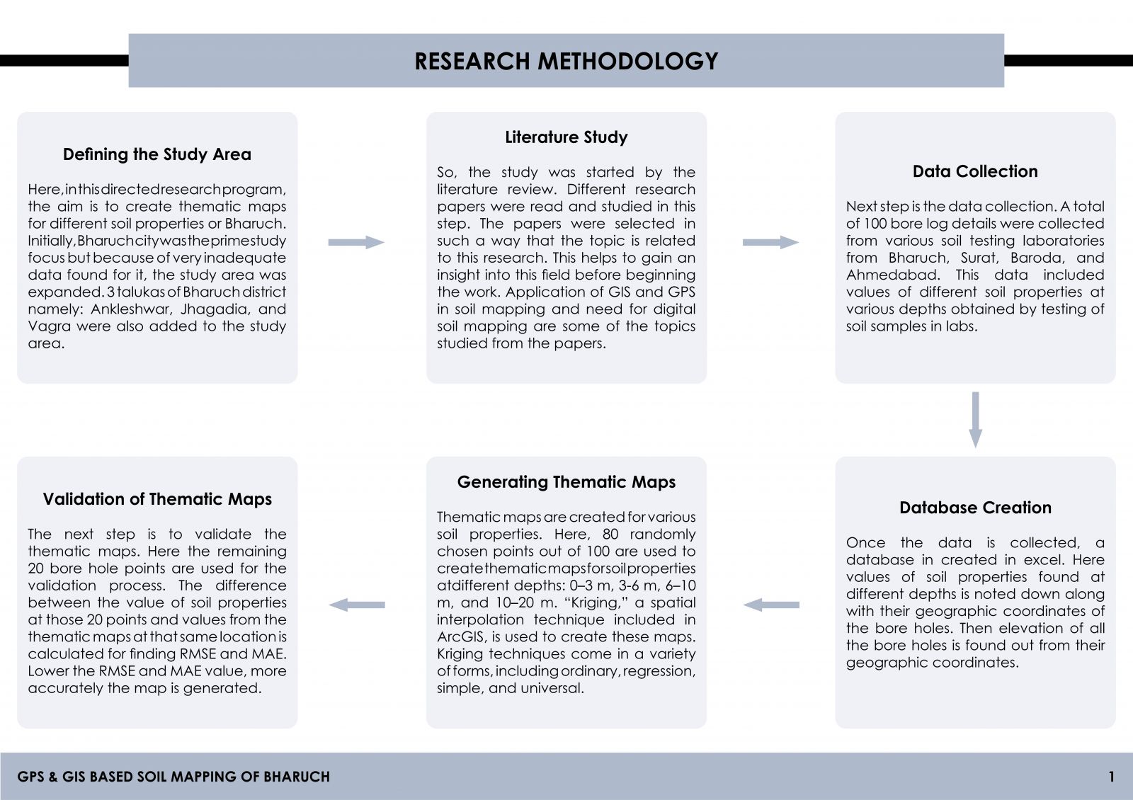
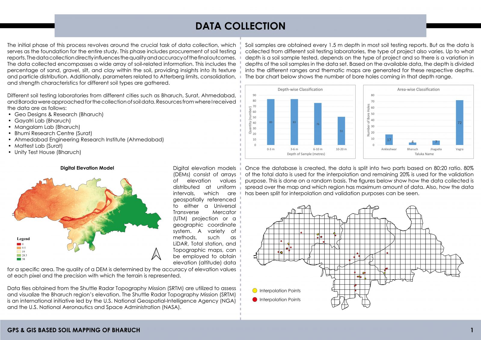
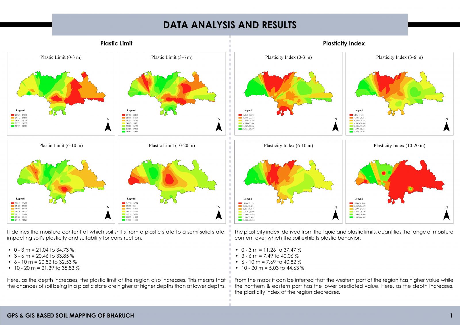
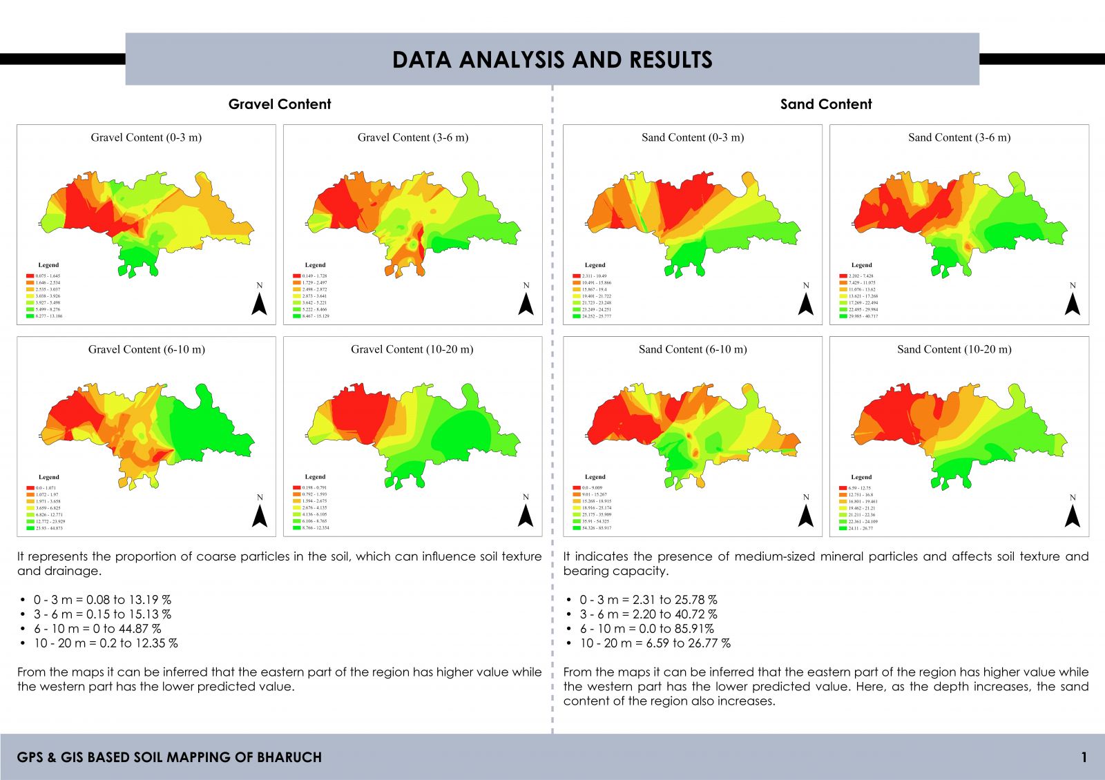
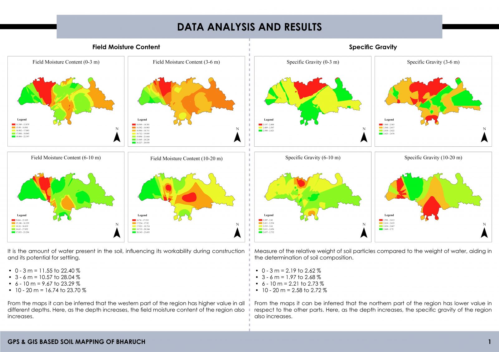
This project employs GIS and GPS technologies to overcome limitations of traditional methods. By consolidating existing soil testing reports, this methodology integrates crucial parameters such as specific gravity, moisture content, and density. Thematic maps, developed through ordinary kriging interpolation, reveals soil variations across locations, depths, and widths within strata. Validation through RMSE and MAE ensures the accuracy of these maps. The resulting database facilitates geotechnical decision-making, offering vital insights into soil suitability for construction. This innovative approach signifies a leap forward in efficient and informed soil analysis, empowering geotechnical engineers in Bharuch's foundation material assessments.
View Additional Work
