Your browser is out-of-date!
For a richer surfing experience on our website, please update your browser. Update my browser now!
For a richer surfing experience on our website, please update your browser. Update my browser now!
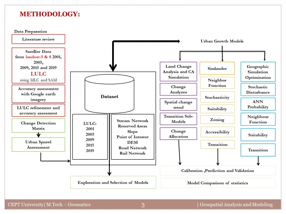
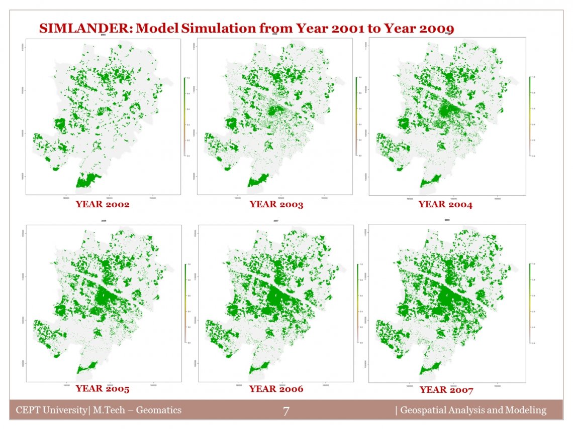
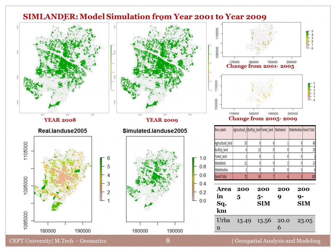
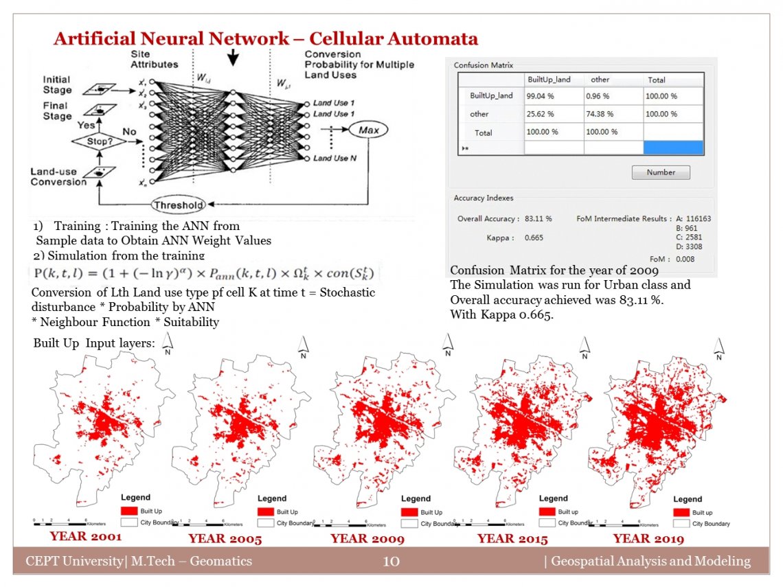
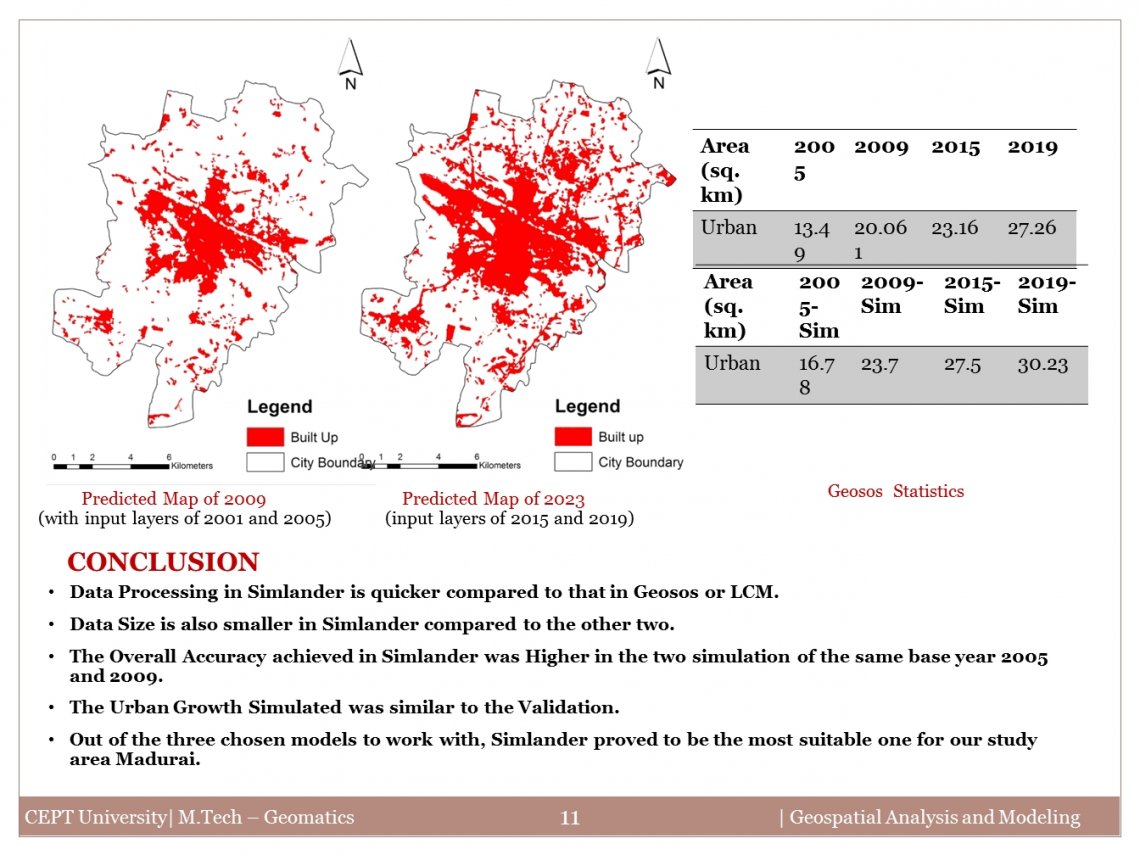
Geospatial models are useful and used in a vast array of GIS applications, from a simple evaluation to the prediction of future landscapes. The thematic area of urban sprawl would be taken up where a geospatial model would be employed to address a problem. The main objective of the studio was understanding the working principles of geospatial modeling, analyzing the trends and pattern, understand the model input and output parameters as well as the processes embedded in the model. The model performance was evaluated with the help of primary/secondary dataset. An attempt has been made to improve the model structure/code so as to improve model performance and better problem-solving capabilities with respect to the tourist city of Madurai.