Your browser is out-of-date!
For a richer surfing experience on our website, please update your browser. Update my browser now!
For a richer surfing experience on our website, please update your browser. Update my browser now!
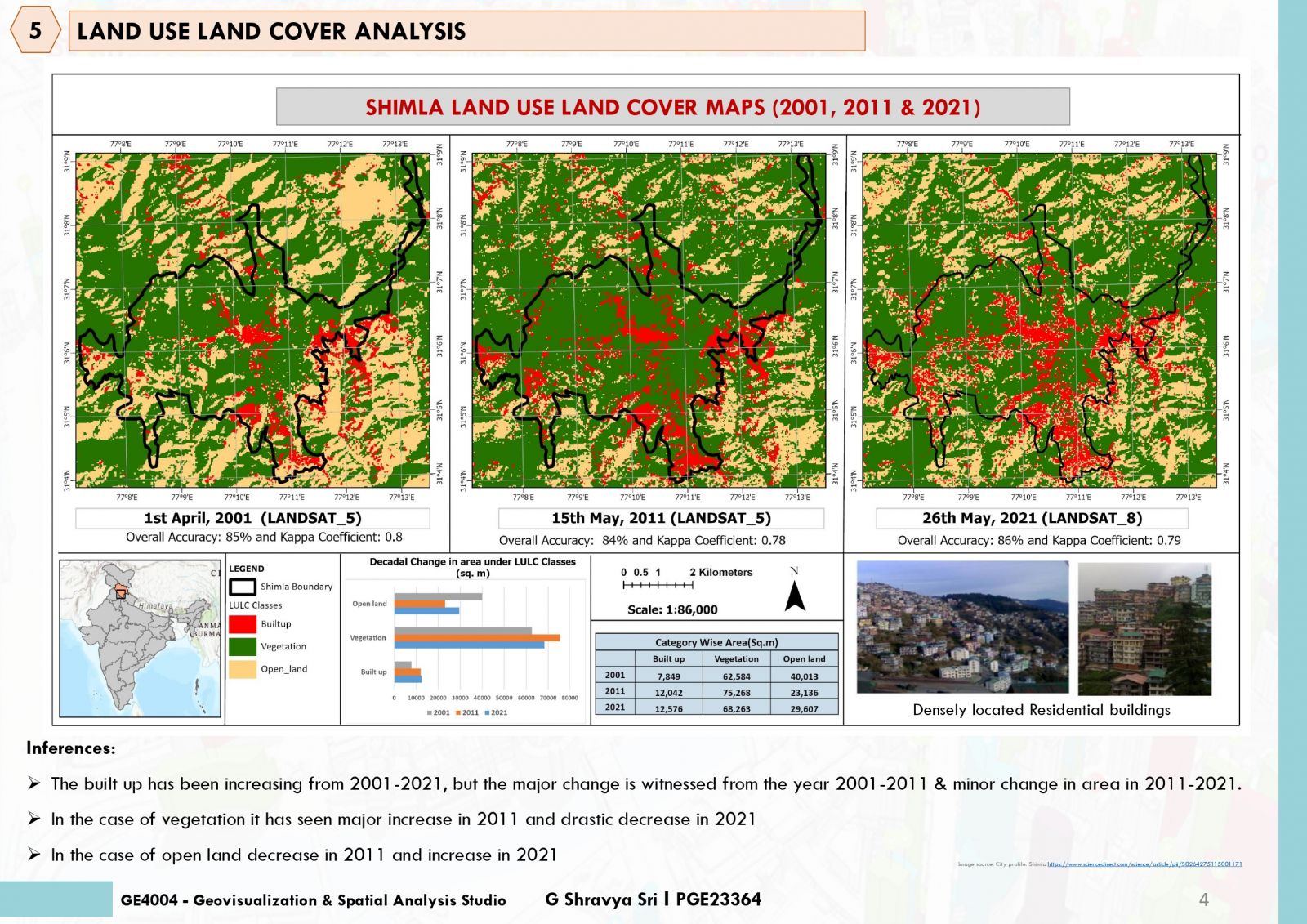
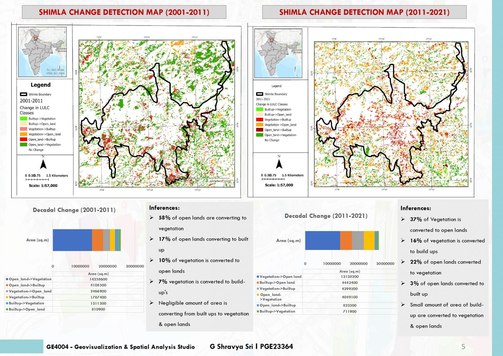
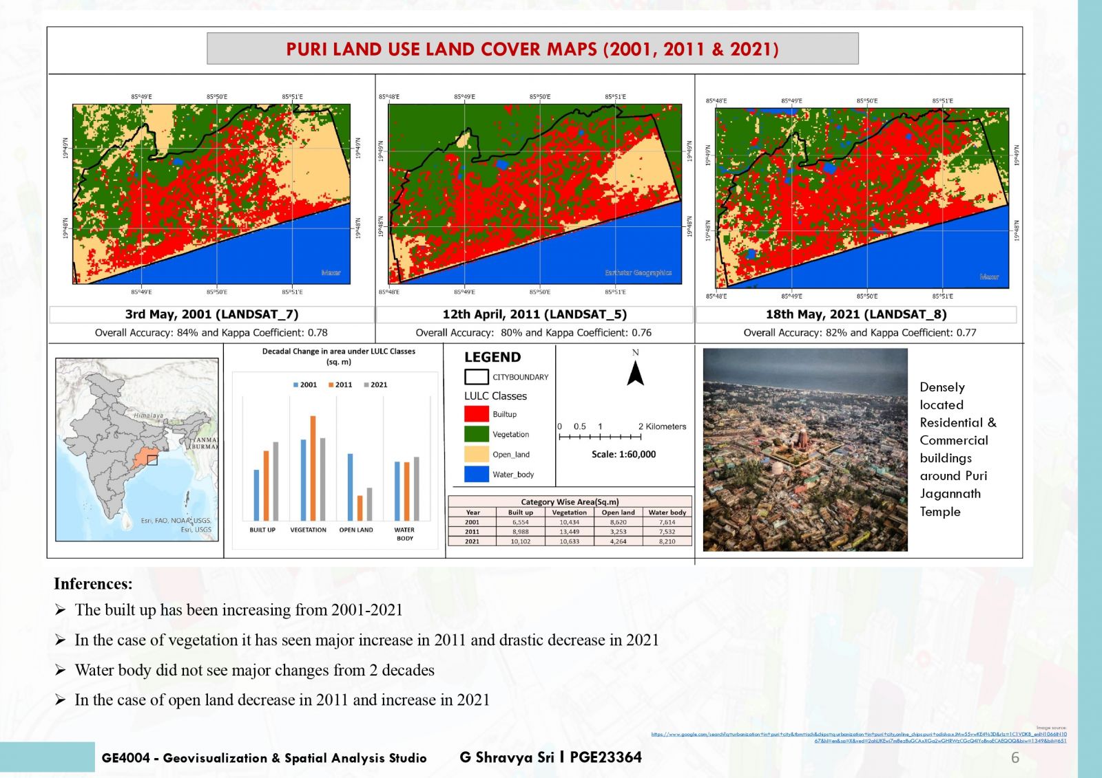
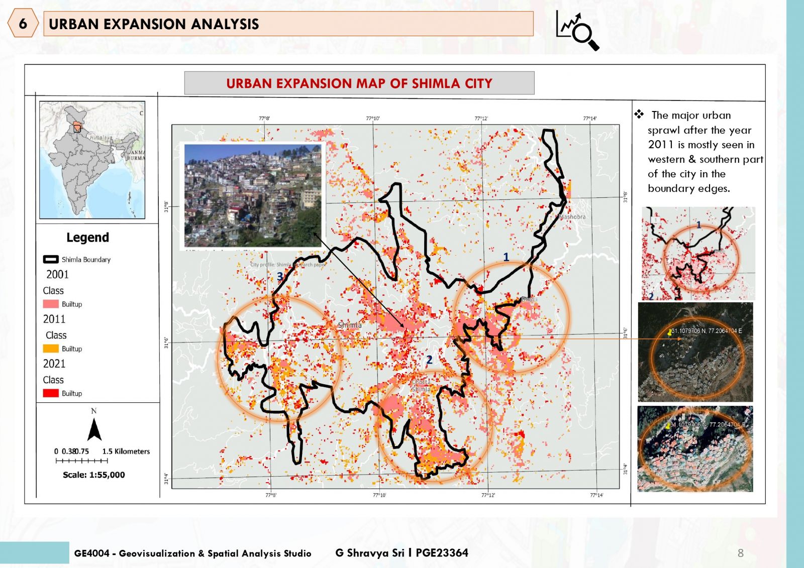
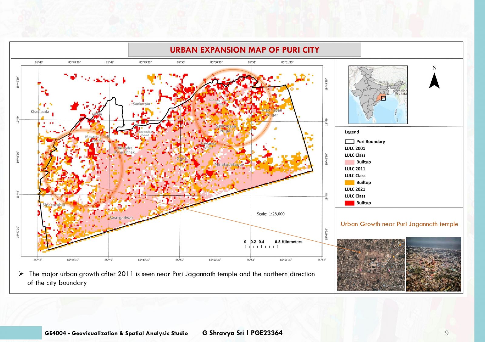
The study aims about understanding the temporal evolution of Urban expansion for past 2 decades with respect to the population growth. Also knowing factors affecting the growth. The study is analyzed using Land Use Land Cover (LULC) change. This method had helped the study to know where the area of built ups happening from different LULC classes. LANDSAT data has been used for the selected study areas. LULC mapping has great significance in planning and management of resources. The study helps other professions like urban planners, policy makers to analyze their study and propose accordingly.


.jpg)