Your browser is out-of-date!
For a richer surfing experience on our website, please update your browser. Update my browser now!
For a richer surfing experience on our website, please update your browser. Update my browser now!
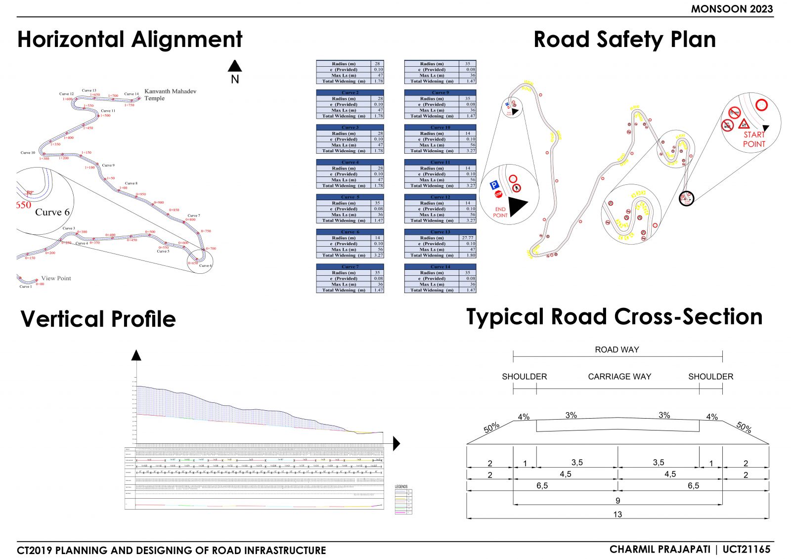
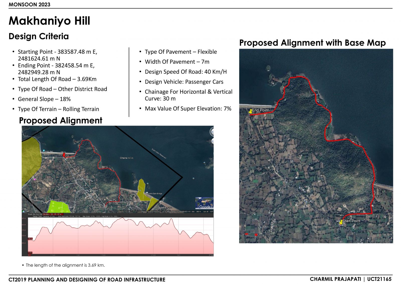
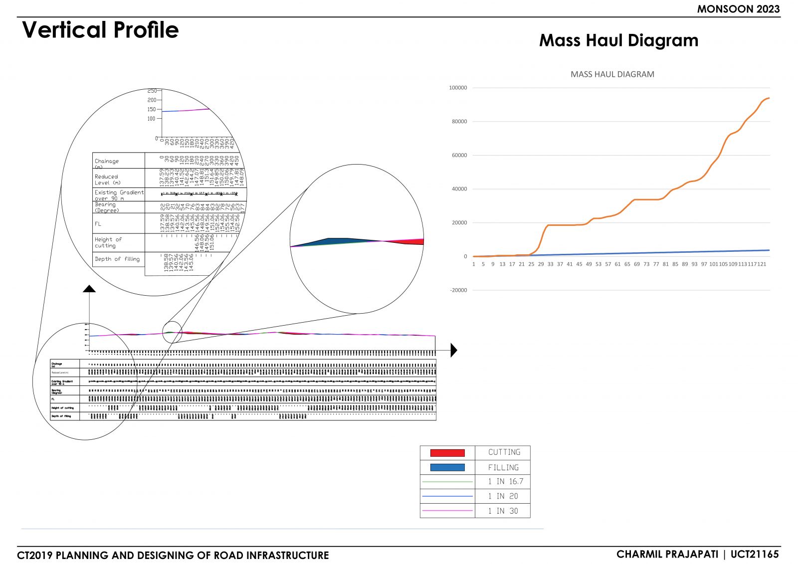
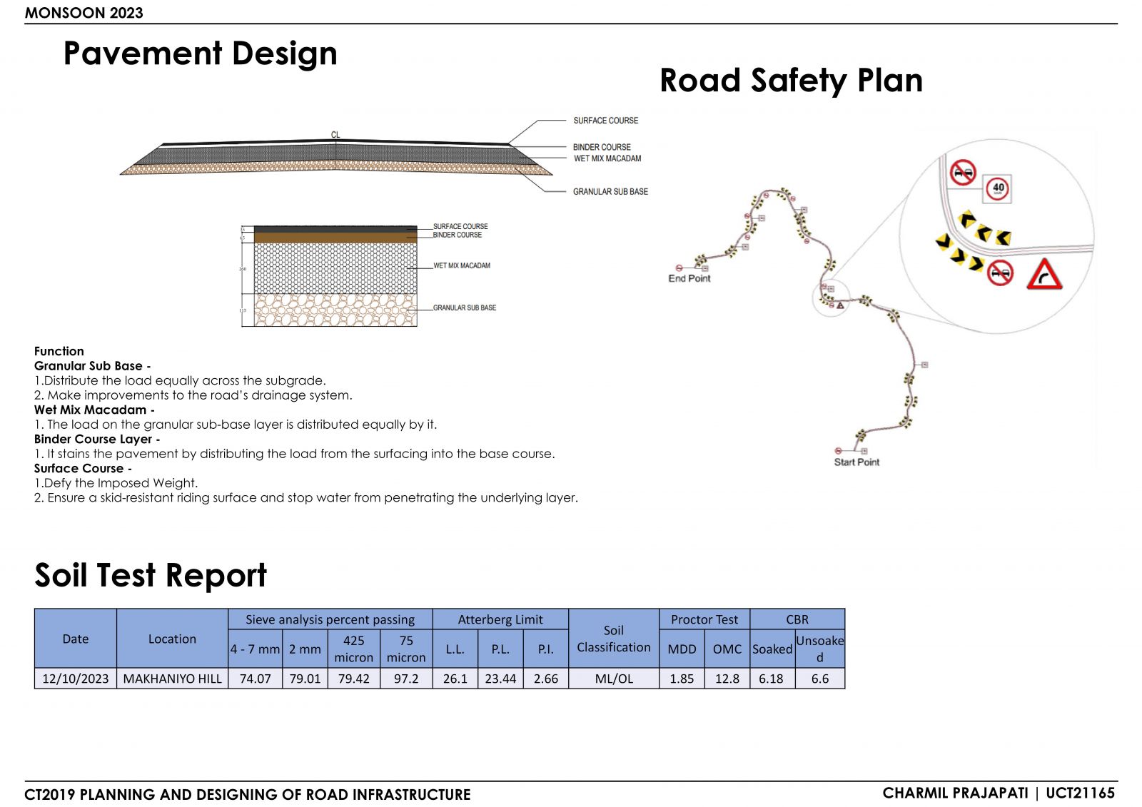
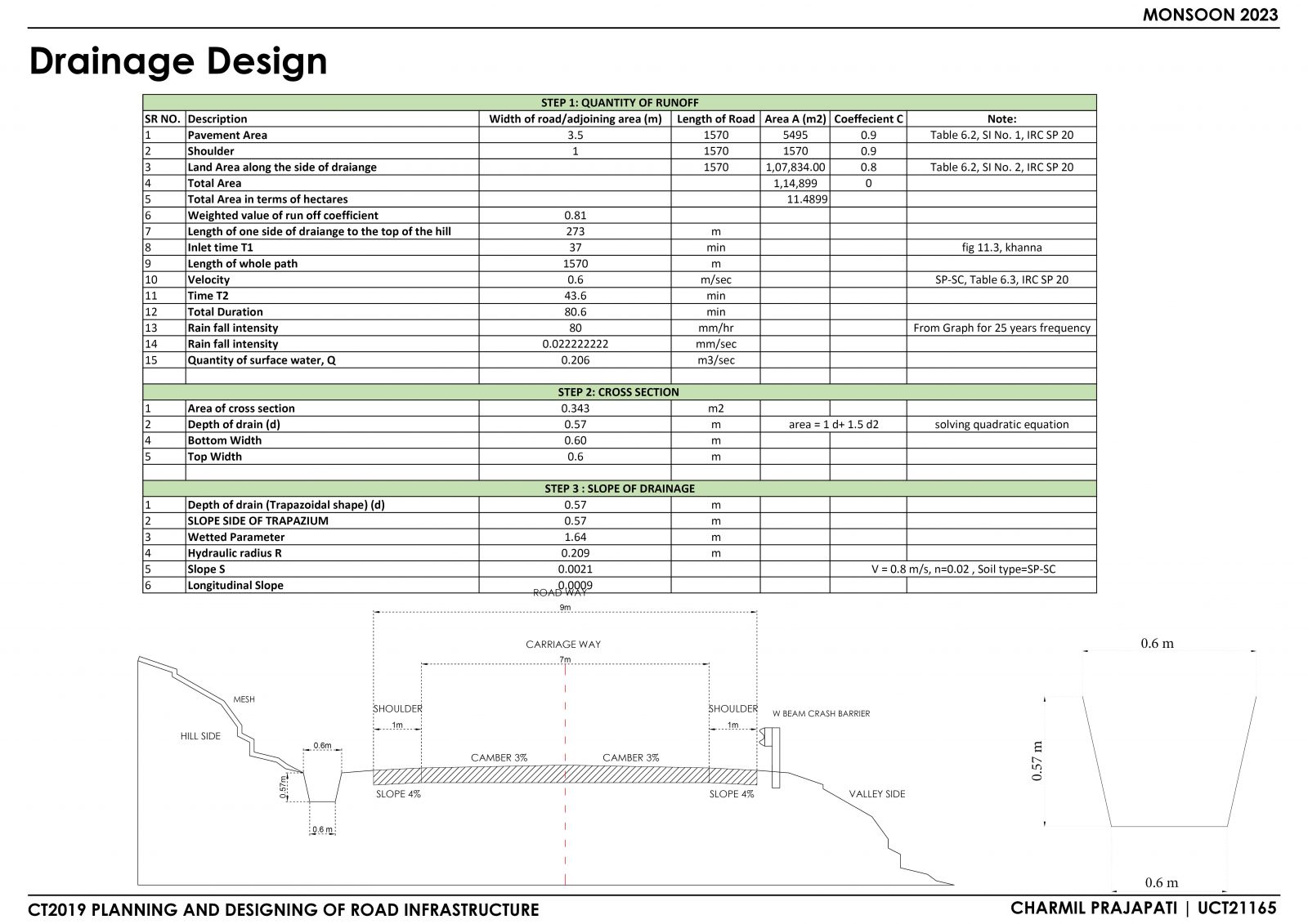
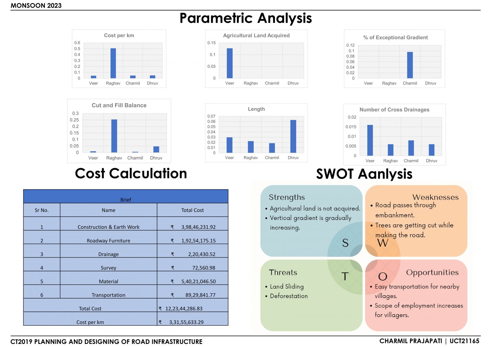
The challenging problem of creating and constructing a workable road alignment while accounting for the influences of the built and natural environments across a range of terrains was the focus of the studio project. An examination of maps and an evaluation of different IRC codes are included in the detailed study. A large number of surveys aimed at collecting and analyzing field data were conducted. The geometric design for both horizontal and vertical curves was created through a number of efforts. The pavement design for the route was also finished. For a thorough comparison, parametric analysis was used to assess alignments at a specific place. In order to provide a thorough approach, the project goes into the challenges and complexities of road alignment planning, taking into account numerous design elements as well as GIS technologies.
View Additional Work