Your browser is out-of-date!
For a richer surfing experience on our website, please update your browser. Update my browser now!
For a richer surfing experience on our website, please update your browser. Update my browser now!
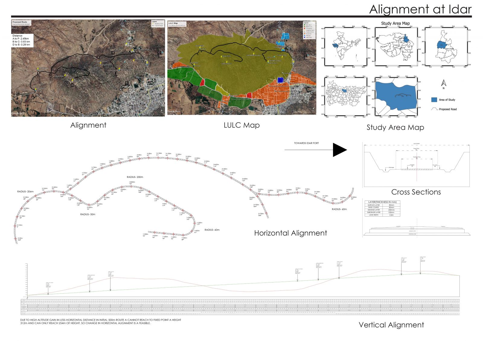
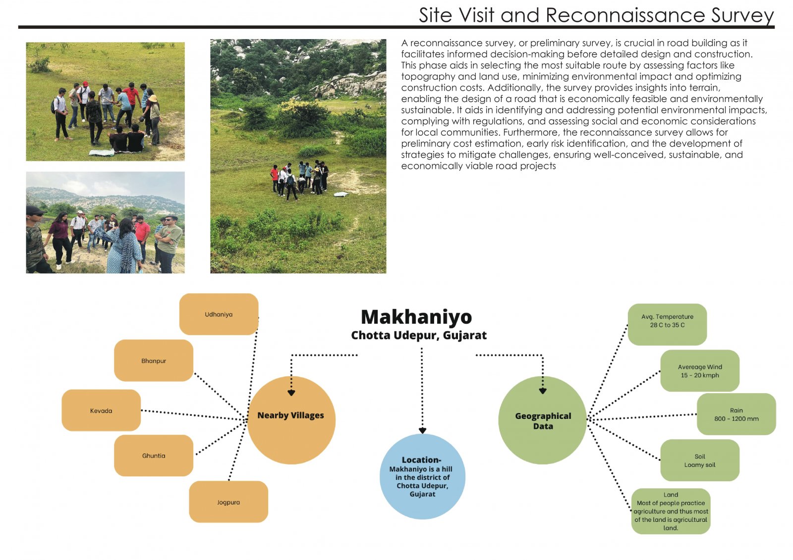
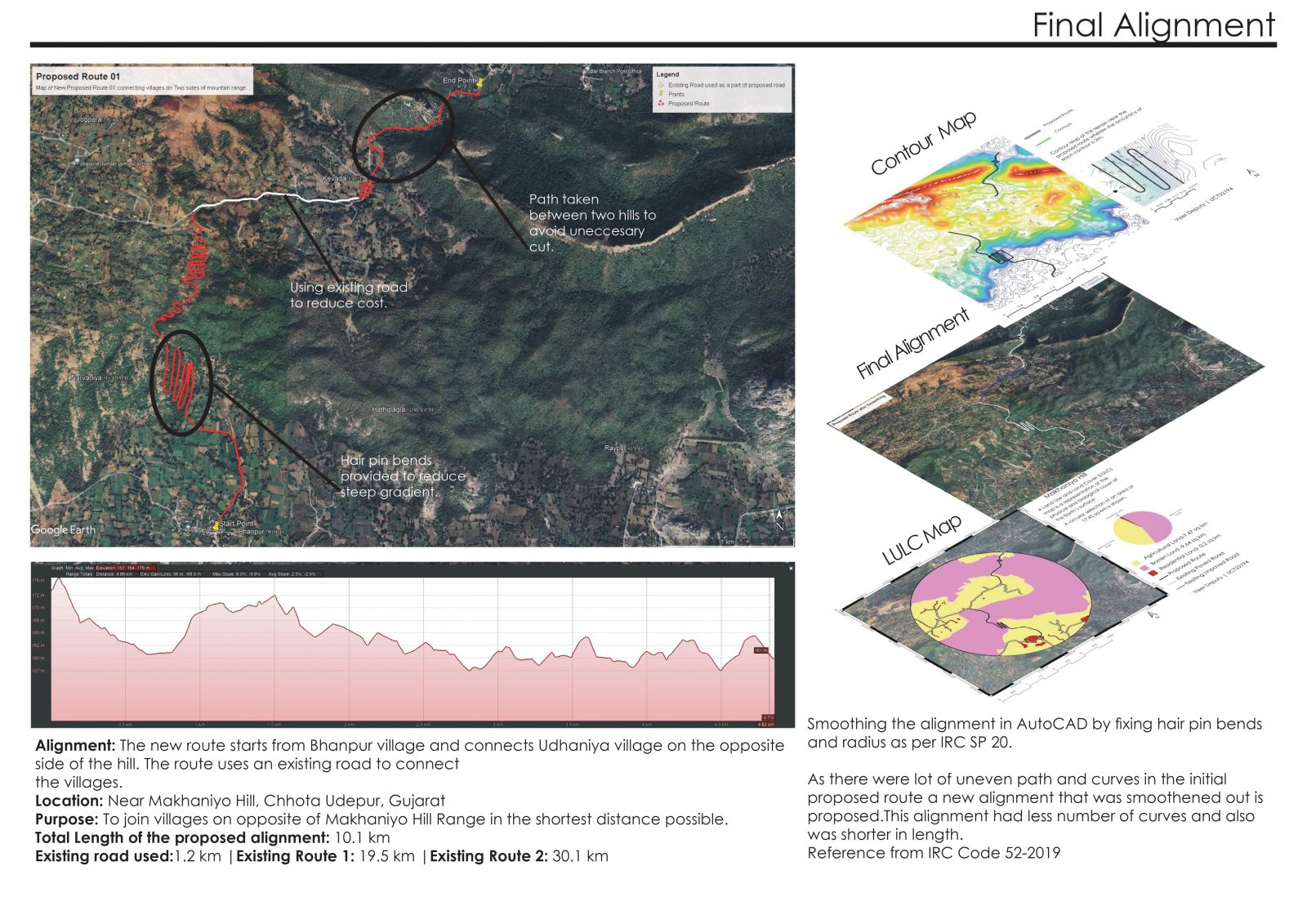
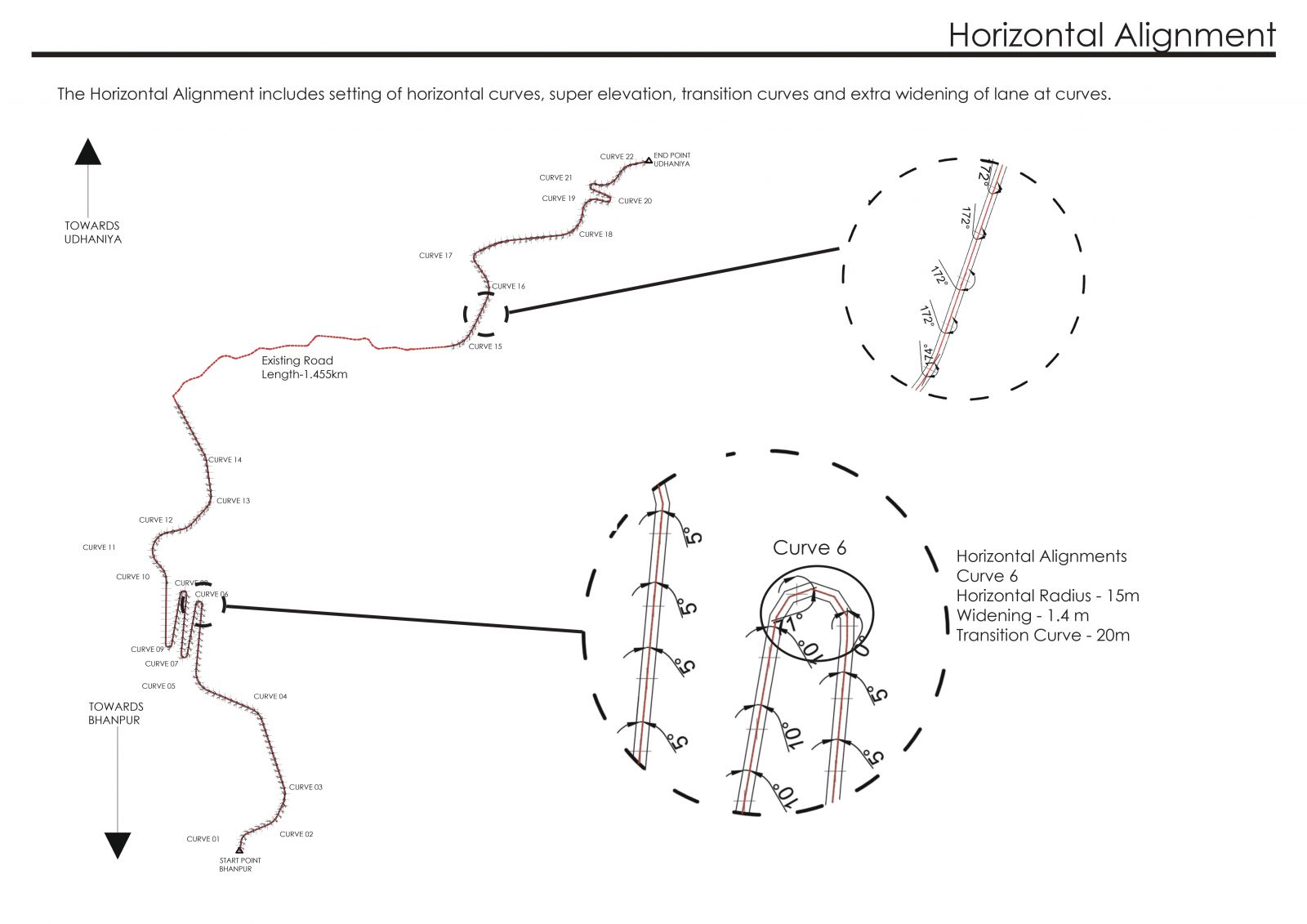
The studio has undertaken the challenge of strategically planning and designing an optimal road alignment within a hilly terrain, where both natural and built environments exert significant influences. The specific focus of this investigation lies in road alignment optimization within the Idar and Makhaniyo Hills. Initiating the process, the primary objective was to identify a suitable route, from which an initial alignment was devised. This preliminary alignment served as the foundation, undergoing subsequent modifications to enhance considerations such as comfort, safety, cost-effectiveness, material selection, and environmental impact. Ultimately, a meticulously refined road alignment was proposed, aligning with the guidelines outlined in IRC Codal provisions and meeting the specific requirements set by the client. The proposal integrates a comprehensive Total Cost and Safety Plan, ensuring that the final road alignment not only adheres to established standards but also caters to the unique demands of the project. For further details, please refer to the provided booklet
View Additional Work