Your browser is out-of-date!
For a richer surfing experience on our website, please update your browser. Update my browser now!
For a richer surfing experience on our website, please update your browser. Update my browser now!
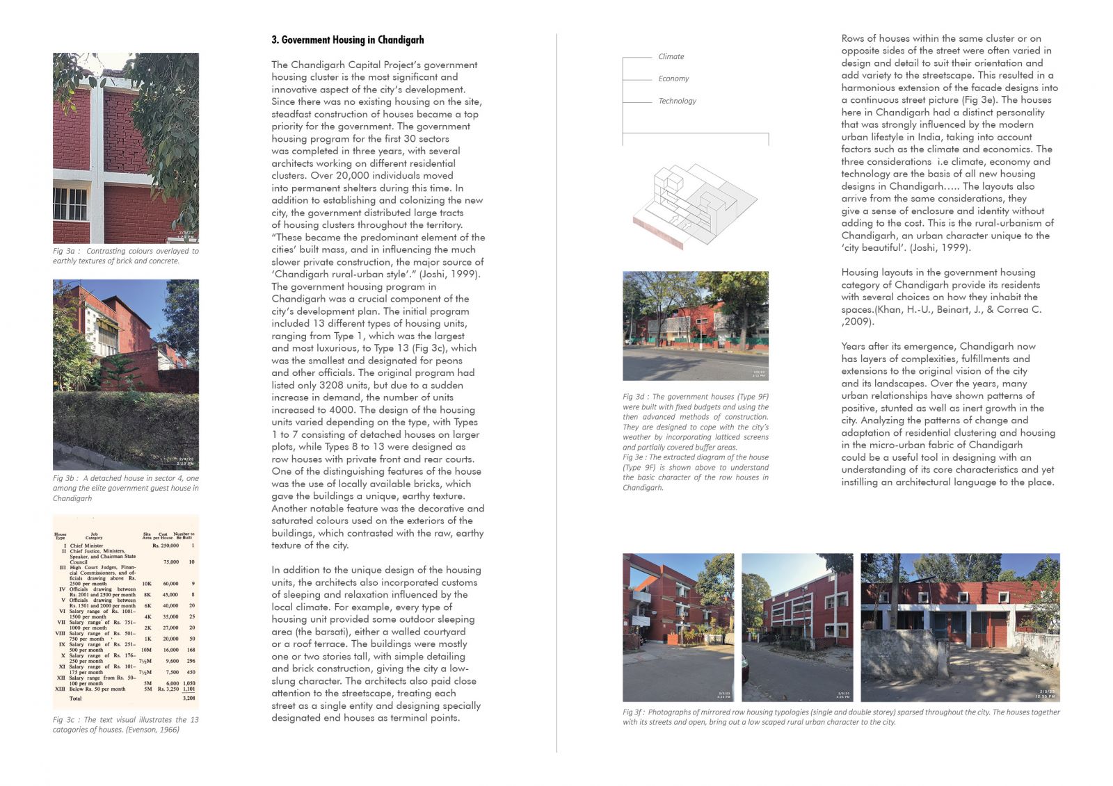
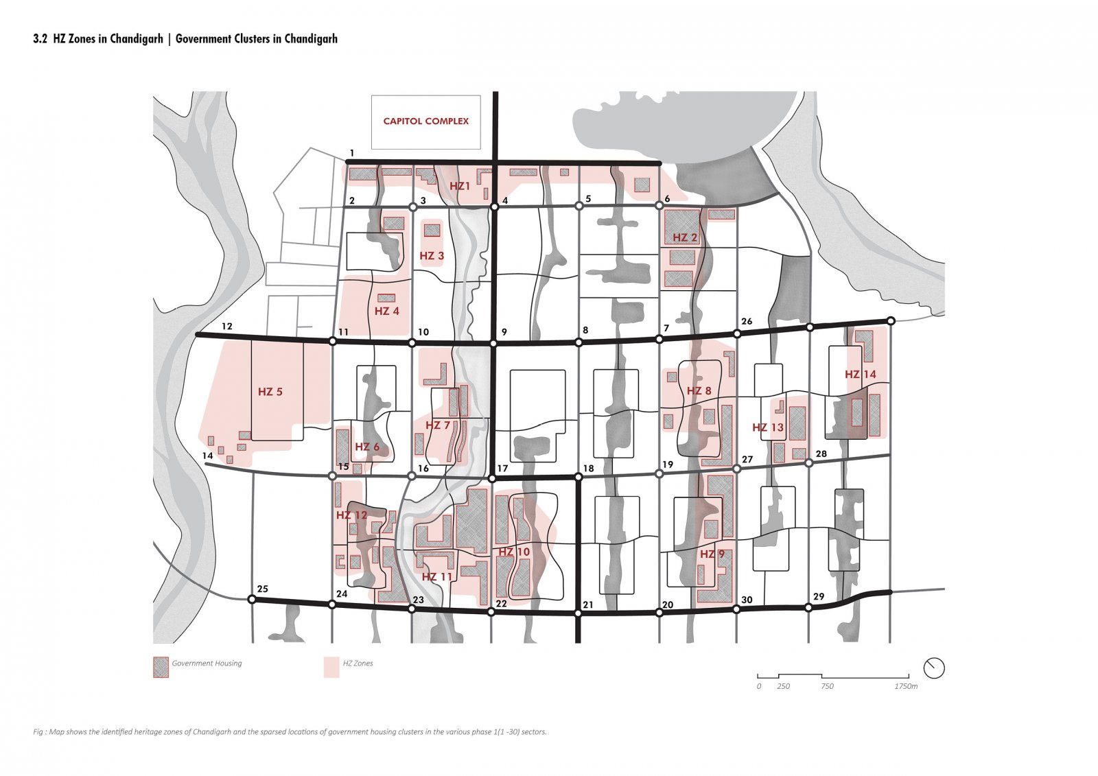
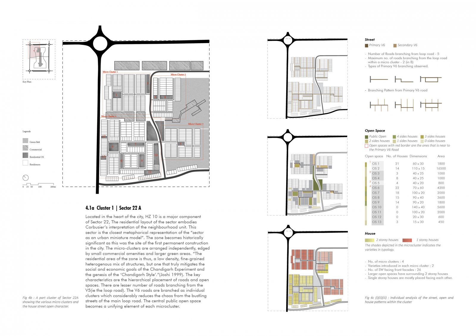
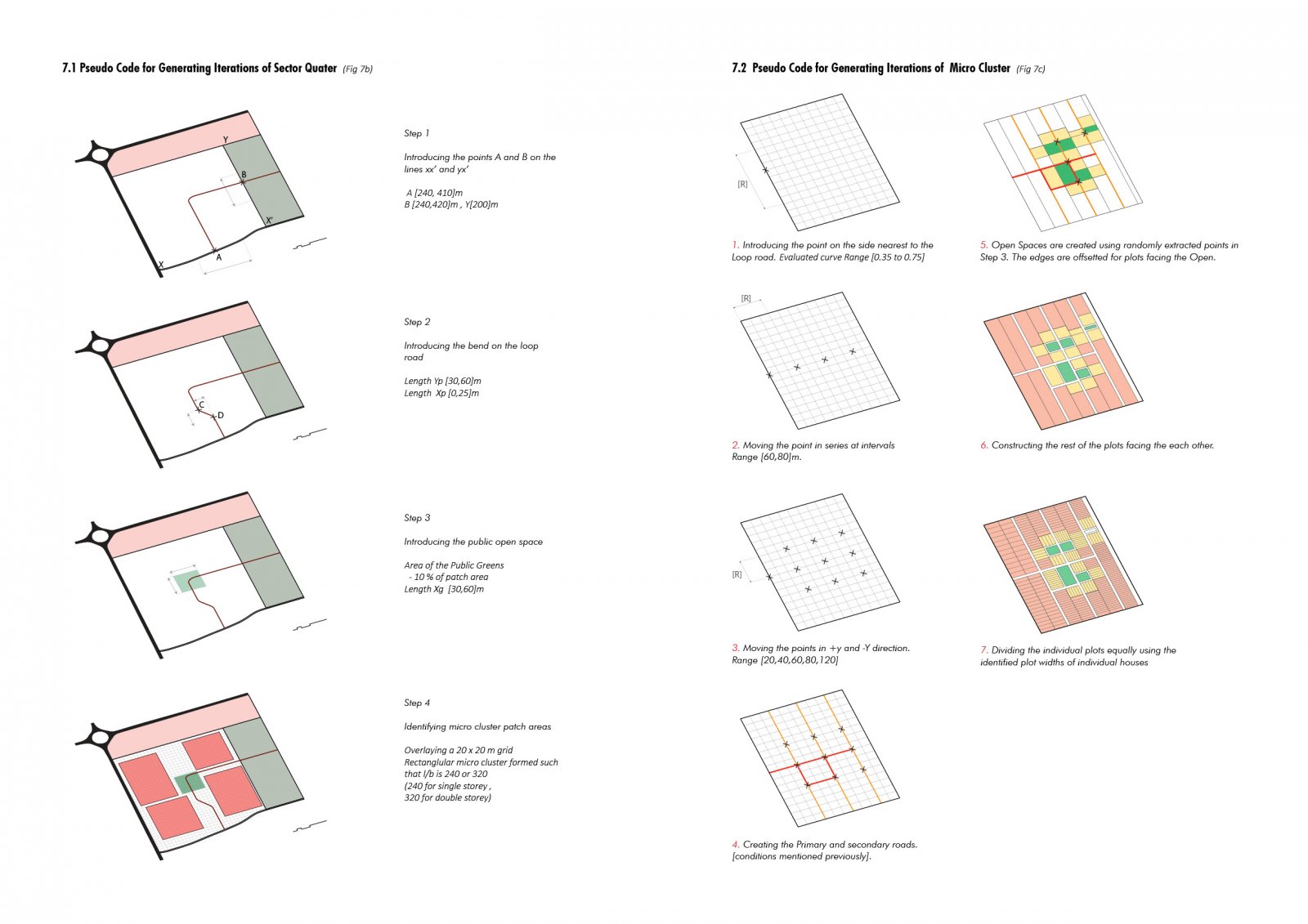
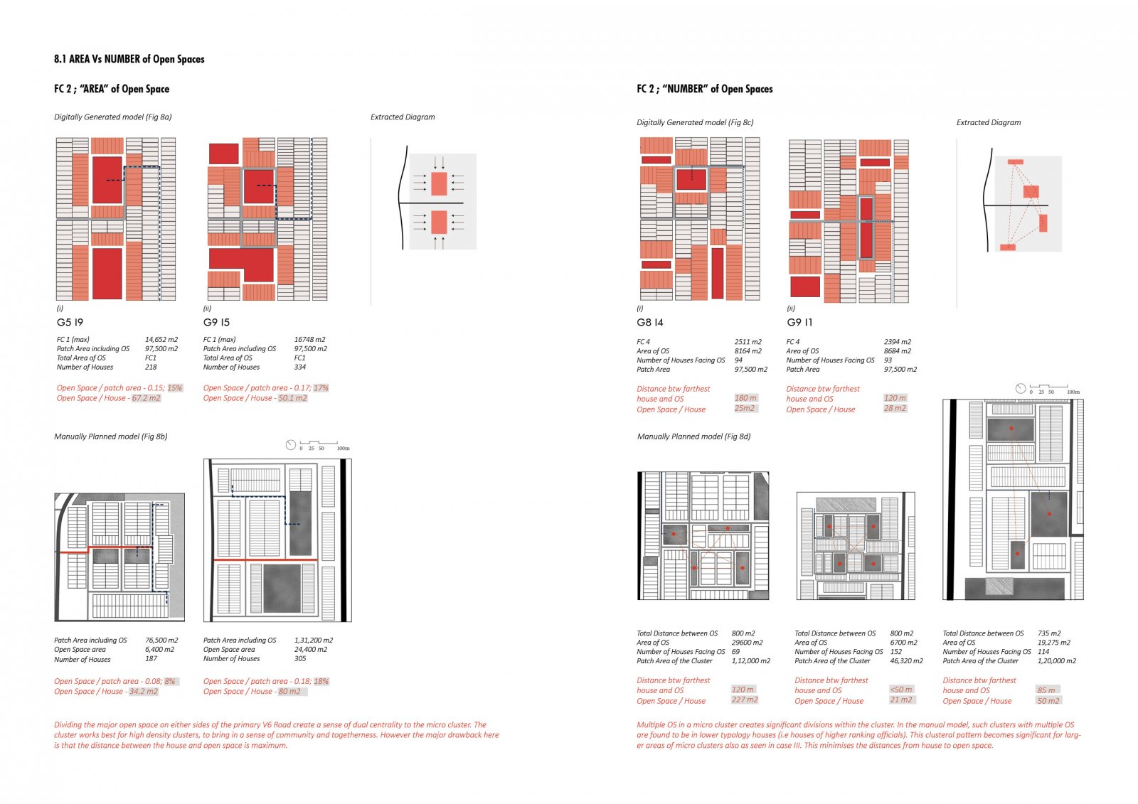
Cities are complex entities but meticulous to the basics - they constitute people and communities to interact with objects such as roads, buildings and public spaces across a broad range of settings and contexts. Over the years, technological advancements and various interfaces have helped to uncover information that was previously too laborious to quantify. These quantified data analysed under different parameters define the urban characteristics and patterns of growth of that place, its livability, its workability etc... Together with the citizen's inputs, it helps in determining relationships that coordinate with the needs of the people thus forming a more optimally utilised urban scape. The research attempts to understand this technological tool for ‘Optimisation’ and the ‘Urban Morphology’ in the selected cityscape. Le Corbusier envisioned Chandigarh as a self-sufficient unit in both its master plan and its sector scale. Across different sectors, one can find certain repetitive decisions made in terms of its built-open distribution, street scapes, building-use pattern, orientations of buildings, climate-responsive elements etc..; however, its specific configurations vary extensively. It is interesting to note that within each of the sectors, multiple iterations of residential clusters in housing typologies were designed, 13 typologies in the government housing, to be exact. The first 7 typologies are detached houses of ministers and higher-ranked officials and the rest (Type 8 to 13) are row housings for middle and lower-income families. Architects Jane Drew, Pierre Jeanneret and Maxwell Fry with their various housing designs(specifically government housing typologies) provided its residents numerous choices in the way in which one could inhabit the space and yet instil an architectural language to the place. Years after its emergence, Chandigarh now has layers of complexities, fulfillments and extensions to the original vision of the city and its landscapes. Over the years, many urban relationships have shown patterns of positive, stunted as well as inert growth in the city. The study focuses on analysing the house-street-open character in a residential cluster scale of Chandigarh to identify a ‘grammar’ that could lead to defining the rural-urban residential characteristics of the city. The resultant positives, negatives and constants are conjectured and quantified and further taken forward as input parameters to optimise a cluster using an evolutionary computational generative model. The research is not primarily on creating the ideal generative model but on how it can be extended to better define some urban relationships such as climatic considerations, concerted social living, the coexistence of built and the open, its utility etc.