Your browser is out-of-date!
For a richer surfing experience on our website, please update your browser. Update my browser now!
For a richer surfing experience on our website, please update your browser. Update my browser now!
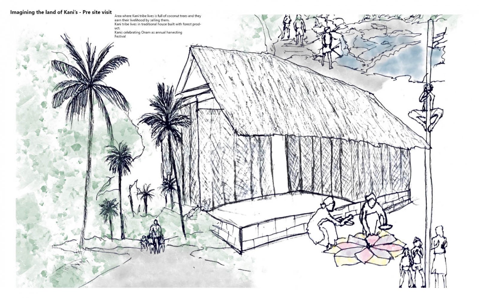
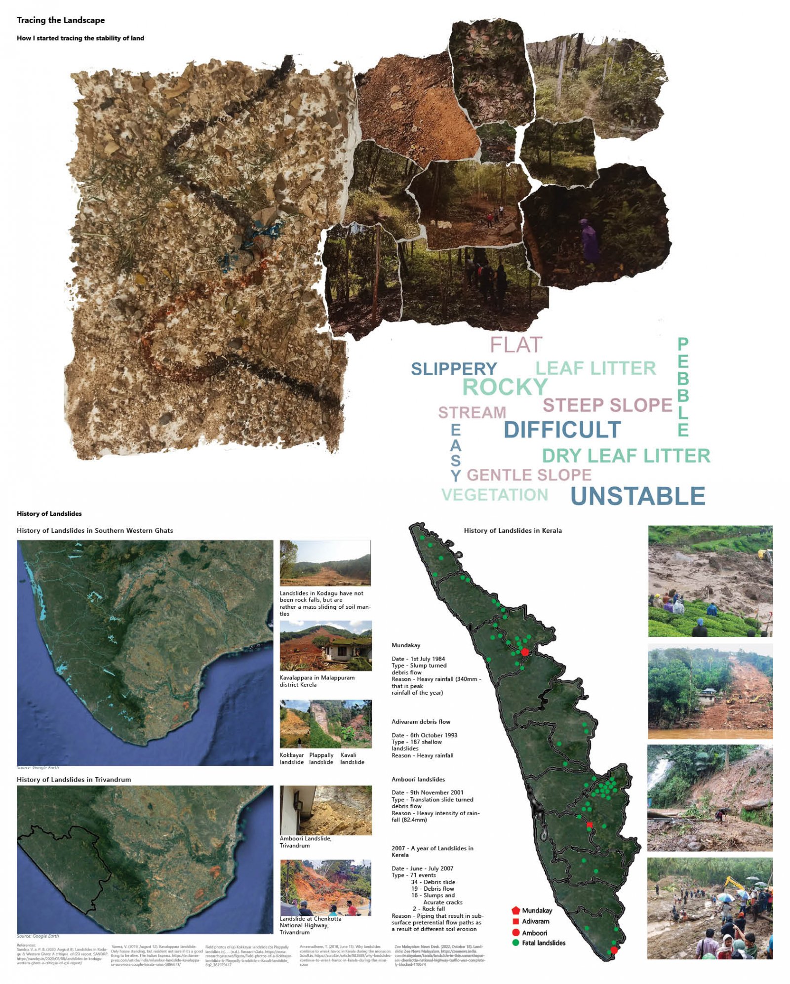
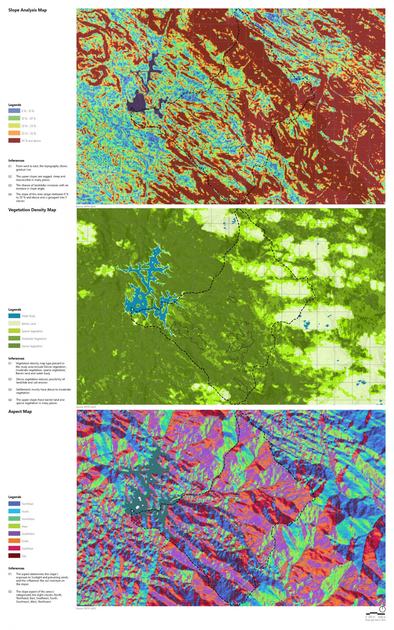
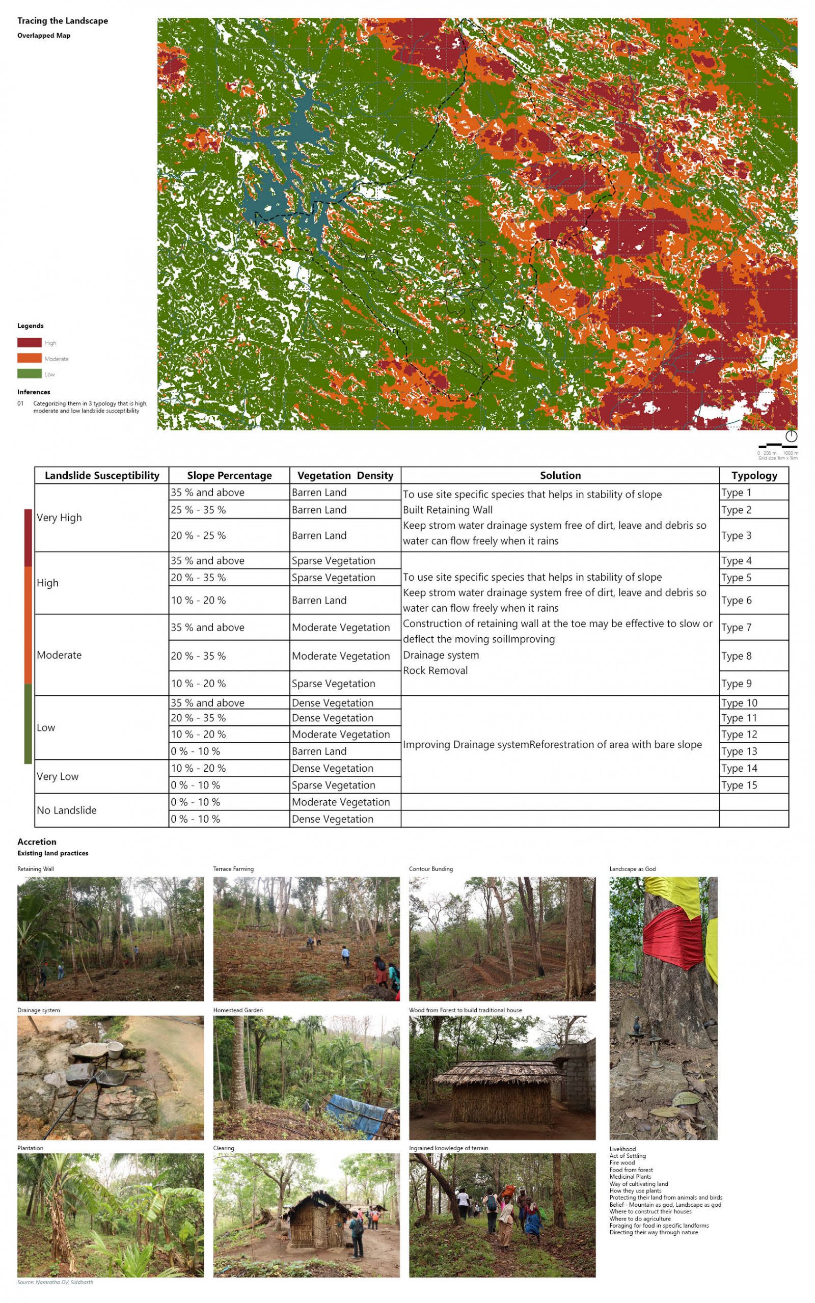
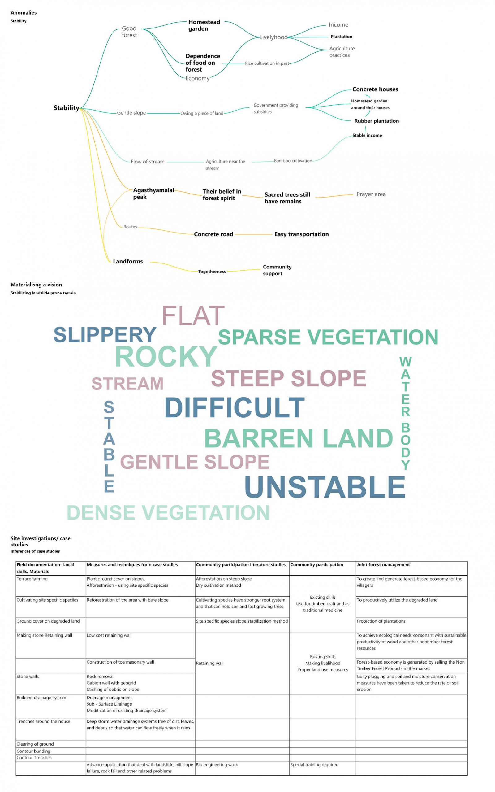
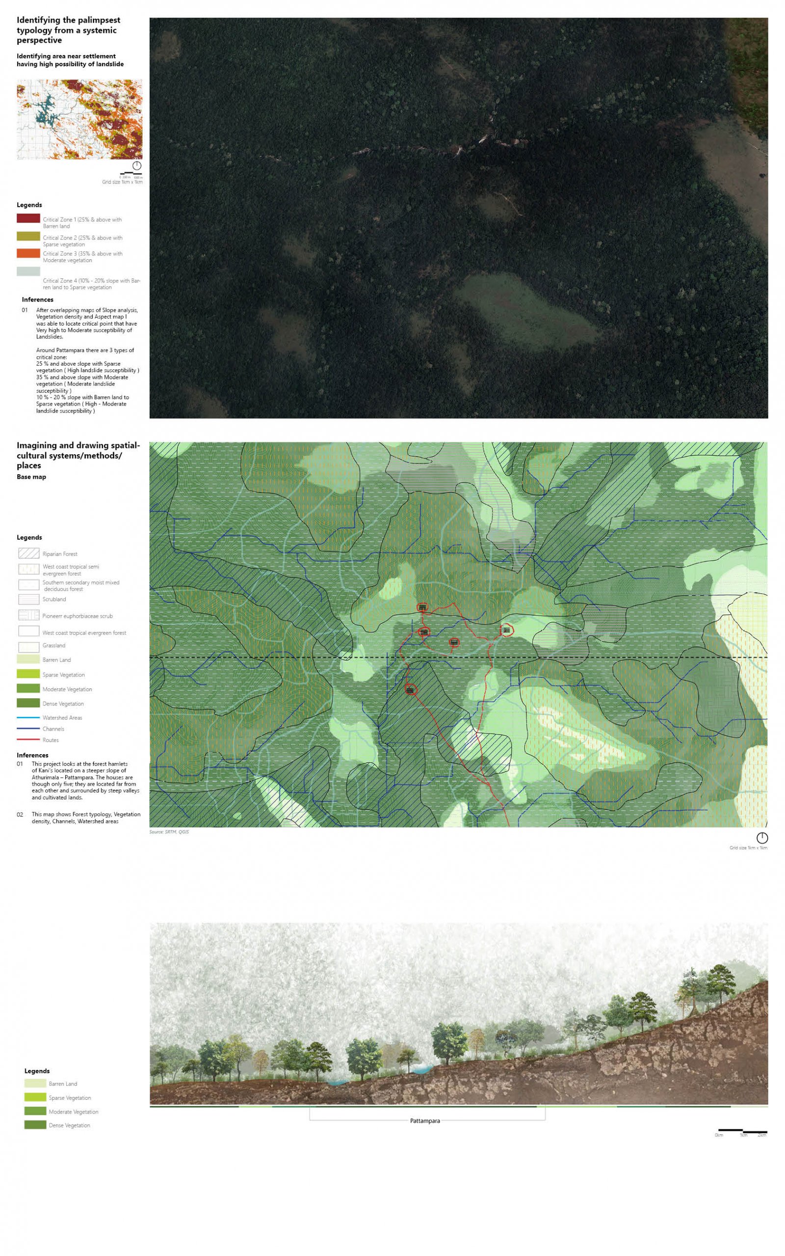
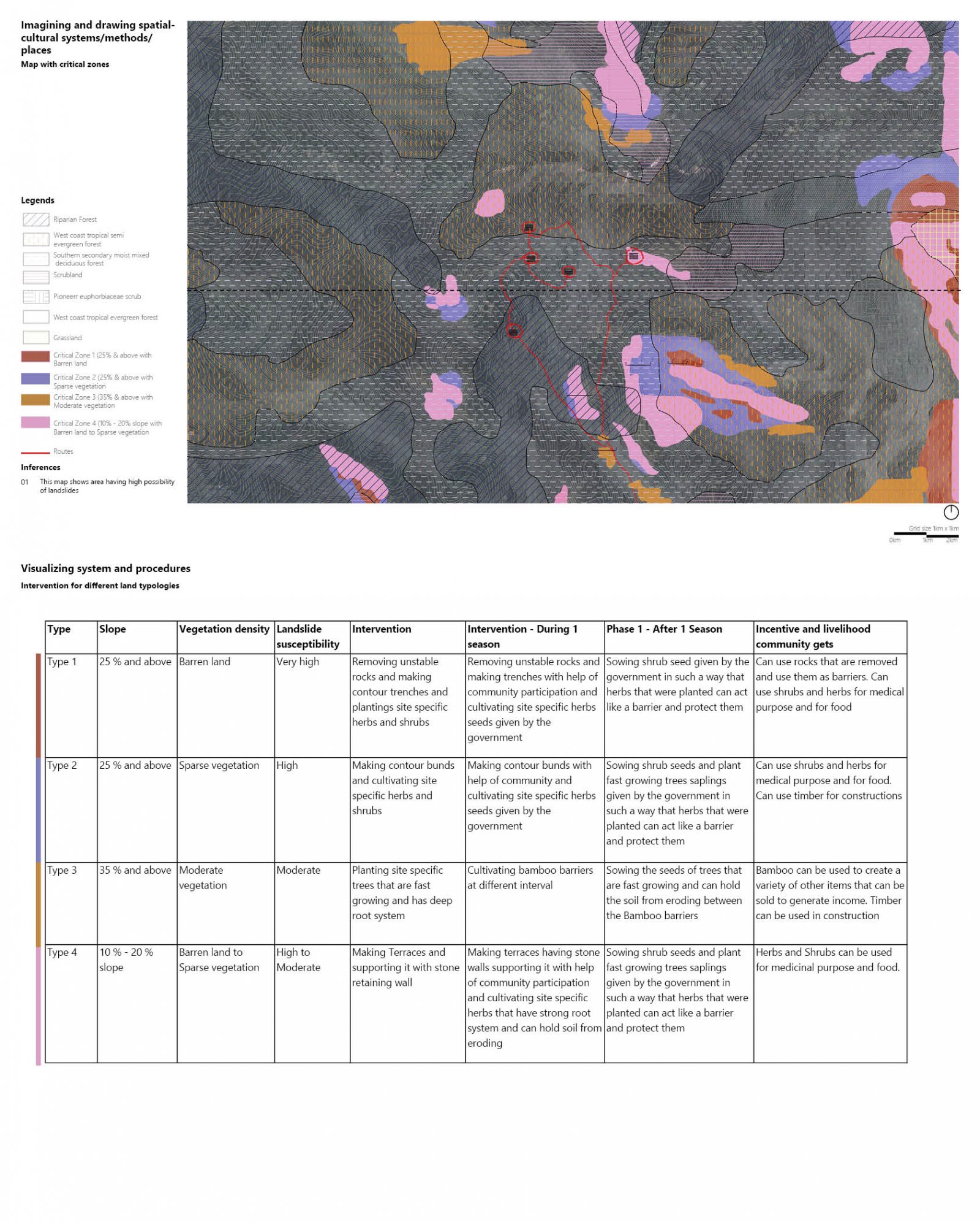
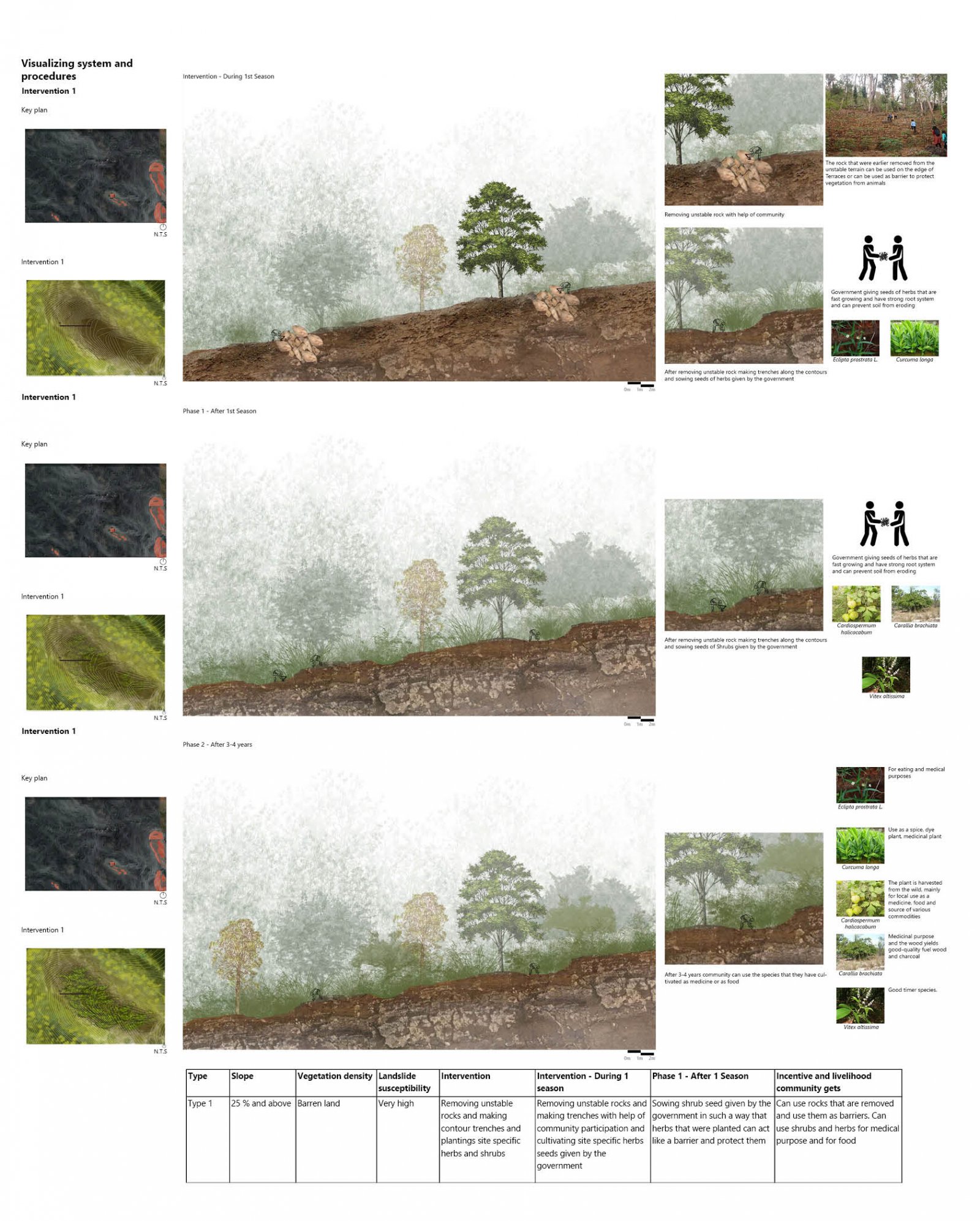
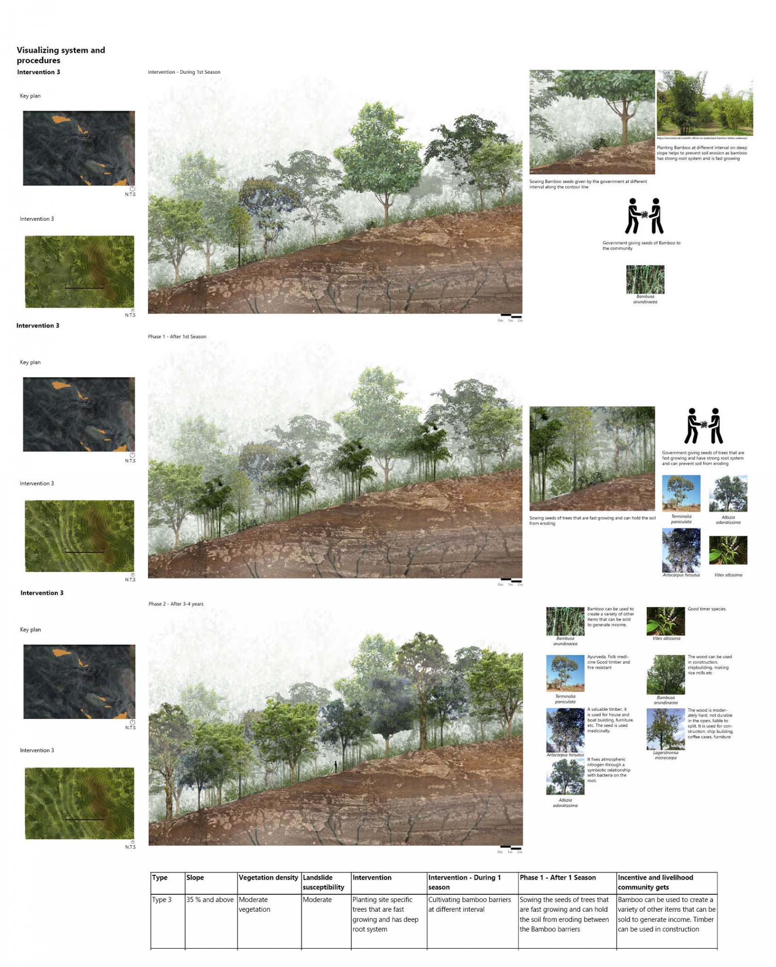
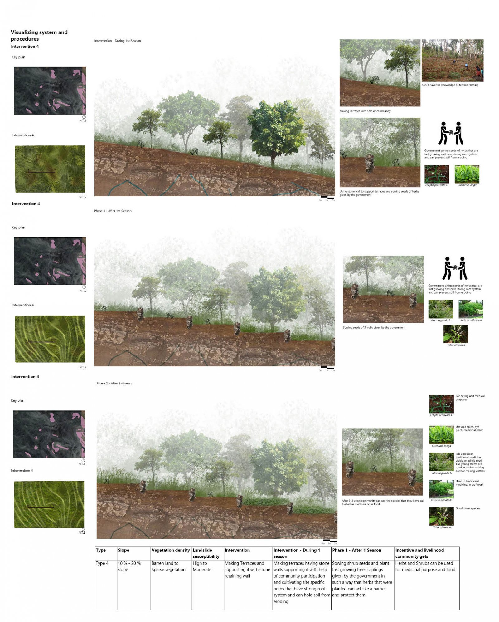
The project derives its motif ‘Stability‘ from my experience of walking through the difficult terrain of Pattampara during our site visit. It made me think of the key attribute of such a terrain – steep, difficult to navigate, or access more over extremely ‘slippery’ during rains. The proposal then looks at a crucial problem that is frequent in such steep, difficult, and arduous terrain that encounters heavy rains and landslides. It looked at the idea of stability, particularly in relation to the ground. This is exaggerated due to anthropogenic factors that are causes of the degradation of forests. Landslide is a common phenomenon in the Western Ghats and is caused by trained forces of topography, rains, and winds. It has been aggravated due to climate change and degradation of vegetation characteristics and becomes a disaster when it coincides with human life. This project looks at the forest hamlets of Kani’s located on a steeper slope of Athurimala – Pattampara. The houses are though only five; they are located far from each other and surrounded by steep valleys and cultivated lands. They are difficult to access and conduct rescue operations as well makes it more critical. The study uses an approach to landscape management. Using composite layers analysis, it identifies key regions that are prone to landslides. It simultaneously attempts to discover Kani's association with land and landforms. The next step considers the present way of community participation in the land- forest-management techniques to lower the risk of landslides and manage soil erosion. There, vulnerable locations identified will be brought under a community conservation scheme of forest regeneration.
View Additional Work