Your browser is out-of-date!
For a richer surfing experience on our website, please update your browser. Update my browser now!
For a richer surfing experience on our website, please update your browser. Update my browser now!
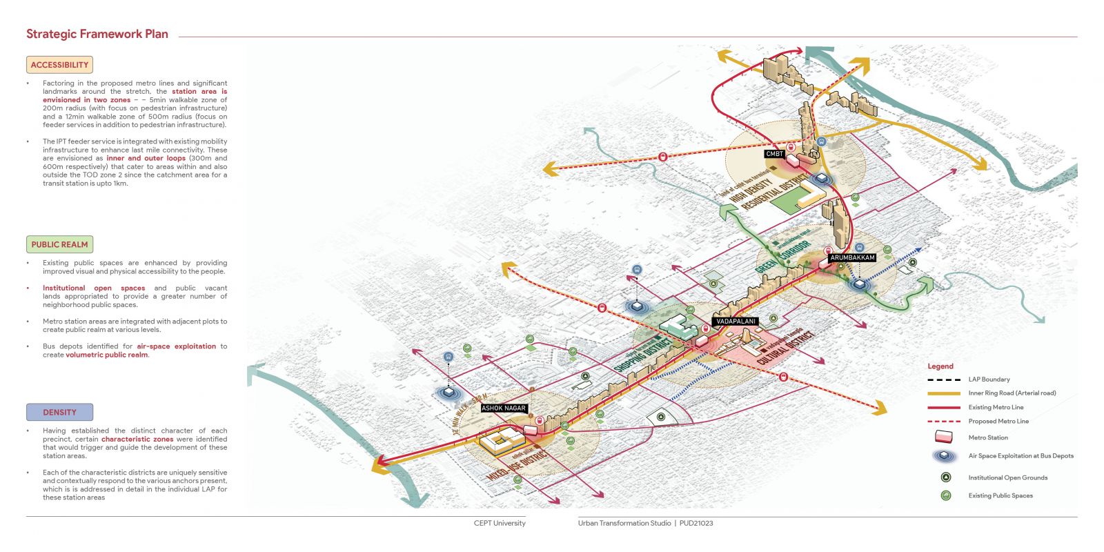
This studio will focus on the design aspects of urban transformations within the existing urban areas. The underlying context is that Indian cities are growing rapidly in terms of population and therefore expanding physically. Increasing urban population and the growing urban incomes will fuel demand for more and more built-floor space in cities accompanied by a demand for infrastructure. Many urban areas within these cities are dealing with unstainable levels of stress on infrastructure, resources and public services and are becoming increasingly unliveable. As an attempt to address these concerns, the Ministry of Housing and Urban Affairs (MoUHA) has initiated various schemes such as AMRUT (Atal Mission for Rejuvenation and Urban Transformation), SMART CITIES MISSION and HRIDAY (Heritage City Development and Augmentation). These schemes enable planning for developing infrastructure in the brownfield areas through mechanisms such as Local Area Plans (LAP) and Town Planning schemes (TPS). These typically include those parts of the city that are already developed but are not able to sustain the pressure on existing infrastructure and seek redevelopment. For this unit, 2 sites in Chennai are selected, one is the TOD stretch on GST road from CMBT to Ashok Nagar, covering 4 Metro stations and the stretch between them; second site is the redevelopment project of George Town which is already envisaged by Chennai Metropolitan Development Authority (CMDA). Students will work on the projects that are emerging out of these initiatives defined by their studio tutors. Through their design projects, students will explore the methods of integration of the physical design with the regulatory frameworks like LAP in creating liveable, functional, memorable, safe and sustainable urban areas.
View Additional Work