Your browser is out-of-date!
For a richer surfing experience on our website, please update your browser. Update my browser now!
For a richer surfing experience on our website, please update your browser. Update my browser now!
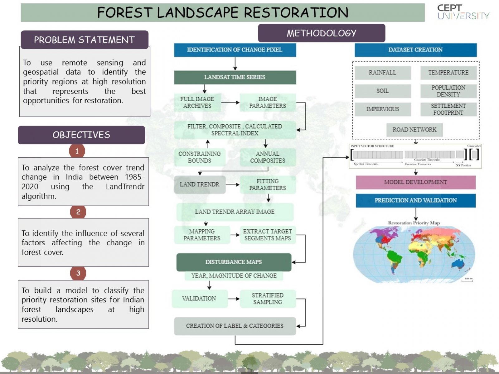
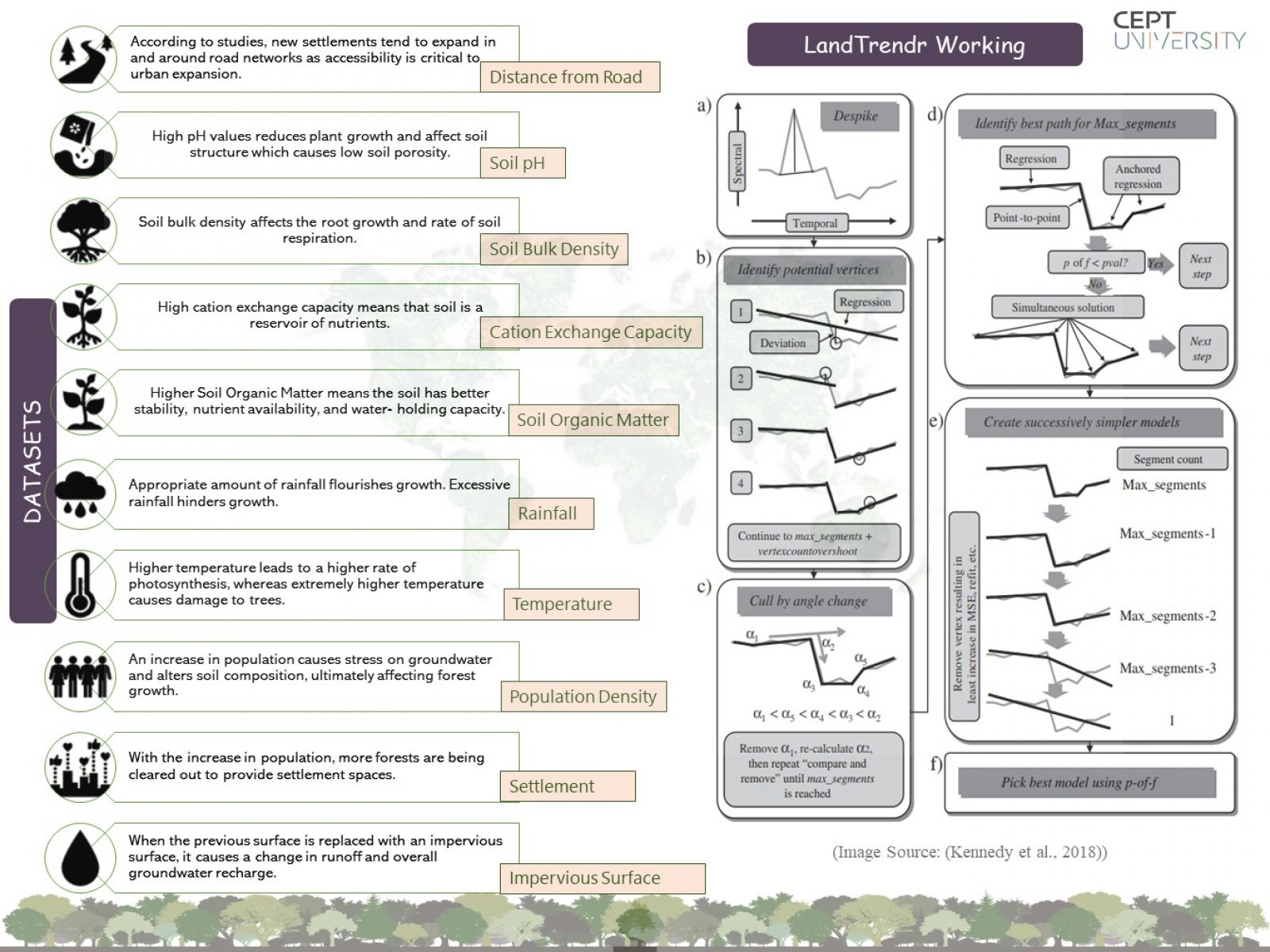
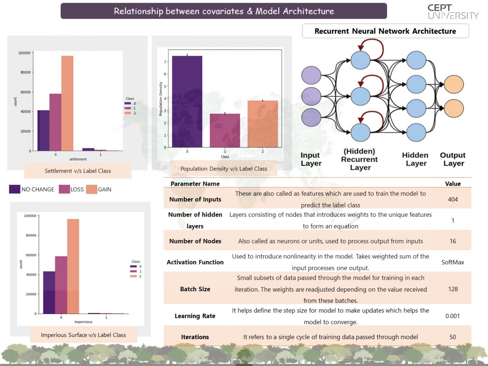
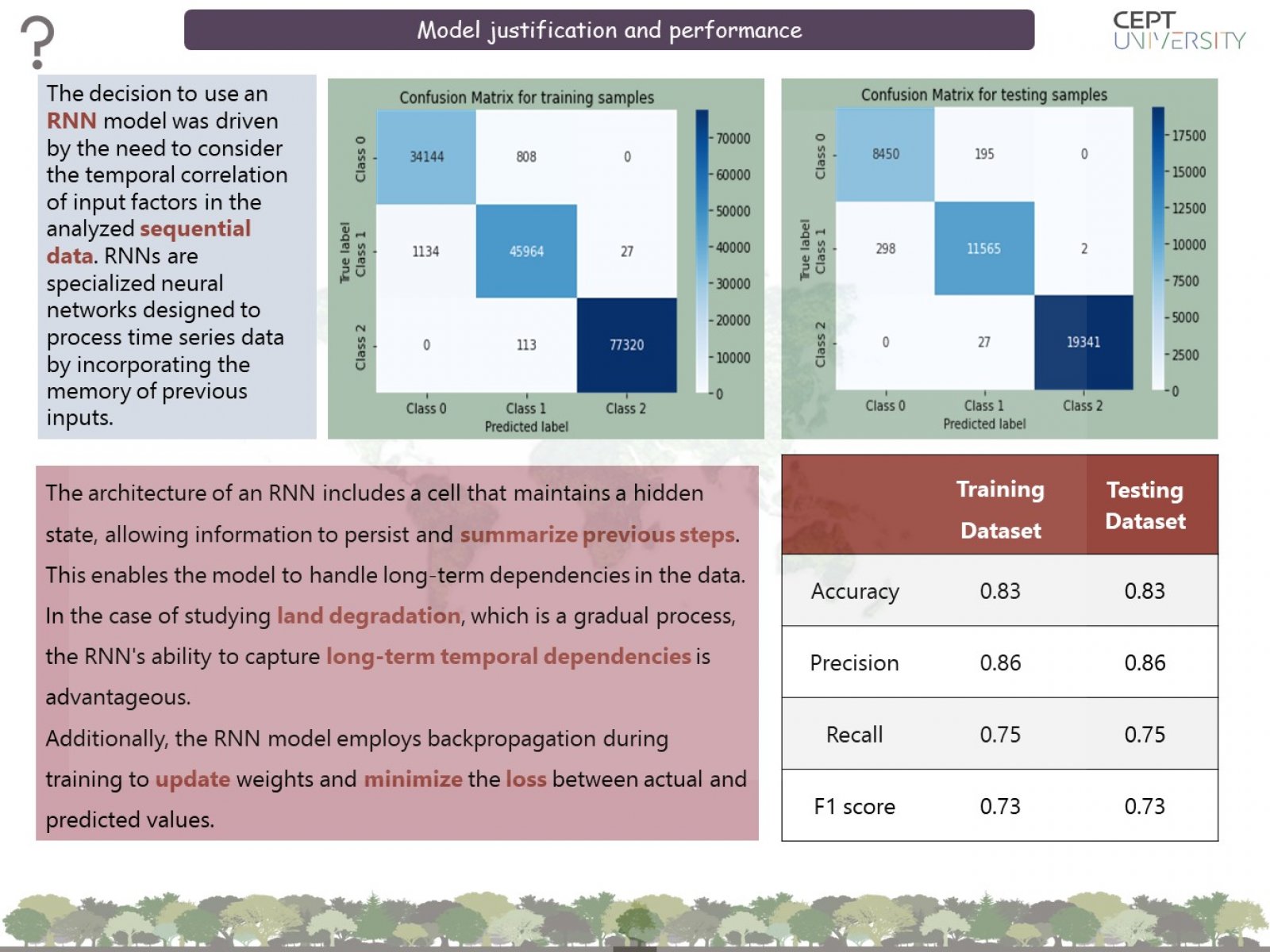
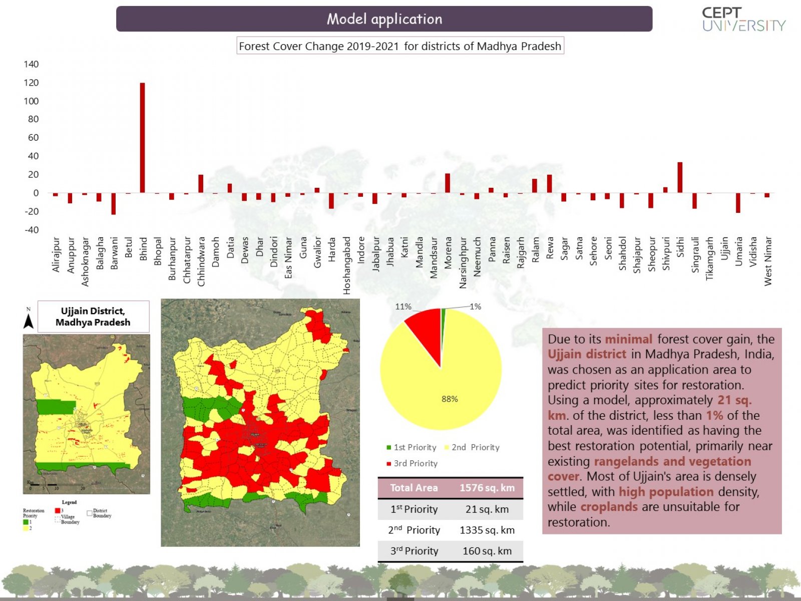
This project aims to identify areas with the best opportunities for forest restoration using remote sensing and geospatial data. To identify potential restoration opportunities, the LandTrendr algorithm and satellite data analyze forest disturbance, recovery, and areas with no change. Multiple factors contribute to forest thinning, including climate, soil properties, and human intervention. A simple recurrent network model is developed to predict whether degraded forest pixels have restoration potential, achieving a classification accuracy of approximately 83%. The model is applied to the Ujjain district to identify regions with restoration potential. The study assesses the restoration potential of pixels that have experienced forest loss in the past 20 years.