Your browser is out-of-date!
For a richer surfing experience on our website, please update your browser. Update my browser now!
For a richer surfing experience on our website, please update your browser. Update my browser now!
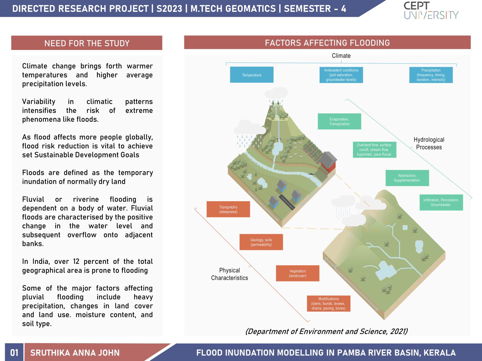
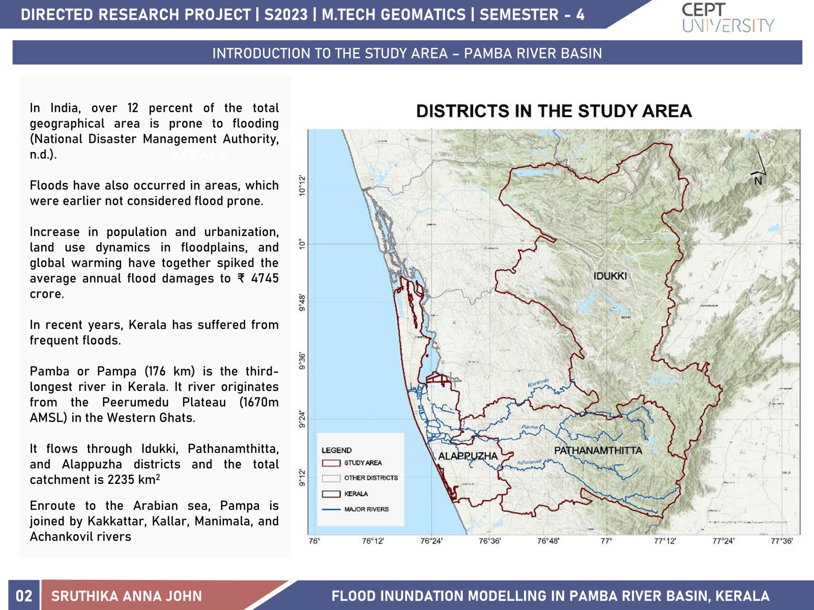
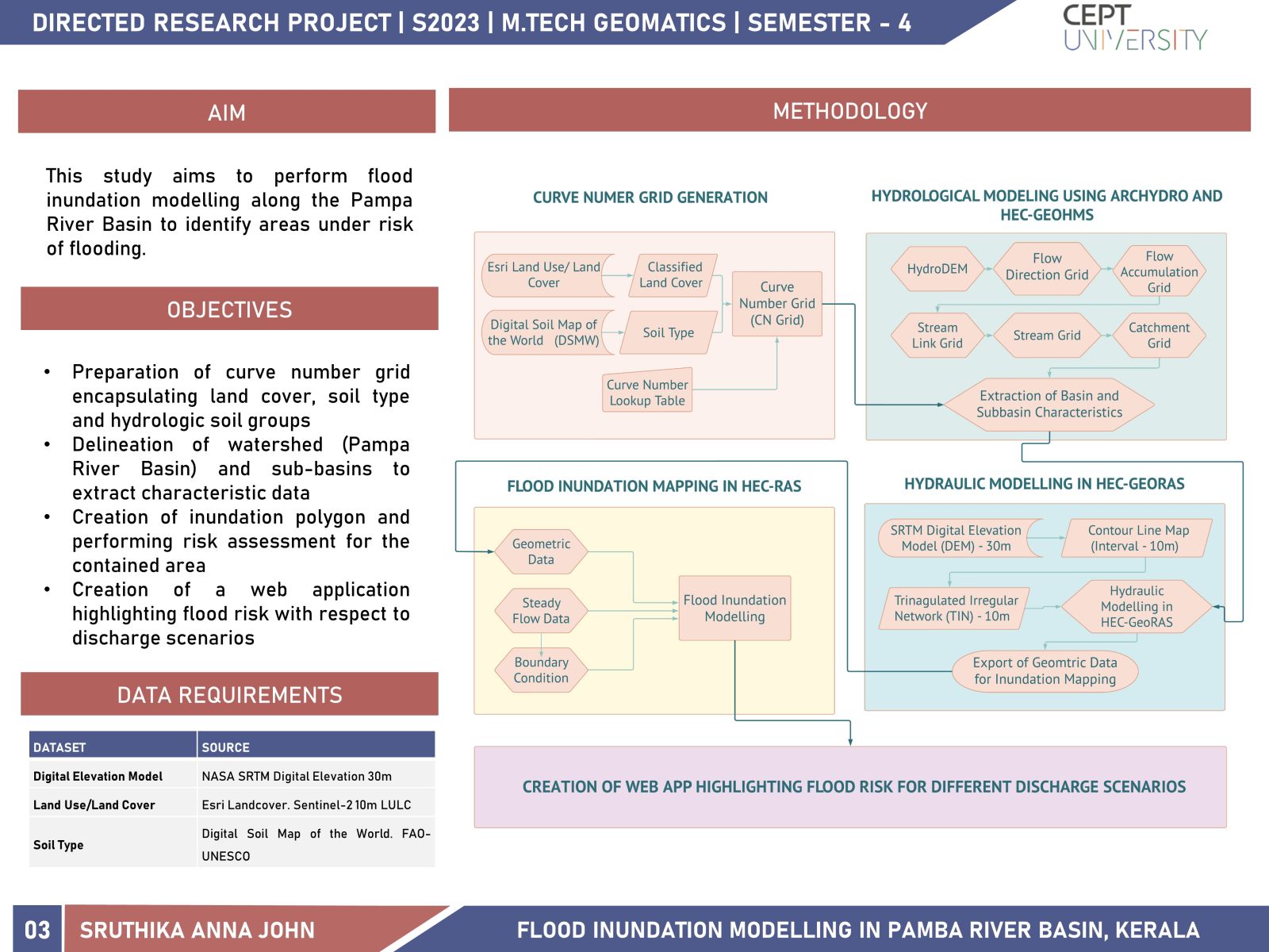
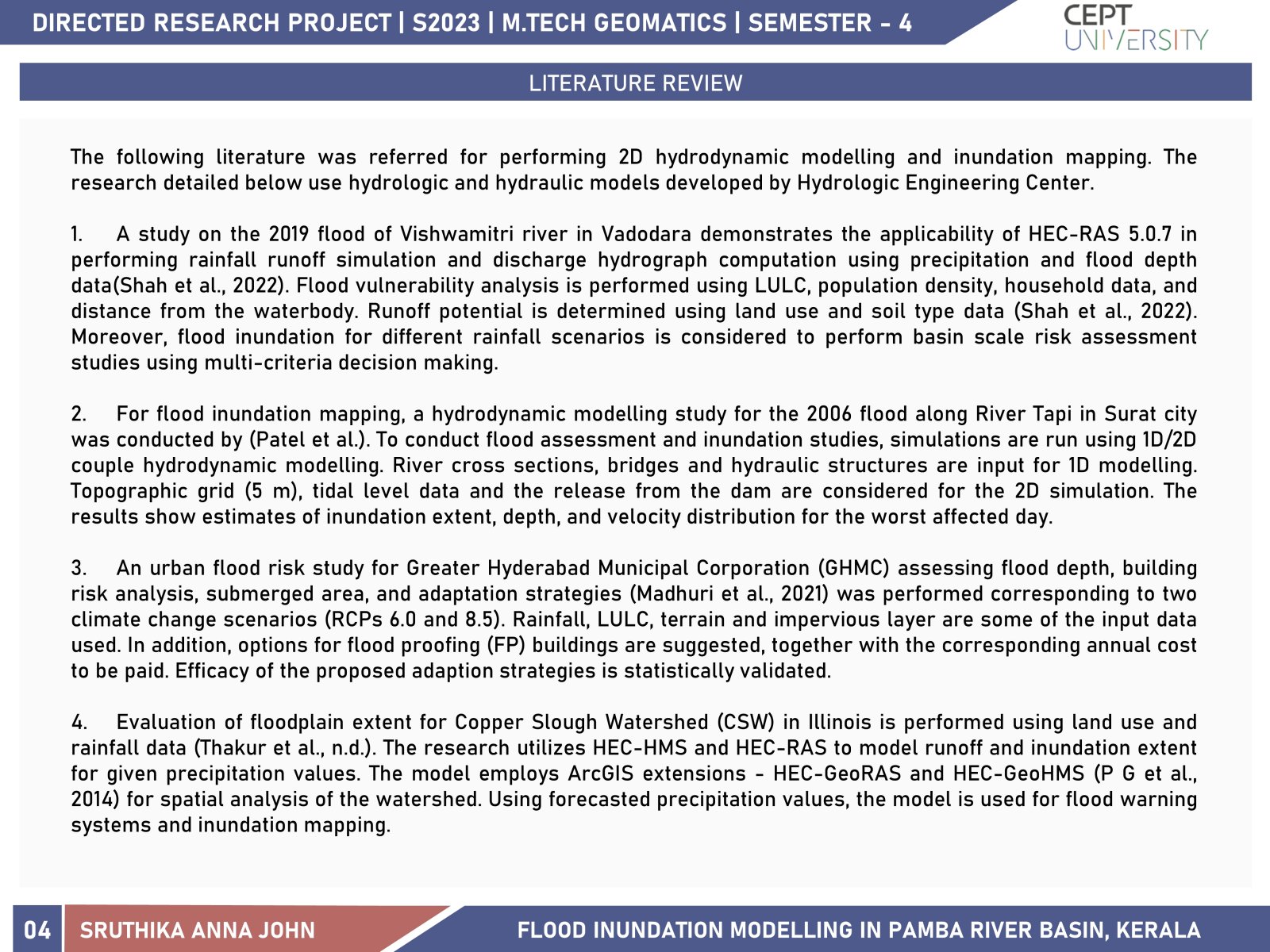
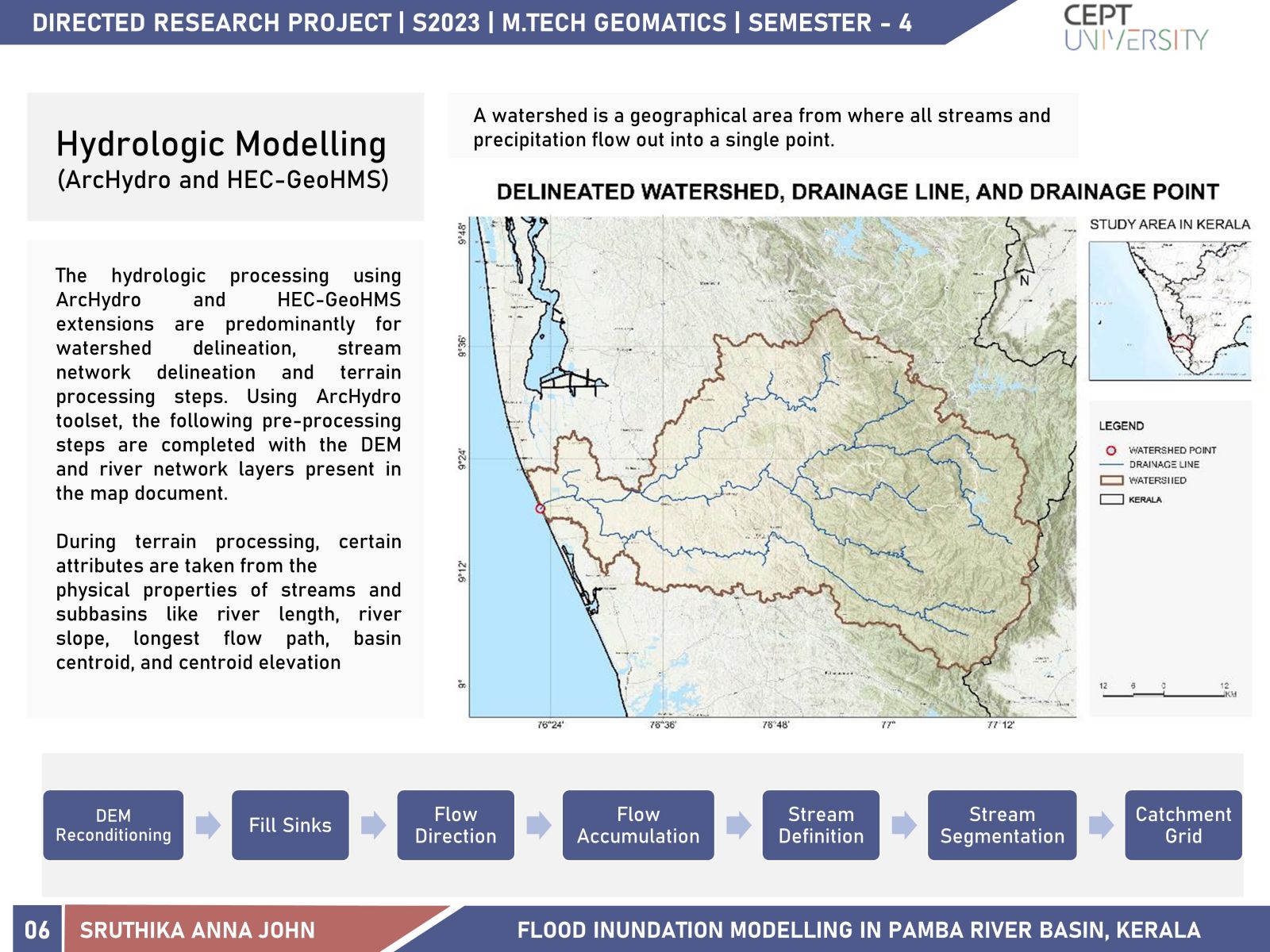
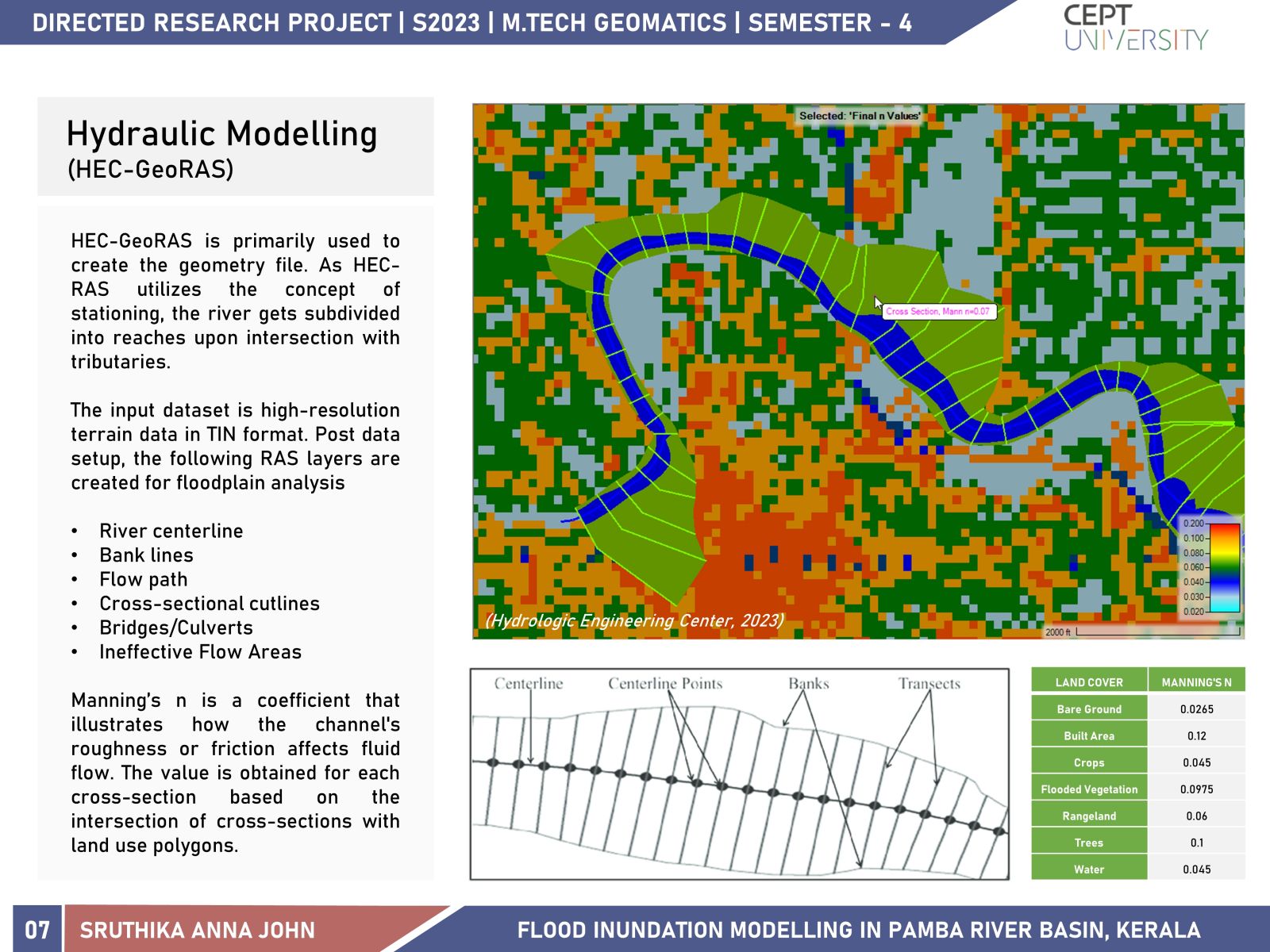
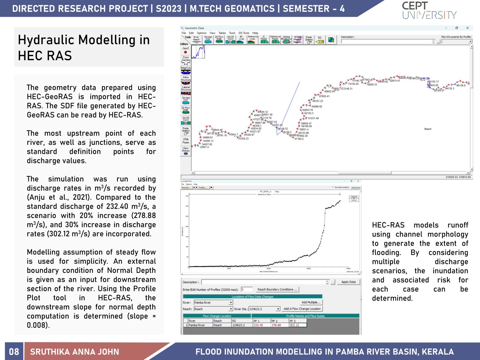
Climate change and land use dynamics have created an imbalance in the hydrometeorological cycle, increasing abnormal precipitation and extreme events like flooding. This study uses HEC-RAS model, along with ArcGIS extensions HEC-GeoRAS, HEC GeoHMS, and ArcHydro tools to estimate the inundation in the Pamba River Basin, Kerala. The simulation results for various discharge scenarios are visualized through a web application, enabling a better understanding of the impact of the hazard on the Pamba River Basin.
View Additional Work