Navya Garg

UM4003-3

Pol Housing

he Urban Management Foundation Studio (Monsoon Semester 2024) focuses on assessing POL housing in Ahmedabad through a Facility Management Framework. Covering 134 households and multiple graded heritage structures, the project explores critical issues like accessibility and parking. The narrow streets of the pols, originally not designed for vehicular traffic, now face significant congestion due to increased vehicle usage, underscoring the need for effective study and management. The project seeks to preserve the cultural heritage of the pols while introducing modernized facilities to enhance livability. By addressing infrastructure challenges, fostering community cohesion, and promoting sustainable practices, it aims to balance tradition with progress in this UNESCO Heritage-listed area.
Report Content

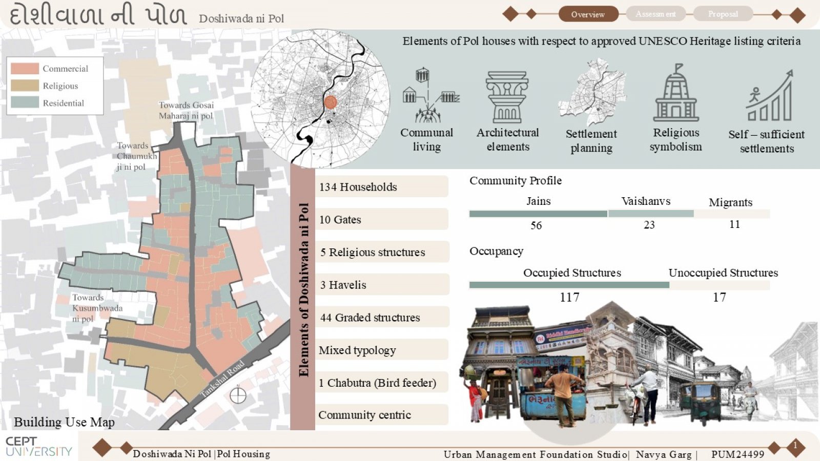
Overview of Doshiwada Ni Pol: Exploring the unique elements of Doshiwada Ni Pol, a heritage-rich community with 134 households, 44 graded structures, and a blend of culture, architecture, and communal living.

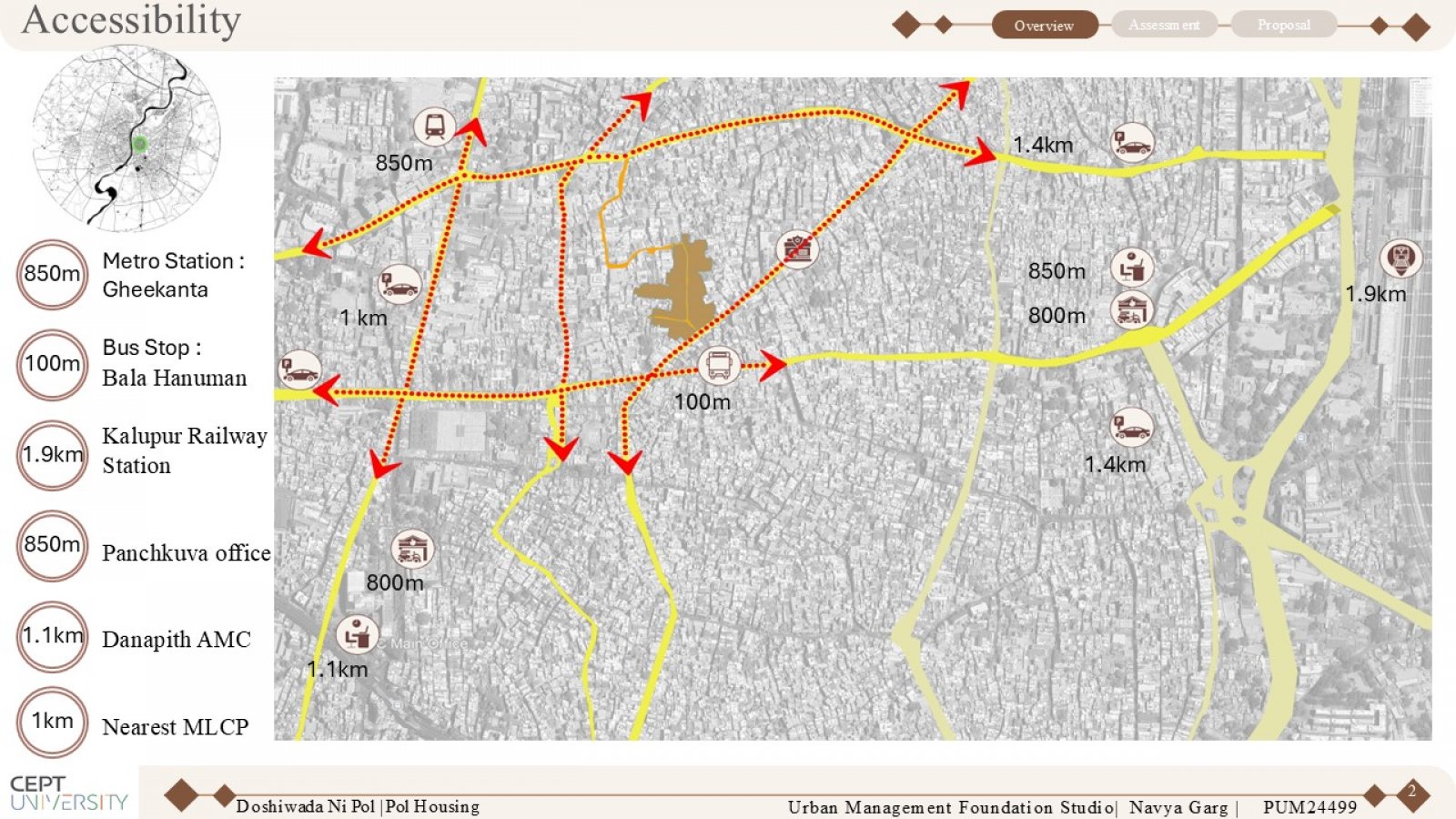
Connectivity Mapping: Showcases the linkages between Doshiwada ni Pol and essential amenities, emphasizing access points, routes, and its reliance on nearby facilities.

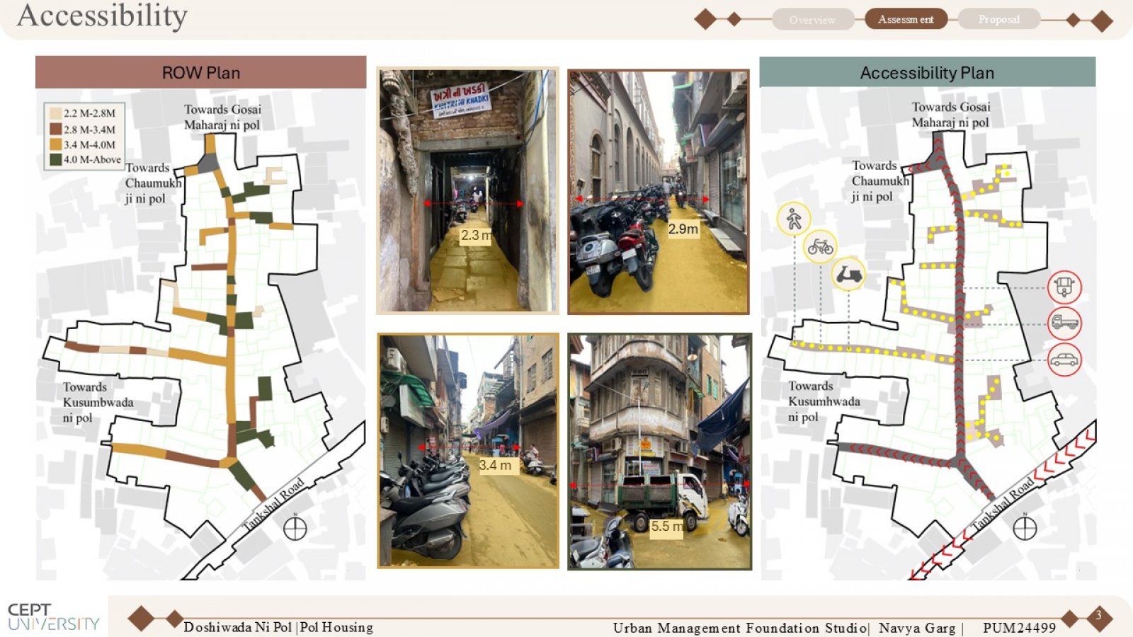
Row Mapping: Depicts the spatial organization and alignment of streets within Doshiwada ni Pol, focusing on the layout, street hierarchy, and their connection to surrounding areas. Accessibility Mapping: Highlights the ease of access to and within Doshiwada ni Pol, showcasing entry points, movement corridors, and barriers, while assessing connectivity to essential amenities and public spaces.

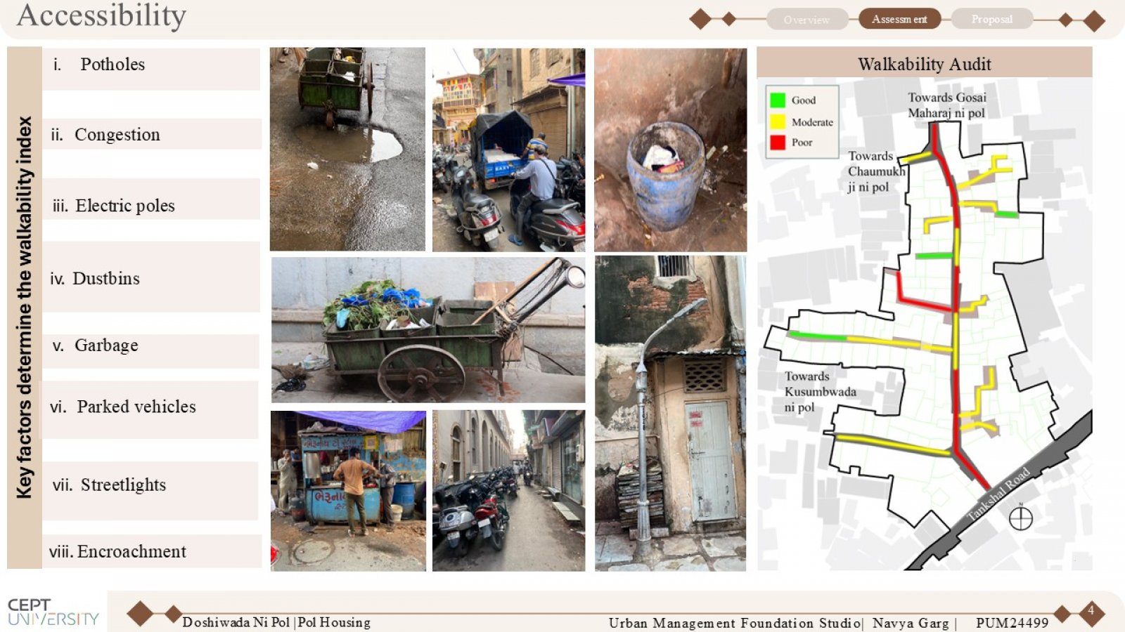
Walkability Audit Mapping: Evaluates the pedestrian experience within Doshiwada ni Pol by analyzing footpath conditions, street widths, pedestrian crossings, obstructions, and overall safety. The map highlights areas of high and low walkability.

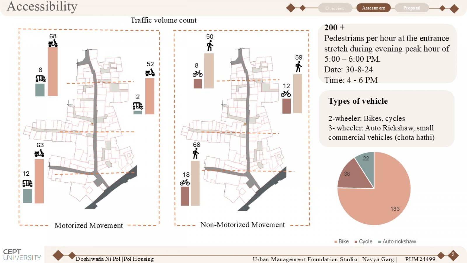
Traffic Volume Count: Records and analyzes the number of vehicles passing through specific points in Doshiwada ni Pol, capturing peak and off-peak traffic periods. This data helps assess congestion levels, identify high-traffic zones, and inform decisions on traffic management strategies.

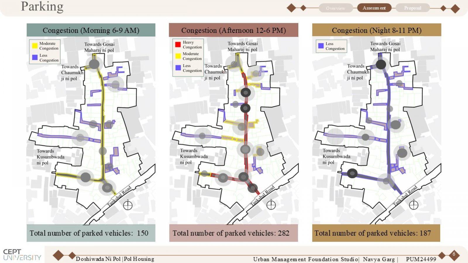
Congestion Mapping: Morning, Evening, and Night This mapping identifies and visualizes congestion levels in Doshiwada ni Pol during different times of the day—morning, evening, and night. It highlights areas of high traffic density, peak congestion times, and the impact on mobility and accessibility.

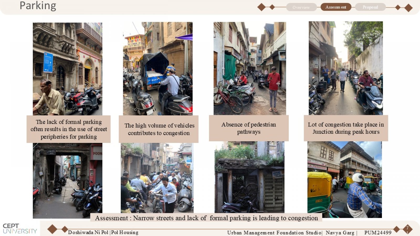
Visual representations highlighting the parking challenges in Doshiwada ni Pol.

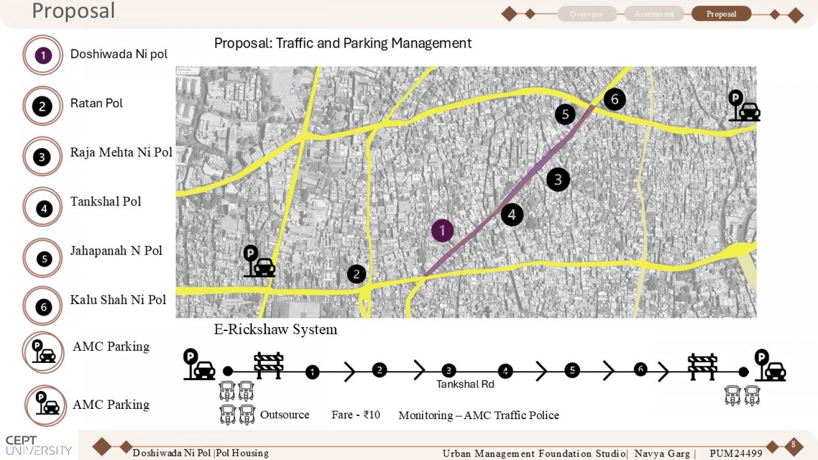
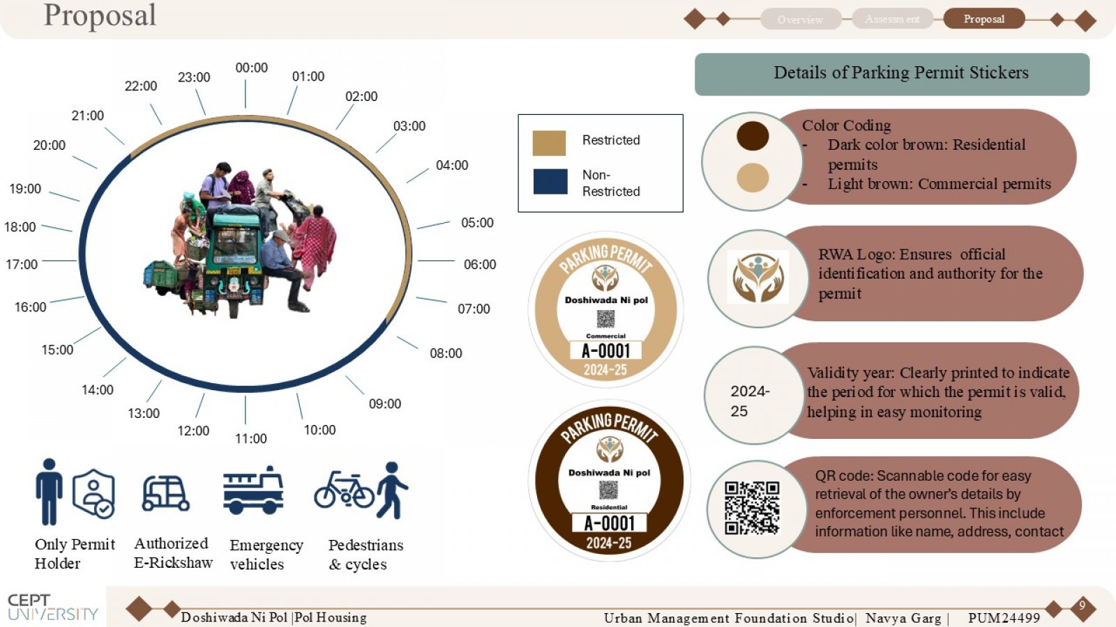
Proposal for Parking Management in Doshiwada ni Pol

Proposal for Parking Management in Doshiwada ni Pol

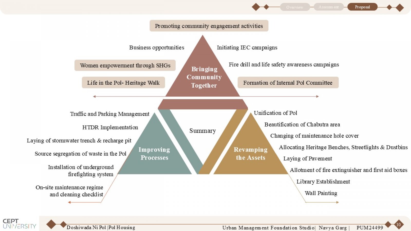
Summary and Action Plan: Enhancing Doshiwada Ni Pol through infrastructure upgrades, heritage conservation, community empowerment, and sustainable development initiatives.