Your browser is out-of-date!
For a richer surfing experience on our website, please update your browser. Update my browser now!
For a richer surfing experience on our website, please update your browser. Update my browser now!
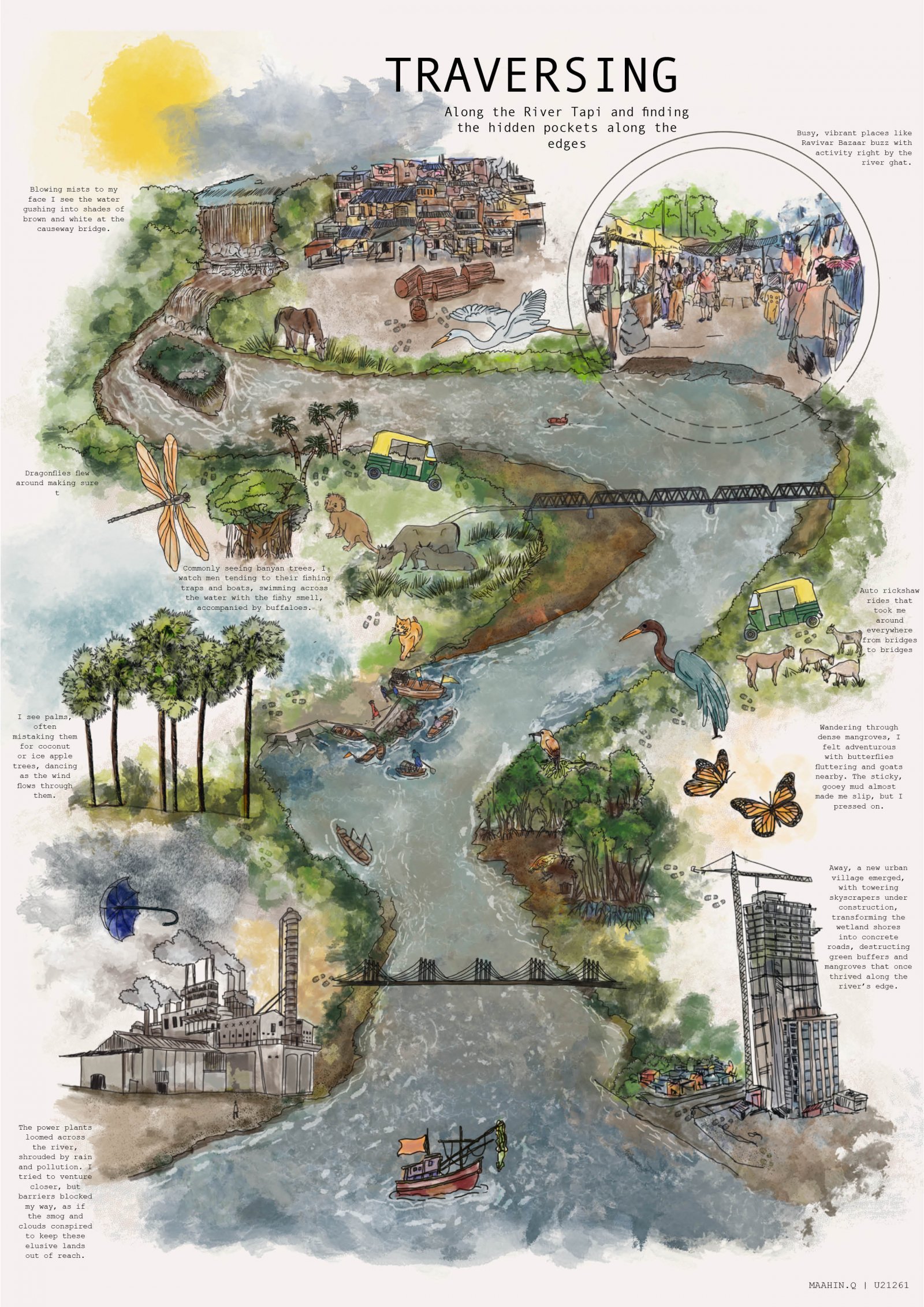
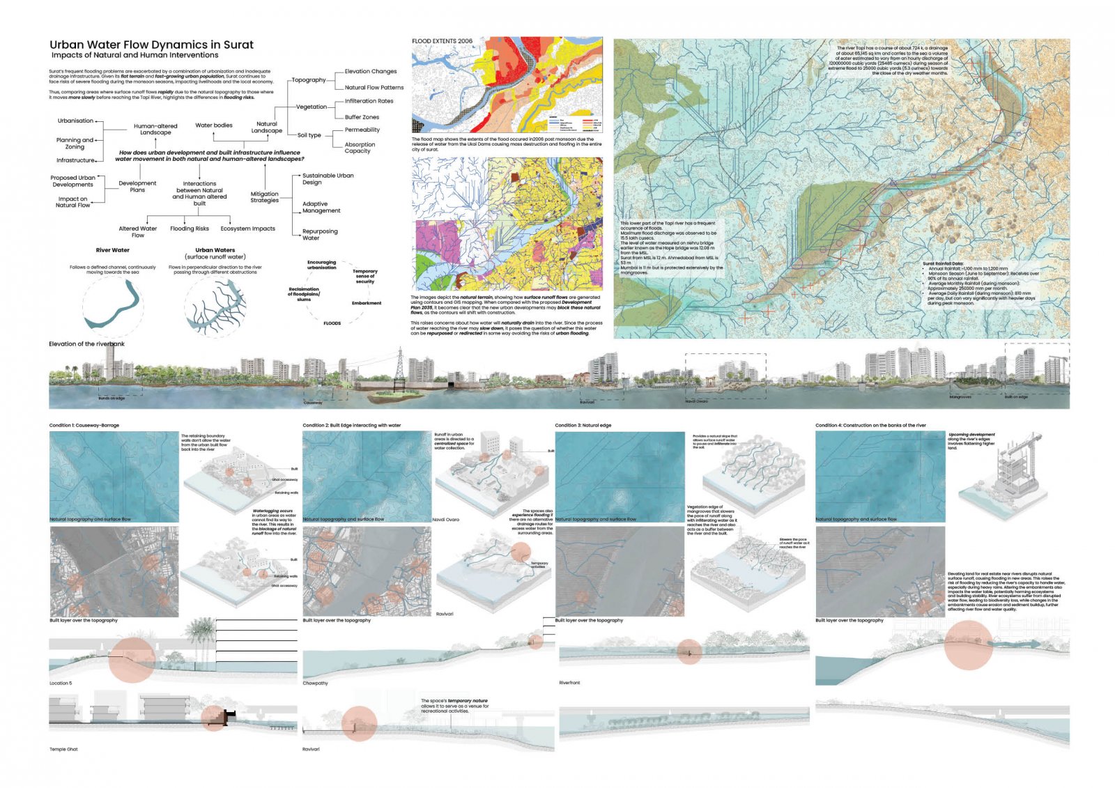
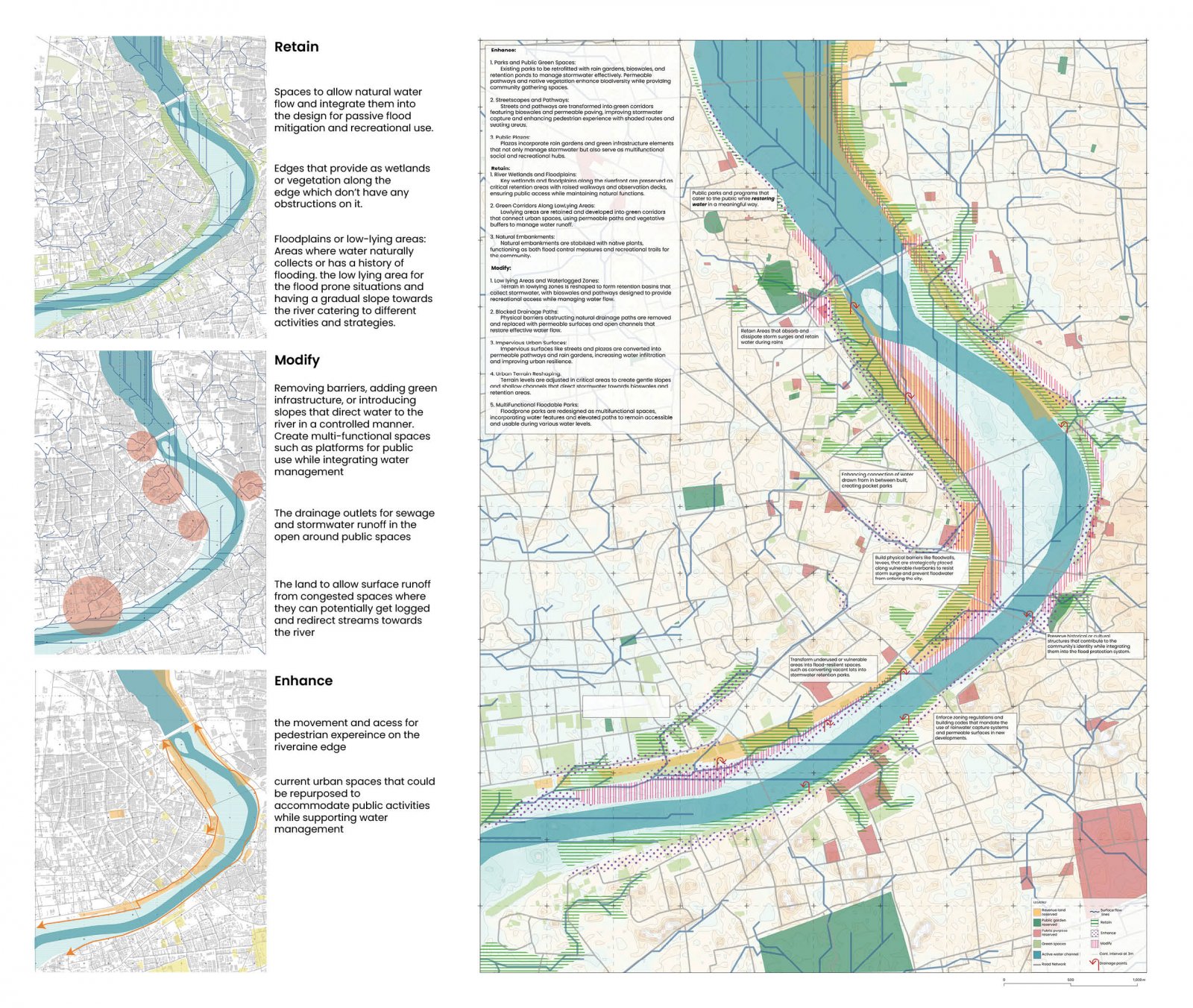
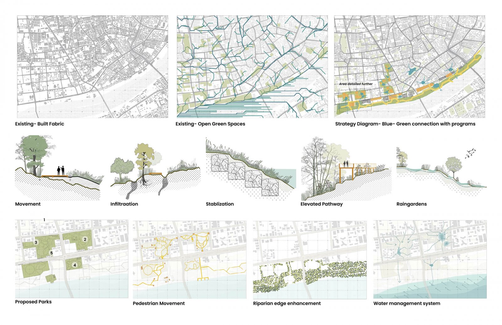
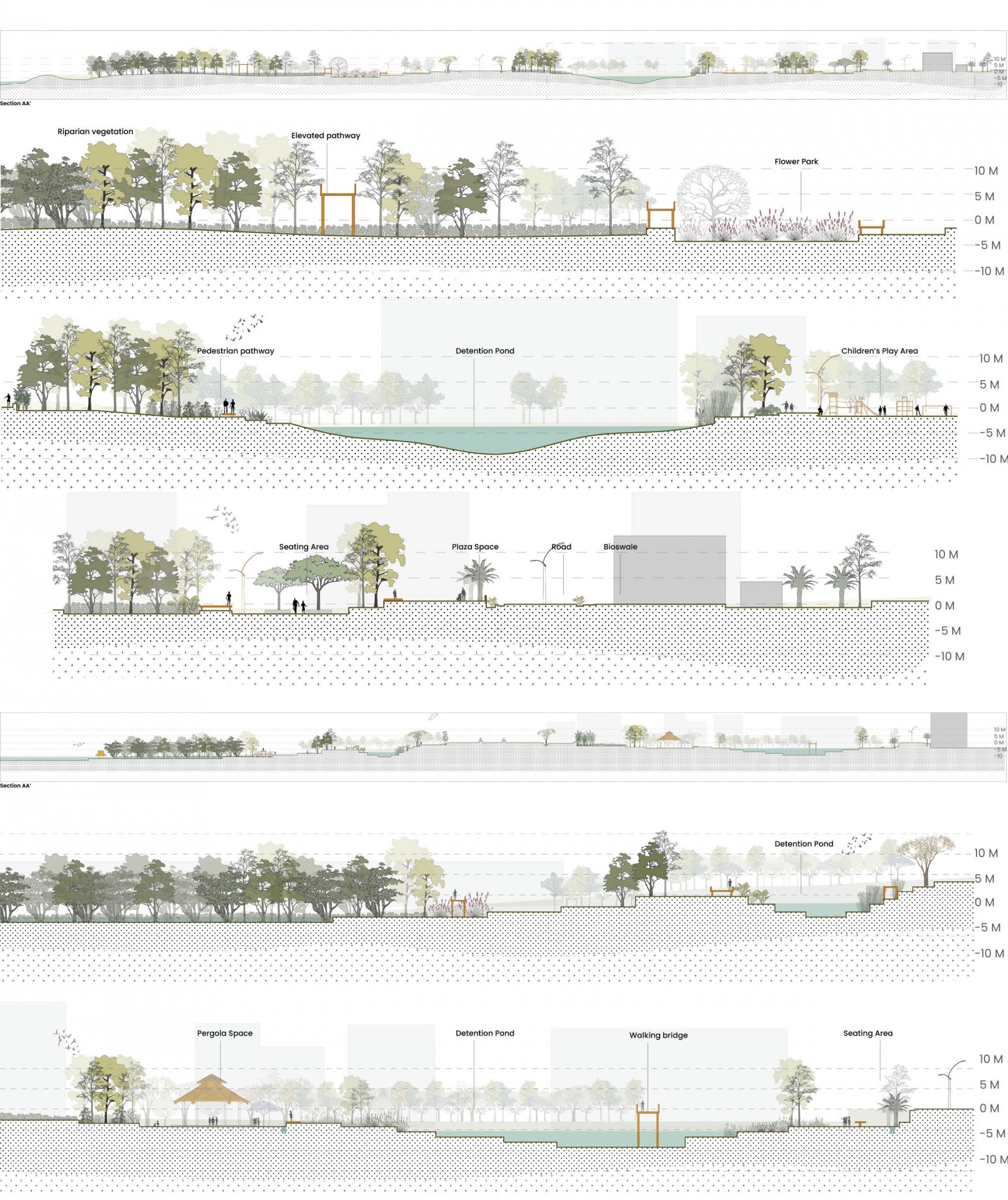
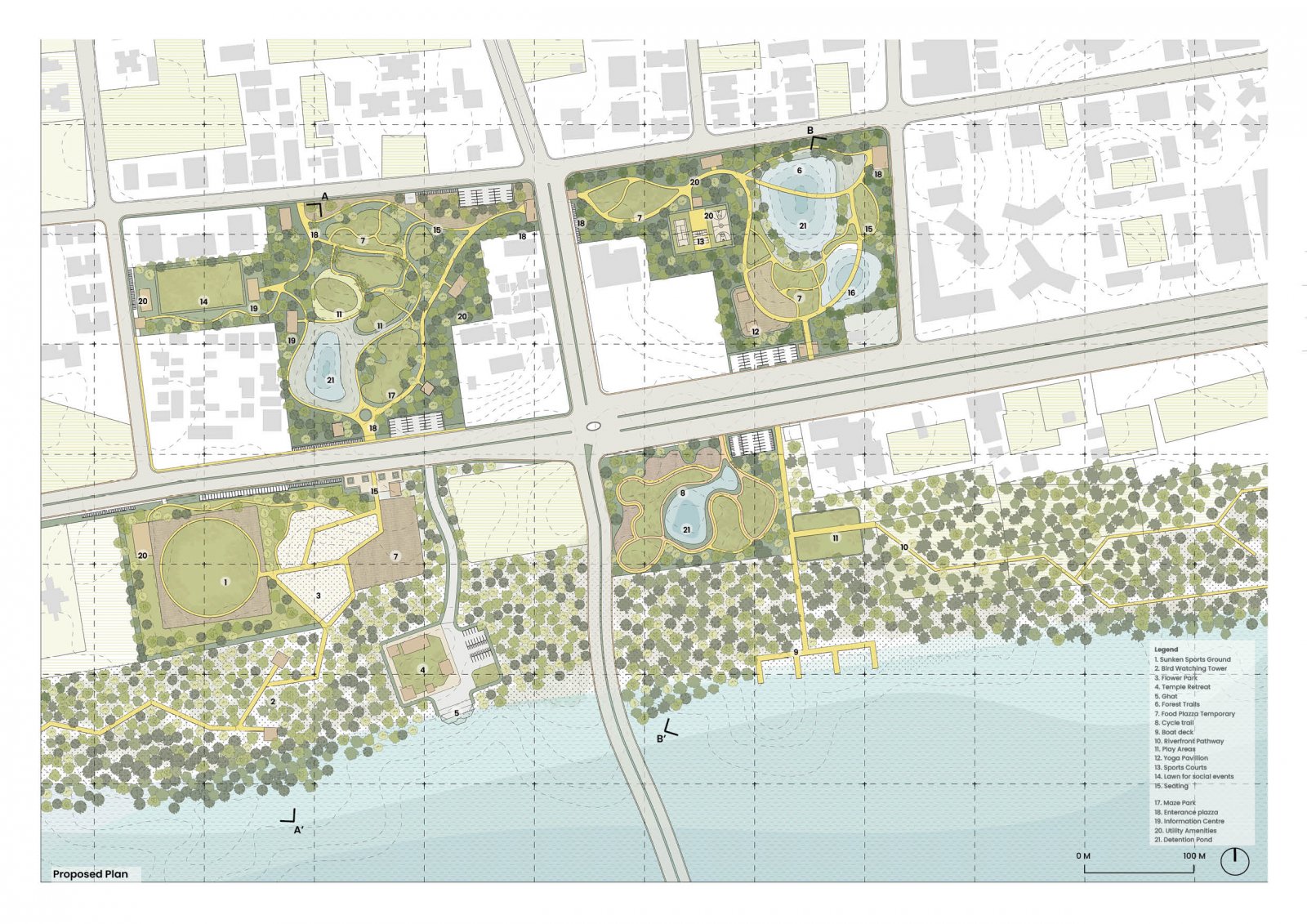
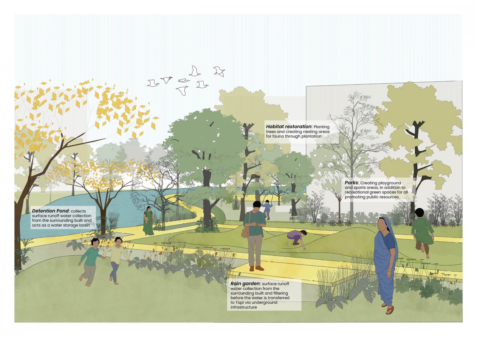
Surat experiences significant flooding challenges due to rapid urbanization, inadequate drainage infrastructure, and its flat terrain, leading to severe socio-economic impacts during the monsoon season. This project proposes the transformation of low-lying areas into multifunctional zones capable of storing surface runoff to mitigate waterlogging and flooding. These areas function as seasonal detention and retention zones while serving as public amenities such as parks and lawns. Strategies include enhancing riparian vegetation as natural flood buffers and utilizing bioswales to channel runoff for rainwater harvesting. By integrating existing cultural landmarks, the design fosters a sustainable, flood-resilient urban ecosystem through ecological restoration and adaptive public programming.
View Additional Work