Sanjoli Kumawat

UP4001-3

Environmentally Sensitive Micro Level Planning

The Amberi Land Pooling Scheme in Udaipur aspires to transform an ecologically sensitive area into a sustainable, tourism-driven growth hub. Spanning 3.5 sq. km near the intersection of NH-27 and NH-58, the project  integrates eco-tourism, mixed-use development, and ecological conservation. Key proposals include the establishment of blue-green infrastructure, contour-aligned road networks, and disyribution of equitable land parcels. These elements are designed to harmonize environmental preservation with urban vibrancy. The plan also prioritizes sustainable development, aiming to create a dynamic hub for tourism, hospitality, and economic activity, while respecting the area’s unique ecological and cultural heritage. This innovative initiative sets a benchmark for balancing environmental sensitivity with growth-oriented urban development.
Report Content

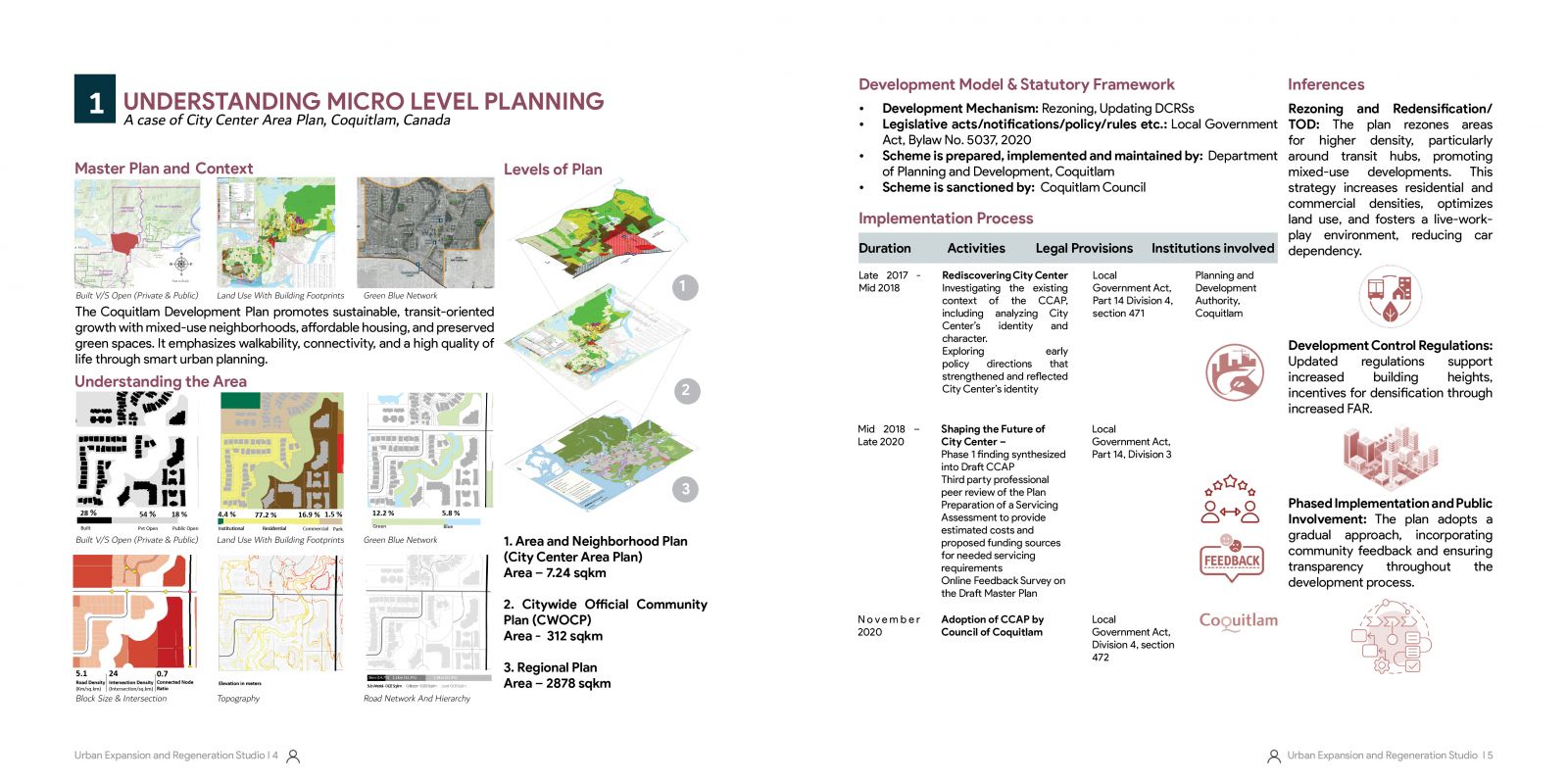
Understanding Micro-Level Planning: The City Center Area Plan of Coquitlam, Canada integrates sustainable urban design, transit-oriented development, and green-blue networks to create a vibrant, walkable, and connected urban environment, emphasizing community involvement and phased implementation.

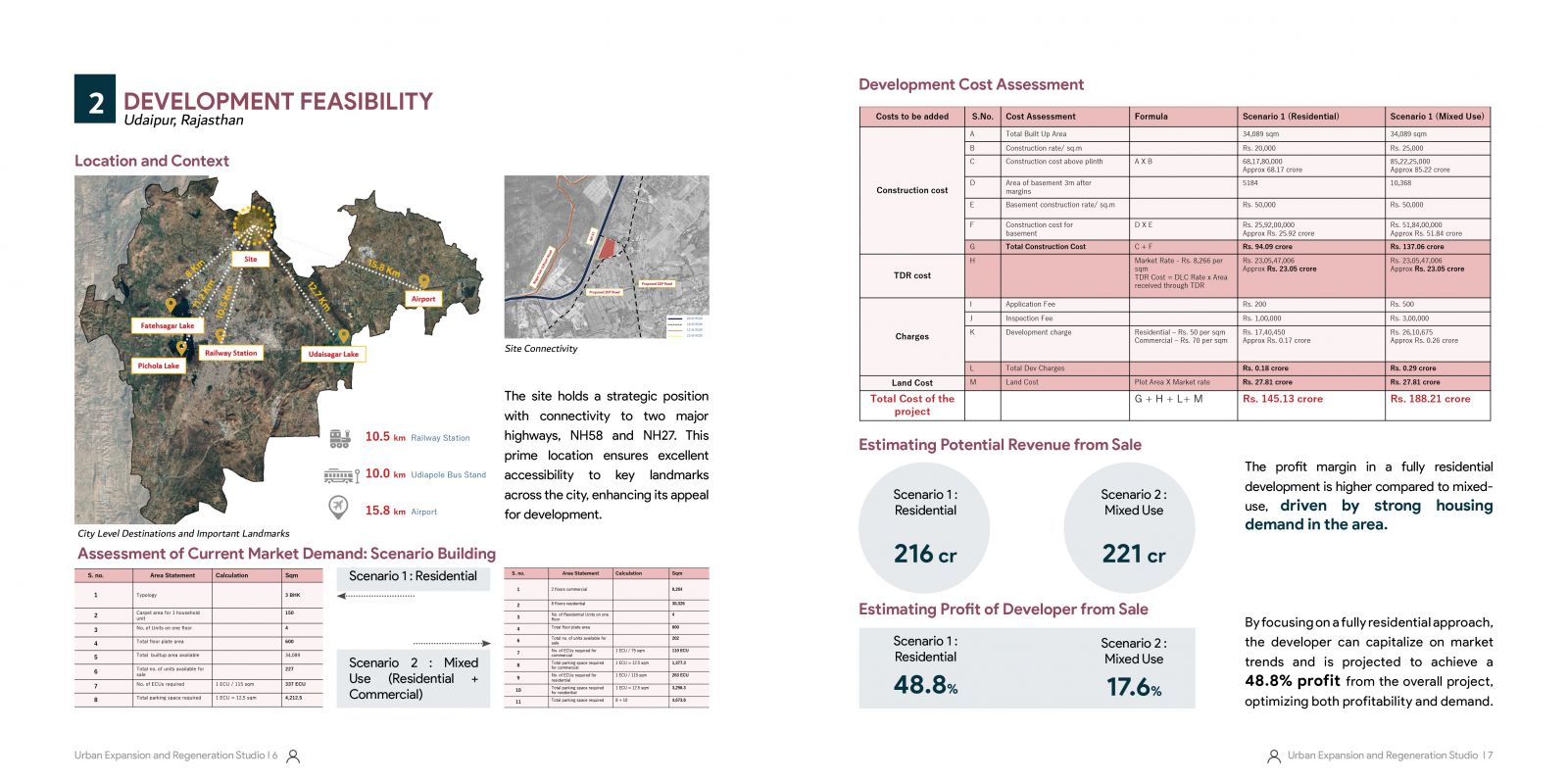
Development Feasibility: Udaipur, Rajasthan - This analysis evaluates a strategically located site near NH-58 and NH-27 with excellent connectivity to key landmarks. It outlines construction costs, market demand, and revenue projections for residential and mixed-use scenarios, highlighting a profit margin of 48.8% for residential development driven by strong housing demand.

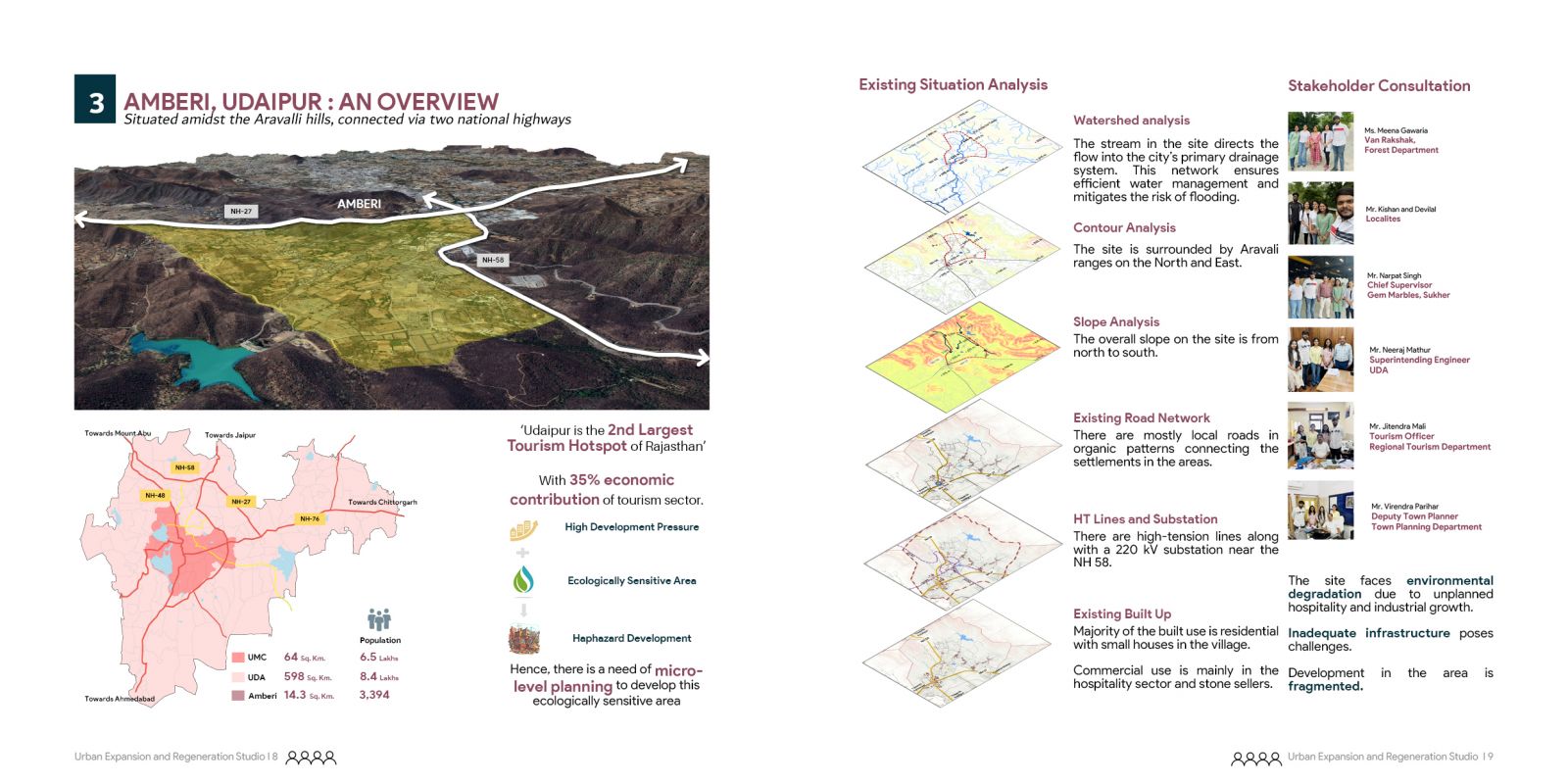
The analysis emphasizes Amberi's watershed, topography, ecology, and connectivity.

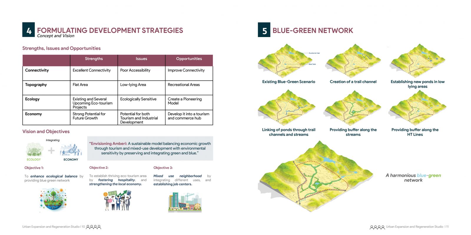
Formulating Development Strategies and Blue-Green Network: This section highlights strengths, issues, and opportunities for Amberi, Udaipur, focusing on connectivity, ecology, and economic growth. A vision for integrating ecology and economy through eco-tourism and mixed-use development is supported by a proposed harmonious blue-green network linking ponds, trails, and buffers, emphasizing environmental and economic sustainability.

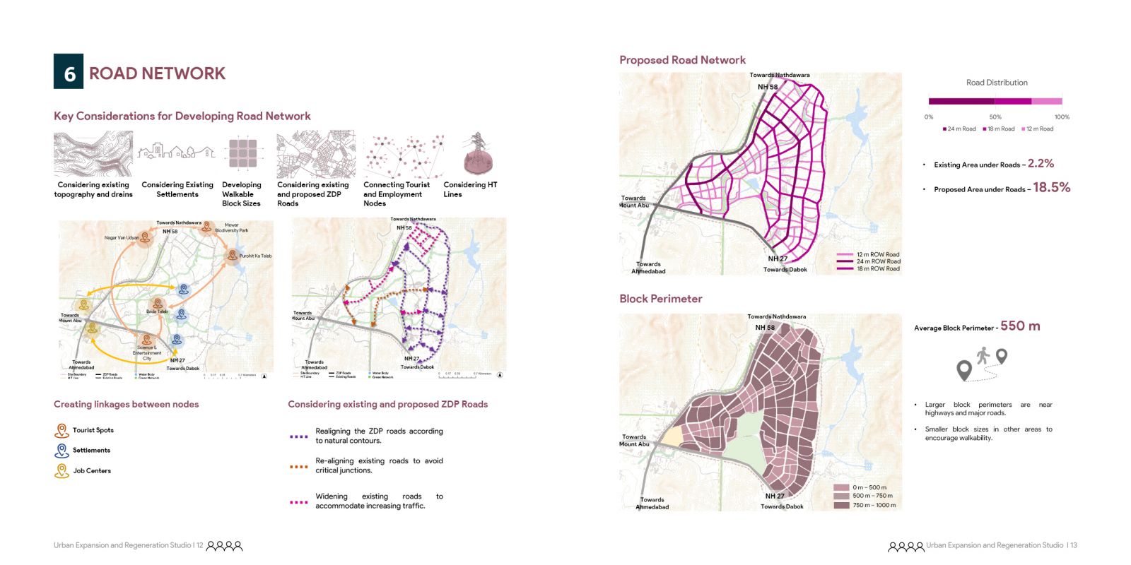
Road network considering topography, drain and existing road network

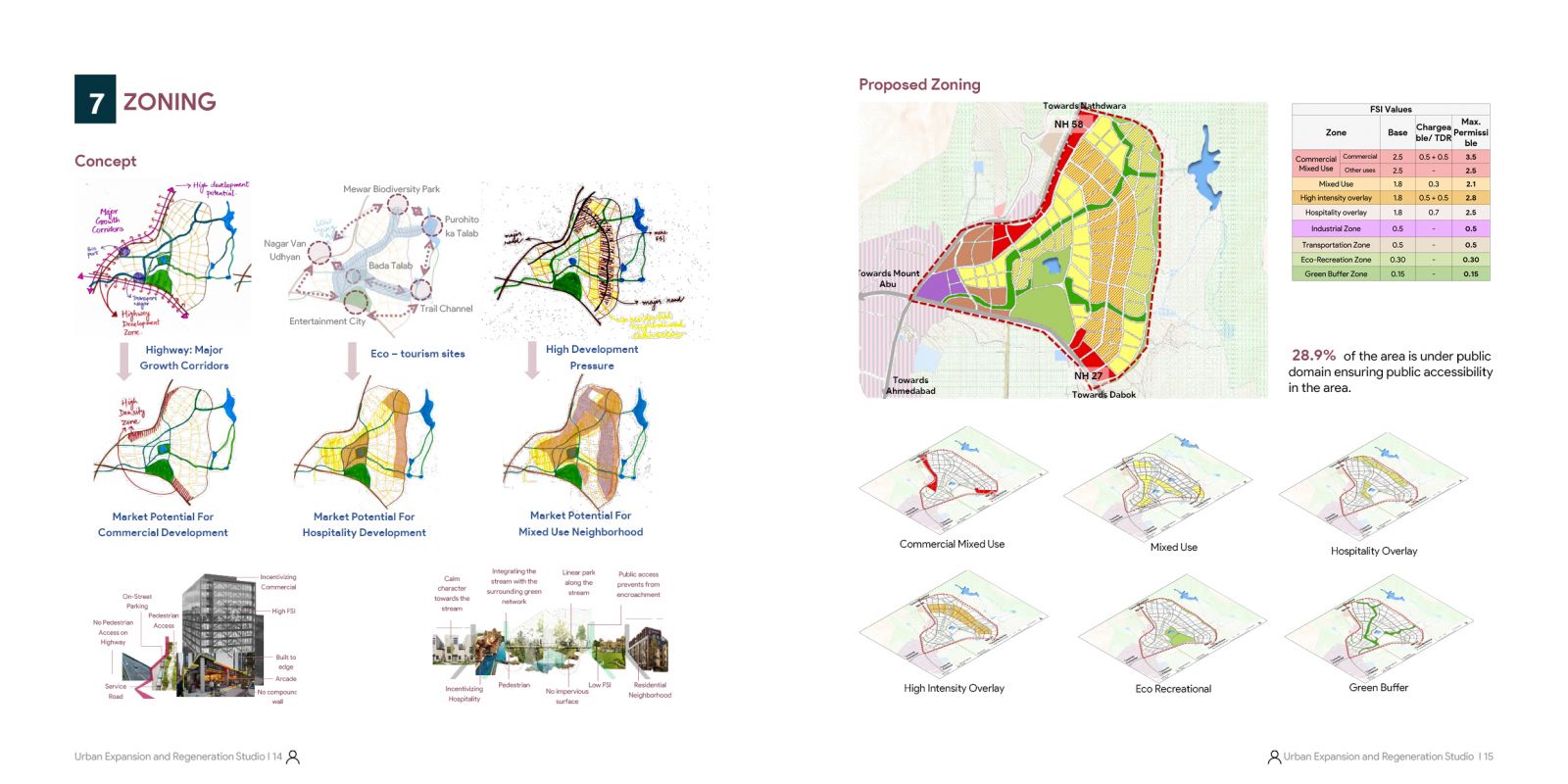
The zoning proposal defines Commercial Mixed-Use, Hospitality, and High-Intensity Overlay Zones to foster sustainable development, emphasizing density, mixed-use spaces, and hospitality through optimized FSI values and DCRs.

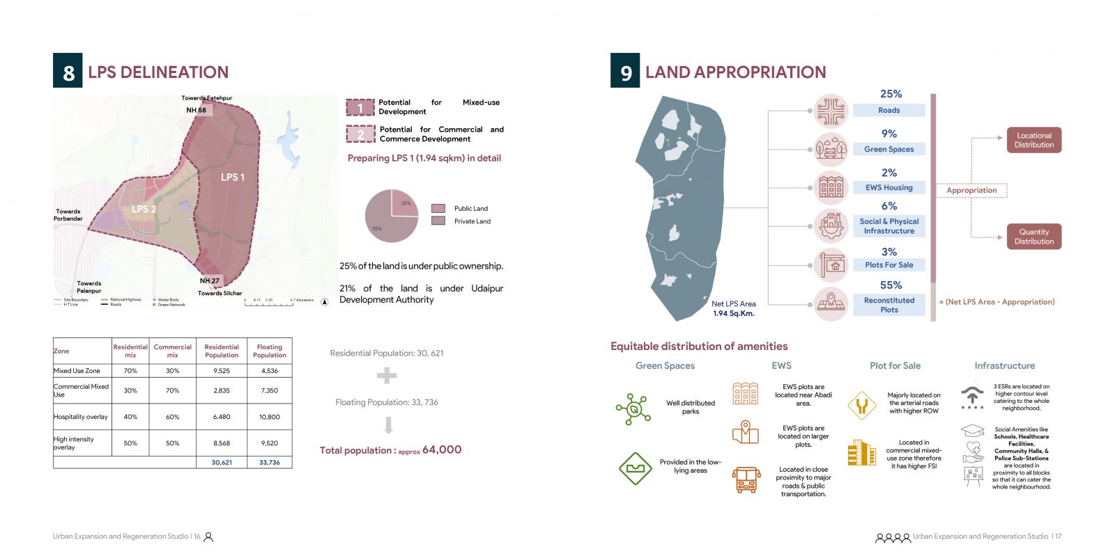
Land Pooling Delineation and Appropriation Plan: Highlights include zoning distribution for mixed-use and commercial areas, equitable allocation of amenities like green spaces and EWS housing, and land ownership details within a 1.94 sq. km LPS area

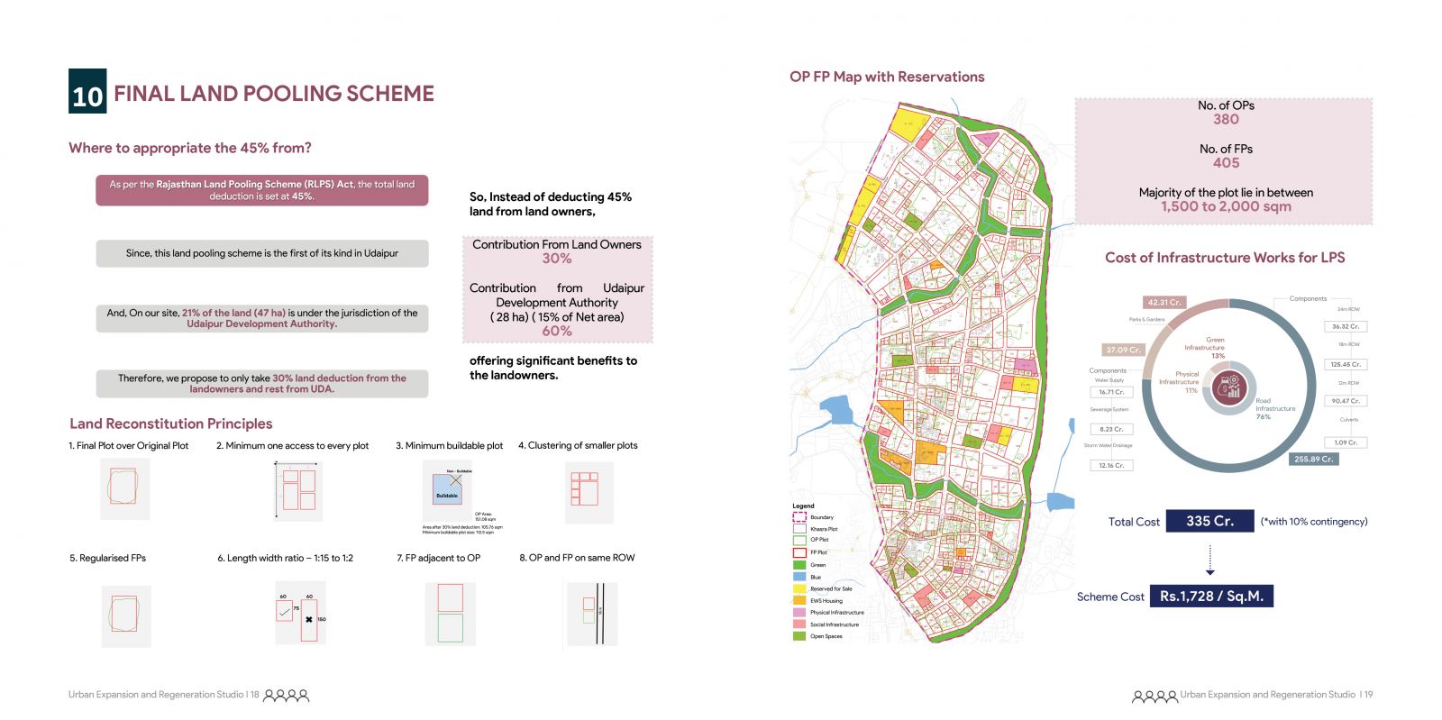
Final Land Pooling Scheme: Overview of land reconstitution principles, contributions from landowners and UDA, plot allocation, and the cost breakdown of infrastructure works, with a focus on equitable land distribution and efficient utilization.

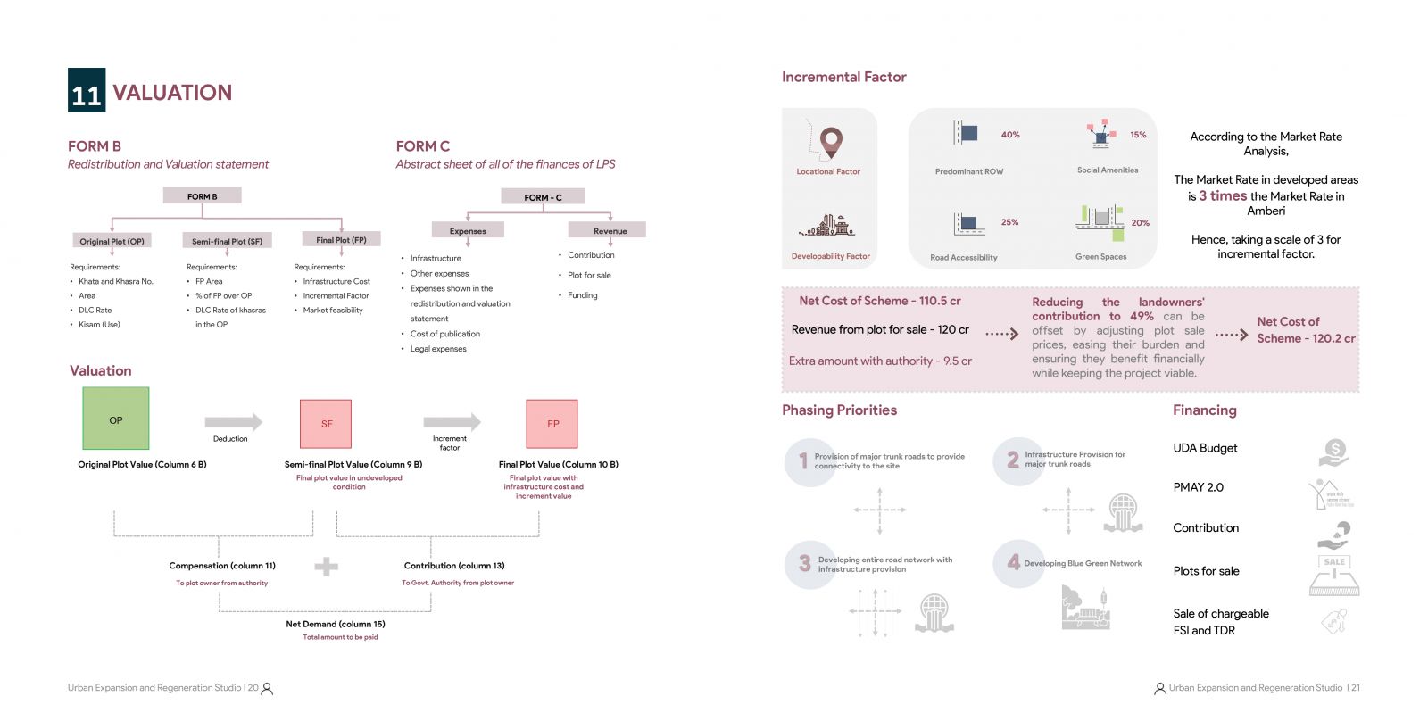
Valuation and Incremental Analysis: Detailed framework for redistribution, valuation, and incremental factors under the LPS, outlining phasing priorities, financial strategy, and cost recovery mechanisms to ensure project feasibility and equitable contributions

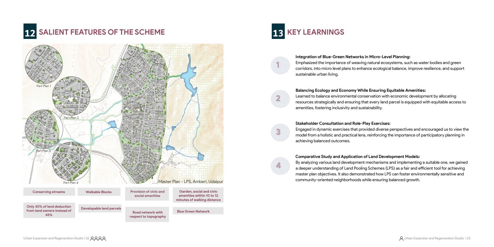
This semester's focus on micro-level planning through a Land Pooling Scheme emphasized skill-building in data collection, valuation, and sustainable development. Key outcomes include a harmonious blue-green network, stream conservation, accessible civic amenities, and minimal land deductions, ensuring stakeholder alignment.